Leaderboard


Popular Content
Showing content with the highest reputation on 2017-08-13 in all areas
-
Nevermind, I think I got it to work:5 points
-
Well I've almost got the first faction done, almost all their buildings are in:4 points
-
i have a market to make and no tent textures
 3 points
 -
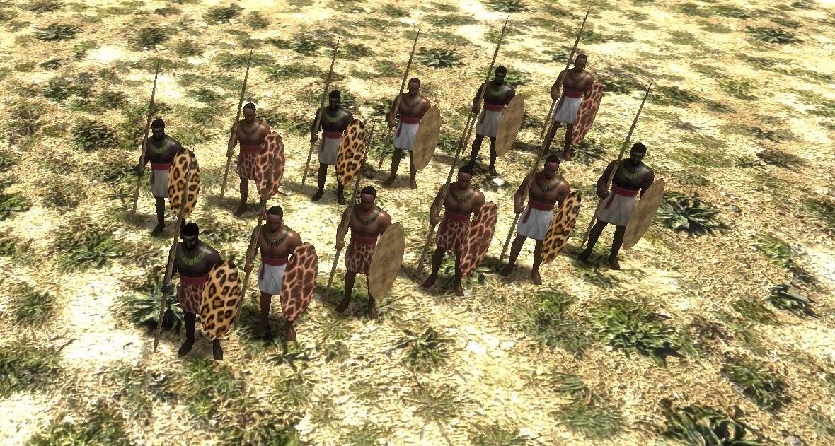
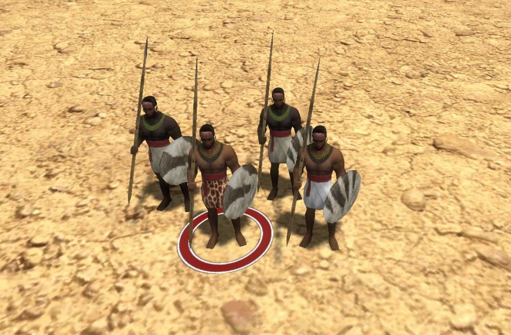
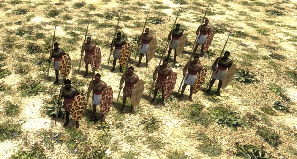
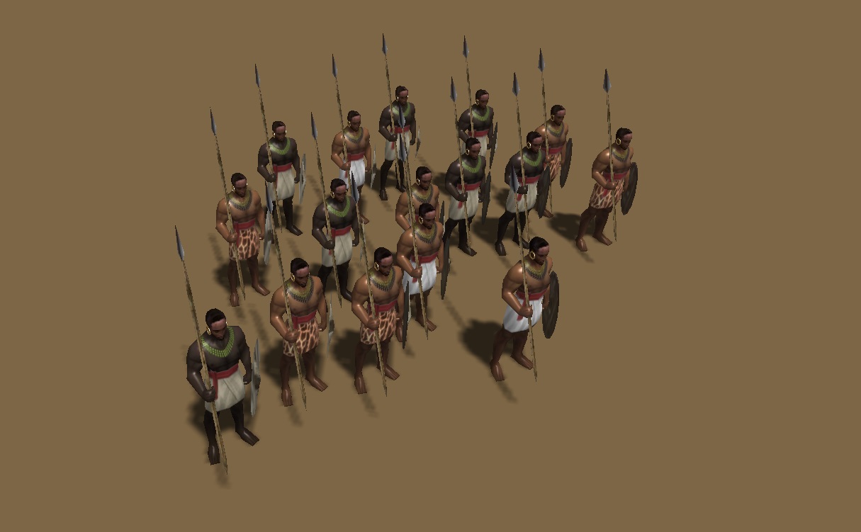
The thread for unit textures and props, except shields. Shields are another thread. All unit textures will need specular maps. @Sundiata and @balduin can provide more references and commentary. Attached, base textures: kush_female_base.psd kush_male_base.psd Unit Roster Civic Center Kushite Woman Nubian Spearman Barracks Nubian Archer Fastest archer in the game, like the Mayan Plumed Archer in Age of Kings:The Conquerors. Meroitic Pikeman Perhaps make available after researching Sarissa at the Blacksmith. Meroitic Axeman Swordsman class, but attack is half crush damage. Meroitic Spear Cavalry I suggest can switch back and forth from spear to javelin. Temple of Amun (Terra Magna, a special building / in Delenda Est, an upgrade for the standard Temple) Priest of Amun Napatan Temple Guard (khopesh swordsman) Boosted by the Fervor for Amun special tech. Fortress Hero 1 Hero 2 Hero 3 Meroitic Noble Archer (champion unit) Perhaps can switch to firing fire arrows, for a siege attack, same as Maiden Guard in DE. Meroitic Noble Cavalry Lancer (champion unit) Kushite Light War-Elephant Mercenary Camp (Delenda Est) / Tribal Village (Terra Magna; a special buildable structure) Nuba Clubman Nuba Hunter (skirmisher) Gives them access to a skirmisher unit. Blemmye Mercenary Camel Lancer Blemmye Mercenary Camel Archer General Looks for Units Basic Citizen-Soldiers: Bare chested. No armor. No sandals. Bare headed. Simple loin cloths and cumberbuns. Advanced Citizen-Soldiers: Bare chested. Strappy leather corselet across stomach for armor. No sandals. Decorative animal skins for loincloths. Decorative cumberbuns and straps. No helmet for lighter units, basic helmet for heavier units. Bronze bracelets and arm bands. Elite Citizen-Soldiers: Linen/cotton Meroitic tunic for chest/shoulders or padded linen/cotton armor for "heavier" units. Meroitic sandals for the feet. Decorative cumberbuns and straps. Basic helmet. Additional bronze bracelets and arm bands. Champions: Scale or padded armor. Meroitic sandals for the feet. What else? Heroes: Crown with snake heads. Colorful tunics and gowns. Lots of jewelry and golden/bronze bracelets, anklets, etc. Colorful gorgets. Nubian Units, specifically the Archer and Spearman: Units with this hairstyle ("Nubians") are the ones that get (ostrich) feathers. Either 1 feather (Basic Rank) , 2 feathers (Advanced Rank), or 3 feathers Elite Rank).2 points
-
I like that solution. Should be added to the core game.2 points
-
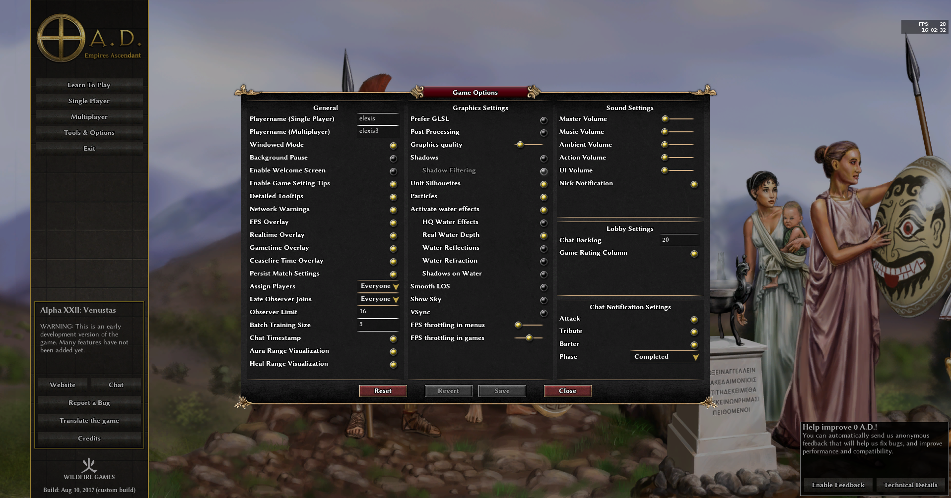
I've made a quick and dirty mod to slightly adjust the top panel: delenda_est_a22_1024x768.zip It shrinks the resource labels and displays only thousands if the resource amount is greater than 10K.

 2 points
 -
A bit of dramatic lighting never hurt:2 points
-
Now it looks gorgous! The castle was the building I knew would look very nice with an AO map. Now you need one for all buildings.2 points
-
Checked all other GUI pages. The options page is also inconsistent: "Graphics quality" -> "Shader Effects" (less ambiguous, accepted by Vladislav) "Activate water effects" -> "Water Effects" "FPS throttling in menus" -> "FPS Throttling in Menus" For the gamesetup, we could have "Start Game!" instead of "Start game!" while keeping "I'm ready!" and "I'm not ready!". For the multiplayer join-by-ip dialog, "Player name:" -> "Player Name:" as that has the label "Server Hostname or IP:" and "Server Port:" in the label below that. Other than that, replay menu, savegame selection screen, mod selection, welcome page, manual, lobby, prelobby are all using title case consistently </canofworms> Gimme some like button, then I'll commit it (or complain loudly).
 2 points
 -
[sketchfab]32e4cc17316a4b20bf76c156b4a2efa4[/sketchfab] Slave Market by StanislasDolcini on Sketchfab @Lion.Kanzen Here is the slave market. In the zip file, game ready files, only missing the template, cause I don't know what are you guys up to. merc_slave_market8.blend slave_trader.zip

 2 points
 -
No, I want life and color and saturation, not the "grey and brown" look.2 points
-
2 points
-
Darkest possible filtering, going further will make the skin lose its detail.
 2 points
 -
It appears I did some time ago... there's a pull request waiting that should was intended to bring the repo up to A22 compatibility. It's roughly 2 months old, and a quick 3-way ai match reveals that there's at least one problem that either I didn't catch at the time or has appeared since. I'm working today, so fixing that is either going to have to wait until tomorrow or fall to someone else to look into it. Depends on how desperate you are... Edit: Done. Ponies Ascendant should now be A22 compatible.2 points
-
I don't think they have actually been implemented in Delenda Est. I think that link is just the design document. There shouldn't be anything technical preventing them from being added, but it might be a significant effort. Medieval Total War's battalions were too large for me. I prefer the battalions in the BFME 1 and 2 series although they weren't really large enough to call a battalion because they only contained around 5-20 units depending on the strength of the units. I've been asking for some sort of grouped units to be added to 0 A.D for awhile. I think most people here are really attached to AoK, so they prefer the individual unit control. That said, we do have territories which work very well and were not present in AoK, so maybe there is still hope for battalions to be used in some portion of the game. Even if 0 A.D. doesn't use them, I think having a battalion system would be great for modders. I played AoK and AoE3 recently and they both feature a column formation when moving units from one location to another. We used to have that too, but it was removed in one of the many pathfinder fixes. It was a very, very nice feature. I hope that one gets added back someday for sure.2 points
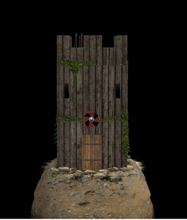
-
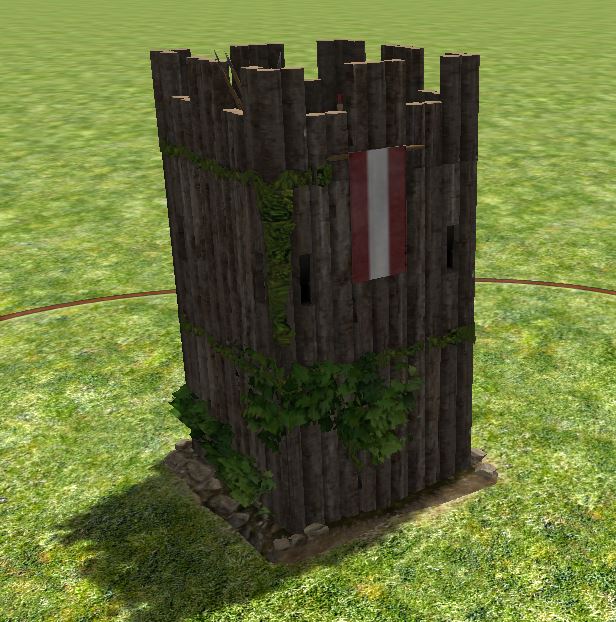
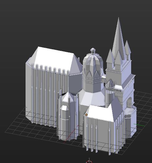
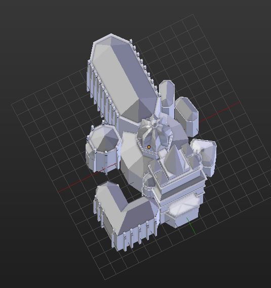
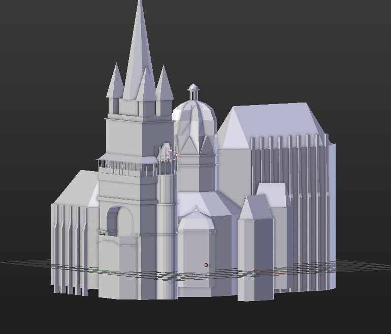
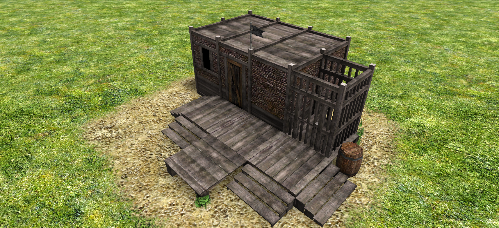
Norse defense tower 4 props Mesh redone, only i keep is the concept and the props. the Wood pillars are better organized and more symmetrical. Screenshots Blender file >>Norse Defense Tower[Finalizado].blend<<
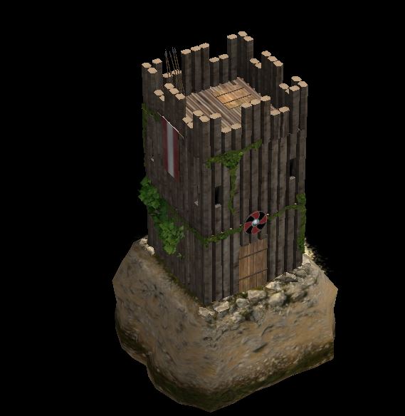

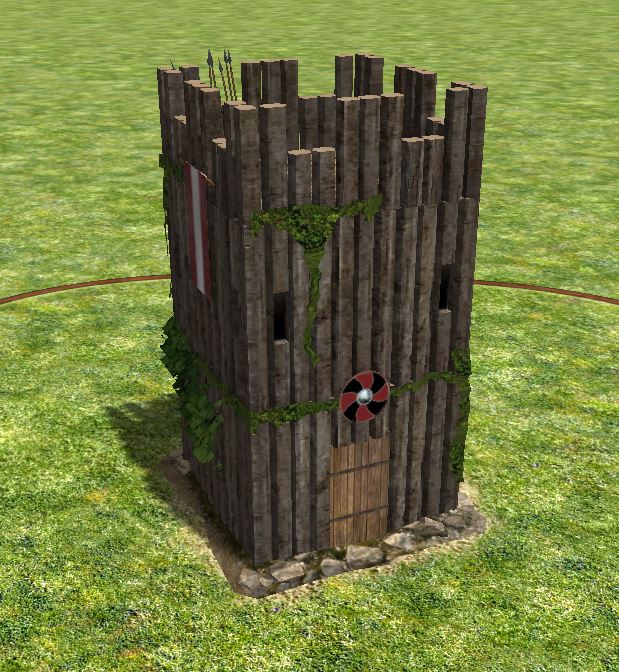 1 point
 -
1 point
-
I have a discord channel at the moment, though it was originally meant for the Total War version of the mod: https://discord.gg/TyhvujD1 point
-
The biggest trade gain is trading with an ally over a long distance (though you only get a part of the traded value at the ally's market). Cycles for traders are done in the wip code for the Silk Road map, however there is no gui support for creating such cycles.1 point
-
windows are too close to the edges for archers to comfortably use them, some vertical division will help too.1 point
-
Oval, like this one?
 1 point
 -
@Lion.Kanzen (Done for both) slave_trader.zip

 1 point
 -
Those changes look good to me.1 point
-
Years ago, I created a small tutorial video about using real world height data I never stumbled across OOM data...1 point
-
@Lion.Kanzen Just made another building. Anything top priority on your list ?1 point
-
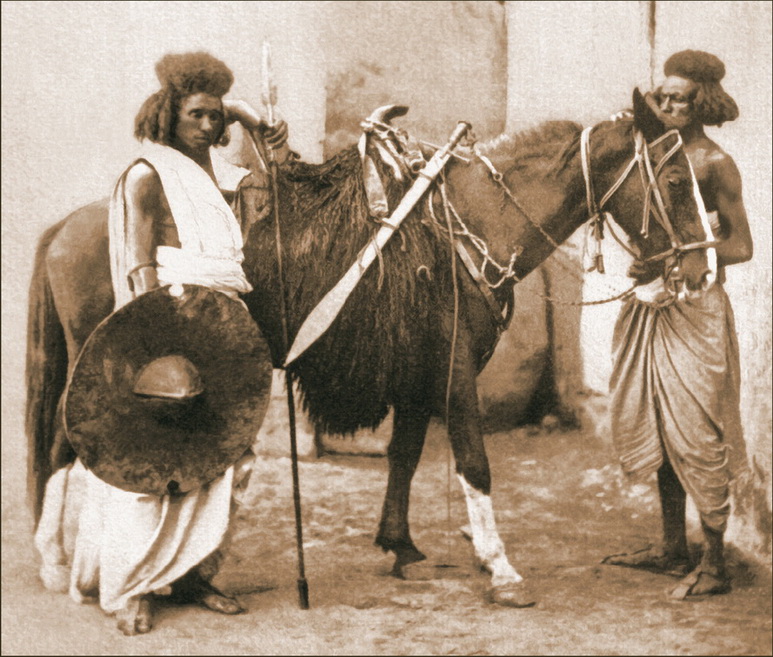
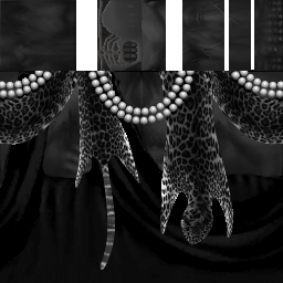
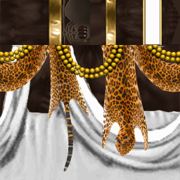
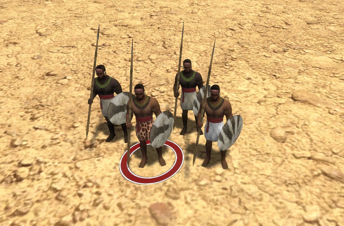
@wackyserious Yeah, needs to be oval or round, not pointy like that. Their textures are all a bit too fantastical for my taste. I prefer to stick to what we know: elephant-, rhino-, hippo- or ox-hide or wicker- round-shields or oval shields. New Kingdom Egyptian inspiration is also good (wooden shields covered in animal hide: cow or leopard), for infantry. For cavalry, I'd advice round-shields though, like the shield carried by this old-school Beja warrior:
 1 point
 -
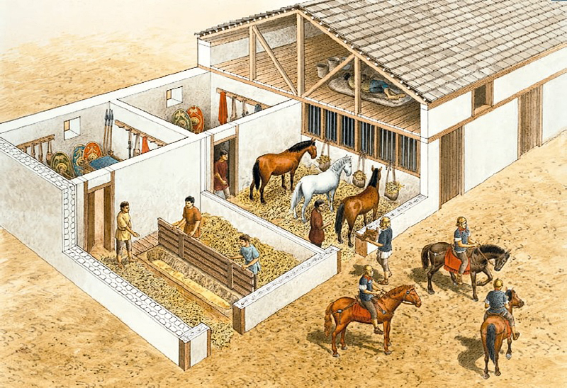
@LordGood This is about how far I got with market references, it's mostly guess work though, nothing I know of survived the times... I think it were just large open markets in the open spaces between the large structures of the city centers, not necessarily dedicated buildings, but smallish, semi-perishable setups: w surv1 point
-
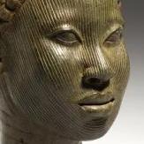
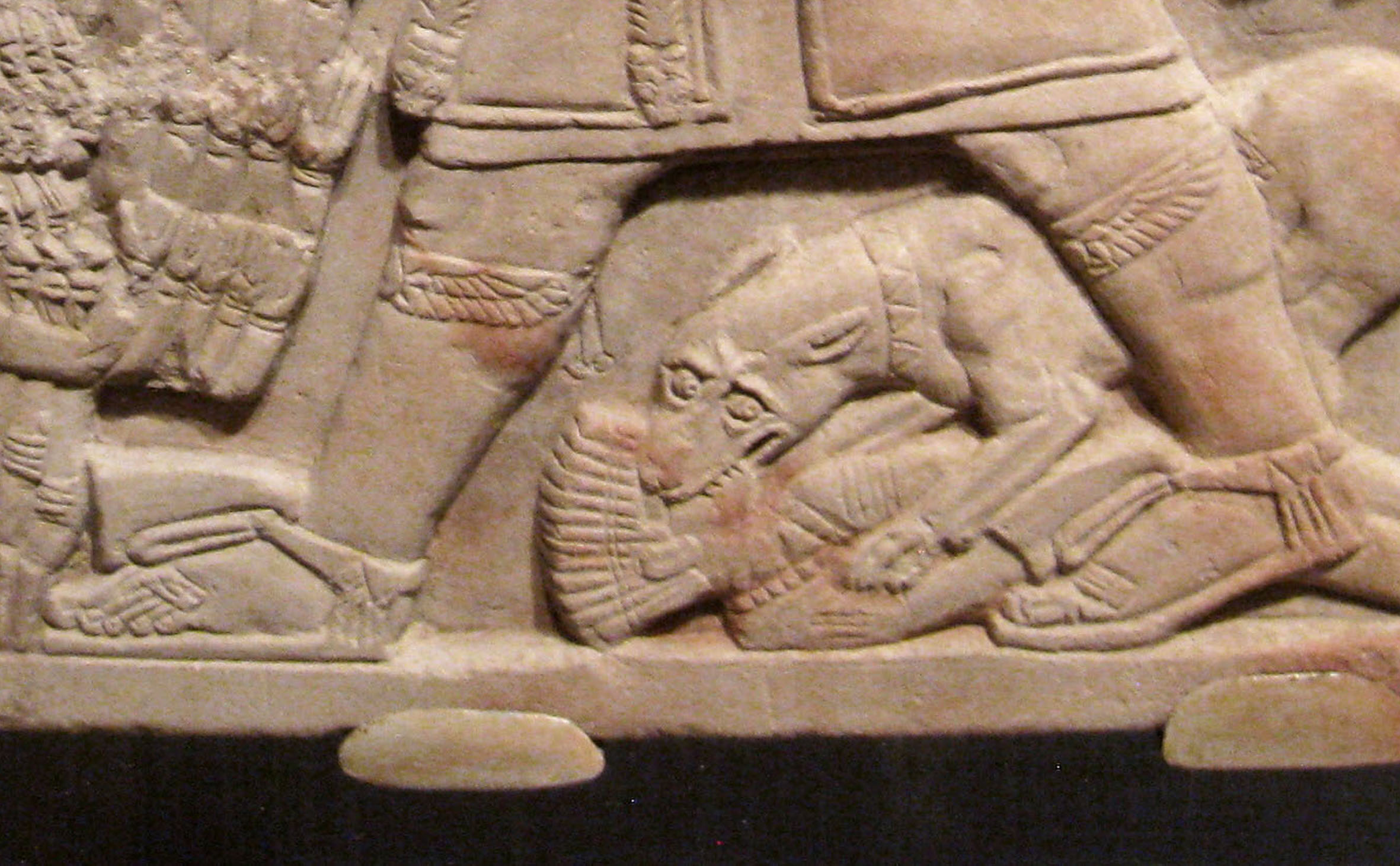
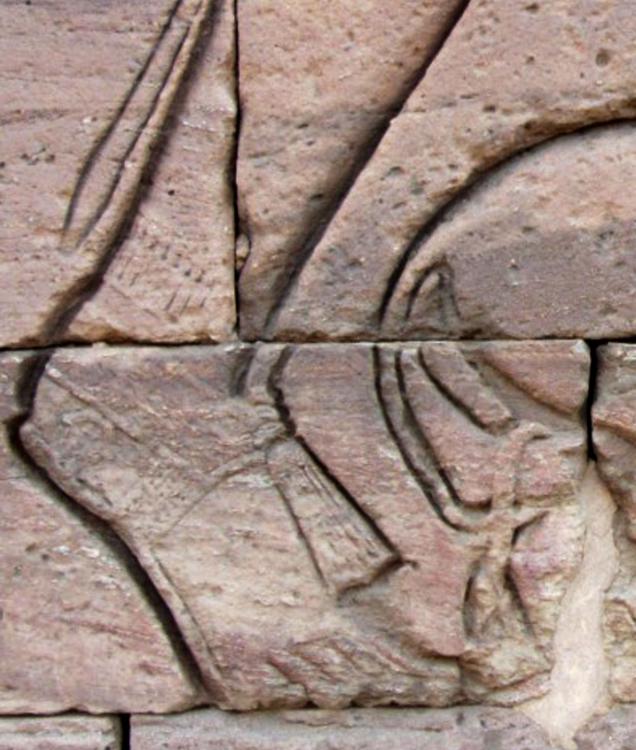
"the cobra piece on the forehead" is only for royals... Sign of divine rulership... That's Taharqa, by the way...1 point
-
1 point
-
Priest: Guy in front, could maybe use a bronze/gold helmet as shown here with the cobra piece on the forehead. Also maybe a new staff. Some textures so far:

 1 point
 -
Meroitic Sandals (for elites)

 1 point
 -
Yes, Spellforce environments look incredible. Would be perfect for 0 A.D.1 point
-
I'd say not even close Lordgood is an excellent artist in all aspects. I just enjoy making unit textures.1 point
-
Spellforce another RTS/some little rpg looks incredible, but gameplay....meh.1 point
-
War elephants are typically champion units, only exception being the Mauryan work and archer elephants. Could the Kushite war elephant be a skirmisher citizen elephant or do elephants hold too much prestige in kushite culture?1 point
-
Hmmm, for DE Ima put those in the merc camp. It would be awesome to have some biome/ethnic themed merc camps though. Like a "Nuba Village"-looking camp for Egypt/Kush maps. "Nuba Tribesman" could give the civ access to the skirmisher class.1 point
-
They could get the Siege Ladders tech from DE, which grants soldiers additional capture attack.1 point
-
i'm making this as wonder for the carolingian. Need some details and textures.
 1 point
 -
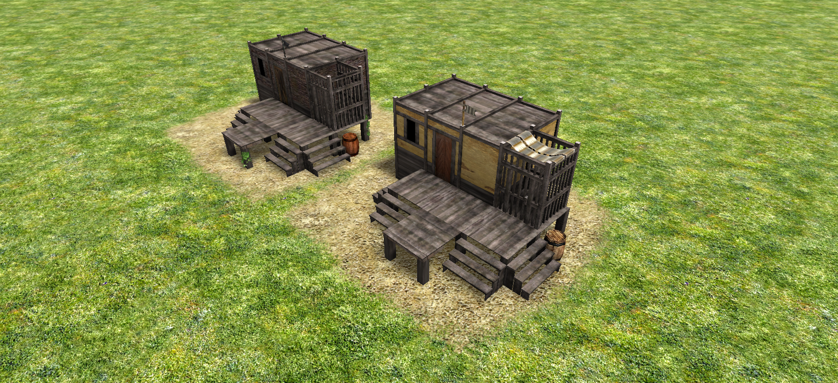
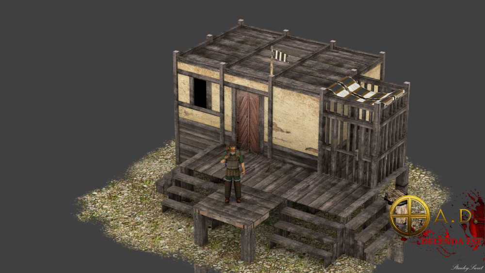
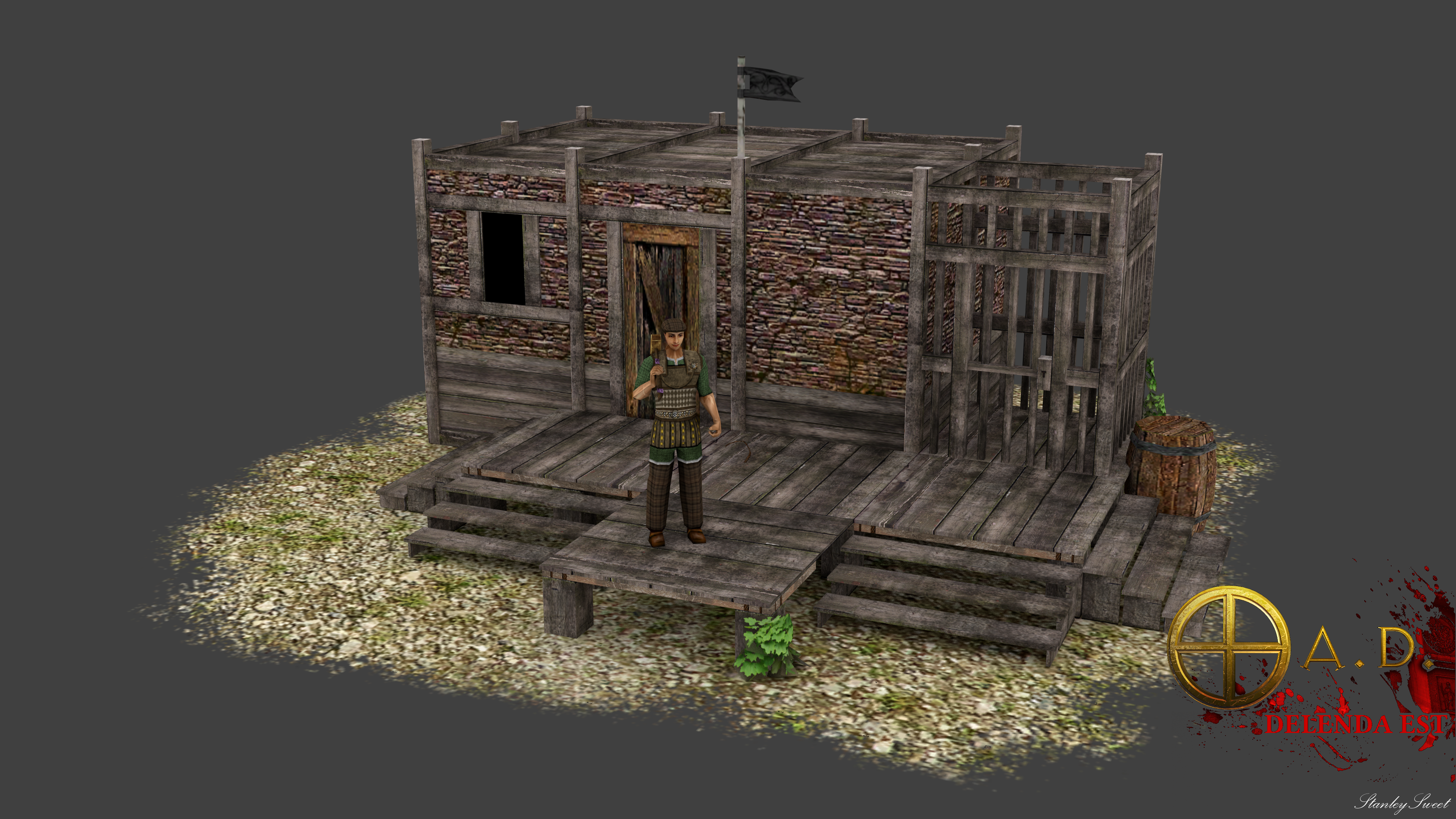
Auxiliar barrack, after see discuss realism vs rts way what you think? and I propose have 3 maximum.
 1 point
 -
@niektb You're absolutely right, I made that mistake for the first few posts because I had trouble uploading them directly... I've been thinking about re-uploading them directly for that same reason.1 point
-
1. network lag is basically solved since we have warnings if the round-trip-time exceeds the turnlength in both match setup and ingame. The player with the crappy network connection is informed, gets the chance to rearrange his WIFI, can become kicked by the host if he's a spectator, otherwise the players can rehost without that player. 2. CPU / simulation lag is the most prevalent lag issue currently. We have to work with the confinements of what the game can currently handle (1200 units at most and normal to large mapsize that is basically). It's not only the host's PC, but every client has to compute the entire thing. So putting the hosting mechanism to an external server won't help with the "simulation lag" at all unfortunately. 3. Yep, the next turn is only started once all players finished the computation of the current turn. Could be changed to compute several short (constant duration) turns consecutively without waiting for players feedback, depending on the actual performance. Basically it's going to be a bit of work, but we've got some plans that we can pull from the drawer. We also plan to add a dedicated hosting, but that's mostly relevant for ensuring rated 1v1s scoring and providing a host for people who can't host with STUN nor port forwarding.1 point
-
This isn't so much a huge suggestion or anything monumental, but simply speaking, it's been a while since I've played 0 A.D. (I used to play multiplayer on a regular basis and was pretty decent; nothing more), but I decided, with the new alpha out, to give 0 A.D. a couple more goes to see how development has been, and given the fact that I've not followed the meta or developed a proper build, I decided to stick with single-player. Simply speaking, I was pleasantly surprised by the diplomatic options available to me. While before it was simply a matter of turtling enough to kill off the AI's army while exploiting home-turf advantages, the diplomatic options made the formerly static interactions much more intriguing. Beyond my expectations for the AI, I began to have an emotional connexion with those which I played with/against. With those whom I had formed a stalwart alliance, I felt glad when I saw them actively participating in my border conflicts after requesting their assistance, and those who had refused my offers of friendship or even went as far as to declare war against me became actual rivals. All to say, awesome job! Given the fact that this has been a wonderful addition for me, I was wondering if you could clarify some of the mechanisms dictating their interactions. Specifically why they like/don't like players. What are the future plans in this direction?1 point
-
AI diplomacy is simple right now, and it relies on the illusion that the AI knows what it's doing. If a bot realizes it has a lot of enemies, it may try to request an alliance with a player who also has a lot of enemies. If you try to change your stance with a bot in a positive direction, it will be more likely to accept if its population is low. In many cases, if you are the same civilization as a bot, it will be more likely to become allied/neutral with you (I'm not sure if I should have added that quirk, although mimo was fine with it). But also in many cases, the decisions it makes (when it comes to diplomacy) are random. In terms of future plans, it would be nice to get rid of most of the randomness, and use some heuristic algorithms instead.1 point
-
I don't think the plan was to go full 3D for now, only to port the assets in 0ad1 point
-
I will be brief, since I'm almost sure this has been brought up before at least once in some manner. Consider adding some actual black people to the game, and not just as mercenaries. If the Nubians existed enough to be hired as mercenaries, then maybe you might think they must have actually had a distinct civilization? And that is just one black, African civilization. I know your game is meant to be about Rome (as usual) and their contemporaries (as usual). In other words, very Euro-centric. However, I can assure you there is a much wider community that would be happy to not only play, but contribute, to a game where we are actually represented and taken seriously, and not as though we either did not exist, or simply were not "advanced" enough to be of any significance. I challenge anyone, before you reply and say "Africans were living in huts back then", use Google. We were not. Slavery is recent, and descendents of slaves (like myself) are largely responsible for building the civilizations you are now so proud of. So, give us equal respect.1 point
-
One thing that really annoyed me about Age of Empires series was the euro-centrism... Its not just Africa the entire world is usually skipped. This is not an issue of Age of Empires or 0ad, its a far far larger issue that we face today when we try to study "WORLD history"; it quickly becomes obvious you are almost entirely going to find (mostly Western) European History with a few mentions of other great civilizations mostly in relation to European powers. History is written by victors and Western Europeans started taking over after 1500ad, began to really dominate in 19 century until WW II. Most historical games reflect this. Only a few exceptions like Rise of Nations broke away from this. I get this is probably going to only be included in the shape of a mod or expansion to base game (if ever). Here are my thoughts (& dreams) on Africa. Southeast Asia & Ocenia, North & South America, East Asia. Gonna try to limit these civs to 2-3 for each region. Africa: I think Bantu (Africa's Celts), and Axum (or Kush*) also deserve consideration. + Nubia*. Not sure about Numidia. East Asia: Han China* is obvious. Goguryeo (Korea). Yomato (Japan). North America & South Americas: (early) Maya* & Chimu South East Asia &Ocenia: Malay*, Polynesia Funan not included (lack of info) The star* civs are my top recommendation. I choose these civs because they were the most influencial in their region and we know quite a bit about them.1 point
-
I'm not sure that even post marian reform units had black troops, they were still either italian latin or roman, the reform just opened up to anyone who was a member of the "capite sensi" (or headcount/those counted by the head). However, when auxiliaries came into play (when they ran out of men from italy/latium/rome) black troops aren't that unlikely.1 point
-
Just as an example of how wrong this is (information is a bit hard to find unfortunately with limited time right now: http://en.wikipedia.org/wiki/Mero%C3%AB There were imperial Kingdoms in Africa for most of Africa's history. They're just not mentioned in contemporary history very often, because it's inconvenient to admit that we're not a primitive sub-species that couldn't get anywhere till we had a helping hand.1 point
-
Thanks guys, this is all very very helpful, especially the architectural references! Please keep the info coming as we need lots of inspiration1 point


.thumb.png.ce58cea22940c255f5b0a735d5abee36.png)