Leaderboard

Popular Content
Showing content with the highest reputation on 2017-08-13 in Posts
-
Nevermind, I think I got it to work:5 points
-
Well I've almost got the first faction done, almost all their buildings are in:4 points
-
i have a market to make and no tent textures
 3 points
 -
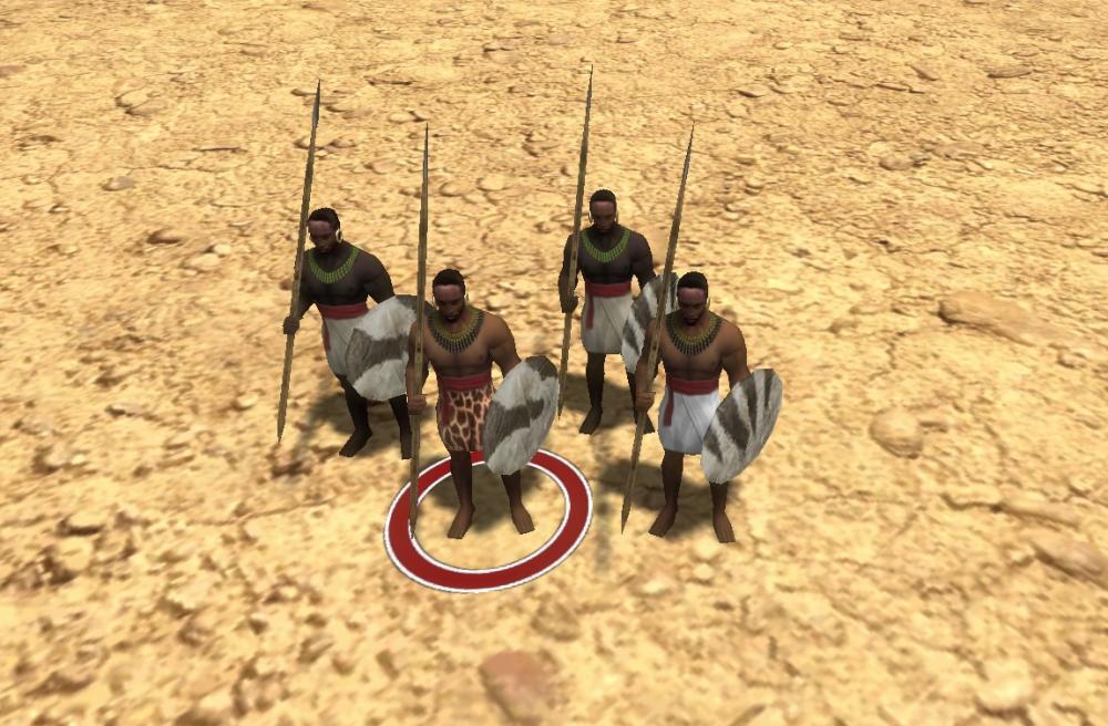
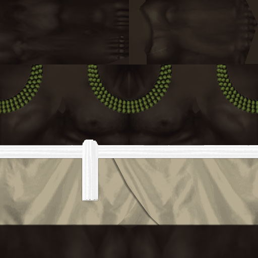
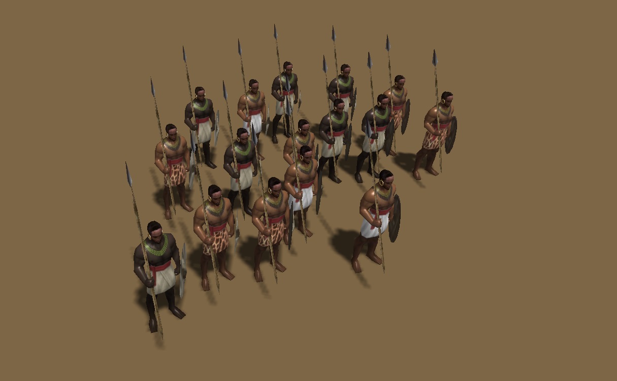
The thread for unit textures and props, except shields. Shields are another thread. All unit textures will need specular maps. @Sundiata and @balduin can provide more references and commentary. Attached, base textures: kush_female_base.psd kush_male_base.psd Unit Roster Civic Center Kushite Woman Nubian Spearman Barracks Nubian Archer Fastest archer in the game, like the Mayan Plumed Archer in Age of Kings:The Conquerors. Meroitic Pikeman Perhaps make available after researching Sarissa at the Blacksmith. Meroitic Axeman Swordsman class, but attack is half crush damage. Meroitic Spear Cavalry I suggest can switch back and forth from spear to javelin. Temple of Amun (Terra Magna, a special building / in Delenda Est, an upgrade for the standard Temple) Priest of Amun Napatan Temple Guard (khopesh swordsman) Boosted by the Fervor for Amun special tech. Fortress Hero 1 Hero 2 Hero 3 Meroitic Noble Archer (champion unit) Perhaps can switch to firing fire arrows, for a siege attack, same as Maiden Guard in DE. Meroitic Noble Cavalry Lancer (champion unit) Kushite Light War-Elephant Mercenary Camp (Delenda Est) / Tribal Village (Terra Magna; a special buildable structure) Nuba Clubman Nuba Hunter (skirmisher) Gives them access to a skirmisher unit. Blemmye Mercenary Camel Lancer Blemmye Mercenary Camel Archer General Looks for Units Basic Citizen-Soldiers: Bare chested. No armor. No sandals. Bare headed. Simple loin cloths and cumberbuns. Advanced Citizen-Soldiers: Bare chested. Strappy leather corselet across stomach for armor. No sandals. Decorative animal skins for loincloths. Decorative cumberbuns and straps. No helmet for lighter units, basic helmet for heavier units. Bronze bracelets and arm bands. Elite Citizen-Soldiers: Linen/cotton Meroitic tunic for chest/shoulders or padded linen/cotton armor for "heavier" units. Meroitic sandals for the feet. Decorative cumberbuns and straps. Basic helmet. Additional bronze bracelets and arm bands. Champions: Scale or padded armor. Meroitic sandals for the feet. What else? Heroes: Crown with snake heads. Colorful tunics and gowns. Lots of jewelry and golden/bronze bracelets, anklets, etc. Colorful gorgets. Nubian Units, specifically the Archer and Spearman: Units with this hairstyle ("Nubians") are the ones that get (ostrich) feathers. Either 1 feather (Basic Rank) , 2 feathers (Advanced Rank), or 3 feathers Elite Rank).2 points
-
I like that solution. Should be added to the core game.2 points
-
I've made a quick and dirty mod to slightly adjust the top panel: delenda_est_a22_1024x768.zip It shrinks the resource labels and displays only thousands if the resource amount is greater than 10K.

 2 points
 -
A bit of dramatic lighting never hurt:2 points
-
Now it looks gorgous! The castle was the building I knew would look very nice with an AO map. Now you need one for all buildings.2 points
-
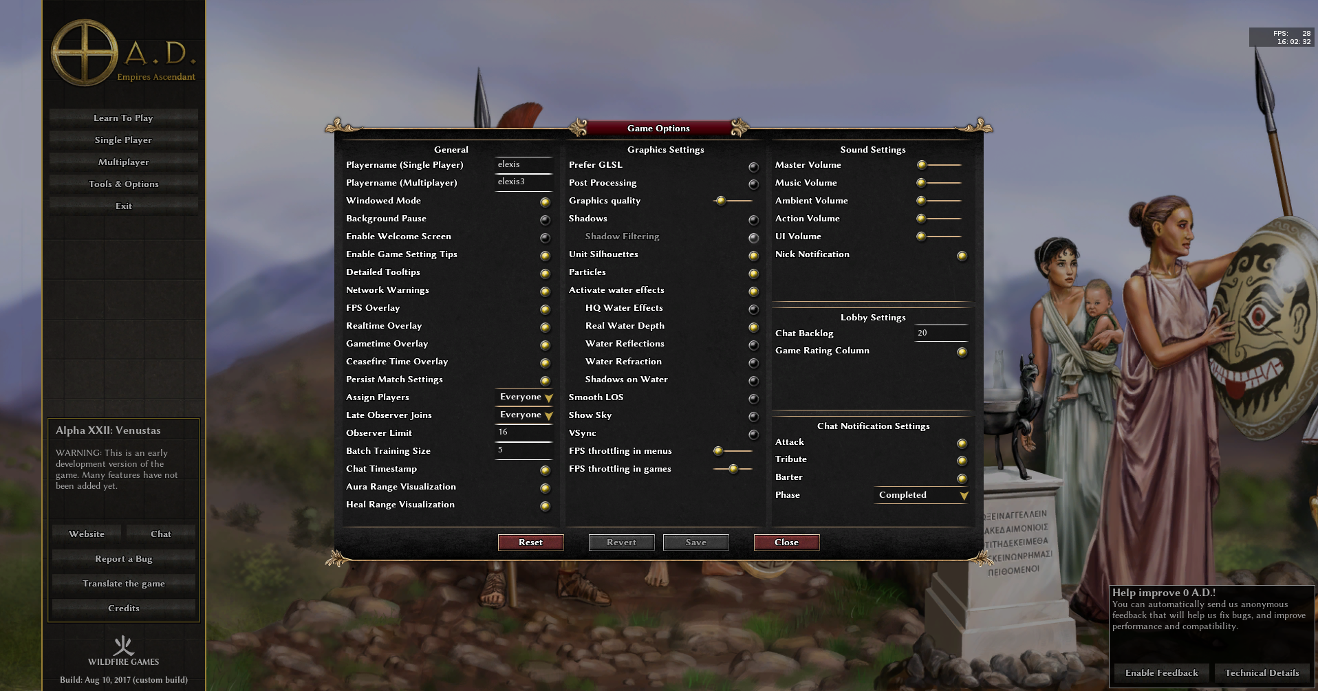
Checked all other GUI pages. The options page is also inconsistent: "Graphics quality" -> "Shader Effects" (less ambiguous, accepted by Vladislav) "Activate water effects" -> "Water Effects" "FPS throttling in menus" -> "FPS Throttling in Menus" For the gamesetup, we could have "Start Game!" instead of "Start game!" while keeping "I'm ready!" and "I'm not ready!". For the multiplayer join-by-ip dialog, "Player name:" -> "Player Name:" as that has the label "Server Hostname or IP:" and "Server Port:" in the label below that. Other than that, replay menu, savegame selection screen, mod selection, welcome page, manual, lobby, prelobby are all using title case consistently </canofworms> Gimme some like button, then I'll commit it (or complain loudly).
 2 points
 -
[sketchfab]32e4cc17316a4b20bf76c156b4a2efa4[/sketchfab] Slave Market by StanislasDolcini on Sketchfab @Lion.Kanzen Here is the slave market. In the zip file, game ready files, only missing the template, cause I don't know what are you guys up to. merc_slave_market8.blend slave_trader.zip

 2 points
 -
No, I want life and color and saturation, not the "grey and brown" look.2 points
-
2 points
-
Darkest possible filtering, going further will make the skin lose its detail.
 2 points
 -
It appears I did some time ago... there's a pull request waiting that should was intended to bring the repo up to A22 compatibility. It's roughly 2 months old, and a quick 3-way ai match reveals that there's at least one problem that either I didn't catch at the time or has appeared since. I'm working today, so fixing that is either going to have to wait until tomorrow or fall to someone else to look into it. Depends on how desperate you are... Edit: Done. Ponies Ascendant should now be A22 compatible.2 points
-
I don't think they have actually been implemented in Delenda Est. I think that link is just the design document. There shouldn't be anything technical preventing them from being added, but it might be a significant effort. Medieval Total War's battalions were too large for me. I prefer the battalions in the BFME 1 and 2 series although they weren't really large enough to call a battalion because they only contained around 5-20 units depending on the strength of the units. I've been asking for some sort of grouped units to be added to 0 A.D for awhile. I think most people here are really attached to AoK, so they prefer the individual unit control. That said, we do have territories which work very well and were not present in AoK, so maybe there is still hope for battalions to be used in some portion of the game. Even if 0 A.D. doesn't use them, I think having a battalion system would be great for modders. I played AoK and AoE3 recently and they both feature a column formation when moving units from one location to another. We used to have that too, but it was removed in one of the many pathfinder fixes. It was a very, very nice feature. I hope that one gets added back someday for sure.2 points
-
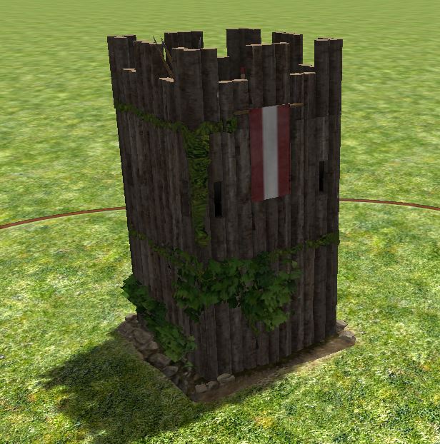
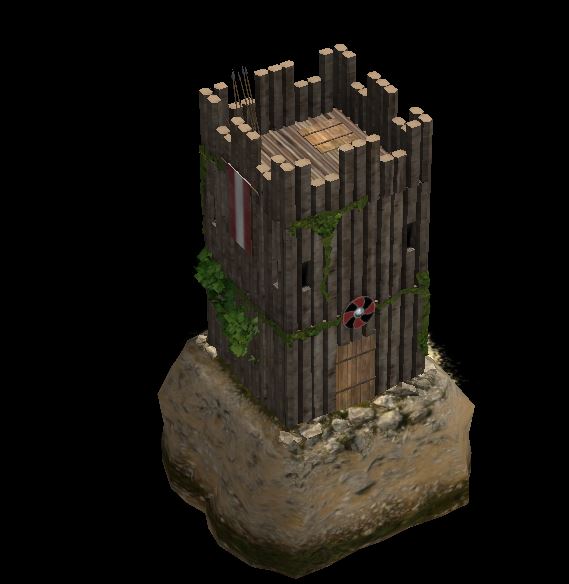
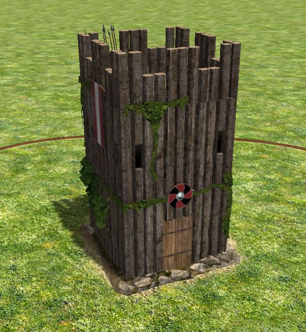
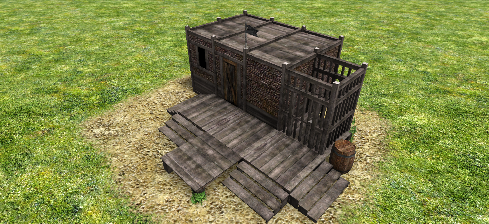
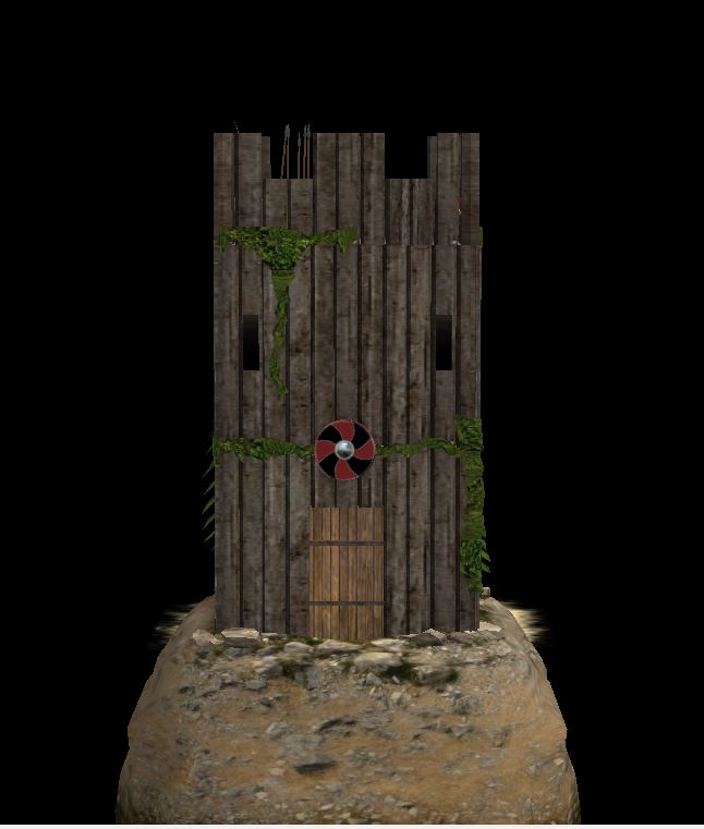
Norse defense tower 4 props Mesh redone, only i keep is the concept and the props. the Wood pillars are better organized and more symmetrical. Screenshots Blender file >>Norse Defense Tower[Finalizado].blend<<

 1 point
 -
1 point
-
I have a discord channel at the moment, though it was originally meant for the Total War version of the mod: https://discord.gg/TyhvujD1 point
-
The biggest trade gain is trading with an ally over a long distance (though you only get a part of the traded value at the ally's market). Cycles for traders are done in the wip code for the Silk Road map, however there is no gui support for creating such cycles.1 point
-
windows are too close to the edges for archers to comfortably use them, some vertical division will help too.1 point
-
Niiiiice. I might play with it and get something nice. A request: Use the Ptolemaic merchant ship as a base and edit it for the Kushites? Mainly need projectile prop point, etc.1 point
-
Those changes look good to me.1 point
-
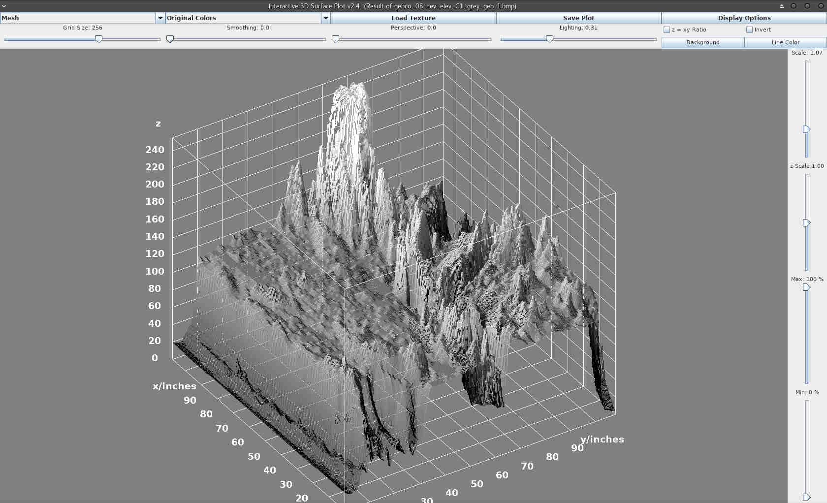
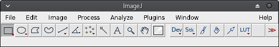
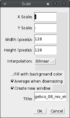
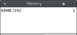
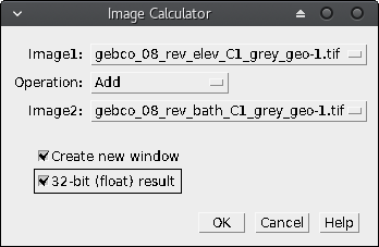
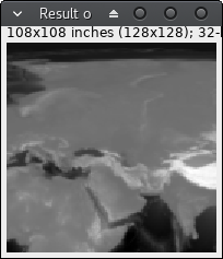
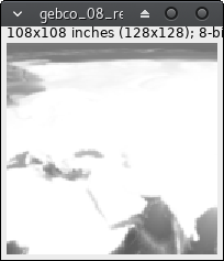
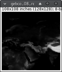
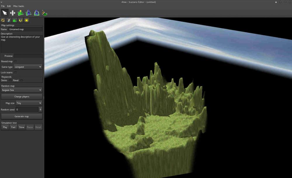
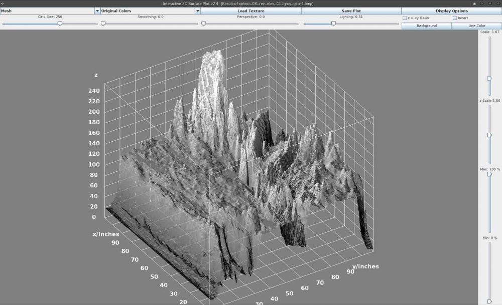
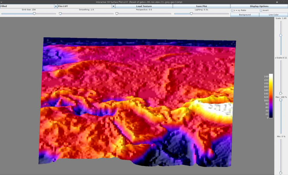
Been trying to master the Heightmap import from the editor, found quite limited in input options as Palaxin's noted in the Height guide. As I have some background on scientific imaging software I started playing around with elevation data here and there and found that there is need for more control on horizontal scaling (the map) related to height scaling. Aswell as (maybe) simpler way of preparing image data for heightmap import in the 0ad editor. ImageJ is an open-source image processing and analysis software written in Java. It is a multi-purpose piece of software very well suited when working with (very) different types of images, specially for scientific analysis. It has the advantage of allowing the extension of software via macros (very simple scripting language for repeated processes) and plugins (Java coding), so anyone can share any piece of code for automating the preparation of geospatial data for the (great but currently limited) heightmap import in the 0ad editor. One of the problems I found first is when I try to prepare a very small map (e.g. 128*128 pixels) having the height values from 0 to 255 (8-bit per pixel) the elevation (z-axis) has too much range whereas the map surface (x,y axis) has too little. Moreover, even if you don't have this problem, you may find in the need of controlling the z-axis scale independently from x,y (to obtain not too steep mountains or not too shallow cliffs, etc. depending on the case). This is precisely the problem I am going to address below. Preparing your system Install ImageJ from its download website (I recommend using your distribution repository if you use GNU/Linux or the platform independent download for other system if you already have Java already installed as ~99,99% people does , if it does not work refer to the documentation or try your platform download ). Download elevation and/or bathymetry data. For simplicity I've selected NASA Blue Marble image series as with this data source you have elevation and bathymetry on the same scale so both maps fit perfectly. I'll use the C1 area that includes the Mediterranean Sea as can be seen here. And download both the topography and bathymetry. Remember using right-click/save-link-as... cause the images are huge and you don't want to crash your browser. Select in both the same areas. I've picked C1. Basic map preparation Start ImageJ, you should see something similar to this: It's a tiny window for a great program don't let you misunderstand this: size in this case DO NOT matter. Open the elevation file, either using menu File/Open... or drag and drop. It is quite big, I strongly recommend you downsample (scale) it before continuing. So click menu Image/Scale... or just press Ctrl+E. I'll pick 128x128 px for showing you the problem with this kind of tiny sizes. I recommend "create a new window" option as I have experienced some weird problems if not. Just close the source image after finishing. If you believe your machine and patience can stand huge images skip scaling. If you prefer cropping than scaling try yourself, this is beyond the scope of this basic tutorial. Just try menu Plugins/Macros/Record... before cropping and guess how to repeat exactly the same crop in the bathymetry image. Further on this: write me or comment this and I will try to post and advanced tutorial on this. Maybe you've seen an error in the log: <Out of Memory>. If so you will have to close ImageJ and start it from the command line with the memory option. In my GNU/Linux it is -x (I guess is the same in other systems, but maybe with whole path before the command in windows): imagej -x 2048 As 768 MB is currently the default limit, and I have 6GB I guess 2GB will suffice (2048 MB). Of course do not reserve too much memory or your system might crash (you can see the free available memory in your task manager or sort-of). Now you can repeat 2, 3 steps until you achieve your wanted image. Close the big one, you want to preserve your memory. If you want to check the available memory ImageJ ships with a tiny monitor: menu Plugins/Utilities/Monitor Memory. You'll see a new tiny window and if you click on it the program will force garbage to be collected and reduce the memory used. This is very handy, if you find the memory usage is growing too much just click the monitor. Also you can click the status bar of the main window and there will appear the program info including its memory usage. Save your file. Either using menu File/Save... or hitting Ctrl+S. The default tiff file will suffice and preserve our original 8-bit pixel depth data. Repeat steps 2-5 with the bathymetry data. You should end up having two (not so big) images with the desired data. Now the magic comes. As I've mentioned above as NASA data uses the same scale and regions for all maps, now we have both elevation and bathymetry data from the very same region. Let's join that. We will use the image calculator. Think of it as a per-pixel calculator, so having 2 opened images of the same size from the same region you can combine it's data and finish having a bathymetry+elevation image. If you hover your mouse over any of the images you will see the value of the pixel under the mouse in the status bar, such as: x=23, y= 46, value = 125 note that x,y coordinates might be expressed in pixels or in inches or any length measure. Remember the value is the 8-bit value (0-255) for each pixel. If you explore a bit, you'll note the elevation image store 0 in the sea level whereas in the bathymetry the earth (above water) level is stored as 255. This gives us the clue to guess the kind of calculation we should choose. Now click menu Process/Image Calculator: So if we add the two images we will have both bathymetry data (from 0 to 255) and elevation data (from 256 to 511) merged into a new image. Please, note that if you do not use 32-bit result you will obtain an 8-bit data with the result of data loss (because with 8 bits you can store up to 256 values). Create a new window is also recommended option always. bathymetry + elevation = result + = Now, when you start thinking you have the perfect image to import on the 0ad editor, you save it (tiff will maintain all your precious data), then you just need to change the image type to RGB (menu Image/type/RGB color), then save it (menu File/Save as/BMP). Go to the 0ad editor import heightmap and get a horrid result: But this is not the end of the tutorial. Remember the z-axis (or height) scaling problem? Here you can see it. Let's address that. Ok, let's return to ImageJ and close anything but the result window (or reopen the tiff saved in 8). Click menu Plugins/3D/3D Surface Plot) There goes the result. The appearance is similar to the map generated by the editor, but you have now 3D superpowers. Have a look and play around: above you can change the visualization type (drawing as a mesh, dots, etc. and colors). At the right you can see Scale (zoom the visualization) and the most important z-Scale. Change the z-Scale value until you like the result and take note of the z-scale value (in my case 0.11). Return to the result window (elevation+bathymetry). Click menu Process/Math/Multiply... Type your desired value, OK and voilá! The image might have appear to become invisible, but the data just have changed (each pixel value has been multiplied by 0.11) You can save this tiff with another filename, such as "corrected" or -0.11 or as you want. Then repeat step 8 (type RGB save as BMP) and import it in the editor. THIS IS INCOMPLETE. SORRY FOR THE INCONVENIENCE BUT I'LL TRY TO FINISH THE TOPIC WHENEVER POSSIBLE.
 1 point
 -
@Lion.Kanzen Just made another building. Anything top priority on your list ?1 point
-
@LordGood Gate texture is looking a bit blurry for some reason1 point
-
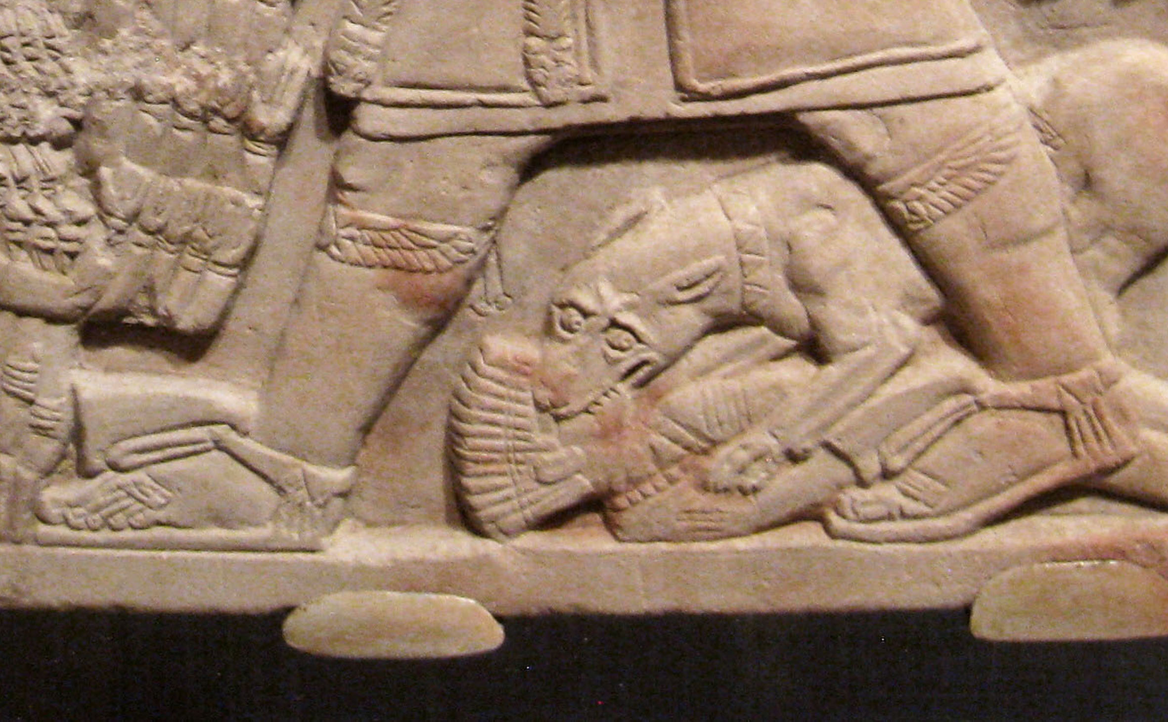
"the cobra piece on the forehead" is only for royals... Sign of divine rulership... That's Taharqa, by the way...1 point
-
1 point
-
Meroitic Sandals (for elites)

 1 point
 -
Hero 1: Arakamani: (Hellenisation) - techs research faster Hero 2 Amanirenas: (Diplomat/warrior queen) - favourable outcomes in diplomatic affairs/soldiers fight harder (can recruit lions?) Hero 3 Nastasen: (Naval superiority) - Boats gain increased attack and defence I'd refrain from using the word Bushman for the Nuba, as that term is most closely associated with "the Bushmen of the Kalahari" , which is the other side of Africa.1 point
-
Yes, Spellforce environments look incredible. Would be perfect for 0 A.D.1 point
-
My suggested roster, based on yours Sundiata. Civic Center Kushite Woman Nubian Clubman Basic-only, does not promote, similar to the Rorarius in DE. Barracks Nubian Archer Fastest archer in the game, like the Mayan Plumed Archer in Age of Kings:The Conquerors. Nubian Spearman Meroitic Pikeman Perhaps make available after researching Sarissa at the Blacksmith. Meroitic Swordsman Meroitic Spear Cavalry I suggest can switch back and forth from spear to javelin. Temple of Amun (Terra Magna, a special building / in Delenda Est, an upgrade for the standard Temple) Priest of Amun Napatan Temple Guard (axeman) Boosted by the Fervor for Amun special tech. Fortress Hero 1 Hero 2 Hero 3 Meroitic Noble Archer (champion unit) Perhaps can switch to firing fire arrows, for a siege attack, same as Maiden Guard in DE. Meroitic Noble Cavalry Lancer (champion unit) Kushite Light War-Elephant Mercenary Camp (Delenda Est) / Tribal Village (Terra Magna; a special buildable structure) Nuba Tribesman (skirmisher) Gives them access to a skirmisher unit. Blemmye Mercenary Camel Lancer Blemmye Mercenary Camel Archer =================================================================================== If we can get the turrets feature implemented, the elephant driver/rider could throw javelins at random nearby enemies.1 point
-
1 point
-
rock-paper-scissors all within the infantry line. I like it1 point
-
I suggest the Axeman be the "Temple Guard" for the Temple of Amun.1 point
-
Hmmm, for DE Ima put those in the merc camp. It would be awesome to have some biome/ethnic themed merc camps though. Like a "Nuba Village"-looking camp for Egypt/Kush maps. "Nuba Tribesman" could give the civ access to the skirmisher class.1 point
-
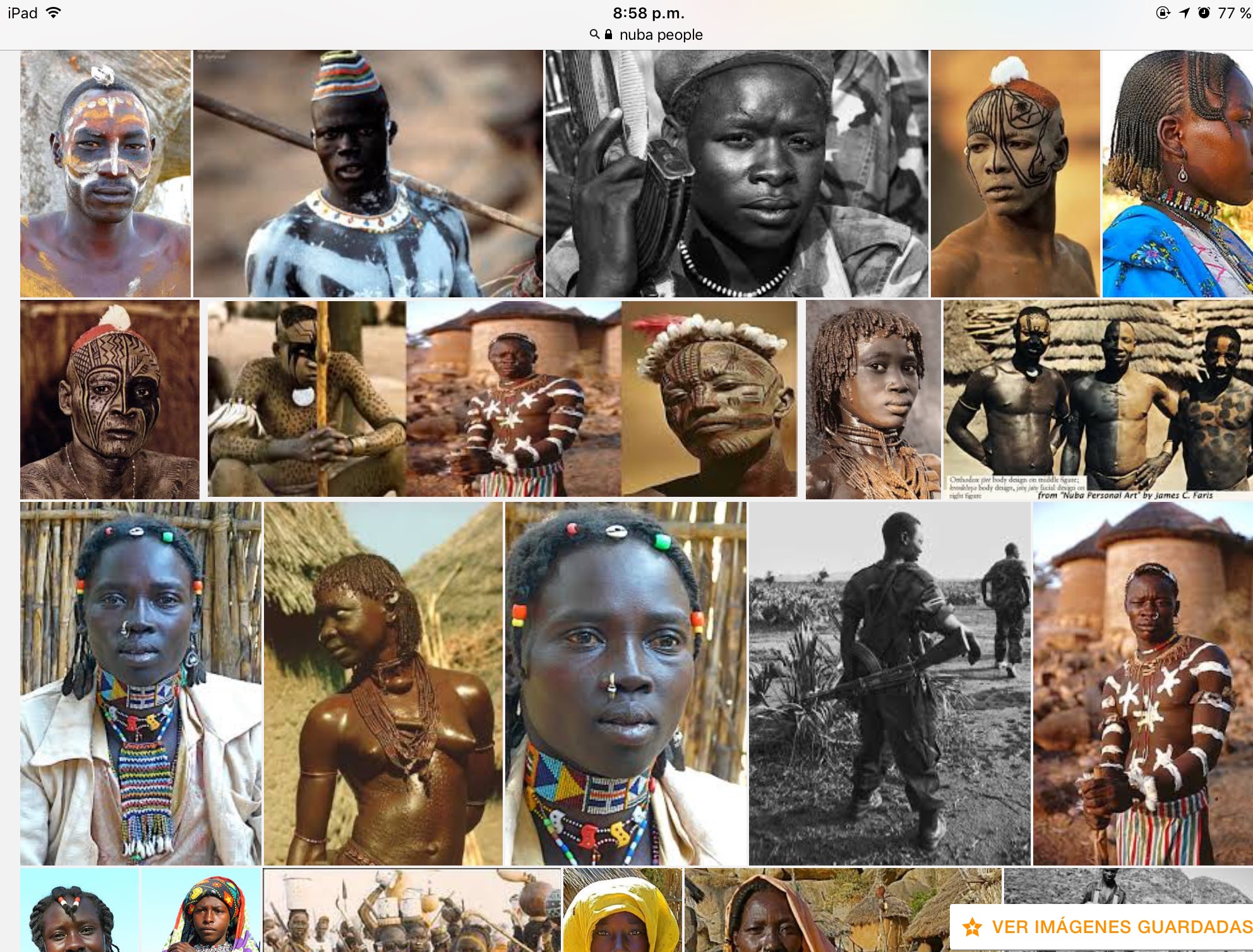
sudanese nuba More images.
 1 point
 -
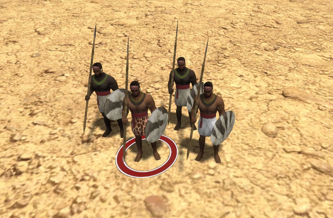
Leopard and lion pelt will be reserved for advanced and elite ranks.1 point
-
@Sundiata Did the common warriors worn hides from nonaggressive animals such as domestic animals like cattle and wild animals like zebras and giraffes? If so, I would use giraffe, zebra, cattle/horse/etc and elephant hides for skirt variations.1 point
-
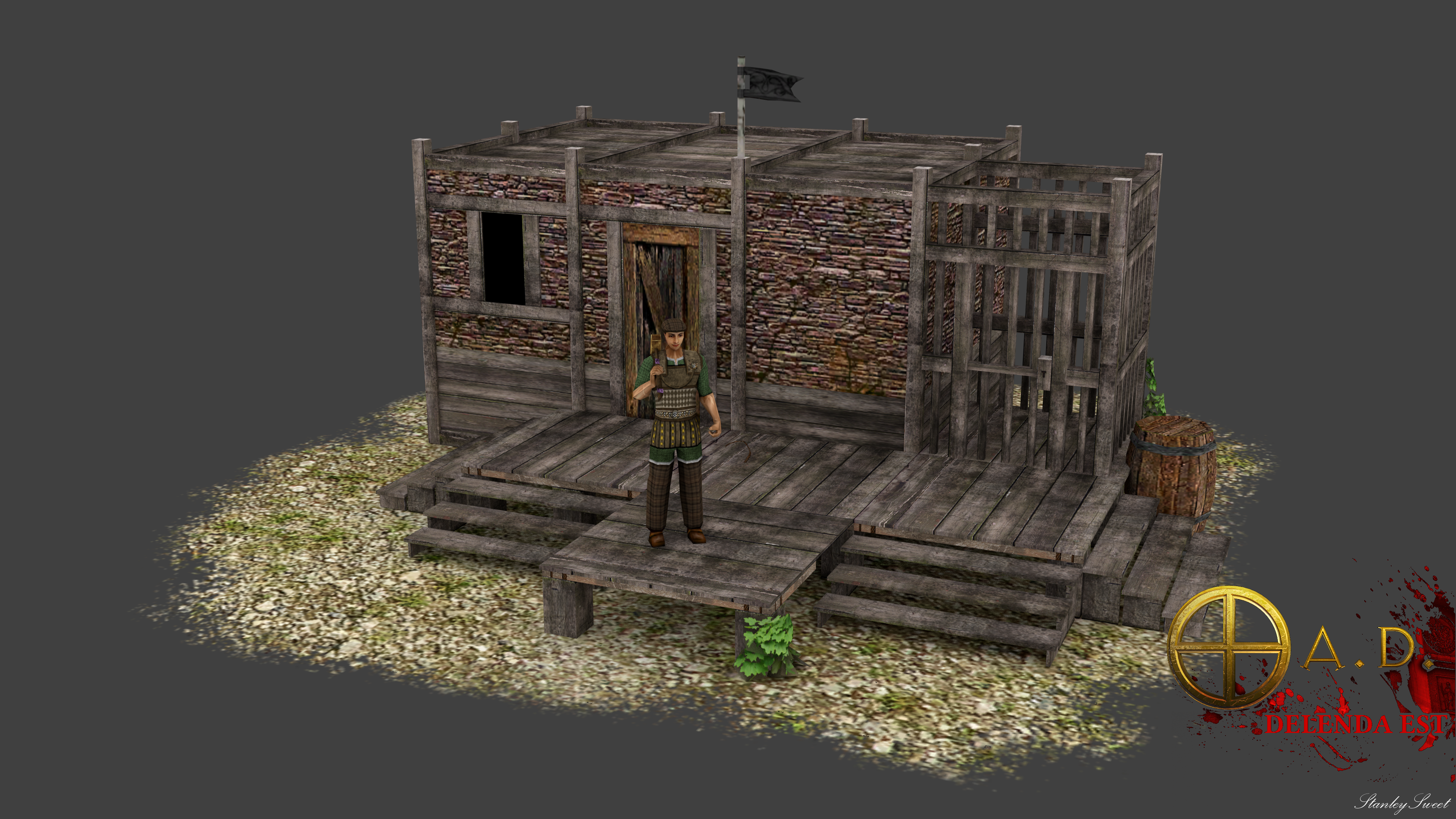
Auxiliar barrack, after see discuss realism vs rts way what you think? and I propose have 3 maximum.
 1 point
 -
Maybe not, I would be more comfortable with a ground decal to tie it all together. I would also like for temples to be standardized in vanilla, but that might be wishful thinking. But that sort of thinking makes me reluctant to stray from the general Greek 2x+1=y temple footprint1 point
-
@niektb You're absolutely right, I made that mistake for the first few posts because I had trouble uploading them directly... I've been thinking about re-uploading them directly for that same reason.1 point
-
+1 Coincidentally thought to check up today, the progress here is incredible. You all deserve a massive congrats! Great work.1 point
-
AI diplomacy is simple right now, and it relies on the illusion that the AI knows what it's doing. If a bot realizes it has a lot of enemies, it may try to request an alliance with a player who also has a lot of enemies. If you try to change your stance with a bot in a positive direction, it will be more likely to accept if its population is low. In many cases, if you are the same civilization as a bot, it will be more likely to become allied/neutral with you (I'm not sure if I should have added that quirk, although mimo was fine with it). But also in many cases, the decisions it makes (when it comes to diplomacy) are random. In terms of future plans, it would be nice to get rid of most of the randomness, and use some heuristic algorithms instead.1 point
-
I don't think the plan was to go full 3D for now, only to port the assets in 0ad1 point
-
@Andrettin : Wyrmsun on pyrogenesis ? Why would you do that ? You're the one that made Stratagus usable ! Although Wyrmsun lacks some gameplay and UI features compared to more modern RTS engines like pyrogenesis, it shows quite a significant progress compared to the BOSWars experience. I had never thought I could enjoy a Stratagus-based RTS until I saw Wyrmsun. Also, although the pathfinding in Wyrmsun is not optimal, I'm skeptical about pyrogenesis being able to improve it. I'd recommend making a lot of performance tests before giving a definite opinion. (I haven't tried Wyrmsun multiplayer so I don't know about that part) Don't get me wrong, I would love to see a 3D RTS based on the lore of Wyrmsun, with nice models, graphical effects and all that stuff. But perhaps not as a replacement of the current 2D game.1 point
-
The easily exploitable part is most likely fixed by now, or shouldn't be hard to solve for someone knowing that code. Not sure how to make it obvious to players, but I planned to use it on the trade route map (for the trading gaia/AI player) as most of the required code (apart from allowing to issue the right commands from the gui, and maybe some small adjustments in the command handlers in UnitAI) was merged in #3812 (and lots of later commits, and likely some cleanup is still missing).1 point
-
Wow this escalated quickly! Sorry for my angry tone in the beginning btw - not to belabour any point - it would be hard to explain the cause of it. Anyway, I see that there is indeed some serious interest. I'm in for a mod.1 point
-
Just as an example of how wrong this is (information is a bit hard to find unfortunately with limited time right now: http://en.wikipedia.org/wiki/Mero%C3%AB There were imperial Kingdoms in Africa for most of Africa's history. They're just not mentioned in contemporary history very often, because it's inconvenient to admit that we're not a primitive sub-species that couldn't get anywhere till we had a helping hand.1 point
-
Thanks guys, this is all very very helpful, especially the architectural references! Please keep the info coming as we need lots of inspiration1 point


.thumb.png.ce58cea22940c255f5b0a735d5abee36.png)