Search the Community
Showing results for tags 'atlas'.
Found 16 results
-
Hello.When I try to open the map editor it returns an exception and stops.I tried to open ,the map editor but I could not enter neither through the game nor directly in the Atlas launcher
-
Hi everyone, Today I want to show you, what will be in the a19 release about atlas. The main idea is to give to all map makers more space to work over map. I hope you like, I will try to keep updating this post about my work. Here is the video New map: Object List filter(Include inside template content) Display Template, Entity Settings (with variations) This videos show terrain tab, Display settings, environment settings and Actor Viewer tool
- 67 replies
-
- 13
-

-

-
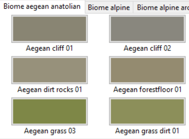
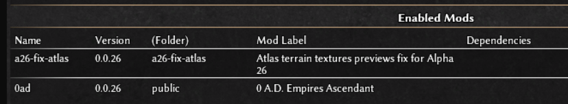
In Alpha 26 due lack of Atlas testers we have a minor bug (doesn't affect you if you don't paint terrain in Atlas). The bug is terrain textures previews are blurried: To fix that you need to download and install the attached mod. Note: you need to put the mod before the public mod in the enabled mods list to make the fix working: a26-fix-atlas.1.pyromod Reported only after release here:
-
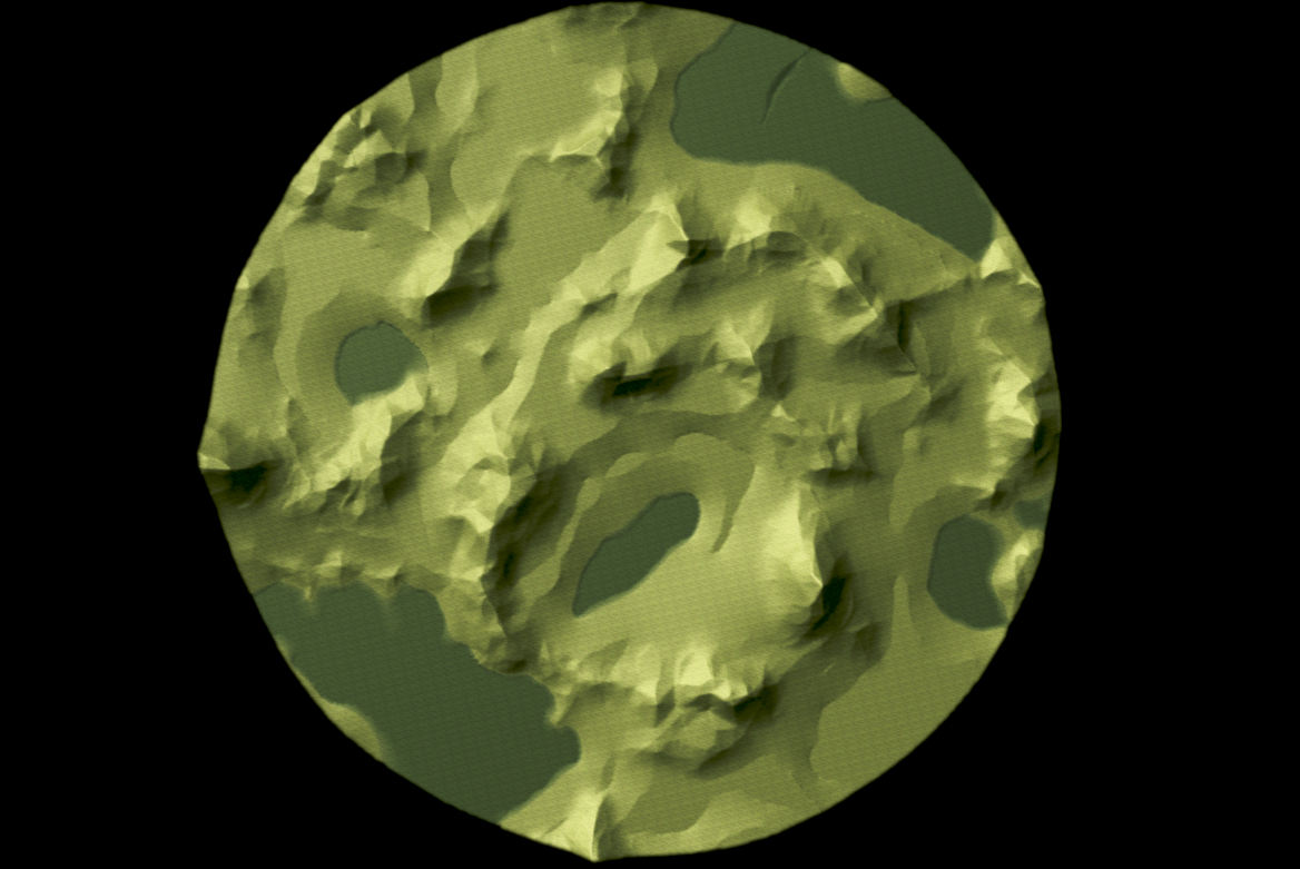
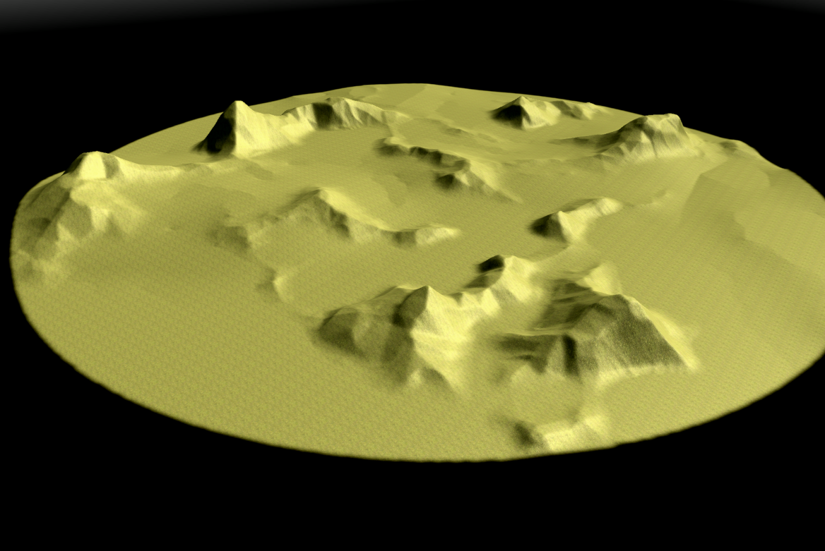
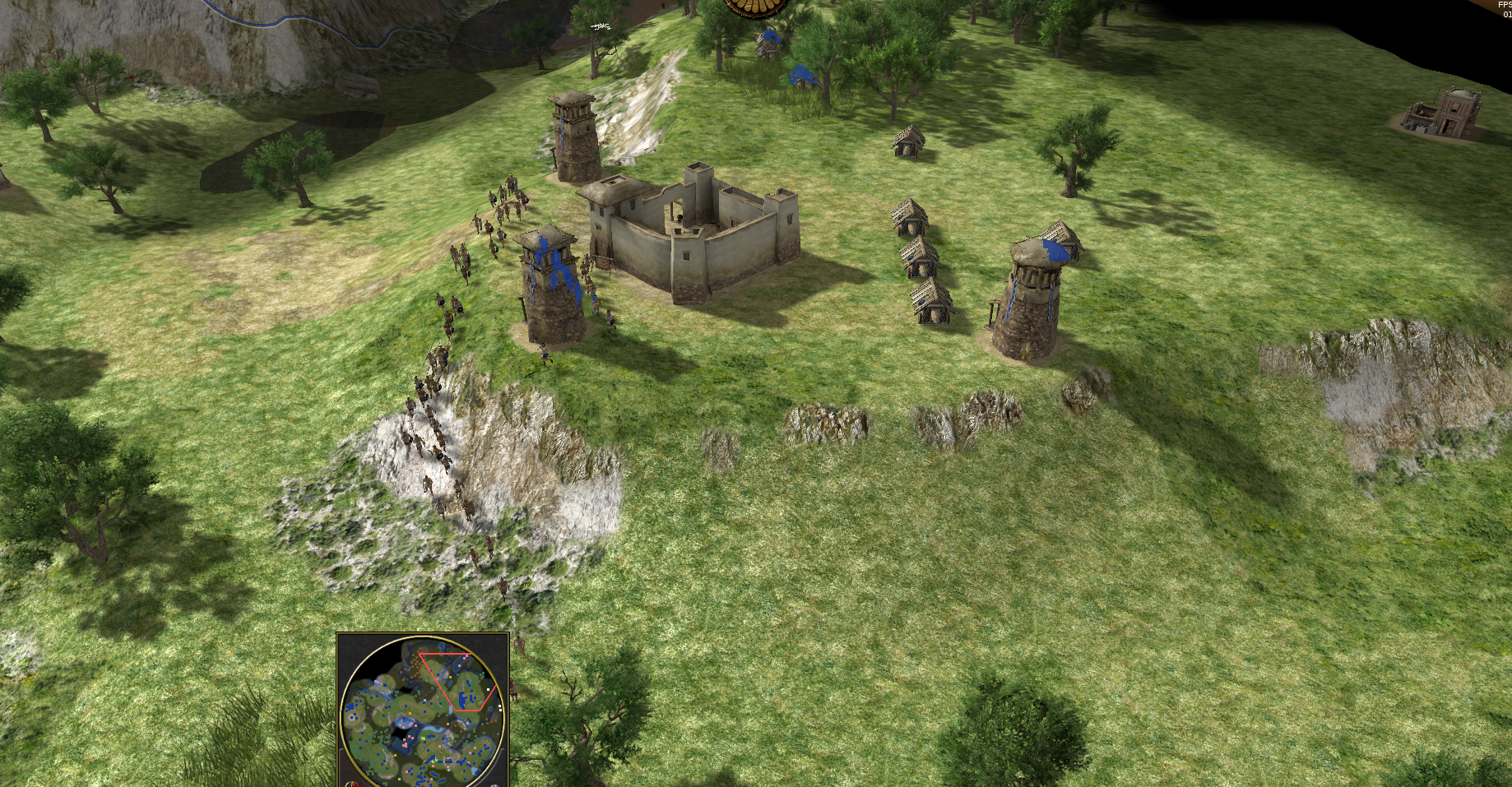
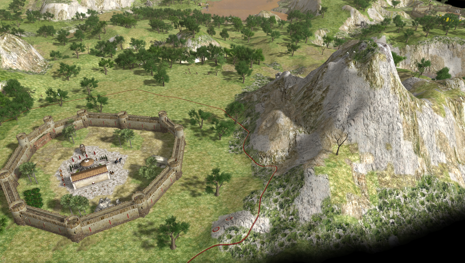
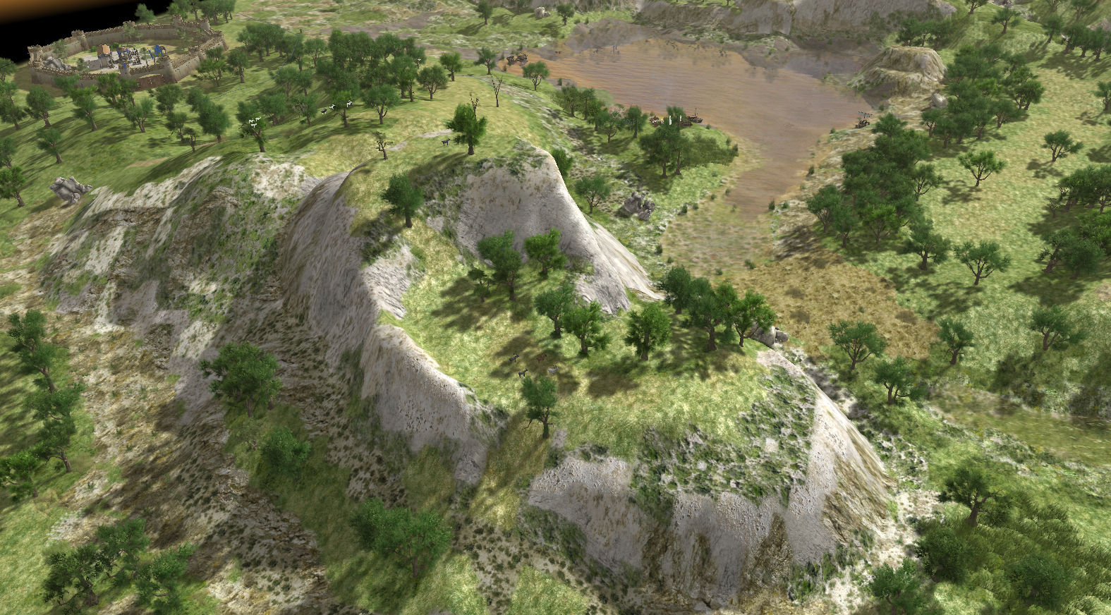
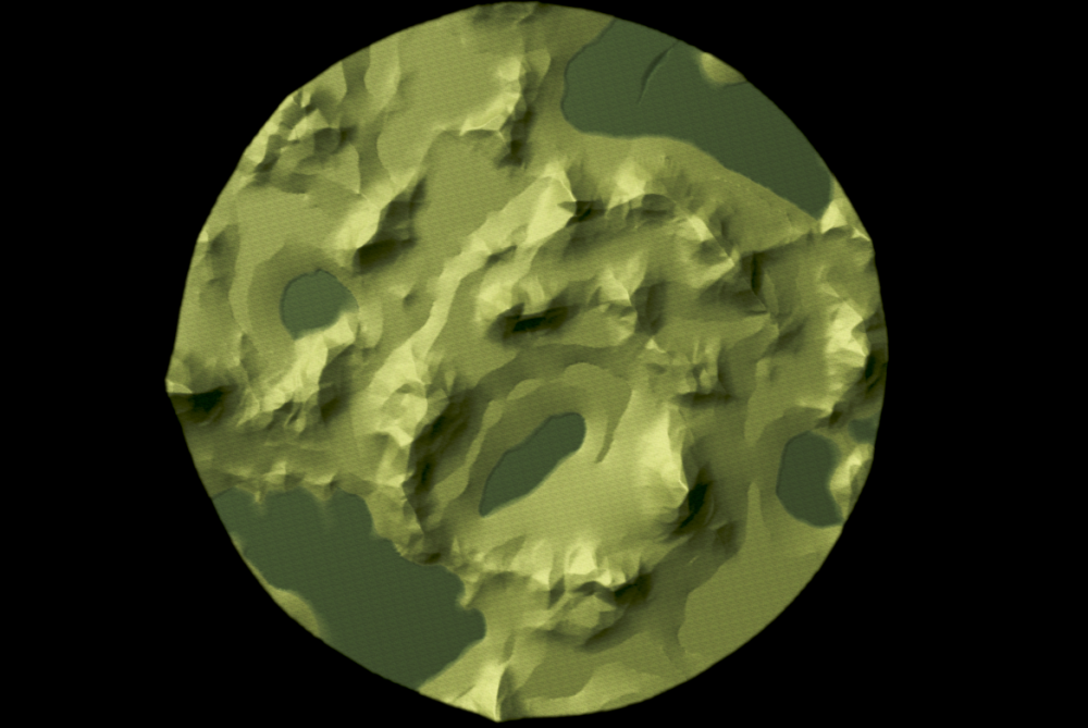
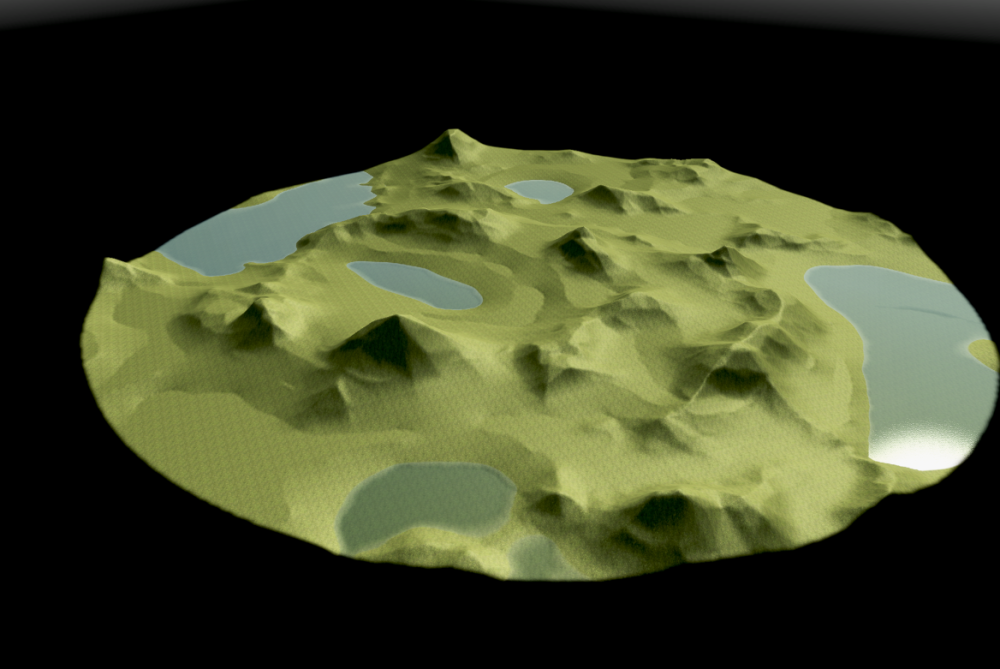
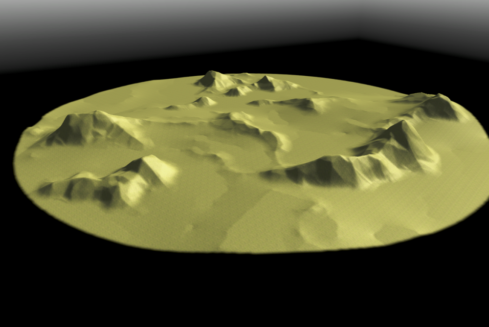
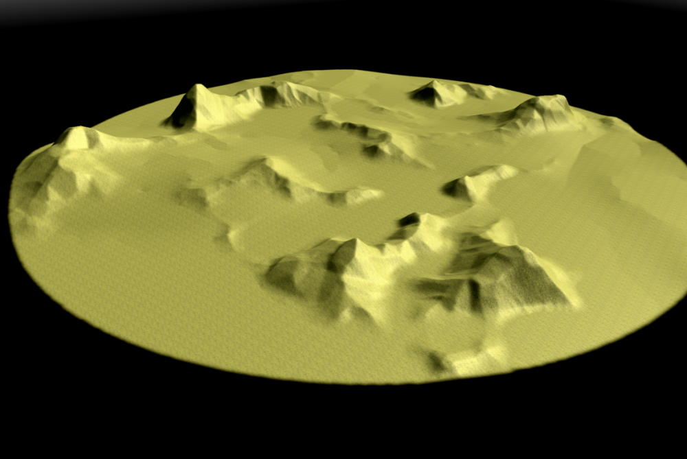
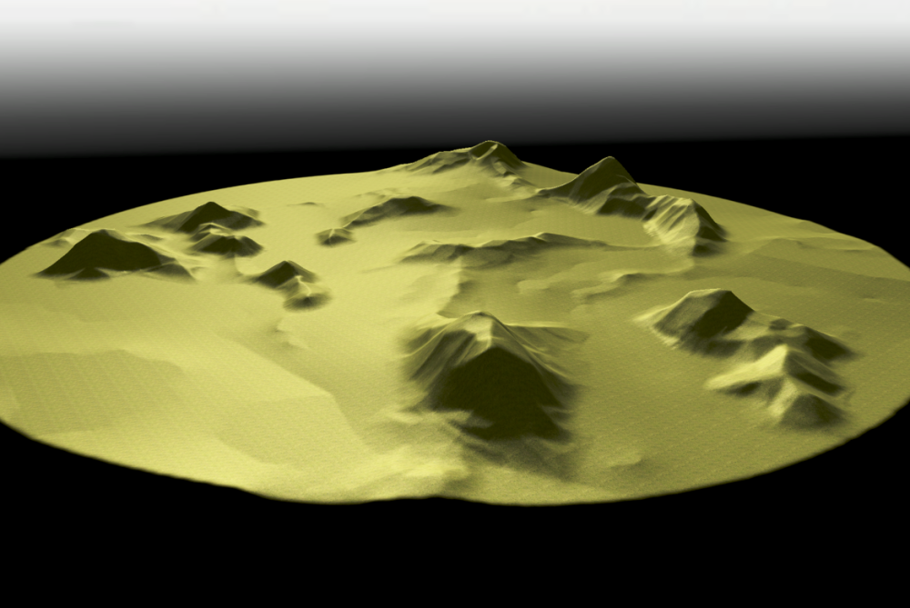
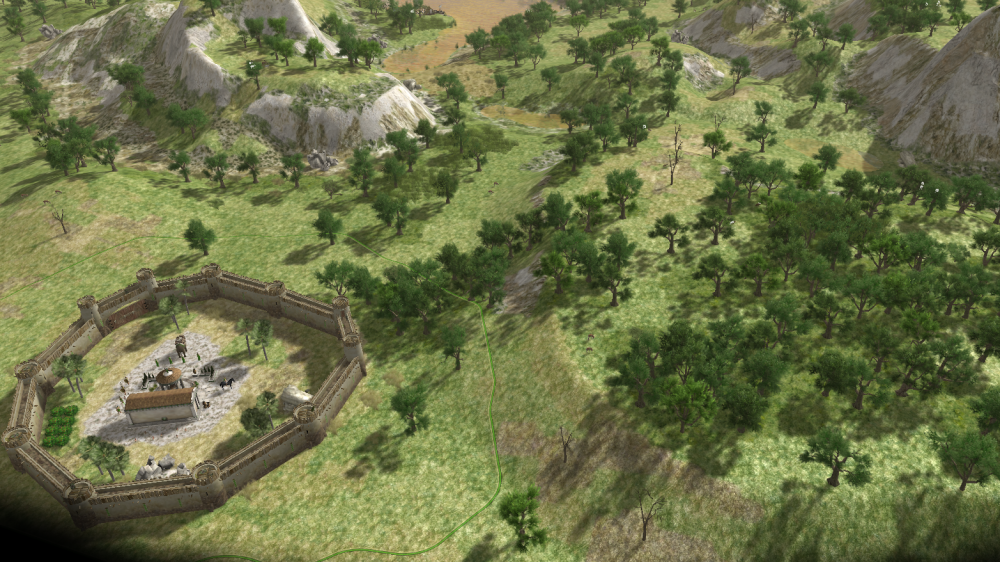
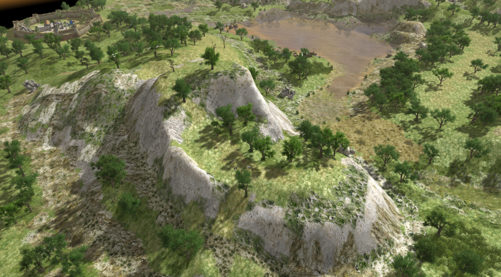
 Hi! I'm currently coding a python plugin for GIMP to help create elevation maps with mountains. The aim is not only to picture realistic mountains, but also to make them suitable for interesting game-play. I think that mountains and relief should not just serve as obstacles, but as tactical features where one can use elevation to it's advantage. Right now, the plugin only creates one type of mountains, mainly rocky / faceted mounts, but with a lot of possible variations inside that type. I'll soon add some erosion factors which will allow to make hills and older mountains. The first version of the plugin should also have an option for symmetrical height-maps. For now, the process is mainly random, i.e. procedural. But a lot of parameters are tweak-able (although I'm trying to simplify things a bit for the interface). Most notably, you can let the plugin choose it's seeds for the random generator well... randomly, and once it produces an interesting configuration you can fix some seeds and let the generator explore other variants inside that particular configuration. If that sounds complicated, it'll become clearer once you can try it. :-) Please note that the plugin only creates the height-map, it doesn't do any import into the Atlas. See this thread for that part, and scroll down to my tutorial for best quality import. But enough explanations, here are a few raw shots from 0 A.D's Atlas. Most mountains shown here are climbable.
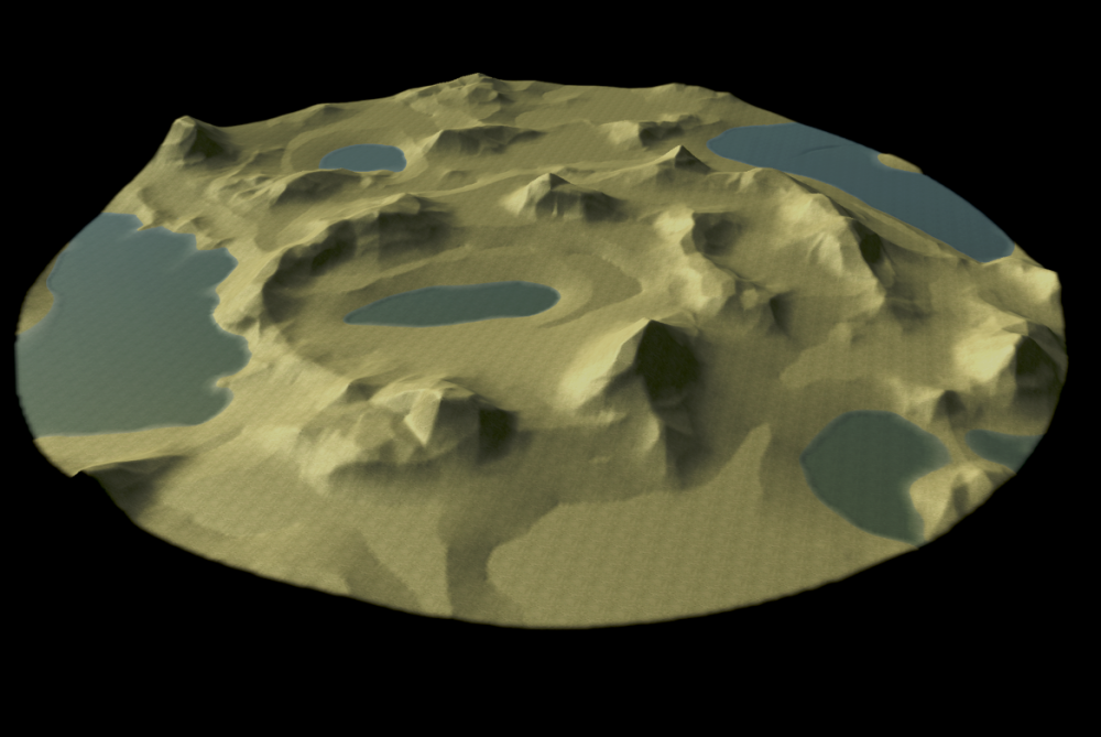
-

atlas Can a bridge over land be made using atlas
andy5995 posted a topic in Scenario Design/Map making
As Atlas is a 3D editor, can a bridge over land be made using Atlas? Something like this? -
New and Updated Skirmish maps in Delenda Est. (I'll update this thread periodically) Crocodilopolis
- 28 replies
-
- 5
-
-
-
- skirmish maps
- mapping
- (and 2 more)
-
This is for discussion and suggestions regarding unused entities, units, etc. in Atlas since Alpha 23. If there is already an existing thread or threads regarding this, please refer me to such. Good to know that stables and siege workshops are going to be standard in Alpha 24. In order in the list of entities: Campaign folders are for entities in campaign "maps" not intended to on played on like a normal game. Celtic hut and longhouse remnants from previous alphas. Make them equal to houses? Desert trading post models are the same as the Persian market ones. Fences (the long, short, and stone) are select-able and attack-able. Hellenic Epic Temple, despite being in an skirmish map (Greek Acropolis?), is basically a modified Parthenon acting as a large Temple. Hellenic Proplyea (entrance to a temple), suggest making it garrison-able if it serves no other purpose. Palisade angle spikes should not have rubble when destroyed, should be able to take many hits from spears and arrows, and should be easily vulnerable to swords, axes, and crushing attacks. How about making them anti-cavalry stakes? Wooden Watchtower can be garrisoned by one unit or small siege engine. Small spikes can be like caltrops, dealing damage to any units going through. Tall spikes can be barricades. Corinthian (Seleucid) colonnade. Table (both rectangle and square variants) Default fishing boats, trading ships, and biremes should be added, not just triremes. Babylonian defense tower should be for the Aristea mod unless any scenario has them for a reason. Outposts may need to be unique models for every faction, current one can be put for one faction/civilization or in the "other" folder if generic. Melonas (rotary mill) is going to be deprecated, suggest a use for Millenium A.D. factions (Anglo Saxons, Carolingians)? Does the next alpha allows upgrading Carthaginian houses into apartments? Borg's mod already does this. Carthaginian embassy (the large one), suggest that it can hire all seven mercenaries from the three embassies. Carthaginian small wall gate is the same as the palisade's Tophet, the other Carthaginian temple. Persian apartment block, found in "Egypt" skirmish map, suggest that it can be like Delenda Est's insula, built in the City phase and housing many. Persian houses A and B also found in "Egypt" skirmish map, suggest that can be built in the Town phase. Persian inn, remnant from a previous alpha. Persian tačara can function like the apadana (palace), summoning hero and anusiya. Where can you find the texture and/or model for the lighthouse in the 4-player "Corinthian Isthmus" map? Different texture than the buildable Ptolemaic one. Temple of Mars also found on Egypt skirmish map. Tent (tabernaculum) can be built by Roman citizen soldiers, and can be transferred like yurts for only food (carried by donkey or horse-drawn cart). Roman Triumphal arch also found on Egypt skirmish map. Imperial Roman special building for Empires Besieged? Spartan gerontía/gerousia (senate?) should be like the Athenian prythaneon. Currently only Leonidas can be trained, why not the other two heroes and some upgrades? Found in an old tutorial from a previous alpha. Athenian gastraphetes currently uses the Scythian archer portrait. Xenophon should be a cavalry swordsman hero. Boudicca's cavalry javelineer and infantry swordsman forms. Carthaginian champion pikemen, also found on Egypt skirmish map. Arstibara (apple bearers), probably the same stats as (and right clicking the icon shows) the anusiya. Persian champion cavalry archer currently has same portrait as the champion cavalry spearman. Some mods correct this. Ptolemaic Nubian mercenary archer. Roman imperial legionnaire and centurion are also in Egypt map. Marian legionnaires can be found in Gallic Fields map, takes experience to promote to imperial legionnaire. Roman onagers do not pack. Delenda Est kind of fixes this problem. Spartan pikeman. Delenda Est has a trainable version of this unit. Theban Fire Raiser, Sacred Band Hoplite, and Thespian swordsman are in Delenda Est, but the Sacred Band Hoplite is also found in the Pelopponesian Wars scenario map.
-
 I just committed a tool to easily setup water height for maps. Just select the tool and click on a terrain where you want a plane of water (if you need more precision just zoom in). No need to spend time with the water slider anymore
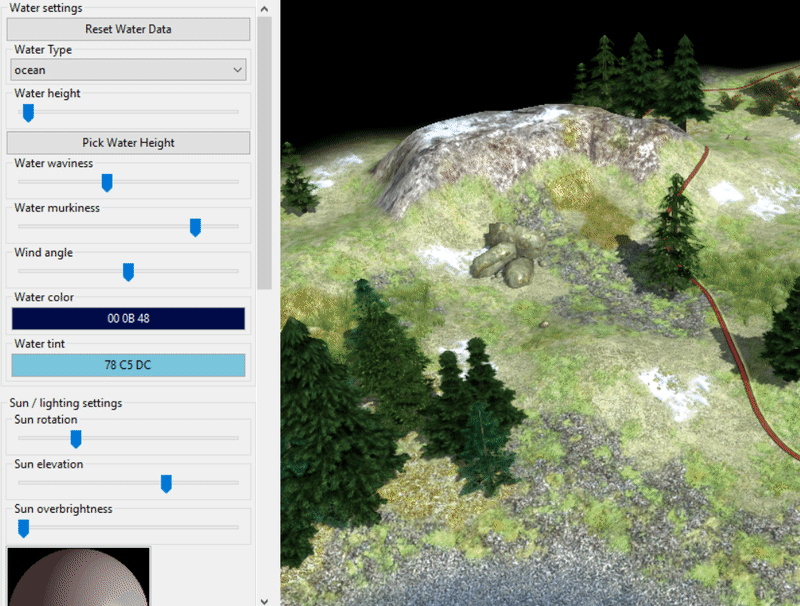
-
Is it possible in Atlas (or manually in the XML) to put garrisoned buildings? Like a tower with a soldier inside?
-
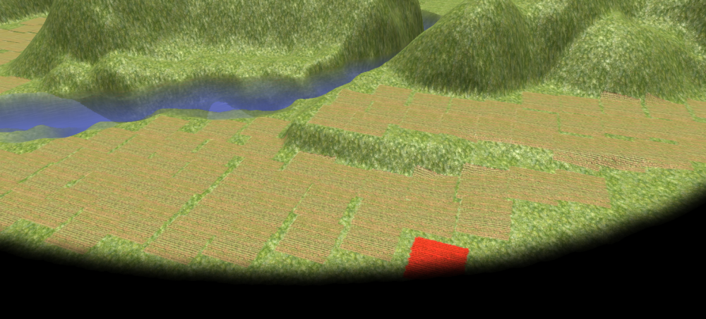
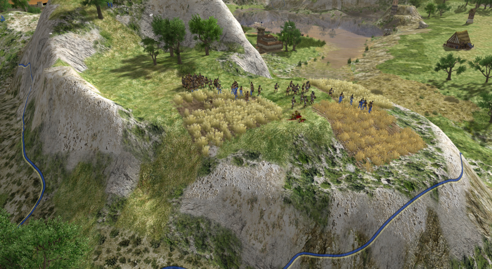
Hi people. I'm developing a new map in Atlas, and it is a full of irregular terrain. I've tried to leave two flat areas for the two players, but I'm trying to make them balanced, more or less the same size. Do you guys have any tricks that you use to estimate if the areas are more or less equal? My method, placing (and counting) fields lol:
-
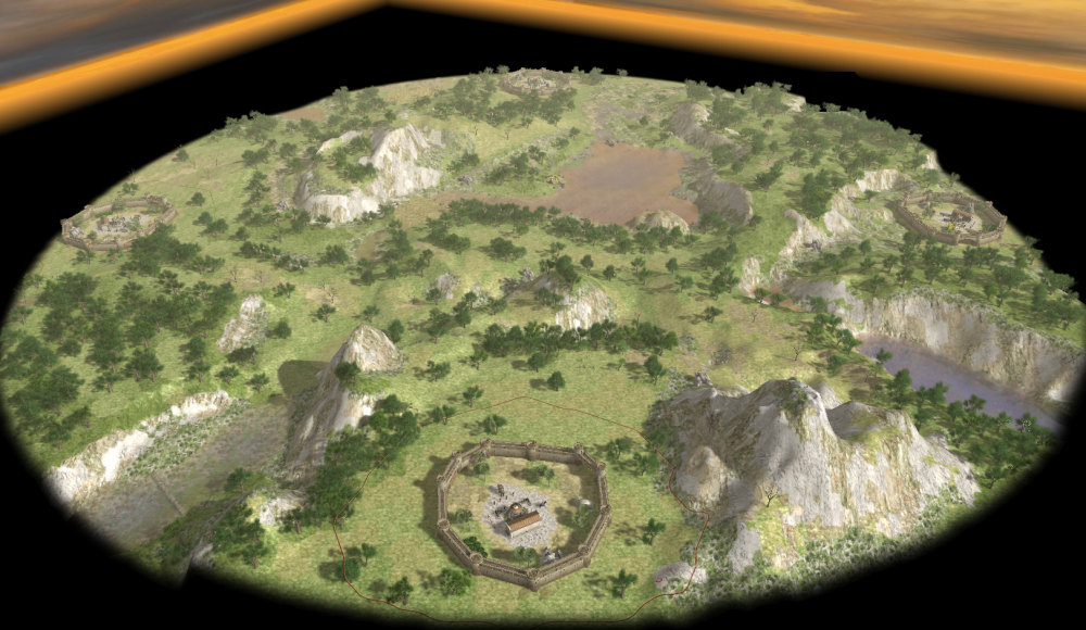
Hello 0 A.D. fellows. I'm proud to present my first polished map: Four Cities Meet (4). It is a map for 4 players, very assymetric gameplay, but I tried to keep it balanced. There is enough trees and animals, but not a lot of stone and even less metal, so there will be struggle for these resources. Player 1 and player 3 start in a large plain, which has a nice mountain where you can build defensive structures. The entrance of the mountain favours player 3. Player 4 starts at an elevated plateau, surrounded by a dense forest, while player 2 is very well protected by hills and a small stream. A pond in the middle of the map prevents a total war in the center: the players will have to fight in the flanks. Some screenshots: If you try it, let me know what you think. Have fun! Download: [It is part of the community maps mod (you get the whole mod on Github or just the map files for this map). The mod is already submitted to mod.io for approval, but that version still does not include this map.]


-
 Hi, everyone, I have been working for some weeks on mapmaking using the heightmap import from the atlas. I have found it great but found some problems I would want to be discussed here in the forum. Then (maybe) we will have a guide or tutorial with all the precious technical information about heightmap import involving all the process. Please correct me or comment as you wish, so I can edit the post and include more information. I followed the guide in the wiki, but found myself stuck some errors (my fault, but miss more technical information) before I learnt (thanks to vladislavbelov), the bit depth and format that the Atlas require for this import. However, still have questions about that: Which bit depth should I pick? 16-bit gray, 24-bit RGB (8-bit per channel)? In the guide in the wiki I can only read a generic "greyscale" Which formats are supported? BMP, PNG, JPEG, TIFF, RAW... not information about that neither, BMP appears to work, but the way bits are stored vary between these, may the results also vary? I would like to have more information or advice here aswell. Regarding the data sources I found good advise, but I would like to write a comprehensive guide on this also. The sources I found are: NASA blue marble: really great source, here you find loads of data. Specially interesting for 0ad the elevation, bathymetry and satellite images actual "colors" (to know where to apply a green or brown texture). Best of all, the images fit perfectly one onto the other cause all represent the same area and size. The disadvantage? Well... resolution might be enough for some maps, but if you want to make a big map from an small area (the island of Malta, for example), you may encounter the limits of this source. Moreover, I've noticed, the elevation is not proportional (yet should be enough for doing maps), cause Himalaya gets 255 (8-bit maximum) value, whereas greenland about 230, and Southamerica reaches 255 also. imagico.de: awesome, a search tool for various data sources. Sadly most sources only have data from America, while the civilizations present in 0ad are from Europe/Asia/Africa. Yet you get very very good resolution indeed, but only for elevation, bathymetry is missing. What can you do? Well, I have found no better solution but getting this greater resolution images for the most important in gameplay elevation (Earth part), and combine them with the coarse NASA blue marble bathymetry data. I have even written a macro in a scientific imaging analysis tool (ImageJ) for this purpose, given some coordinates and pertinent images, however, I have not been capable of doing a proper and beautiful heightmap import, tend to mess everything during my struggle. Perhaps, if I had more info about the required formats for the Atlas I could fix it. One thing really cool about the data I selected in this search tool (J. de Ferranti) is that images are in 16-bit, so data in Z-axis (height) can have a lot more resolution and (not sure about this, but tested on Sicily's mount Etna) it stores actual elevation in meters. In the case of mount Etna I measured values around 3200-3300 m which is really close to its true altitude. What about that? Well, if you know your image is 1 degree x 1 degree (width x height), the Earth's radius and that elevation values are real, you can work out a 100% REALISTIC MAP! when it comes to elevations. Cool, uh? Yet, I still struggle with the formats and Atlas import as I stated above. Global Data Explorer (powered by GeoBrain): thanks to niektb, for this source. He made a video tutorial about getting data from there and so on. Have'nt tried yet (needs login, and my laziness... well... ), but seems easy to navigate and download, but guess no bathymetry is found. What about its resolution, bit-depth, etc? ... there might be more data sources out there, any collaboration is welcome! Just a final comment regarding realistic maps (which is my goal to achieve realistic historic simulation). Does anyone knows where we can find data about sea level about 1st century A.D.? The coastline might have changed quite a lot. Other factors might have modified this also (read the text below the linked photograph). Well... what do you think? Suggestions? Can we push a bit further the heightmap import?
 -
Part 1: I downloaded Alpha 19 directly. As soon as I start the game from the shortcut in the Windows start menu, it initiates and takes me directly to the mod selection menu. Is this normal? I thought it should take me to the main game menu. Part 2: In the mod selection window, I select the Alpha 19 mod, enable, and then start the mod. Then the main game menu comes up. The game works fine. However, when I go to the scenario editor, it does not start. I have given it over 5 min for the user interface to show up. However, when I open windows task manager pyrogenesis.exe is running in the background. This does not seem normal. Intuitively, I would assume the main game menu starts from the beginning, then I can go straight to the scenario editor. This is not the case. Is this normal? What do I need to change to get Atlas working?
-
Hi everyone! We decided it would be a good idea to do some pioneering work on trigger-based scenarios. Hence we are going to create a trigger-based scenario called Athens Triumphant. The main purpose of this project is logically to do pioneering work on triggers, to provide a base for other maps and to get our Scenario Designers accustomed with the Trigger functionality in 0 A.D. This scenario deals with the Greco-Persian Wars. We divided it roughly into three parts: Battle of Marathon, Defense of Athens and the Battle of Salamis. We created a story diagram to give an easily readable overview of the story line. Note that this could be changed in the future. We have used the Athens Sandbox as a base to build our map upon. Here is the current status (with some triggerpoints and names placed): We'll keep you up-to-date with weekly updates! Keep in touch!
-
I noticed that for some time now Atlas crashes the first time I start it after rebooting or updating with: (error while dumping stack: No stack frames found) crashlog.txt crashlog.dmp system_info.txt interestinglog.html mainlog.html
-
 Hi everyone, Lately I tried creating maps in Atlas, but I encountered some limitations: I created a heightmap in world machine but when I imported it, not changed. It turned out to be that something was changing but was barely visible. What I like to see are some sliders in which you can adjust the strength from the heightmap. Also it would be nice to import terrain textures (Or actually not the textures, but just the painting) and then replace them in Atlas with whatever texture you like. When I created elevation myself, the next problem occurred, It is not possible to select a slope to paint on, for example I wanted to paint some cliffs, but of course I do not want the cliffs' texture on flatlands. Any comments or should I create several tickets? Regards, Niek P.S. If needed, I'm able to upload some screenshots.