Search the Community
Showing results for 'age of the aegean'.
-
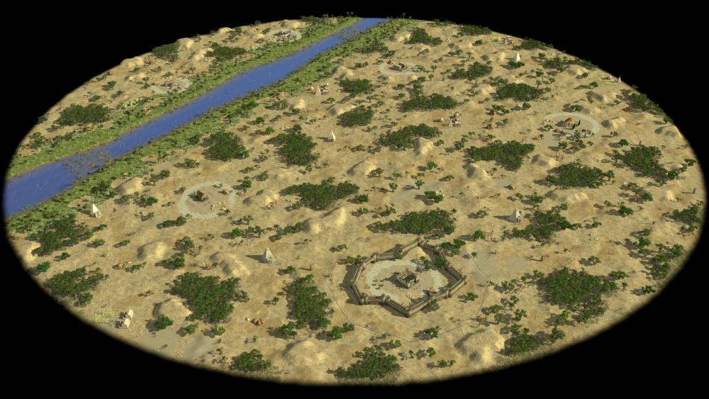
How can you have large enough groups on biomes such as Aegean Anatolian, Arctic, Autumn, Nubia, Sahara, Steppe when playing in a 1v1 on a small map? They have a very weak base if you have at least 30+ soldiers to attack it. When you send your army, the carthage player will likely see it coming, so he will just retire his troups moving them around his territory, building towers, garrisoning in them and barracks, slowly damaging your army thanks to the range of archers (who can be kept near to the cc if we are talking about P1 and P2). In order to damage the carthage player you need then to have a big army, and when you move it away from your territory you 1) renounce to develop your eco 2) become extremely vulnerable to a sword cav rushes (that can rush immediately after your army passed your territory border and still be able to return to the base in order to support the defense against the counter rush)
-
 According to this readme, there are very useful autostart features, e.g.: Basic gameplay: -autostart=... load a map instead of showing main menu (see below) ... -quickstart load faster (disables audio and some system info logging) ... Autostart: -autostart="TYPEDIR/MAPNAME" enables autostart and sets MAPNAME; TYPEDIR is skirmishes, scenarios, or random ... -autostart-civ=PLAYER:CIV sets PLAYER's civilisation to CIV (skirmish and random maps only) ... This works nicely to quickstart in windowed mode (1024x768) a random map with Aegean See: "C:\ProgramData\0 A.D. alpha\binaries\system\pyrogenesis.exe" -xres=1024 -yres=768 -quickstart -autostart="random/aegean_sea" However, when I add the civ Romans, I get an out of memory error (both on Debian 11 and Windows 10): "C:\ProgramData\0 A.D. alpha\binaries\system\pyrogenesis.exe" -xres=1024 -yres=768 -quickstart -autostart="random/aegean_sea" -autostart-civ=user:romans Is the syntax wrong? @wraitii I saw that you created/updated the readme.txt in GitHub and have proposed a minor additional note for the parameter -mod=NAME (if you provide "mod" as NAME, the game starts into the mod selection screen - thanks to @Stan` for this hint elsewhere ). You will find a pull request from 7wells (that's me ). Is that ok?
 -
 This is an idea I've had for a while now (couple of years maybe?)... Original text in spoiler: Proposal below: Our civilisations are currently supposed to be balanced. Picking a random civilisation should, on average, give you a fair chance to win assuming equal skill. Since we now have 13 civilisations, that means we need to balance 78 matchups. This is a considerable amount, particularly since we actually have limited manpower, particularly for gameplay purposes. In my opinion, we only have 2 ways to balance so many matchups: Effectively reduce the # of civs (e.g Celt, Greek, Roman, Kushites), by making the different "sub-civs" very similar. This precludes adding too many different groups, or we have to add "trash" civs. Effectively make all civs very similar. We can't get AoE2 level of variety because our tech tree/unit tree is much too small. So we're reduced to making them all basically equivalent. I like neither of these options. My proposal is to split our civilisations into groups, and only balance inside a given group. What I mean is that any matchup inside a group should give you a fair chance of winning - but matchups across groups (say, below, Roman vs Kushites) could be terribly unbalanced - or could not be. Romans might have one unit or one strategy that Kushites can't counter for example. Below is a Group List (proposal with some quick reasoning). My criteria are, to some extent, chronological and geographical. I am also picking what I think would be interesting matchups. Superpower Group - the 3 largest empires in the relevant timeframe Macedonians - Under Alexander the Great, circa 330 BC, they conquered most of what I will call the then "civilised" world. Obvious pick. Aechemenid Persians - While Cyrus II is technically out of our date range, he's in the game files, and it makes fine gameplay to have Macedonians and Persians in the same group since they did fight. Mauryas - Under Chandragupta, became one of the largest empires — period — back then. These 3 together also form a continuum of Greek-Indian empires and are historically somewhat tied. I think they make up an interesting group. Mediterranean Civs - More naval oriented Romans - Since we are pre-marian, this is the Rome of the punic wars. Stronger in terms of naval power than we might think, not yet mingling with the gauls up North too much. Carthaginians - Foil to the Romans at the time, we need them in the same group for historical play reasons. The question is "who next?". I think we might put Athens, a strong naval city state, but they did not really wage war on each other too much. Alternatively, Iberians were conquered by Rome by 100BC, so they could be put here. I'm having a hard time putting Athens somewhere more relevant, because as a strongly Naval civilisation they would be easily unbalanced against "land-based" greek civs, and they're historically not really relevant against anyone but these same greek states. Athens/Iberians Aegean Civs - more land-based civilisations perhaps. Spartans - land-based, which makes them good to fight the two other successor states. Seleucids - Successor state in the region, that mingled with Ptolemy Ptolemaic Egyptians - likewise. Celtic Civs I'm grouping these here because they were relatively similar, and thus would be relatively easier to balance. To be honest, we could perhaps move them all alongside the "Rome" group, particularly if we put Iberians there. The trouble is that they didn't really fight many of the other civilisations from our time-range. We could also dispatch one celtic civ in each other group, for variety, but that throws historical realism somewhat out the window and might complicate balancing. Gauls Ibers Britons Unbalanced Civs - those that aren't in a group (yet/ever?) Kushites ---- The advantages of this are: We need to balance fewer matchups. With easier balance, we can make civs more diverse, possibly more historically accurate. Currently, and particularly in A24, we've made civs very similar as balancing is hard. It makes it possible to highlight some different matchups. It also makes it possible to add more civilisations - we don't need to consider the overall balance. As such, a Mesoamerican group can easily be added, like wise for Asian civs. The drawbacks, obviously, are that MP users would have a reduced # of picks, and that it needs some development to support.
 -
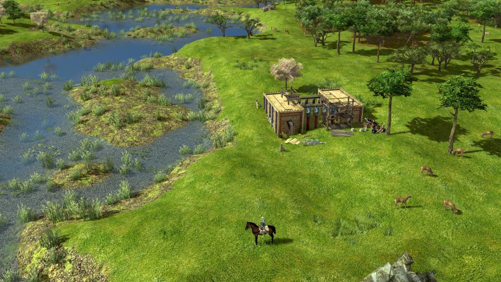
"Unknown" The map "Unknown" is a random map that countain 9 "Land" maps and 4 "Naval" maps. When this map is played, one of these map is picked randomly and generated. Some of these maps are not part of the list of random maps and can't be purposly choosed to be played. So i tryed to make a map pack where each map can be played independently. Map list : Land : "Continent" : Game description : Disk shaped mainland with water on the edge. More info : Map close to the random map called "Continent", slight difference the map can be shaped as a peninsula. "Isthmus" : Game description : Huge central river, connecting the riversides with a narrow piece of land. More info : Map close to "Corinthian Isthmus", main difference is a wider land path and a wider river. Map variant : Dot shaped island or random shaped land can be added to the river part of the map. "CentralRiverLand" : Game description : A very small central river. More info : Map close to the random map called "River", slight differences there is no middle lake and the shallow water path are randomly placed (such as "Lorraine Plain"). "EdgeSeas" : Game description : Align players on a land strip with seas bordering on one or both sides that can hold islands. More info : Map close to the random maps called "Hyrcanian Shores" or "Kerala" or "Northen Lights", main difference is the sea border can be on both side. Map variant : Dot shaped island or random shaped land can be added to the sea part of the map. "Gulf" : Game description : Land shaped like a concrescent moon around a central lake. More info : Map simlar to the random map called "Gulf of Bothnia" "Lakes" : Game description : Mainland style with some small random lakes. More info : Map close to "Alpine Lakes" but without mountain or "Mainland" with randomly placed lakes. "Passes" : Game description : A large hill leaving players only a small passage to each of the the two neighboring players. More info : No similar map exist in the game yet. Map variant : A lake can be generated in the middle of the map. "Lowlands" : Game description : Land enclosed by a hill that leaves small areas for civic centers and large central place. More info : No similar map exist in the game yet. "Mainland" : Game description : No water, no hills. More info : Map simlar to the random map called "Mainland" Naval : "CentralSea" : Game description : Creates a huge central river. More info : Map close to the random map called "River" with a wider river and no shallow watter path.(such as "Aegean Sea") Map variant : Dot shaped island or random shaped land can be added to the river part of the map. "CentralRiverNaval" : Game description : A very small central river. More info : Map close to the random map called "Lorraine Plain" but with no shallow watter path. "Archipelago" : Game description : Chain of islands or many disconnected islands. More info : Map close to the random map called "Islands" "RiversAndLake" : Game description : Creates a river between each player ("pizza slices") and possibly a circular lake in the middle. More info : No similar map exist in the game yet. I don't know who made the map "unknown" or the previews of each map but thanks ! unknownMaps.zip
-
Hi. Here's another map: A sea with smaller scattered islands stands between players who must build a navy to reach the enemy. Warning: Naval map. Bot's won't be able to play properly. Link to Download Next one will probably be a Carthaginian home base random map as part of my plan to make a random map script for each of the races except Romans and Gauls (Which have Latium and Catabarinian Highlands respectively). Greek and Persian maps are done. Any suggestions for Iberian or Carthaginian random maps?
-
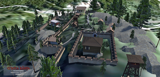
.thumb.jpg.b21ca1d0c15fb56b42c39b25a0a40815.jpg)
Splitting our civs in groups - Fixing the balancing problem
Genava55 replied to wraitii's topic in Gameplay Discussion
Group 1: Mediterranean supremacy Romans Carthaginians Athenians Group 2: Aegean enemies Spartans Macedonians Persians Group 3: Galatian safari Gauls Seleucid Ptolemies Group 4: The rest of the world Britons Iberians Mauryas Kushites Obviously the names of the groups are only an excuse but at least like this the civ could be really balanced -
 Let's take stock of the current terrains situation (Alpha 23-24) Current Biomes. Inconsistent. Alpine 41 terrains 41 textures Desert 58 terrains 59 textures Mediterranean 40 terrains 42 textures Polar 17 terrains 17 textures Savanna 36 terrains 37 textures Steppe 13 terrains 13 textures Temperate 47 terrains 48 textures Tropic 32 terrains 33 textures Let's look at a potential Alpha 25 situation. Consistency. Proposed Biomes Aegean-Anatolian 18 terrains 36 textures Alpine-Arctic 18 terrains 36 textures East Asia (Bonus) 18 terrains 36 textures Equatorial Africa (Bonus) 18 terrains 27 textures Hispania-North Africa 18 terrains 27 textures India 18 terrains 36 textures Italy 18 terrains 36 textures Mesoamerica (Bonus) 18 terrains 27 textures Middle East 18 terrains 27 textures Mongolian-Tarim (Bonus) 10 terrains 15 textures Nubia-Savanna 18 terrains 36 textures Sahara 18 terrains 27 textures Steppe (Bonus) 15 terrains 30 textures Temperate-European 18 terrains 36 textures Why do some proposed biomes have 18 terrains and 36 textures, while others have 18 terrains and 27 textures? It's because they will reuse many of the same assets, specifically normal maps and spec maps. Some diffuse maps will simply be color corrected for the biome and can share normal maps and spec maps from other biomes. For example, the Alpine-Arctic biome could use the same diffuse map as the Temperate biome for a cliff texture, just color corrected for Alpine theme, and then share the same normal and spec maps between them. This saves time and effort as well as unifies the look of the complete set of terrains. (Bonus) Biomes are lower priority. For instance, if the Xiongnu are added, then the Mongolian-Tarim biome would good to add. If Scythians or other similar civs are added, then the Steppe biome would be good to add. Otherwise, these biomes could be added lastly, the others a greater priority since we have civs already in-game for these biomes.
 -
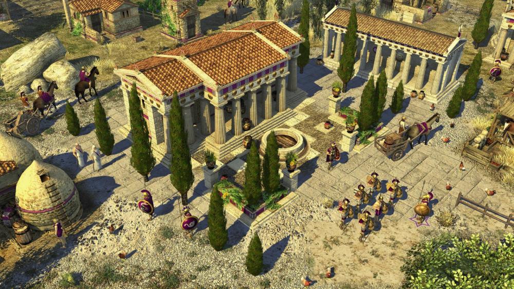
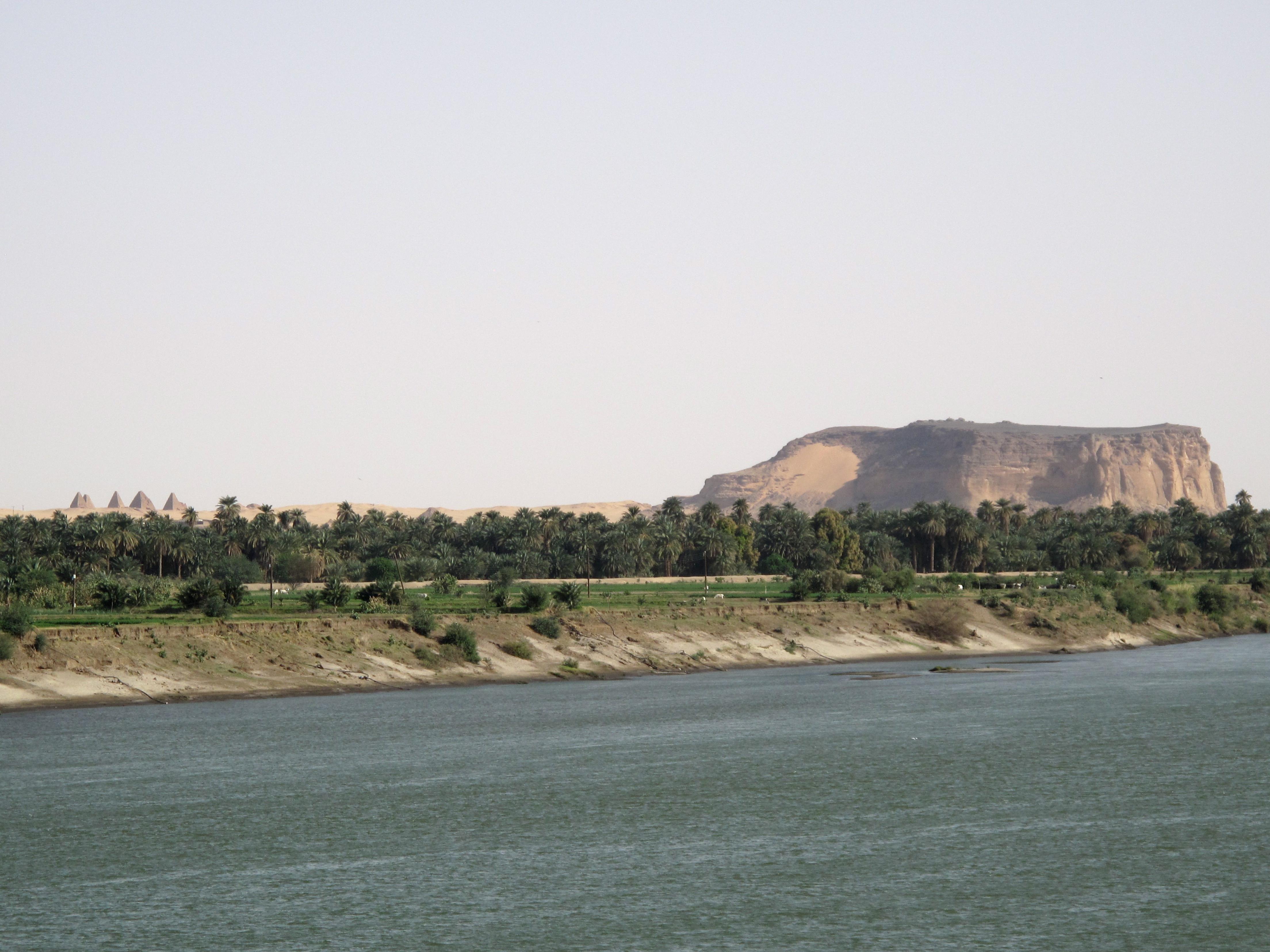
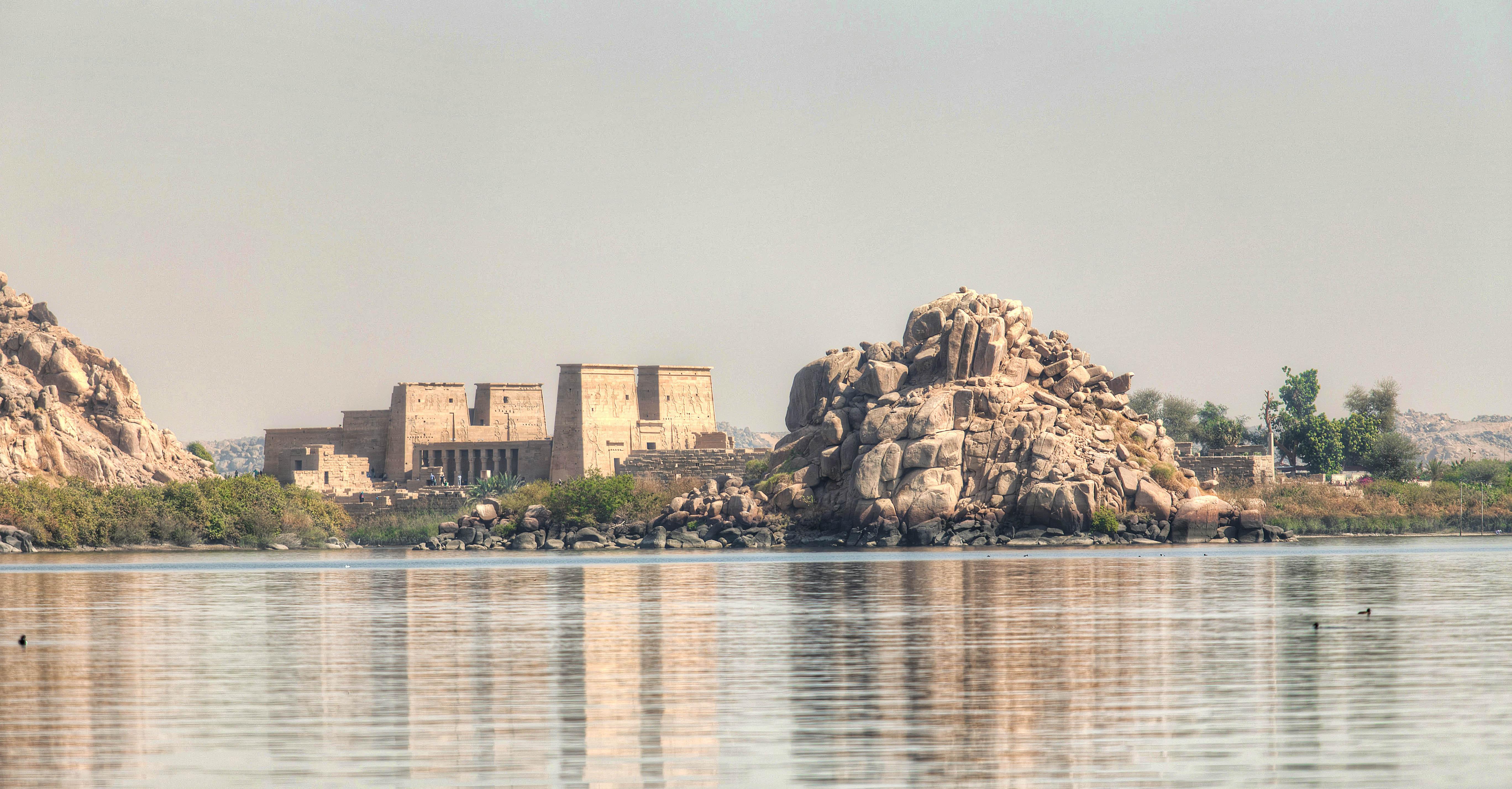
Working on a possible new INDIA biome for Alpha 25. Biomes I think we should make: Aegean (Greece, Crete, Cyprus, Eastern Turkey) Hellas Acropolis Cycladic Archipelago Crete Aegean Sea Corinthian Isthmus Miletus Penninsula Peloponnesian War Very Large "real world" map closely approximating the lower half of Greece Players are restricted to Greek civs, Macedonians, and Persians Just for fun: The Troiad Similar to Jebel Barkal, a special "Trojan" civ defends against and attacks the players Alpine (Alps, Pyrenees, Dolomites) Cisalpine Gaul Pyrenees Pass Alpine Lakes Alpine Valleys Anatolian (based on Cappadocia and Armenia) Neareastern Badlands Balkan (Illyria, Croatia, Dacia, Thrace) Dacian Highlands Illyrian Coast Baltic (Northern Europe, Scandinavia) Polar Lights Arctic Summer Other "snowy" maps East Asian (China, Japan) Great Wall of China Chang Jiang - European (Gaul, Germany, Britain) Ardennes Forest Teutoburg Forest Gallic Fields Acquitania Belgian Bog Caledonian Meadows White Cliffs of Dover Hadrian's Wall Britannic Road Equatorial Gambia River Ngorongoro (hybrid with Nubian biome) Iberian (Spain, North Africa) Siege of Numantia The first player to capture and hold the Numantine civic center for X amount of minutes wins. The Numantine civic center is heavily fortified on a hill and defended by Gaia-player Iberian units. Cantabrian Highlands Atlas Valleys Numidia Indian (Punjab, Deccan) The Punjab Kerala Deccan Plateau Ganges Valley Kalinga Italian (Italy, Sicily) Latium ( a mix of Italian biome and Alpine biome to approximate the Dolomites Mountains) Sicilian Campaign Etruria (Tuscany) Magna Grecia Vesuvius Corsica and Sardinia Middle Eastern (Arabia, Syria, Phoenicia, Fertile Crescent) Arabian Oases Coele-Syria The Dead Sea Babylonia Palmyra Nabataea Canyons Mongolian (Gobi Desert, the Tarim Basin) Tarim Basin Gobi Desert Nubian (East Africa, Upper Egypt) Nubian Frontier Nuba Mountains The Island of Meroe Serengeti Watering Holes Jebel Barkal Trigger Map Ngorongoro (hybrid with Equatorial biome) Blue Nile Nomads Persia (Iran, Afghanistan, Hindu Kush) Median Oasis The Persian Gates Persepolis This map alternates between a "living" version of Persepolis or a ruined version of the city and its surrounding lands Bactriana Zagros Mountains Hyrcania (hybrid map) Caspian Sea (hybrid map; northern part is Steppe biome) Saharan (Sahara Desert, Egypt) Nile River Nile Cataracts Crocodilopolis Siwa Oasis Elephantine Garamantine Frontier Steppe (the Eurasian Steppe) Scythian Steppe River Oxus And then we should seriously curate the random maps to focus them to the game's theme. We don't have to get rid of a bunch of them, but we can move those out of theme maps to a separate menu.
-
===[TASK]=== Crowd Sourced - Thracians (Faction)
Genava55 replied to Cleo's topic in Game Modification
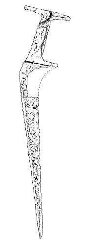
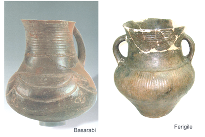
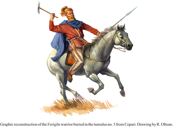
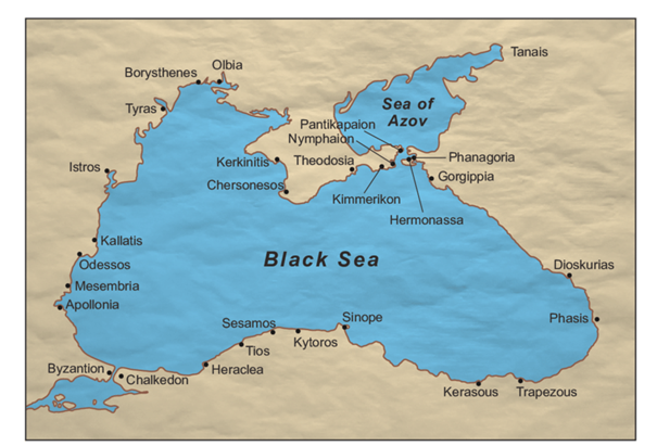
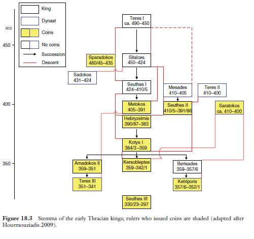
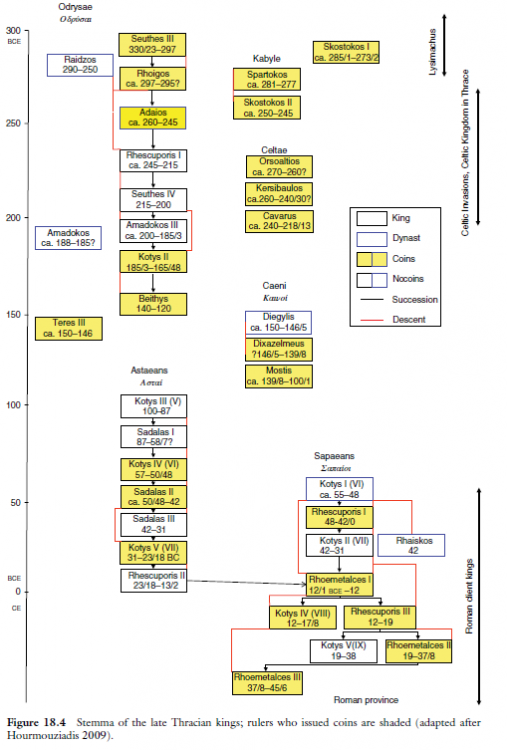
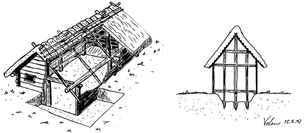
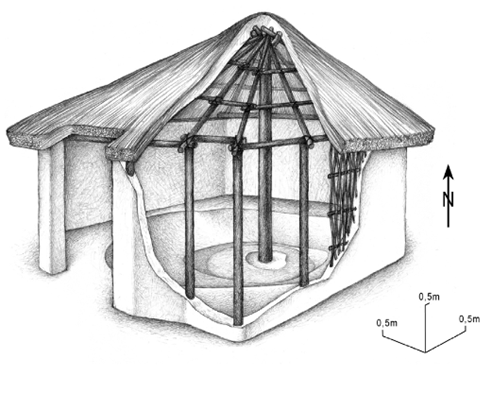
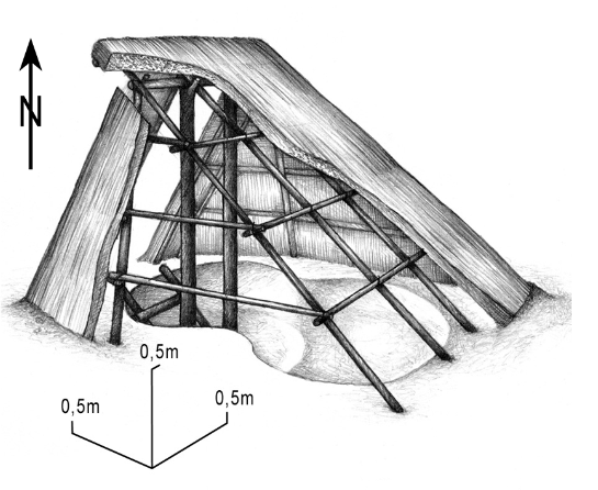
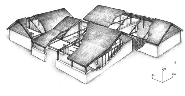
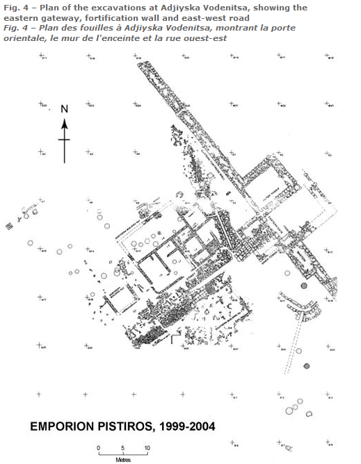
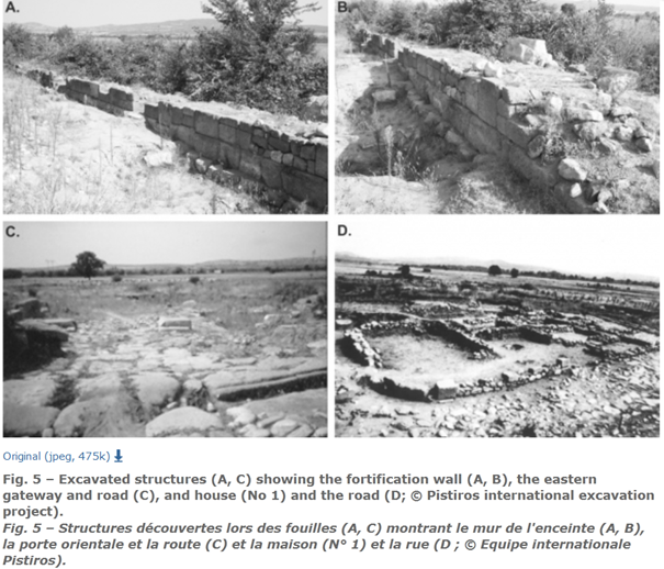
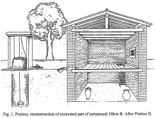
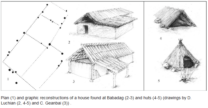
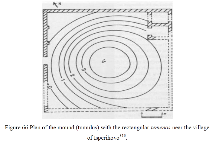
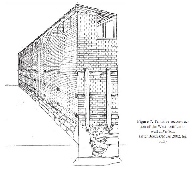
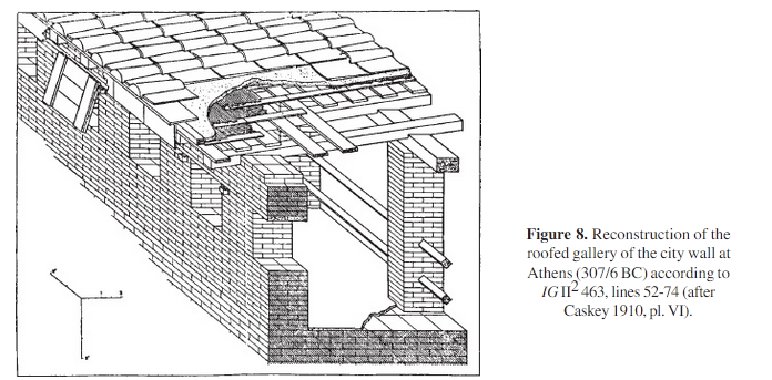
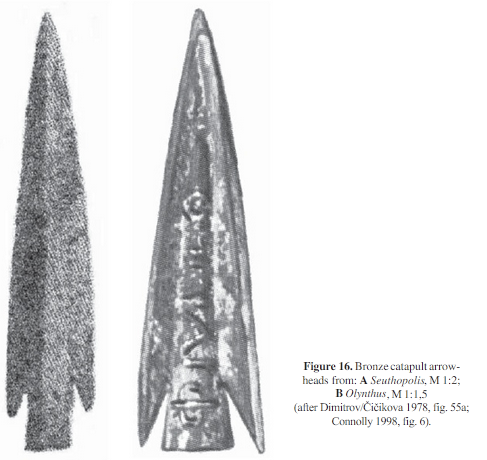
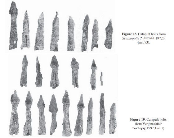
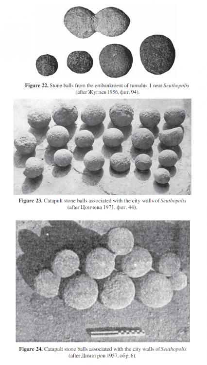
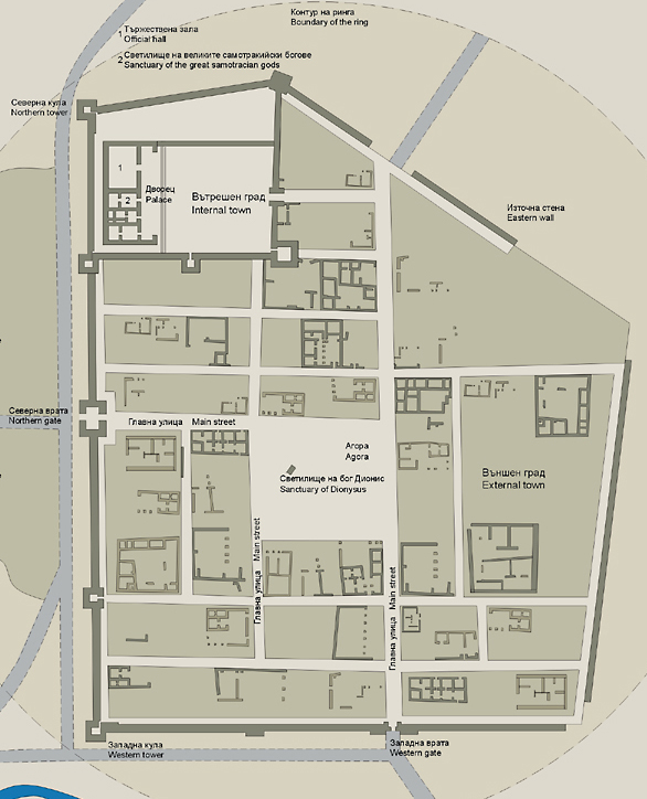
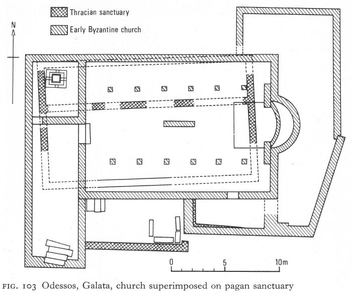
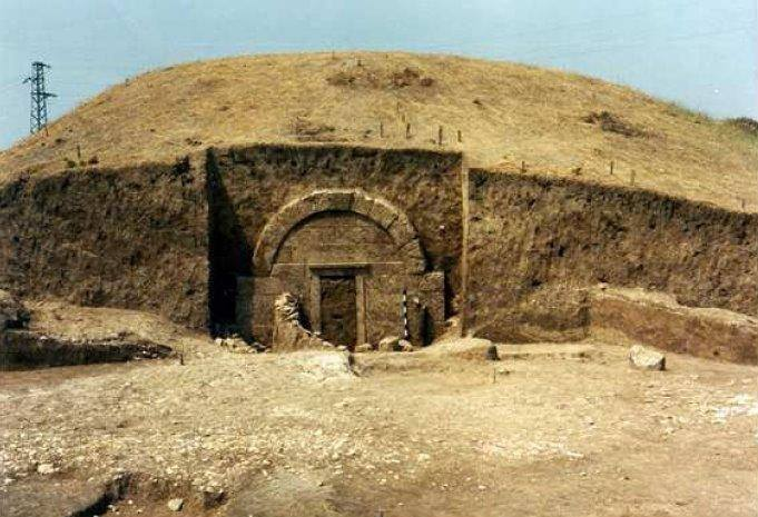
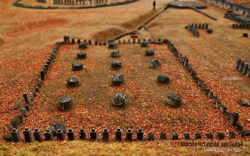
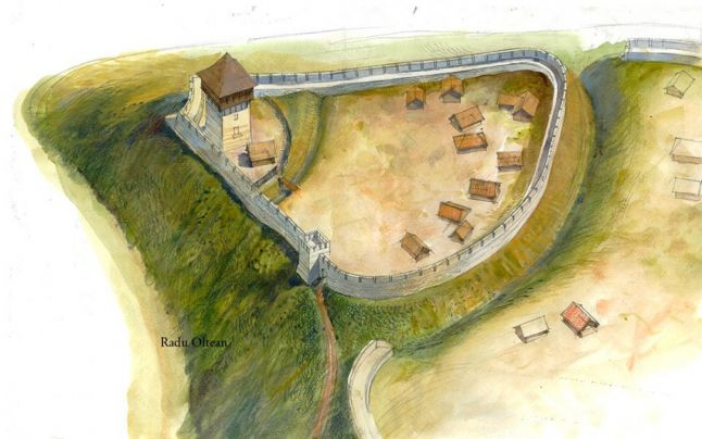
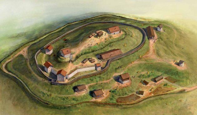
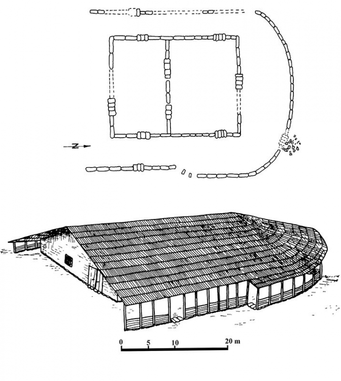
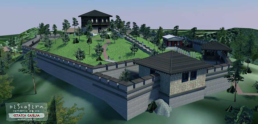
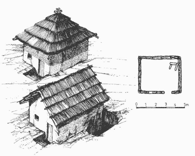
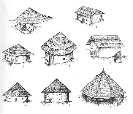
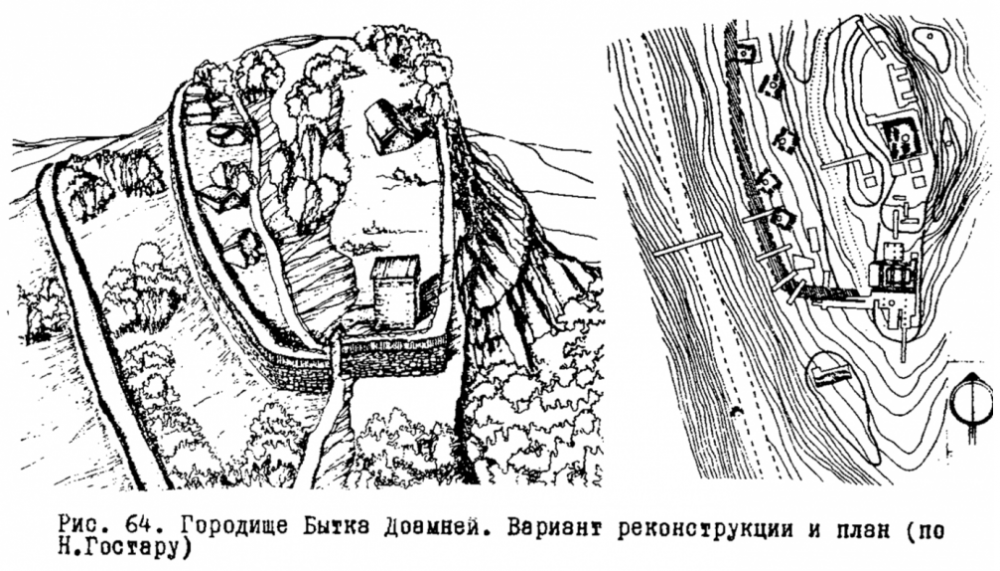
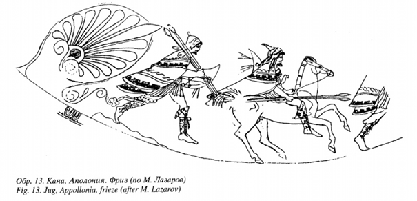
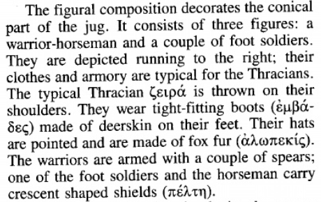
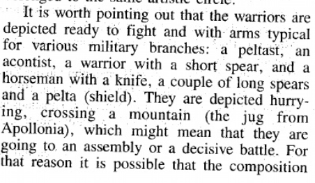
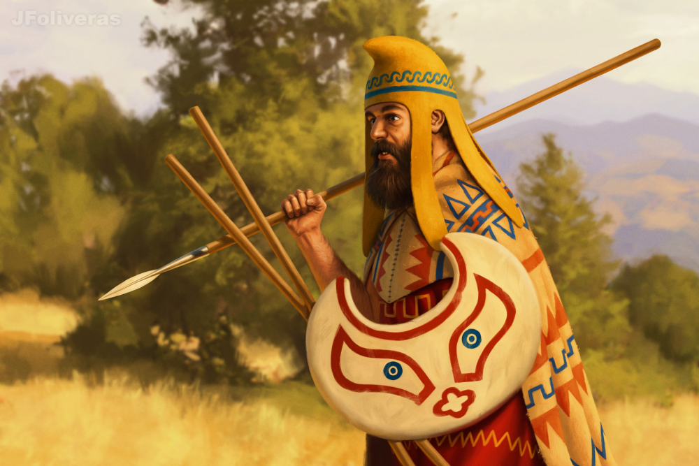
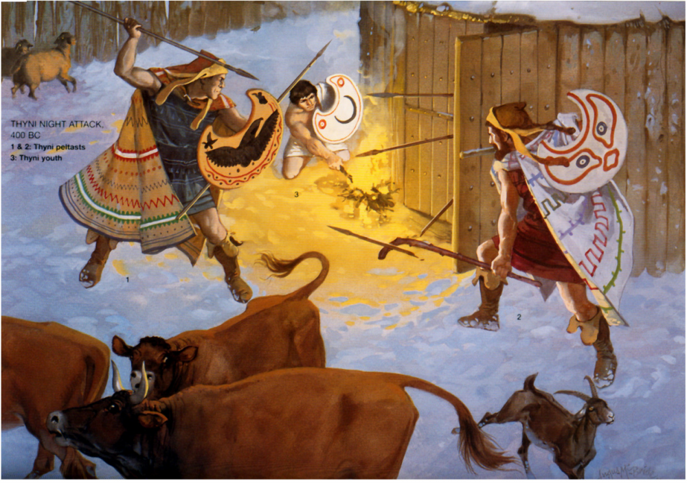
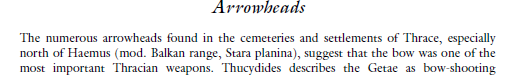
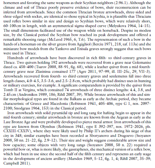
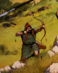
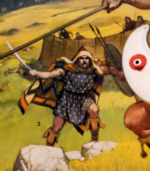
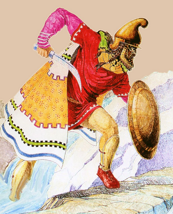
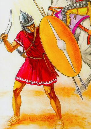
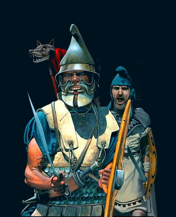
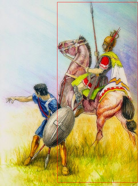
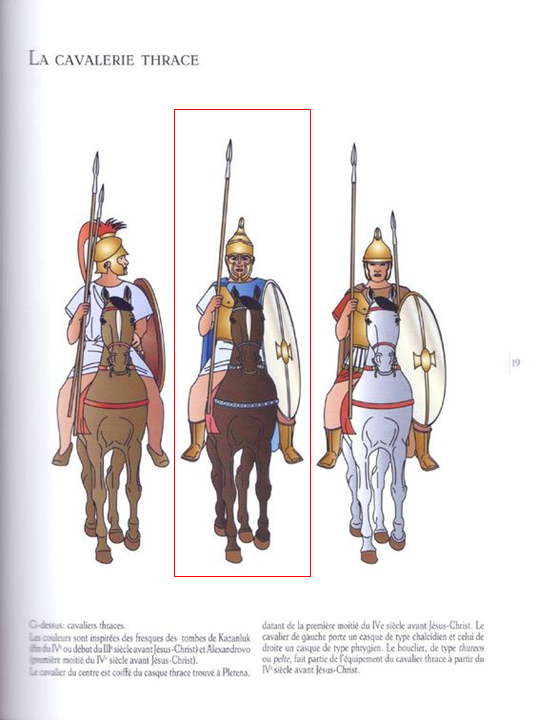
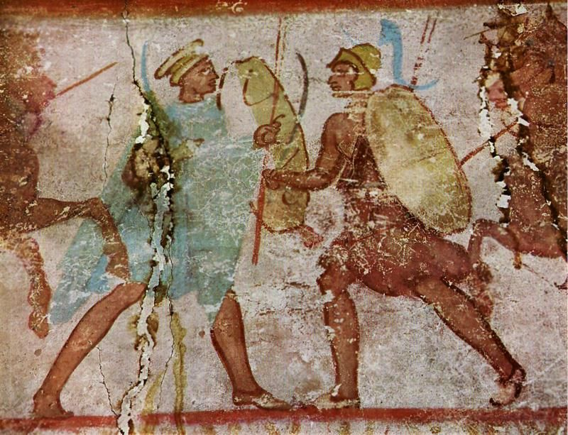
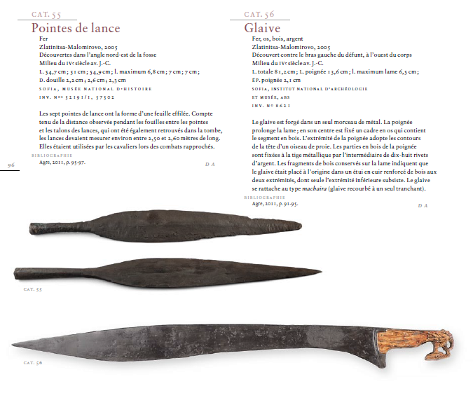
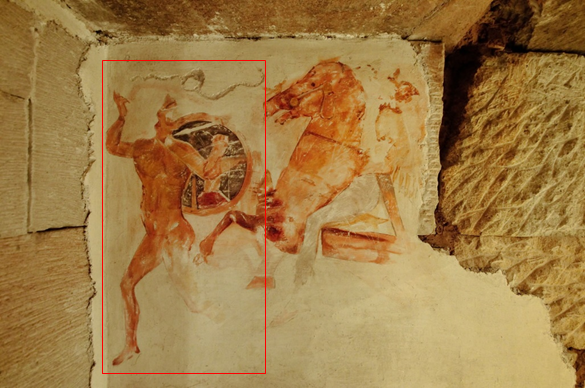
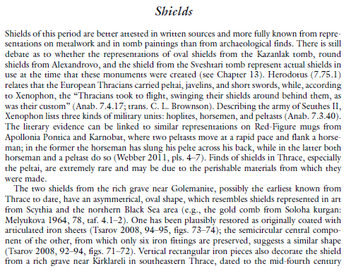
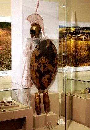
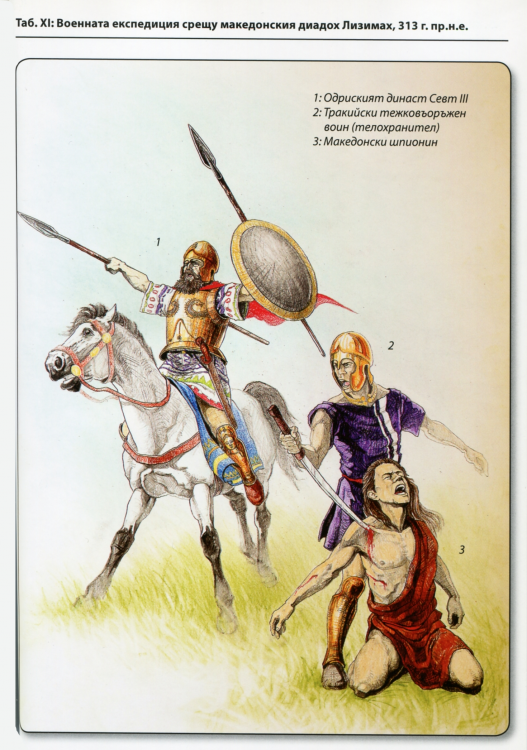
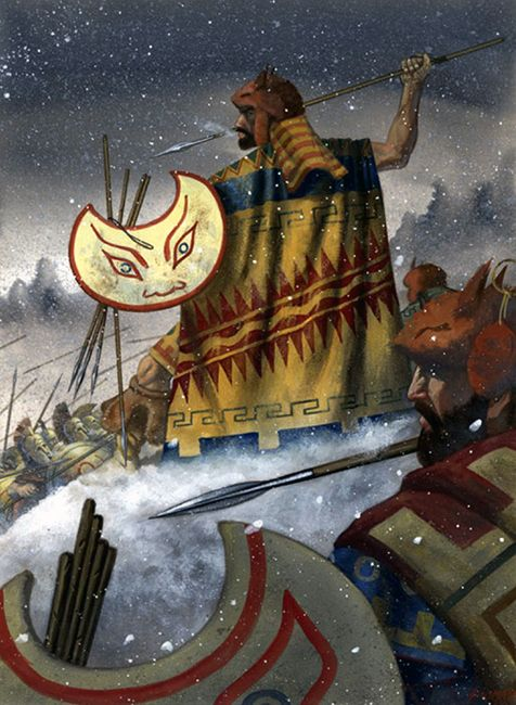
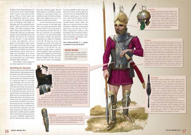
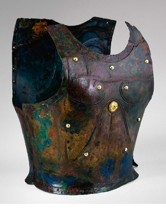
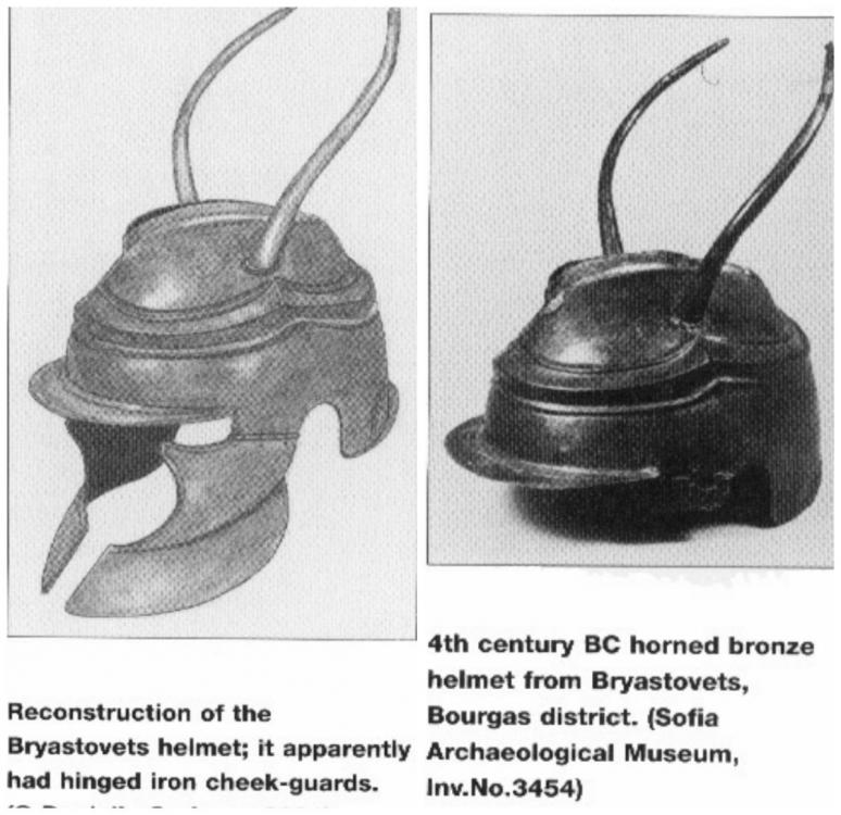
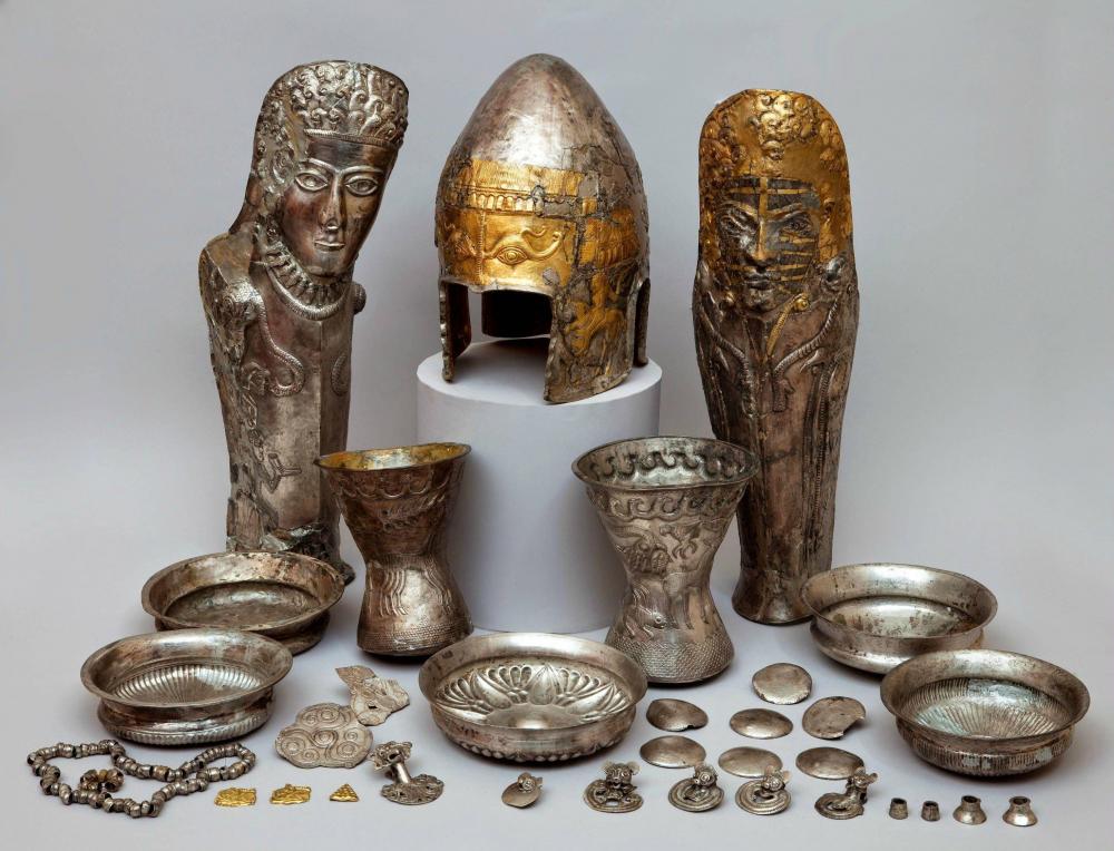
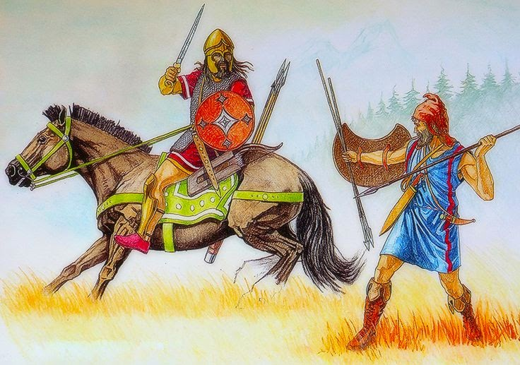
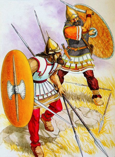
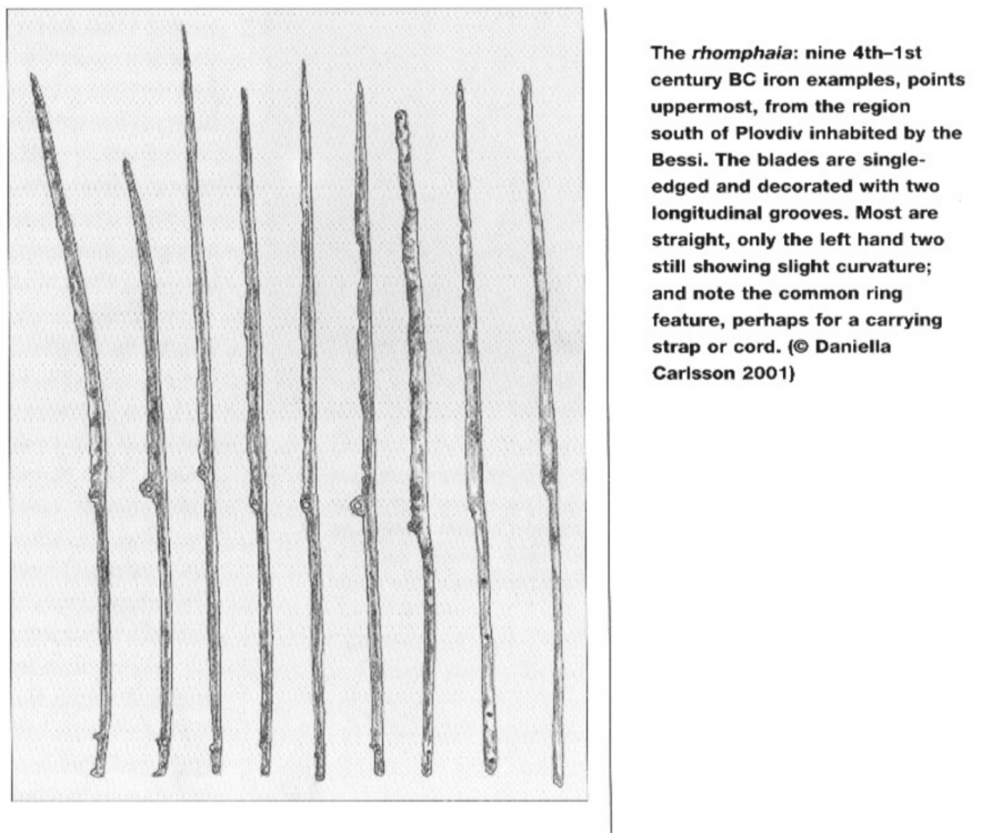
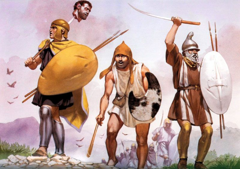
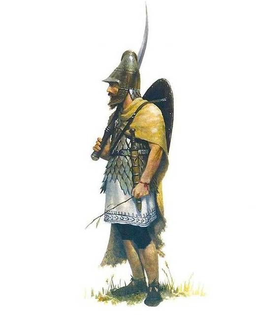
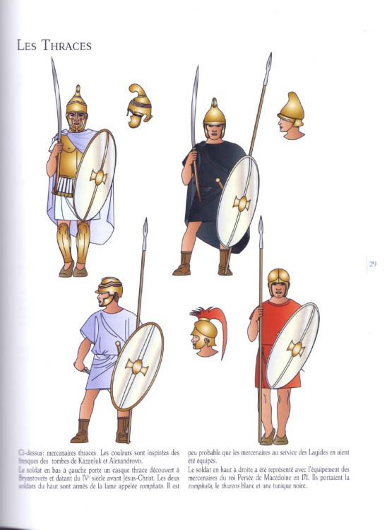
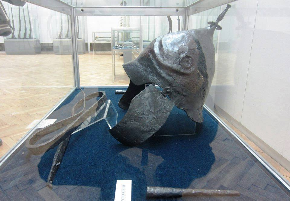
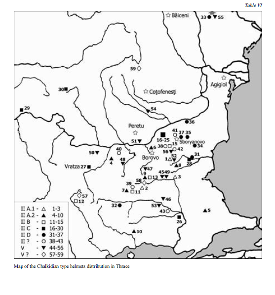
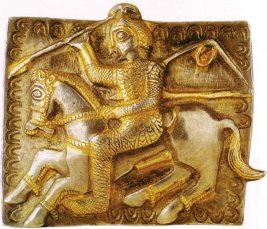
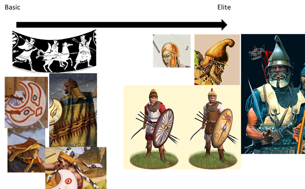
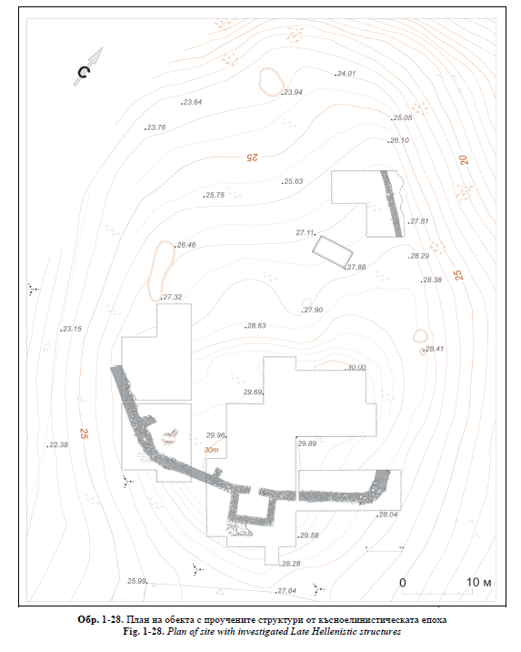
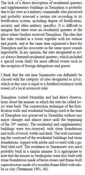
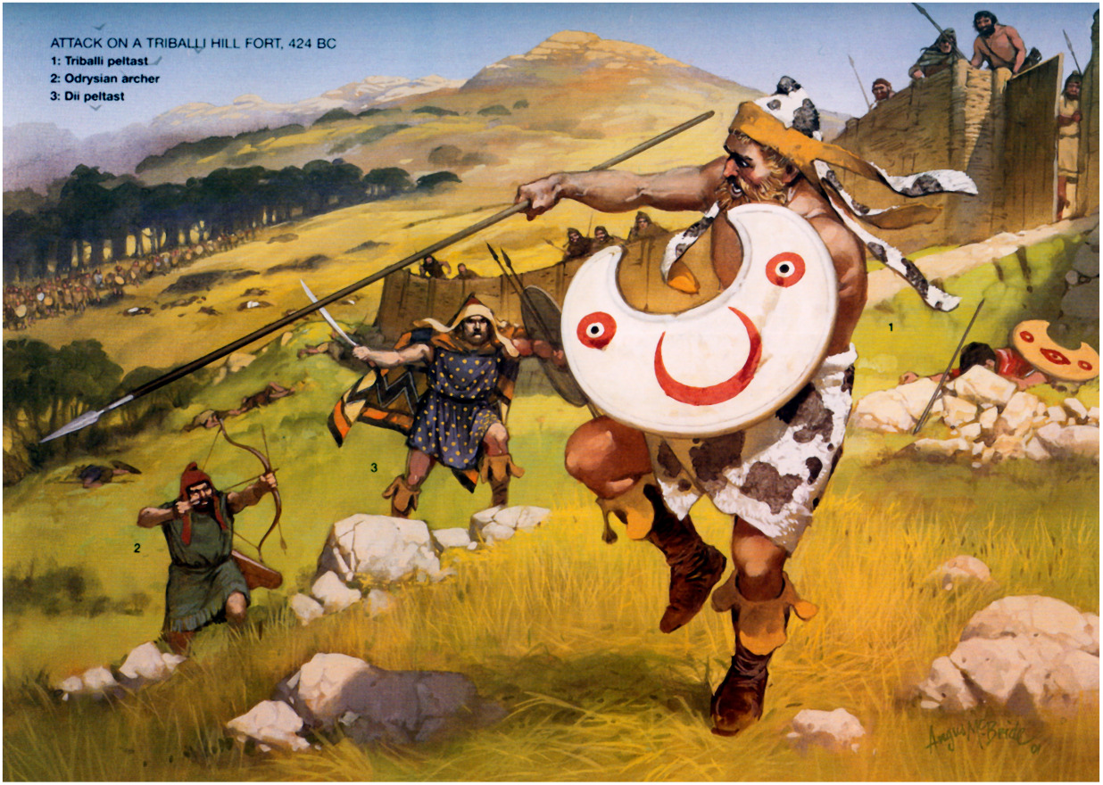
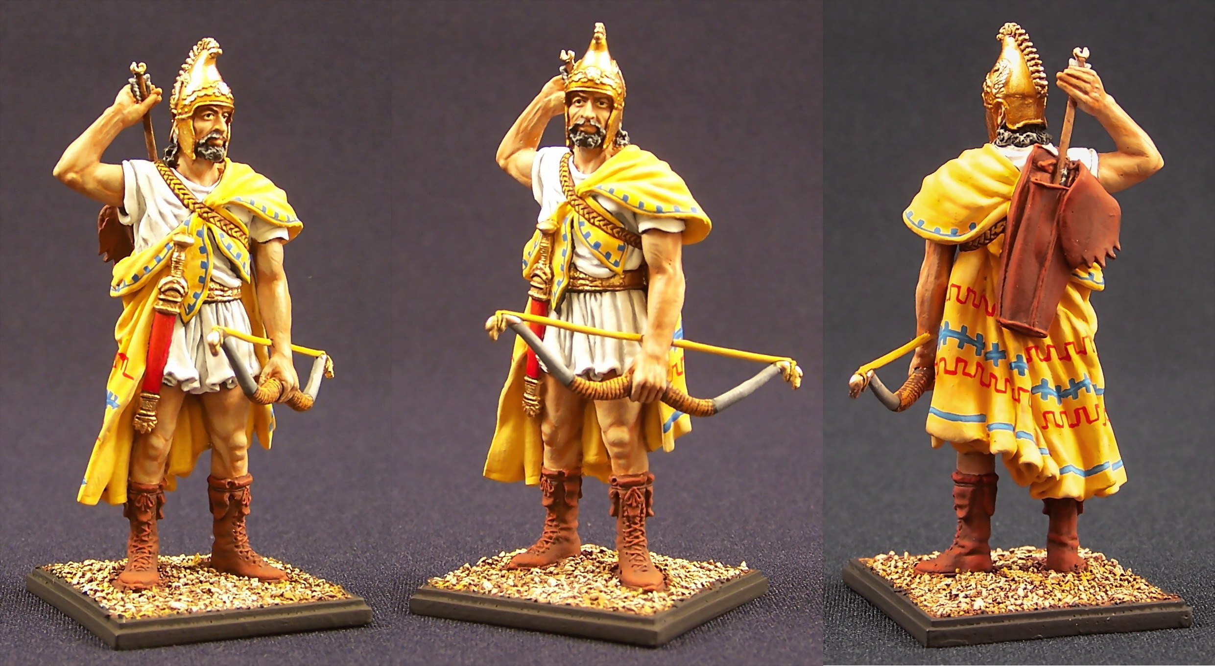
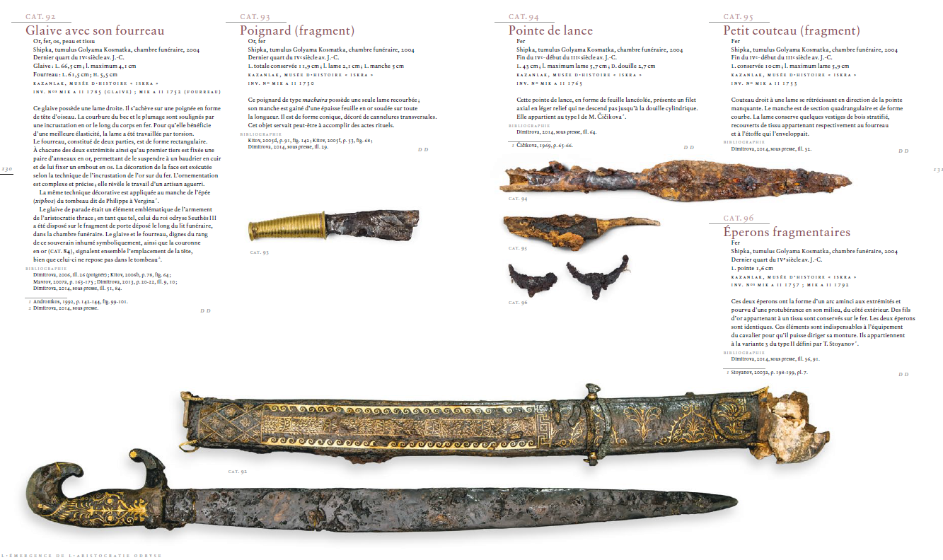
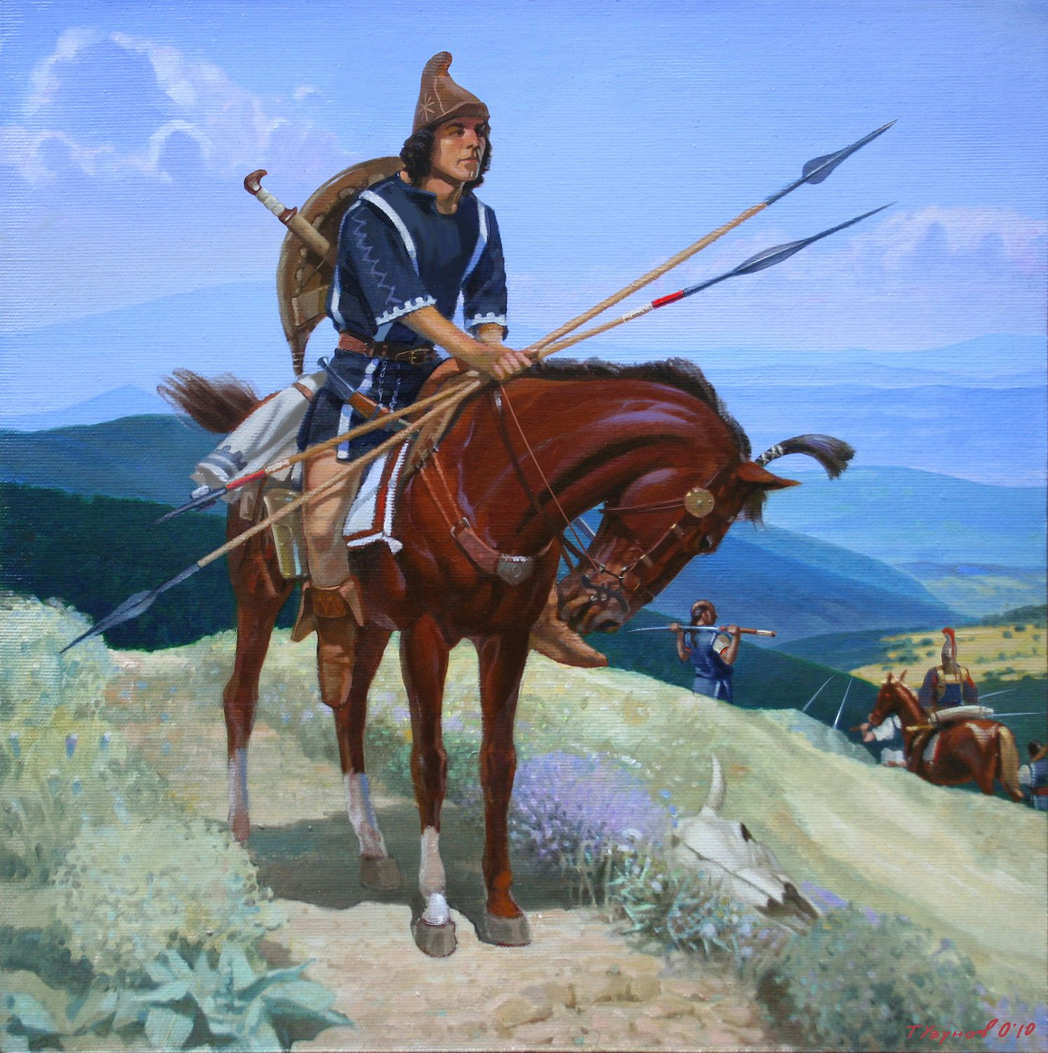
Overview of the Thracians (I will edit this post through time to update the thing when I have the time): The Thracians are a mysterious group of different tribes, often mentioned in ancient sources and commonly known for their mercenaries but it is difficult to get a proper picture of what was the Thracian culture and how they lived. First, what are the Thracians? This is in fact an important issue because there are contradictory definitions depending on the point of view adopted. The most common definition is administrative, the limits of Thrace is based on the Roman divisions of their territories and the Thracians are simply the tribes living in this region (see the map below). This is good enough because most of the historical tribes are indeed in this region. But if we look from the point of view of the languages, there are connections between the Thracians and the Dacians and between the Thracians and the Illyrians. It seems that the case was ambiguous enough for Herodotos to conclude they are one of the most numerous population and most of the barbarian tribes north of Greece were belonging to the Thracians. Even up to the Crimea in other accounts, notably including the Getai/Getae. However, there is indeed a sharper linguistic group in the South of Thrace related to the historical Thracians and to their material culture. This group correspond to the tribes in front of the Aegean Sea, like the Bessi and the Odrysai. To sum it up, the concept of “Thracians” was very wide in the oldest accounts and became narrower through time to become restricted only to the Southern Thrace. This follows the historical interactions of the Thracians with the Hellenistic world. Prehistory The beginning between the Greek, the Scythians and the Persians The Odrysian kingdom The remnants invaded Buildings and architecture Housing Xenophon (Anabasis 7.4) describes fighting in Thracian villages near Perinthus in 399. His comments on the settlements are vague, but are certainly consistent with the remains of small villages found at Vinitsa, Brestak, and Devnja. Vinitsa was a fourth-century hamlet of twenty or twenty-five one-roomed rectangular wattle-and-daub huts. The roofs would have been pitched and made of thatch. The huts ranged from 3×3 m to 4.5×4.5 m, and most were “Halberdhütten,” in which the floor level inside the hut had been dug out some 30–90 cm deeper than the ground level outside, to give more headroom. Most huts had a small internal hearth in or near one corner, and an oven built against an outside wall, often under a simple lean-to. There were numerous round pits, some for garbage, but most for grain storage. These villages would have had 100–200 inhabitants. There were also some bigger and longer-lived sites, such as Shoumen, which was partly protected by double stone walls; and recent work at Adjiyska Vodenitsa (an emporion called Pistiros) has revealed houses built from monumental stone blocks. This site was bigger than Shoumen, and may have been a princely seat within the Odrysian kingdom (while being as well a commercial center for the Greeks). There had been Greek cities on the Black Sea coast at Apollonia, Mesembria, Odessos, and Histria since Archaic times, but most Thracians went on living in tiny villages. As with the handmade pottery, it was only in Hellenistic times that traditional ways changed significantly. Philip II founded cities at Beroe, Kabyle, and Philippopolis in 342/1, and Aegean-style urban life began to penetrate Thrace. Late in the fourth century, the Thracian rebel Seuthes established Seuthopolis. This small town was filled with very Greek-looking large courtyard houses, but they were organized around a distinctively Thracian palace complex. The houses had mudbrick walls on low stone foundations, faced with plaster on lath, and tile roofs. In the third and second centuries, the kind of villages Xenophon had seen became less common in southern Thrace. Cannot find any sketch of these huts described above so here some random Iron Age examples of pit-house and wattle-and-daub houses (up to 3D artist to do whatever he wants from the description): Pistiros - Adjiyska Vodenitsa "Seuthopolis provides a good example of a manifest regularity, repeated in many settlements that become prominent political centers and seats of members of the high aristocracy; developed quickly, often without continuity with earlier settlements in the same locality, within a short time they become central in the settlement hierarchy. Many such sites, however, lose their importance equally quickly or come to an end, as their livelihood was evidently closely bound to that of their founders and the political structures created by them. The duration of settlement occupation at Vasil Levski, Krastevich, Seuthopolis, and Sboryanovo was brief, ranging from a few decades to slightly more than a century. In the last decade, in fact, the issue of whether or not some of the settlement forms widely distributed throughout Thrace ca. second half of the 1st millennium bce were in fact royal residences has undergone an important development. Various ancient authors mention fortified small places, “thyrseis,” that have been interpreted by modern scholars as towers or residences which served as “permanent homes of the Thracian aristocracy” or a “typical kernel of urbanization in Thracian settlement life” (Fol 1970, 166–168, with summary of the ancient sources). For a long time, this specific element of the Thracian settlement structure has had no convincing archaeological counterpart or, alternatively, the architectural complex excavated on the shores of Mandrensko Lake near Burgas was cited as a unique example (Dimitrov 1958; Balabanov 1984). The recent discovery of the residences near Kozi Gramadi (Khristov 2011, and earlier publications cited), Smilovene (Agre and Dichev 2010а, 214–217), Sinemorets (Agre and Dichev 2010b, 217–219), and Knyazhevo (Agre and Dichev 2013, 143–145) have revised this picture and confirmed the ancient sources. These compact architectural complexes are characterized by monumental architecture and often fortification; Knyazhevo is at present the only exception. On the other hand, the investigations at Sinemorets demonstrate that this settlement form, specific to Thrace, was in use not only in the heyday of early Thracian states, between the fifth and the first half of the third century bce, but also during the later stages of the Hellenistic period. [...] Undoubtedly the most prominent manifestation of centralization processes and stratification in the settlement system of Thrace arrives with the emergence of political capitals – the leading urban centers of various Thracian political formations. If southern Thrace has yielded the example of Seuthopolis, for northeastern Thrace such a role is played by the Getic city research has enabled some investigators to identify the Thracian settlement in Sboryanovo with Helis, the capital of the Getic ruler Dromichaetes – a political opponent of Lysimachus (Delev 1990; Stoyanov 2000b; Stoyanov in press, cf. Chapter 5). The image that the city boasted during the end of the fourth and the beginning of the third century bce corresponds to its leading position within the strong Getic state developed on both sides of Danube. In the fortified area of the settlement both residential and artisanal neighborhoods existed. Recent archaeological data show that, in the southwestern part of the fortified section of the city, the remains of a basileia – an internal quarter in which the ruling aristocratic elite resided (Stoyanov in press) – can be identified. Numerous residential neighborhoods and other urban areas of commercial and manufacturing character were located outside the city walls, with the total area of the city exceeding 30 ha. Archaeology shows that the city was destroyed by an earthquake in the middle of the third century bce. Attempts to resurrect it failed to restore its previous role. The site at Sboryanovo does not seem to have followed in its development the main trends outlined on the basis of the settlements of higher rank located in southern Thrace. The site’s excavator rightly notes that, in its development of the individual elements of its urban character, architectural forms, and construction techniques, the settlement diverges from the rules of Greek and Hellenistic architectural features, which had been directly imported in some centers south of Stara Planina, but rather shows a regional variation of local development (Stoyanov 2006; Stoyanov in press)." Sinemorets For the fortress of Shumen, this is a place occupied for a very long time and most of the construction are actually medieval I think. A picture of the site is not useful in our case. I starting to understand why there are so little information about these fortresses: here, here and here. Nationalist fantasy everywhere Sboryanovo: Royal tombs (possible civic center or temple): Greek temples in Thracian towns (possible use as a temple?): Royal palace of Seuthopolis (inhabited between 325 to 281 BC): Walls and fortifications: Getae sanctuary: Dacian sanctuaries (actually they are not similar to the Getae and Thracians): Rock-cut monument: Roster: Early Peltast/Akontistai or Highlander Thracians (Triballi, Dii, Serdi, etc.) as described by Xenophon: Archers: Dii swordsmen/machairaphoroi (highlander Thracians): Noble spearman or Noble spear cavalryman: Light cavalry: Light noble cavalry: Getae Horse archer: Celtic influenced Noble Thracians: Armor: Artillery and fortifications: rhomphaia infantryman: "They were tall men armed with white shining shields and greaves, underneath dressed with black chitons, swaying on their right shoulders raised upwards heavy iron rhomphaias." - Plutarchus "And the Thracians could not even use their rumpias here, which, being too long, intertwined with the stretching from everywhere tree branches." - Livy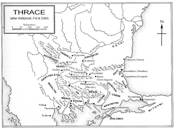


-
Splitting our civs in groups - Fixing the balancing problem
wraitii replied to wraitii's topic in Gameplay Discussion
Interesting points about the history and Age of the Aegean, thanks to both of you . Overall I think we did kinda lose ourselves in this civ business. I remember the "AoM like branching" discussions. I guess it would be an interesting idea for a game representing more of history? I'll agree with your that I'm going game first, history second, but some people do feel more at ease with the reverse. -
Splitting our civs in groups - Fixing the balancing problem
Wijitmaker replied to wraitii's topic in Gameplay Discussion
Yeah, it all kind of started with Michael's dream to convert 0 A.D. into his dream game he was calling "Age of the Aegean". I think the Hellenes were the first generic civ that was broken apart and split into multiple civs. When you look at RTS games 15 years ago (I'm not sure what is out there these days) you usually find that they are either many civs/races that are slightly different from one another (Age of Kings), or few civs/races that are drastically different from one another (StarCraft). Each Civ was supposed to have a general theme and favor a certain playing style... Romans - Generic all purpose, Strength in siege Hellenes - Generic all purpose, Strong fortifications Persians - Cannon Fodder, Cheap infantry, Cavalry strong Celts - Aggressive and Offensive, Cheap/weak structures Carthaginians - Economy is based on metal/gold because of mercenaries, biggest variety of units, strong navy Iberians - Defensive, Small numbers, Tactical New civs were created and I'm not sure how they fit in or how they are distinct but I would encourage there to be a distinction to give players a reason to use them. For me - 0 A.D. was always a game first and wasn't ever intended to be a historical simulator. That was for games like Total War. -
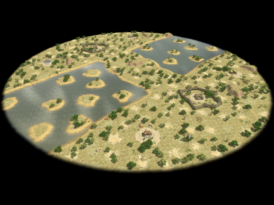
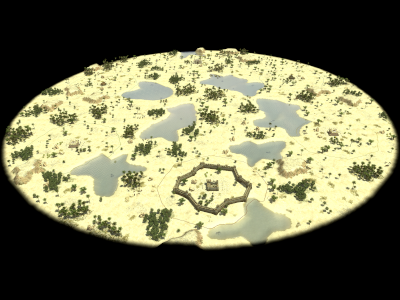
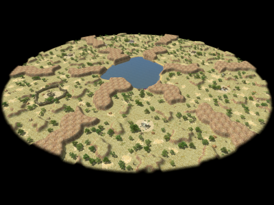
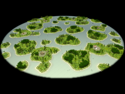
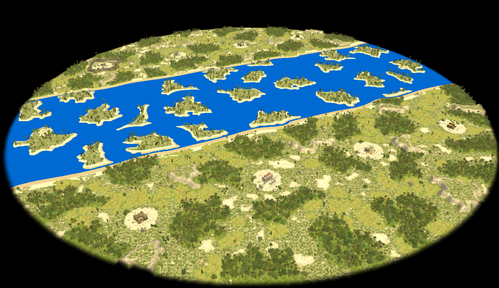
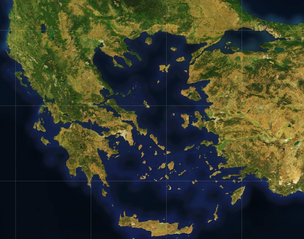
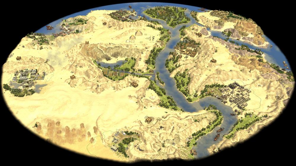
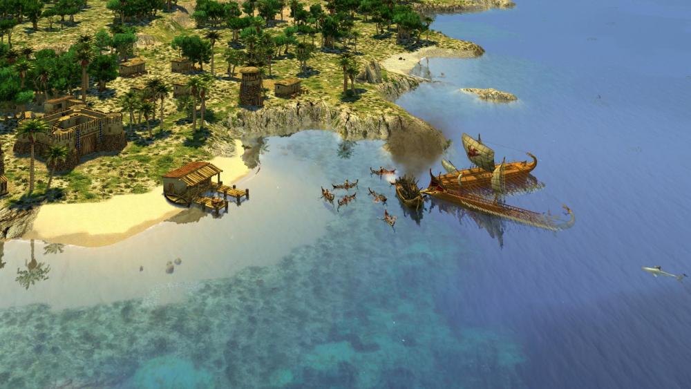
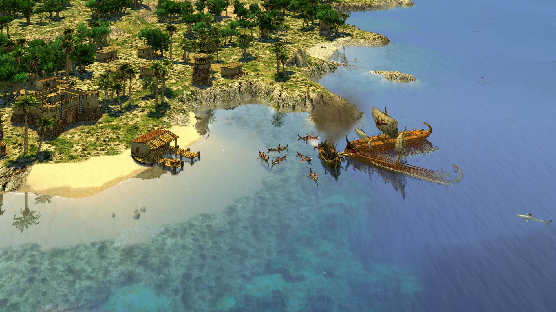
Also, the Aegean Sea random map doesn't look like the Aegean at all:
-
AI Programmer application - Mina Sami
elexis replied to Mina's topic in Applications and Contributions
I think the application forms come from back in the day when 0 A.D. hadn't been open source yet. Indeed http://trac.wildfiregames.com/, especially http://trac.wildfiregames.com/wiki/GettingStartedProgrammers are the entry points. The AI receives some information via C++, but other than that it is written almost exclusively in JS, so it is easy to start modifying it. I've also wondered whether it wouldn't be cool to have multiple AIs and have them fight each other (reminds me of playing counterstrike offline against bots). While you can probably find some tickets on trac, I would recommend to start playing the game, become a bit familiar with how it's played, and find some obvious defects or missing feature of limited scope. In your case you might want to observe bots playing instead of playing yourself. If there are errors popping up, that can give you a good starting task. Other more obvious choices are "silly" behavior of the AI that could be redesigned (silly for every human, but it's not so easy to detect such behavior with code). For example trade routes through enemy territory were a frequent example. I don't know if the author who is currently working on a fork of 0 A.D. has worked on that. If you have specific questions about the Petra AI, you will probably get a more qualified answer from them, as Petra is the product of mimo. There was a previous AI in 0 A.D. called aegean by wraitii, but that was removed long ago. Creating a new AI sounds really good, but there are many strategies that need to be accounted for. For example I imagine naval transport to be difficult. But perhaps one could also start with an AI that is optimized for Mainland. In case you have created some kind of patch, 0 A.D. also provides the possibility to run games from commandline without graphics, allowing to test it more quickly, see README of the source. -
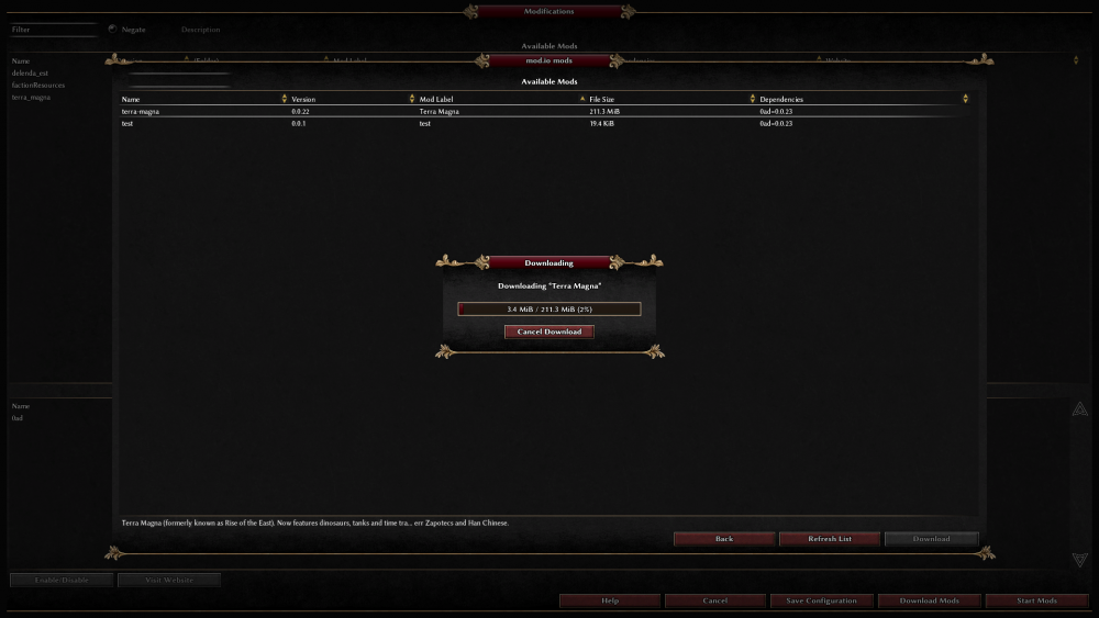
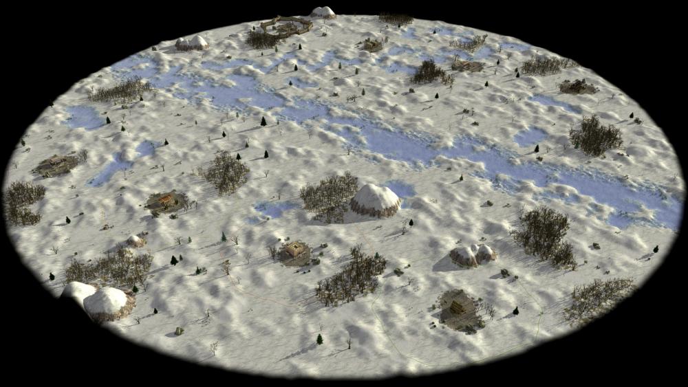
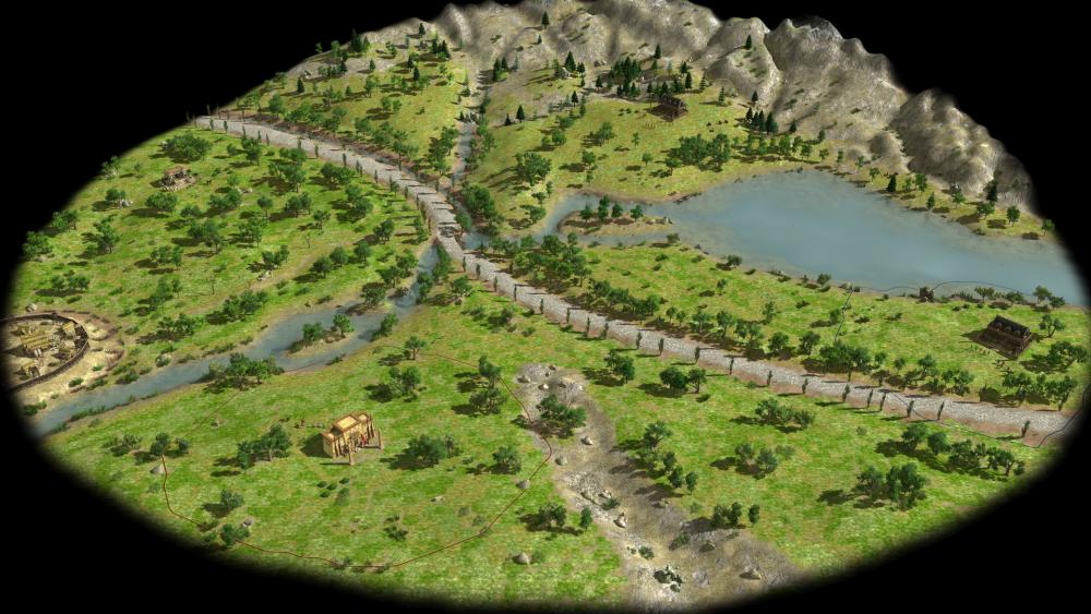
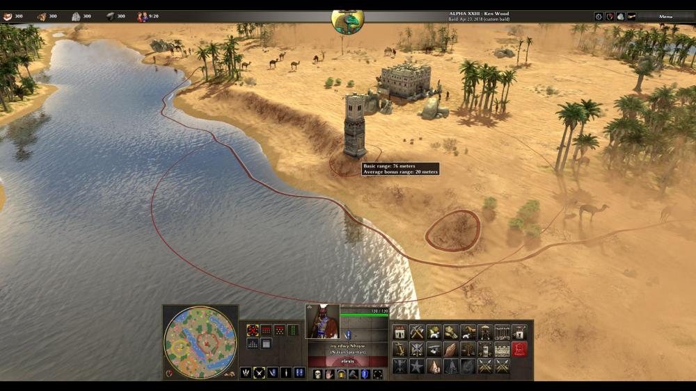
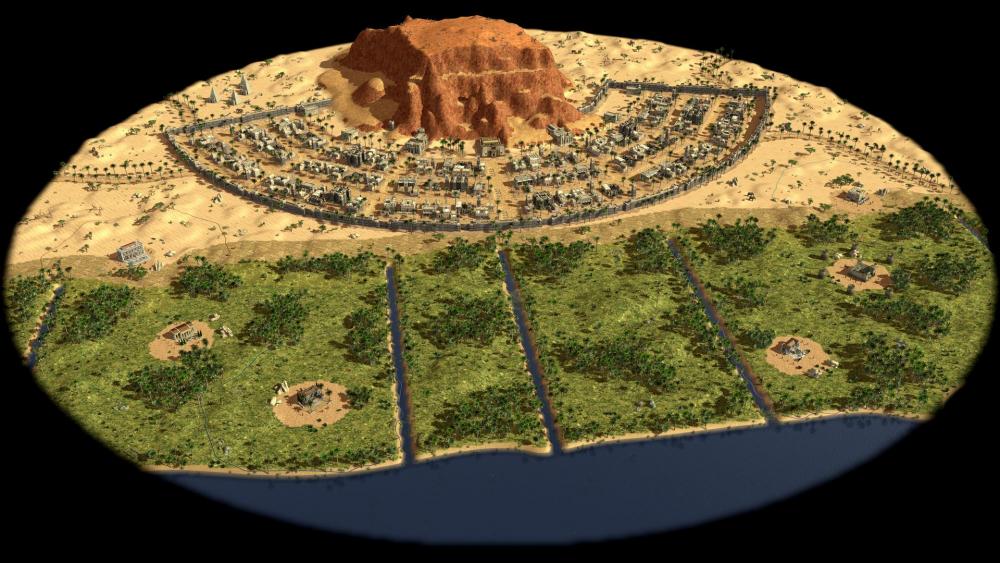
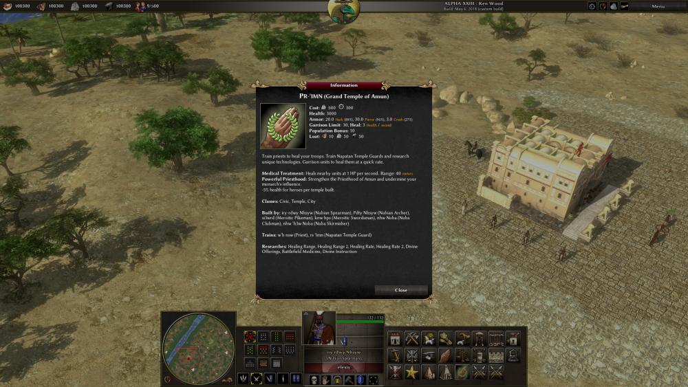
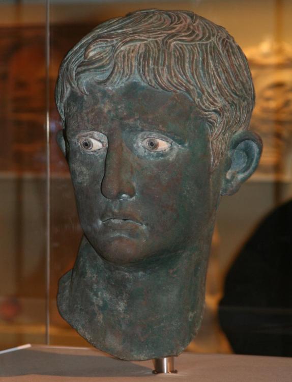
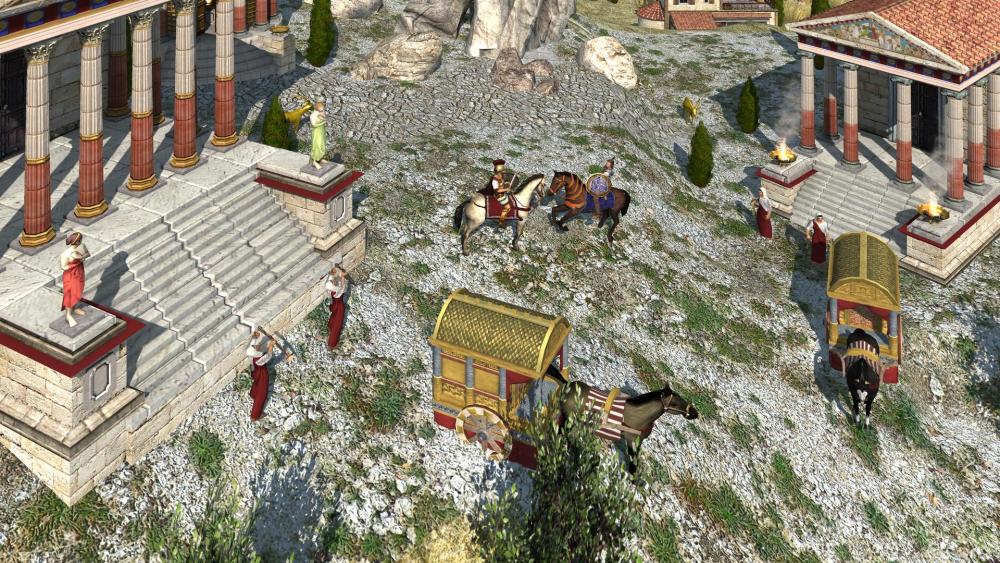
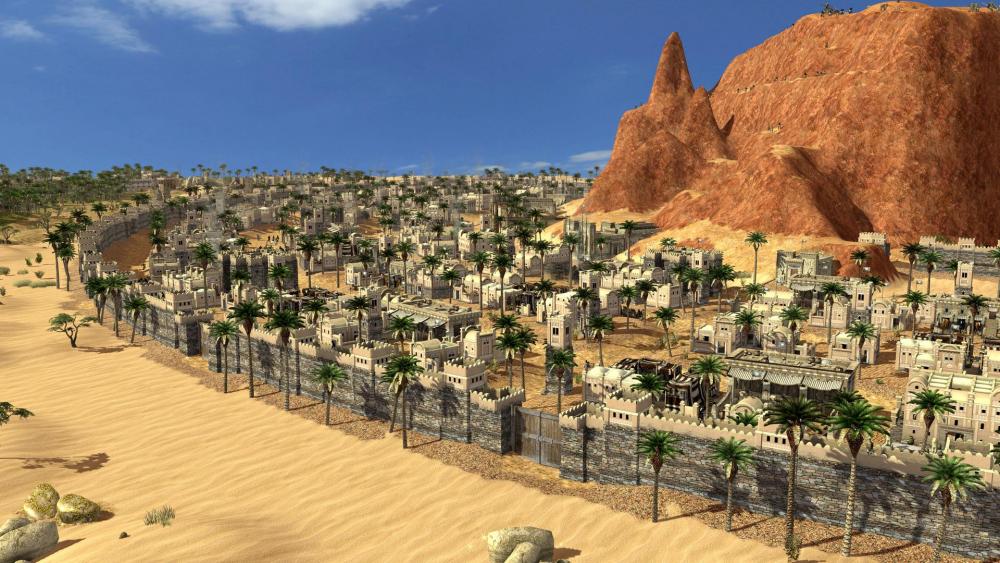
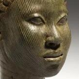
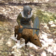
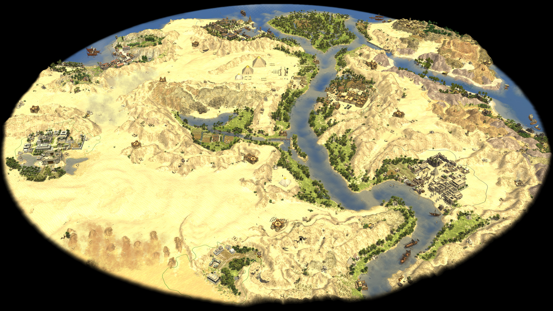
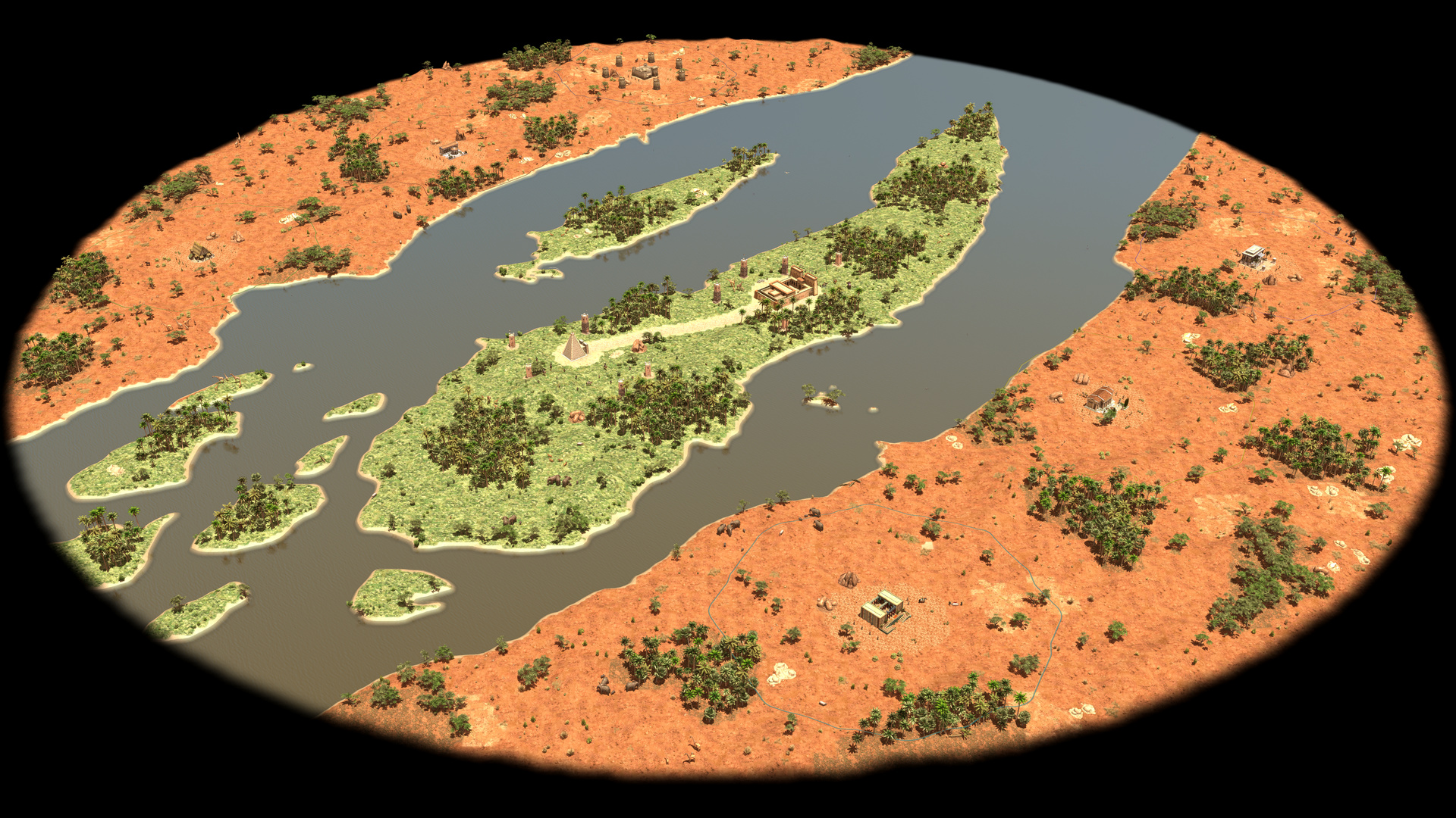
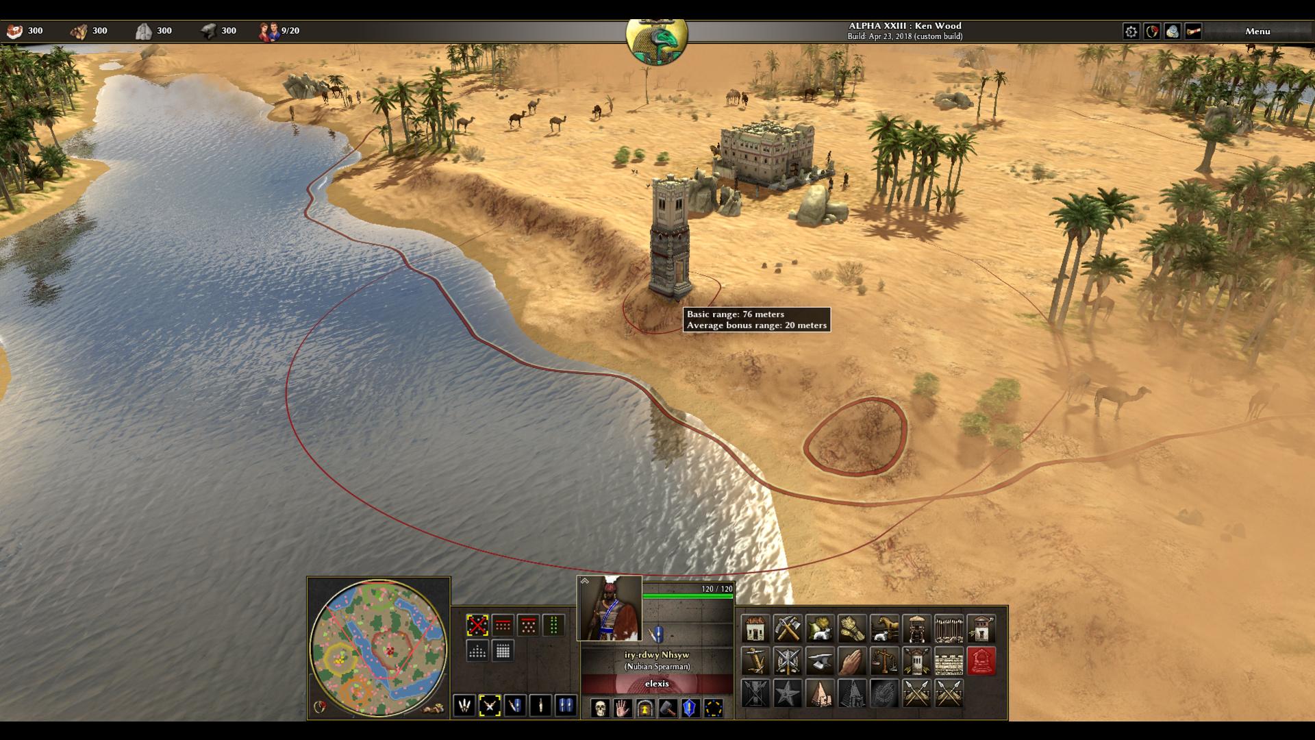
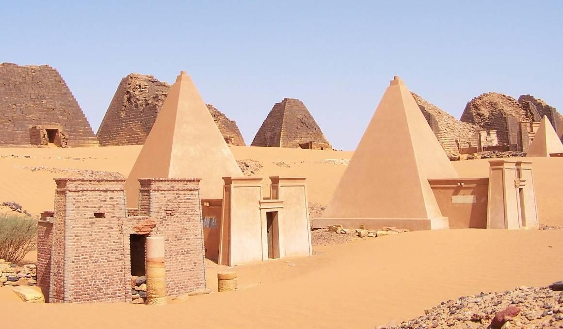
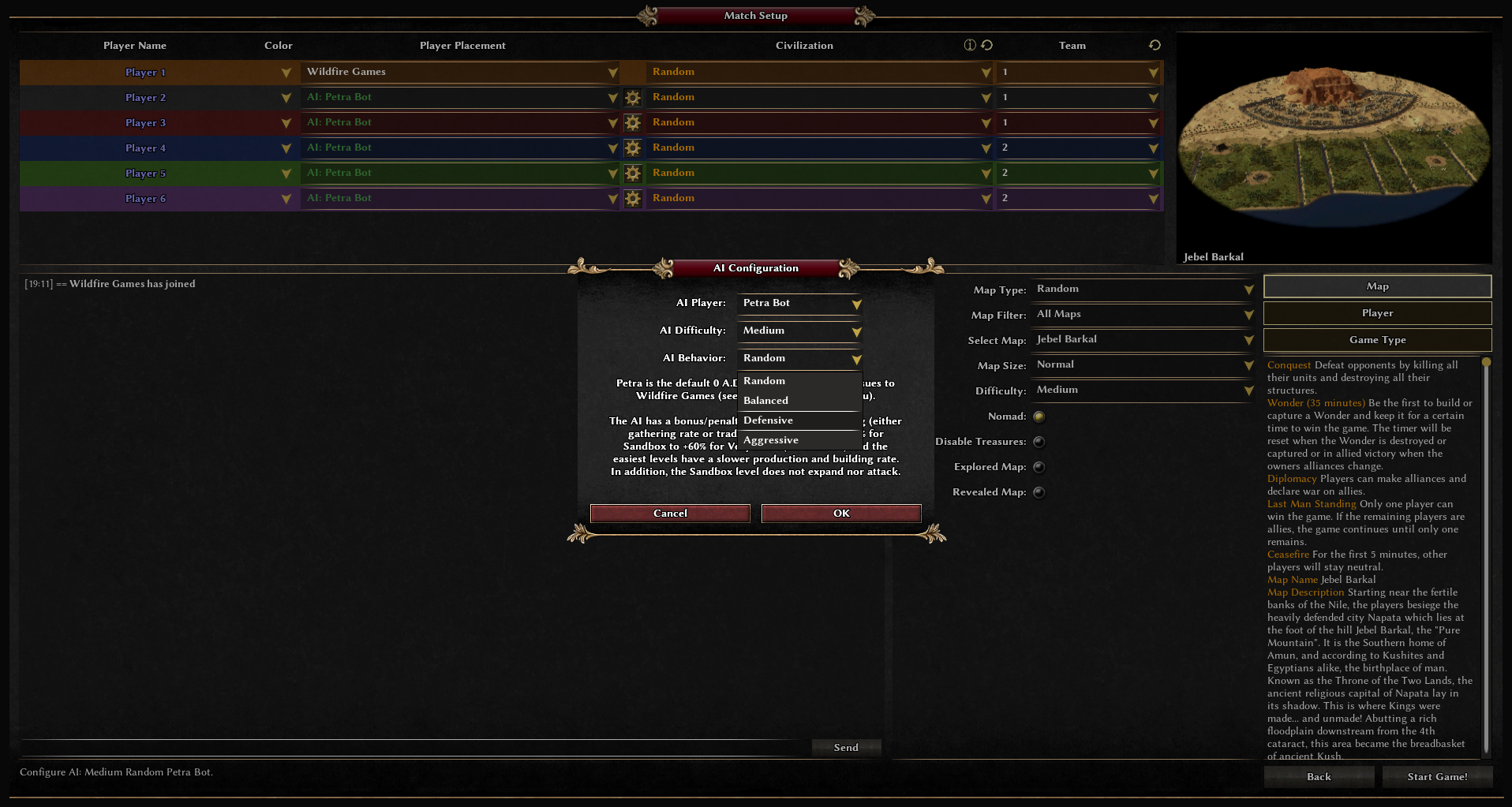
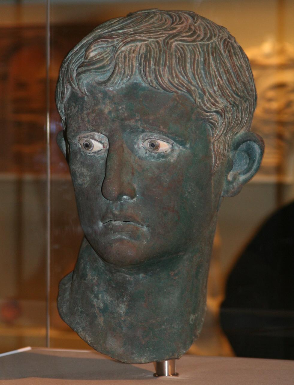
New Release: 0 A.D. Alpha 23 Ken Wood Wildfire Games, an international group of volunteer game developers, proudly announces the release of 0 A.D. Alpha 23 “Ken Wood”, the twenty-third alpha version of 0 A.D., a free, open-source real-time strategy game of ancient warfare. Easy Download and Install Download and installation instructions are available for Windows, Linux and Mac OS X. 0 A.D. is free software. This means you are free to download, redistribute, modify and contribute to the application under the same licenses (GPL v2 or a later version for code and Creative Commons Attribution Share-Alike 3.0 for artwork, see license). Although you might find some people selling copies of 0 A.D., either over the internet or on physical media, you will always have the option to download 0 A.D. completely gratis, directly from the developers. No “freemium” model, no in-game advertising, no catch. Top New Features New Civilization: Kushites Mod Downloader Cavalry and Spartan Building Models Combine Victory Conditions Attack Range Visualization Diplomacy Colors Destruction Damage Unit Information Dialog AI Behavior Lobby Authentication to prevent impersonation Nomad Mode on all Random Maps New Random Maps: Lower Nubia, Jebel Barkal, Elephantine, Fields of Meroë, Hellas, Dodecanese, Scythian Rivulet Civilization: Kushites The most prominent feature of the new release is the introduction of the Kushites. The Kingdom of Kush was a Middle Nile Valley civilization between 785 B.C. and 350 A.D. The region became known as Nubia and is located in present day Sudan. Steeped in pharaonic traditions, Kushites considered themselves the true heirs of the New Kingdom. They were fierce in the defense of their homeland, facing Persian, Ptolemaic and Roman invasions as well as constantly testing the strength of their northern neighbours. The armies of Kush are diverse, with contingents recruited from all across its vast domain. With a wide array of trainable units, they can adapt to almost any kind of opposing army. Boosted both economically and militarily by their monumental pyramids, ingenious leaders and special technologies, Kushites gain a variety of benefits. Lead the Nubian kingdom to bloody war and see the emergence of the mighty Kingdom of Kush. Learn more about ancient Kush here. Economic and religious Kushite sites (10MB 6k-HD) A nubian city in full bloom ( 6MB 6k-HD) Temple Of Amun Pyramids of Meroë, photograph by Fabrizio Demartis, CC-BY-SA 2.0 Nubian Pyramid Two Apedemak Champion Guards and a Blemmye Camp ( 4MB 6k-HD) Harsiotef, Kushite King of Meroë (404 B.C. to 369 B.C. ) Looted bust of the first Roman Emperor Augustus, found in Meroë, photograph by Steve F-E-Cameron CC-BY-SA 3.0 Mod Downloader Beginning this Alpha, players can install mod files just by opening them with 0 A.D. This new version also comes with a mod downloader, that allows you to connect to the new mod.io platform and fetch mods from inside the game. Wildfire Games and the mod.io team have worked together to bring you this feature, and 0 A.D. is one of the first games for which mods are available from this new and powerful platform. Please note that only mods that Wildfire Games has tested against blatant security issues will be available through mod.io. However, you are always free to install mods manually from other sources. 0 A.D. Mod Downloader Millenium A.D., a free mod featuring Anglo-Saxons, Byzantines, Carolingians and Norse civilization at the of Charlemagne and the Viking Age Terra Magna, a free mod featuring the Han Dynasty of China and pre-columbian Zapotecs New Models Similar to previous releases, meshes, animations, textures and materials for a number of units have been reworked. This time with a focus on helmets, shields and clothing. But 0 A.D. Alpha 23 also comes with many new artwork, as the Spartan faction has received an entirely new set of models. All Cavalry units have been replaced with much more realistically looking, more fluently animated high-poly models. New Spartan Buildings ( 9MB 6k-HD) New Helmets and Siege Firing Animations ( 7MB 6k-HD) New animal type Zebu and new Cavalry models ( 6MB 6k-HD) Combine Victory Conditions The addition of new victory conditions throughout the last releases, such as Wonder Victory, Regicide and Capture The Relic gamemode have made it reasonable to allow players to combine all these modes arbitrarily. So if you ever wanted to play a game where you can choose between defeating the enemy by taking out the hero or starting an ambush on the relics after building a citystate and assembling an army, now is the time! Two heroes fighting for victory ( 9MB 6k-HD) Attack Range Visualization Similar to the aura range visualization of the former release, fortifications and mobile towers now reveal the range they cover upon selection. Furthermore, the attack distance is also drawn when in the building placement preview, so that the player can find the best suitable location prior to settling the position. Attack Range Visualization during building preview mode ( 7MB 6k-HD) Diplomacy Colors Both in traditional games with two teams and in diplomacy teams with interactive alliance buildup, players could have often used a quick way to find out where the border to the enemy lies and which parts of the territory can be considered a safespace. With 0 A.D. Alpha 23 players are rewarded with a way to toggle between the player colors and team colors (one color per diplomatic stance), enabling them to react to every threat to their city instantly. Blue indicates the player, green allies and red opponents ( 12MB 6k-HD) Destruction Damage One of the new features that targets 0 A.D. (but also mods and other RTS that once might use the Pyrogenesis engine) is the ability of units to deal damage to surrounding enemies when they are destroyed. The effect is demonstrated by Fireships that can and will sink enemy ships if not taken care of by the enemy combatant. An Iberian Fireship sinks nearby fishing ships ( 4MB 6k-HD) Unit Information Dialog Players and observers can now open a dialog that displays all the game related details by rightclicking on a unit during a match. It is also designed to provide sufficient space for historic background information in future versions of the game. Everything you wanted to know about the Amun Temple AI Behaviors The Petra AI now supports configuration of different behaviors, such as Aggressive or Defensive. Although still in an early stage of development, it aims at more diverse singleplayer experience. AI Configuration Dialog Lobby Authentication To establish a safer multiplayer environment, the possibility of player impersonation was ruled out by an improved connect mechanism that requires lobby players to remain authenticated at the lobby server when joining games. The new match setup option Furthermore, the lobby chat was made accessible in the match setup, running games and the summary screen, so players can stay in tune with upcoming games without having to leave the party early. Nomad on all Random Maps Players have enjoyed the "Unknown Nomad" random map since years. It required players to scout the randomly generated map and find a suitable location to lay the foundation stone of their city. With 0 A.D. Alpha 23, this game mode is not restricted to this map anymore but can freely chosen on any of the random map scripts. A Persian player starting the city at the river ( 10MB 6k-HD) New Maps The entire random map generation code has been revamped. The results of this endeavor are many more possibilities and comfort for map authors to generate landscapes and a new quality standard in map design. With Alpha 23, 0 A.D. was enriched by seven random map scripts and three new skirmish maps. Six of these maps take place in the domain of the Kushites. New Random Maps Lower Nubia Lower Nubia is the area between the first and second cataract of the Nile and formed the traditional border region between Kush and Egypt. The hostile and merciless Sahara desert makes defending your position on the river and its steep banks an absolute necessity. This map, like most other realworld maps below was created using realworld elevation data from the NASA Blue Marble series. New random map "Lower Nubia" ( 10MB 6k-HD) Abu Simbel Temple of Ramesses II, photograph by Than217, Public Domain Jebel Barkal The "Jebel Barkal" is the holy mountain that was used as a landmark by traders crossing the Nile river, near its fourth cataract. It is located near the Nubian city of Napata, which later became the capital of ancient Kush. The remains of the Napatan temple complex and the nearby pyramids were declared a world heritage site in 2003. Stone Ruins and the famous Pinnacle of the Hill, photograph by Maria Gropa, UNESCO, CC BY-SA 3.0 "Jebel Barkal" is the first 0 A.D. map to present a vivid, procedurally generated cityscape combined with regularly spawned attackers of adjustable difficulty. City Walls of Napata ( 11MB 6k-HD) Procedural Generation of the City ( 10MB 6k-HD) Temple Guards patroling Napata ( 9MB 6k-HD) Players start near the fertile banks of the Nile river. In order to attain resources, players have to either establish a tradeline there or reach the mineral abundance in the shelterless desert. Contrary to the average map, players find complementary advantages and disadvantages depending on the starting location, making cooperative teamplay and strategic decisiontaking much more relevant. New random map "Jebel Barkal" ( 8MB 6k-HD) The Pyramids and the Hill, photograph by Ron Van Oers , UNESCO, CC-BY-SA 3.0 Elephantine Together with Philae, the fortified Island of Elephantine was situated on the Nile River at the first cataract and an important Egyptian city, often under Kushite control. As the border between Upper Egypt and Lower Nubia, Elephantine became an important way-station for the trade in ivory and other goods. It was considered to be the home of the god Khnum, guardian of the source of the Nile, and boasted an impressive temple complex whose remains can still be visited today. This map was created using OpenStreetMap data. New random map "Elephantine" ( 10MB 6k-HD) Temple of Isis on Philae Island, photograph by Olaf Tausch, CC-BY 3.0 Temple of Aswan on Philae Island, photograph by Osama Awny, CC-BY-SA 4.0 Goddess Hathor in the Satet Temple on Elephantine Island, photograph by David Stanley, CC-BY 2.0 Fields Of Meroë The "Island of Meroë" is a vast peninsula flanked by the Nile and Atbarah rivers and formed the heartland of ancient Kush. This map comes in two variants, one depicting the dry season and one for the rainy season. The map demonstrates the new possibility to select the map biome in the match setup. "Fields Of Meroë" - dry season ( 9MB 6k-HD) "Fields Of Meroë" - wet season ( 10MB 6k-HD) Temple of Amun in Naqa, photograph by Coordinamento delle organizzazioni per il servizio volontario, CC-BY-SA 3.0 Hellas This unique random map script choses a random area of Greece each time, yielding a much greater surprise effect each terrain generation. A "Hellas" map generation showing a part near the Aegean Sea ( 9MB 6k-HD) Dodecanese "Dodecanese" is greek and translates to "twelve islands". It names a group of 15 large and 150 small islands in the southern Aegean Sea . This is the first random map script placing little bridges. New random map "Dodecanese" ( 10MB 6k-HD) Scythian Rivulet This is a map focusing on the beauty of pristine winter, featuring crispy mounds of snow, shown under a not-too-bright sun. New random map "Scythian Rivulet" ( 8MB 6k-HD) New Skirmish Maps Alpha 23 "Ken Wood" comes with three new Skirmish maps: Egypt, Butana Steppe and Via Augusta: "Egypt" (6 players) comes with prebuilt cities of geographically accurate civs ( 10MB 6k-HD) "Butana Steppe" (2 players) ( 11MB 6k-HD) ""Via Augusta" (3 players) ( 14MB 6k-HD) Under The Hood This release consists of almost 1900 patches (r19923 to r21819), i.e. several hundred of bugfixes, commits restructuring of the engine code and small features that can barely be listed. It also includes solutions to prevalent crashes and performance bottlenecks. Finally, the Pyrogenesis engine can be compiled using Visual Studio 2015 and premake5. The name "Ken Wood" Ken Wood, also known as Phoenix-TheRealDeal or tonto_real, was one of the three original gameplay designers of 0 A.D, together with Wijitmaker and Acumen. He was a retiree in his 60’s from Arizona, but he sadly passed away in 2006 after a long fight with cancer. It is thanks to the amount of energy and passion he poured into the early stages of 0 A.D. that we are celebrating another great release of our favorite game! We managed to reach that symbolic letter W for our twenty-third Alpha, and we keep remembering him through the development of the project. Ken Wood was instrumental in conceptualizing some of the core concepts of 0 A.D. Most notably, he laid the foundations of the citizen-soldier concept, and its female villager counterpart. He was also fascinated by Celtiberian civilizations and designed the Iberian and Carthaginian factions. He designed a Rock-Paper-Scissors counter system for units of the game, biomes for maps, and had big ideas for naval combat and realistic ship movement. If you want to know more about the story behind 0 A.D., see this article. We have also re-published an interview from the old website here. And let us not forget his famous quote, which gives us all the motivation we can need: For the next alpha, we welcome fan suggestions for words relating to the ancient world beginning with the letter X. Keep it original and related to the time frame portrayed in 0 A.D. (appx. 500 B.C. – 0 A.D.) and post your proposal here! Support Us The work is still in progress and can use every helping hand. You can support us by translating the game in your language at transifex, contributing art or code or simply by donating. If you experience a technical problem with the game, please report it at trac.wildfiregames.com. This is also the first address to visit when you wish to dedicate some of your time to help patching the code. Got any further questions or suggestions? Discuss them with other players and developers at the forum or talk with us directly in the irc chat. Subscribe Contact info for press, bloggers, etc.: aviv@wildfireTROYgames.com without the capitalized name of a city Ulysses spent some time in.


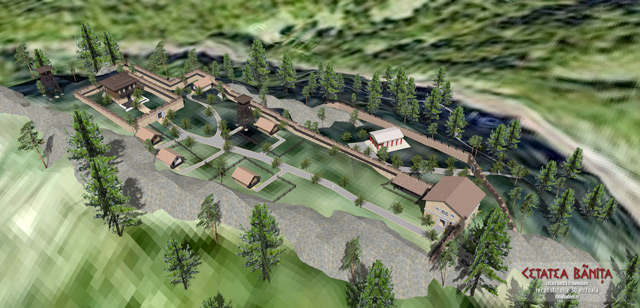
.thumb.jpg.c7762e85d1c65f9c21798da30a392a8c.jpg)


-
The Flood Myth
Sundiata replied to Thorfinn the Shallow Minded's topic in Introductions & Off-Topic Discussion
Another interesting note is that global sea levels have risen by 130 meters since the last glacial maximum, c. 20.000 years ago, rising more than 100 meters over a 7000 year period from 14.000 years to 7000 years ago. Not exactly a sudden deluge, but it's effects on pre-historic human populations and their movement (often traveling and living on the coastlines) would have been significant, and definitely left some kind of mark on the collective global memory. Areas between landmasses which were previously connected and probably "densely" populated according to Pre-Historic standards became submerged: British Isles and Europe were connected, the Aegean sea and islands used to be coastal plains, The Adriatic, Black and Caspian Seas were much smaller, the Bering straight, South-East Asian Islands and the Asian mainland (Sundaland), Australia and Papua New Guinea, India and Sri Lanka, Arabian Peninsula and Iran Korean Peninsula and China (perhaps even Japan) Distance between Yemen and the horn of Africa became negligible Basically every coastline of the world was affected.
-
You are confusing the game with the mod aristeia. You are currently writing on the subforum of aristeia, a mod dedicated to the bronze age and the aegean period.
-
https://www.haaretz.com/archaeology/MAGAZINE-ancient-records-indicate-philistines-weren-t-aegean-pirates-1.5433265 New evidence to discuss.
-
Since you're already working on procedural map generation code, take a look into the rmgen/rmbiome/ folder. Like the rest of the parent directory, it was refactored in alpha 23, because it was an inextensible mess before. Basically the generic biome system is only a vocabulary with some specific variable names and an optional JS function that is called. The map-specific biomes I've seen several thousands of lobby matches, and experienced very heterogeneous feedback, so it leaves an odd impression to speak in the name of all people. While it's ok to have a basic set of generic and ambiguous maps, to me the map design stage was missing when deciding to use generic biomes. In Alpha 20 _kali's rmgen2 maps (Ambush, Frontier, Stronghold, Harbor, ...) maybe doubled the number of generic biome maps, it made something repetitive twice as repetitive. In Alpha 21 _kali and me introduced some very good maps (Red Sea, Mediterranean), but also few maps that are out of place geographically (Amazon) or historically (Howe Sound). For many older and newer maps, the author only had an algoirthm in mind. But the vision of 0 A.D. and it's specifically defined geographic and historical context can only be to let a player relive history. To me it's not in line with the vision of 0 A.D. to not think about specific geographic locations and historic sites. Therefore in Alpha 22, a map that originally was just an aegean sea copy with the generic autumn biome, became Danubius, a certain place at a certain time of a certain scenario with a unique character. Alpha 23 maps took this further and implemented only specific sites for Kushites: Jebel Barkal, Lower Nubia, Fields of Meroe, Elephantine and Greece Hellas, Dodecanse. I have a clear vision to take this to the next level(s). Trying to improve random maps that are bad by design is a good starter task to familiarize oneself with the code, but it limits the potential for improvement one can tap into.
-
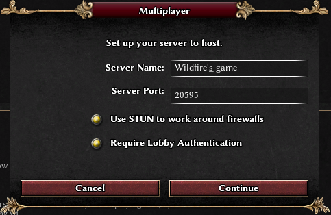
Game Setup Rooms aka games creation room UI "overhaul"
wowgetoffyourcellphone replied to Dade's topic in General Discussion
Exactly, and you can be as granular as you want. You can have Europe as a region and then also Italy, Aegean, Mediterranean, Gallia, etc. as more regions. And any given civ can be in any number of regions, especially the big empires. It's all very possible and already in DE's civ.jsons in case @s0600204's patch is ever committed. -
Brief. Sarmatians: They arose in the foothills of the southern Ural Mountains during the 4th Century BC. They conquered the Sauromatians. The Sarmatians drove their Scythian kin from the Ukraine sometime shortly before 200 BC. The Sarmatians were also famous for their warrior women who inspired legends about Amazons. They wore heavy armor and used lances as weapons. Their artwork was a more austere variation of the Scythian Animal Style. By about 200 AD, some Sarmatians served as auxiliary horse soldiers in the Roman Army, with some of these serving in Britain—where they may have become the basis for the legends of King Arthur and the Knights of the Round Table! The basis of the so-called Sarmatian-Arthurian connection can be summarized as follows. Before the Sarmatian troops arrived in Britain in Roman service, there was no established practice in Britain of fighting from astride a horse with a lance while wearing heavy armor; and, of course, the image of the lance-wielding equestrian knight-in-shining-armor is the central motif of Arthurian legend. The Sarmatian practice of worshipping before a sword thrust into the ground obviously suggests the "Sword in the Stone" story from the larger Arthur story. And one of the Roman commanders of the Sarmatian troops in Britain was named Artorius. All these coincidences are enough to make romantically inclined people swoon and to give even the most cynical and jaded analyst pause. The Hollywood movie King Arthur, released in 2004, plays up the Sarmatian-Arthurian connection with gusto. The Sarmatians were categorized as follows by ancient authors: "Royal" Sarmatians: We may assume these were the ruling clans of the greater Sarmatian nation. Issedones: The location of these people in central Asia is uncertain but may have been northeast of the Aral Sea. According to the ancient Greek writer Herodotus, they practiced ritual cannibalism on their elderly males. Herodotus also said Issedone women had high social status and could have several husbands. Urgi: They are thought to have lived in the north-central Ukraine. Today, "Urgi" is the name of a town in the former Soviet republic of Kyrgyzstan. Aorsi: They were the largest of the Sarmatian tribes. They lived in what is now Kazakhstan for centuries before being driven west. They formed an alliance with the Romans to defeat the Siraces and the Bosphoran allies of the Siraces in 40-45 AD. They were eventually absorbed by the Alans. Siraces (or Siraki): They moved into the northwestern Caucasus shortly before 300 BC and lived there until about 200 AD. They allied themselves with the Bosphorans but they and the Bosphorans were defeated by an alliance of the Romans and the Aorsi in 40-45 AD. After this defeat, the Siraces sank into obscurity. Saii: Presumably, they lived in the south-central Ukraine. But in the confusion that inevitably attends ancient sources, this supposedly Sarmatian tribe could in fact have been a Thracian tribe living on the northern shore of the Aegean Sea. Iazygians (or Jazyges): They lived in the western Ukraine. They were pushed into what is now Hungary by the Roxolani by 80 AD. They then made war on the Romans with some success until they were finally suppressed by the Roman Emperor Marcus Aurelius in 175 AD. They became the Sarmatian tribe most famous for providing military units for the Roman Army. They were forced to provide 8,000 horse warriors for Roman service, of which, 5,500 were shipped to Britain where they may have formed the basis of the Arthurian legends. They were absorbed by the Germanic Asding Vandal tribe by 230 AD and disappeared as a distinct group. Roxolani: They lived in the eastern Ukraine. After being pushed westward by the Alans, they in turn pushed the Iazygians out of the western Ukraine by 80 AD. They made frequent war on the Romans, sometimes winning and sometimes losing. They also provided a number of troops for service in the Roman Army. They were conquered by the Germanic Ostrogoth horse tribe during the 4th Century AD. NOTE: There were many Germanic tribes living in central Europe. Of these, only the easternmost of them, the Ostrogoths, developed a true horse nomad culture as they expanded into the Ukraine during the 4th Century AD, conquering the Roxolani, the last of the Scythians, and the Bosphoran Kingdomon the way. Their great warrior chieftain in this adventure was named Ermanaric. Their steppe realm was destroyed by the Black Huns in 372-375 AD. Ermanaric committed suicide. According to legend, there were two famous Ostrogothic female warriors named Hervor who were grandmother and granddaughter to each other. Their title was "shield maiden." The story is told that the younger Hervor died heroically in battle fighting against the Black Huns. Both she and her "shield maiden" title may be seen as a prototype for the character of Éowyn of Rohan in the Lord of the Rings books and movies. source: http://www.horsenomads.info/section1.html
-
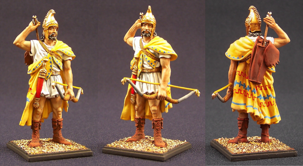
After a lengthy deliberation, for which we sincerely apologize to our loyal fans, we on the Aristeia mod design team have arrived at a clearer vision for making a way forward. No more the divisions of time and space, no more the fractured kingdoms and petty city-states of the threefold separation previously envisioned. Rather, four powers of the ancient world, spanning over a thousand years of history, will be depicted in a mighty struggle for supremacy. The earth of Mesopotamia trembles beneath the mighty hosts of Assyria’s great kings. From Egypt, by land and sea, pours forth a multitude of the Pharaoh’s followers, devotees of his Majesty. The waters of the Aegean are blackened by the ships of Mycenae, bent on revenge and plunder. The Hebrew monarchs, beset by foes on all sides, fortify their fenced cities and arm their people as if for an agelong war. The battle of Nations draws nigh. Stay tuned for further developments!
- 1 reply
-
- 5
-

-
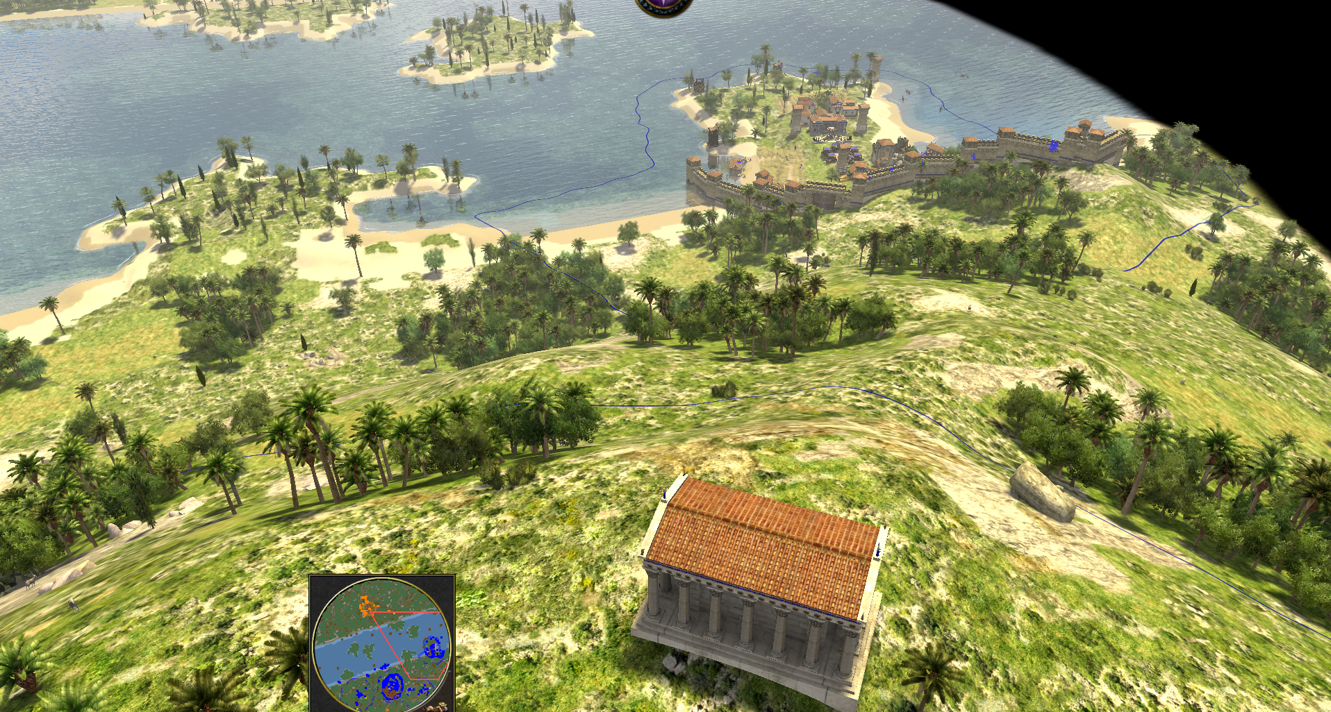
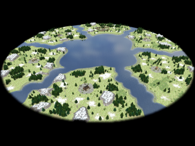
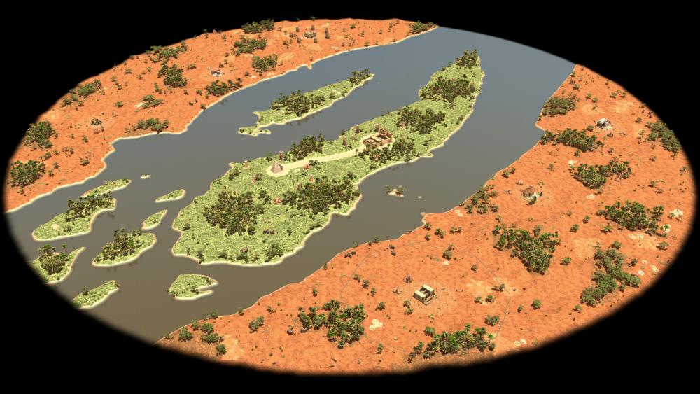
I just modified the Aegean Sea map. Im learning how to manage maps. By the way, Is there a way to position the camera higher without having to create a mountain?. I feel like there is a lack of wider and greater perspectives for such a nice and beautifull Game. Here another perspective from Olimpus mountain

-
For thematic and continuity reasons, we are focusing on a series of four dominant civilizations (Egypt, Israel, Assyria/Babylon, Greece) within their respective geographic regions (the Nile, the Levant, Mesopotamia, the Aegean), but Hittites will most likely be represented in some form in Part II as individual units within a parent Mesopotamian civ.' The idea at this point is a succession of civs like this, represented in sequence for Parts I, II, and III: EGYPT: Old/Middle Kingdom -> New Kingdom -> Late Period ISRAEL: Pre-monarchy Hebrews -> United Monarchy -> Judahite Kingdom MESOPOTAMIA: Sumer/Akkad -> Kassite Babylon/Syria? -> Neo-Assyrian Empire GREECE: Minoans -> Mycenaeans -> Archaic Greeks See above. Neo-Babylon was basically a successor of Assyria (although co-existing in a subordinate position prior to the sack of Nineveh in 612 BC and defeat of Assyria's last major resistance in 609 BC), and inherited pretty much their whole former empire. One of the titles of Nebuchadnezzar II of Babylon was "king of Assyria", indicating some form of imperial continuity. Since both the Neo-Assyrian and Neo-Babylonian empires took place in the 1000-500 BC timeframe, I chose the Assyrians to represent the Mesopotamian region, since they seem to have had the greater impact and influence, as well as much greater longevity. The Neo-Babylonian and Achaemenid Persian empires at least partly used the Assyrian models of administration and governance. All that being said, I'm not ruling out a future Neo-Babylon civ for Part III, but that would have to wait until the main four civs are up and running.
-
Well, I had planned to include the Mycenaeans with the other Greek spheres of influence. As far as splitting things up: same as the vanilla game and Millenium AD are doing (500-year divisions, when you could make the argument that we should combine the Republican and Imperial Romans into simply The Romans). It's partly _because_ I want to do this long and complex 1500-year period justice that I've broken it up into 3 parts. And I think there are enough empire/kingdom heights in 1000-500 BC to satisfy the requirements of a good duke-out. You've got Ashurbanipal of Assyria, Necho II of Egypt, Gyges of Lydia, and Jehoshaphat of Judah. What I did was try to group the Mycenaeans, Archaic Greeks, and Lydians under a broad category. Strictly speaking, you are correct. I should use a different term. All: In order to eliminate some misunderstanding, I'm going to rename the Part III Greeks a more generic term: "Aegean Greeks," since I seem to have misapplied the term "Archaic" in a general sense to cover both the Mycenaean and Archaic periods of Part III. How about we move the Mycenaeans back to Part II, leaving the Archaic Greeks and Lydian kingdom in Part III? As it is, the Mycenaean period is sort of straddling the Part II/Part III divide anyway (and it's unclear just when the Trojan War(s) occurred, it could have been anywhere from 1100-800 BC, depending on how long the Greek "Dark Age" lasted and how widespread it was; my personal conclusion is that what we know as Archaic Greece picked up not too long after the Mycenaean period.)
-
Design: Civillization Name
Wijitmaker replied to wowgetoffyourcellphone's topic in General Discussion
I don't think that artwork is a gigantic concern, it is always changing and evolving. It could always be used in the scenario editor, and could be changed on civ selection in game. I think the depth of strategy it would return to the game would be worth the trade off. With fewer factions, this enables greater diversity. The more factions you have, they all start to blend together in similarities - with only subtle differences. Balancing a dozen plus factions is also challenging. Red Alert had 2 factions. Star-craft had 3. The original 6 civs were chosen because they had some distinct historical differences that gave players a unique experience when they played. Mythos changed that after I left. He really liked the Greeks and was influenced by his own desires to recreate his dream game "Age of the Aegean". So, when he took over the game design of 0 A.D. some of the original vision was lost. When I say balance, what I mean is that you don't want the outcome of the game decided by a players faction selection before the game even begins. Every faction should give players an opportunity to win if played with a strategy that compliments the faction. I'm not saying that what 0 A.D. is doing today is necessarily bad. I'm just saying that it is different than what was intended and (in my opinion) removes elements of strategy and makes the game harder to balance. (An extreme version of what I'm suggesting is that you start the game without a civ selection - just a generic civilization. Everyone starts the same. The civ is then selected in play after you have had a chance to observe the behaviors of your opponent and the map.)


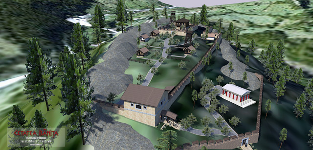
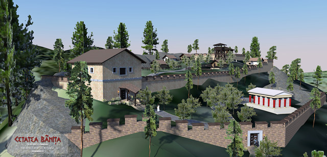
.jpg.c4e3a18a0a21826820e299a1ea988be3.jpg)


.thumb.png.0d87fc71cb8a644c5d862ceabac1e0d5.png)