Leaderboard
Popular Content
Showing content with the highest reputation on 2016-06-06 in all areas
-
3 points
-
2 points
-
1 point
-
Same problem here actually. I always need to hover the icons to see what they're actually used for...1 point
-
Me too. Why not make end of alert a bell with a red line crossing it out?1 point
-
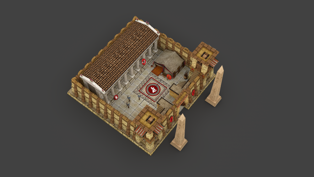
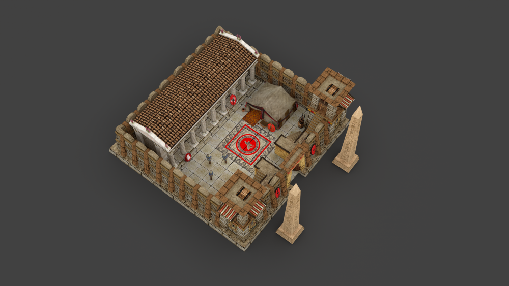
Lion, the problem that people point out with the mix of cultures in the ptolemies is not architectural-wise, but texture-wise. I understand that people wants authenticity, but gameplay also demands uniqueness, and having 3 civs using already a hellenistic-like textures the decision to go more into the egyptian-side looking for ptolemies was made. If the discontent with how ptolemies look is so wide I guess we should consider tuning the colors to the white side to match more closer the hellenistic set. However I'm not a big fan of this due to the 4 white-centered civs in the game.1 point
-
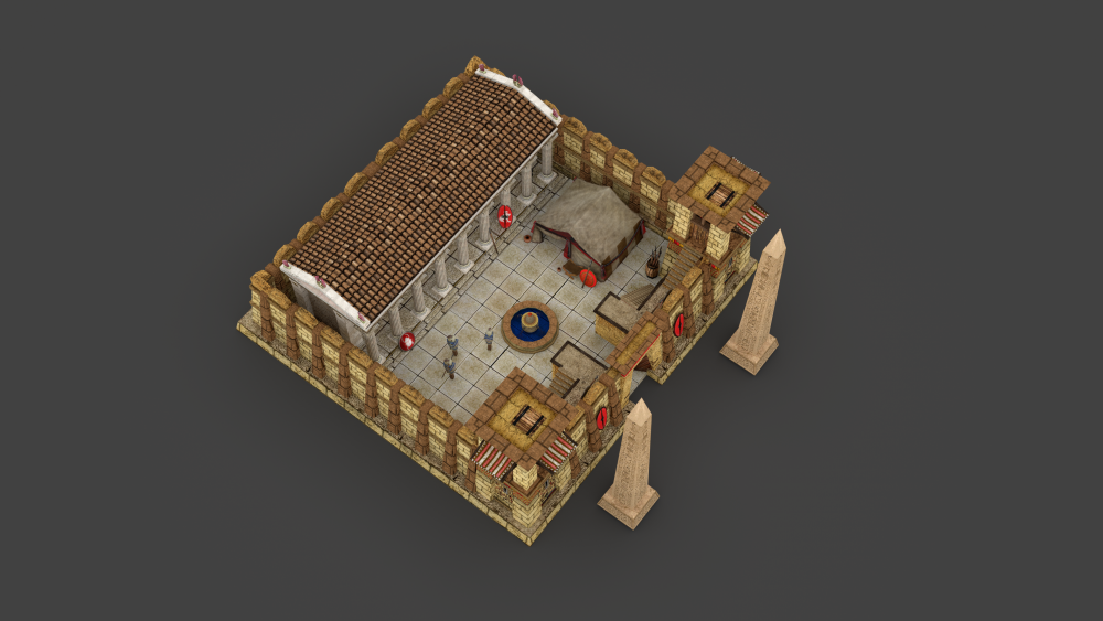
The one on the left is how I would have gone about merging the two styles. Sometimes its useful to use the fly-through function in blender to drop yourself into your building and see at a ground level what's an architectural oddity, and what's missing. ie- "colonist walks up to impressive, and defensible colony stoa and wonders where he's going to be sleeping tonight." - add ambiguous buildings, building extensions, or tents- "where will I train?" -training grounds, targets, dummies ect and since the colony is a mini civic center, perhaps bring some civic center elements into it, like only two flagpoles or just one obelisk to make it aesthetically "less but same" anyhow, I hope this helps!1 point
-
The first iteration was my favorite to be honest, the biggest problem for me is that this feels like two separate structures, and they don't visually engage at all angles. It'll take some creative thinking to get these things to work together. Altering the texture pack per building throws off the entire building set, so if we can avoid doing that that would be for the best. I'll see if I can sketch something to illustrate my point1 point
-
I'd hate to sleep on a tent pitched on a stone floor. haha I hate to say it but I feel the need to,his feels really disjointed, the stoa and obelisks don't match the ptolemaic texture and overall there's no marrying of the styles enough to keep the two styles from separating like oil and water. With such bright distinction its difficult to do in this case. I like the front, the entryway and flanking towers are great, though the egyptian walls around the back get a bit architecturally bland. Same thing with the floor, perhaps it doesn't all need to be tiled? Thick stone walls enclosing tents is a little off to me too.1 point
-
That ziggurat was from a never made mod of warcraft III that I followed with a lot of enthusiasm. Was like 5 years ago, times goes fast.1 point
-
1 point
-
@Lion.Kanzen https://skfb.ly/OYZw @sanderd17 can try with ptol columns.1 point
-
That's Seleucid Texture X) Pillars are Ptolemaic though.1 point
-
1 point
-
Every I'm confused with End of Alert and High Alert. someone else have this problem?1 point
-
1 point
-
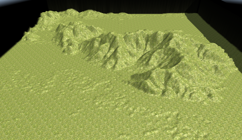
Hi, @Palaxin Is already an excellent guide , I quickly posted that data for two reasons: - From the Main Page also get access to a Research Database, where data collection is very rich, has a choice that ranges from 1 to 3 and 15 seconds of arc, one that I linked has some areas of Europe with precision a second of arc. - With GDAL I saw that the data can be extracted with various parameters, but I have not studied further, and more - this could be of interest to programmers - it has a variety of cross-platform API to use and open source, but I do not know how to use them Atlas; It is used in several GIS systems and for the construction of maps in 3D. When I have a little time on their hands to see further data extraction and various export formats, I also see for bathymetric. Keep in mind that the test I made was "on the fly" and not to make too harsh heights have limited the range of gray (256) to a number of 52 starting with 2: 2: 2 to 54:54:54 at the time extraction in Tiff. I made a scaling, and this is the result first test in the mountains where I live and which I know well: These are the files used (Including those of Atlas): Files Serra.zip I just tidying things ... will let you know, I think if we can make it as easy as possible the creation of maps close to the real, many will be even more interested in the game and participate in the development . Greetings to all, good job and have fun.1 point
-
1 point
-
There are a few things I would like to tweak in the animation, but this is how it look so far:1 point
-
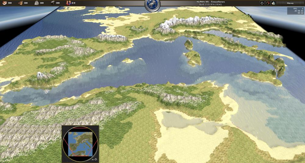
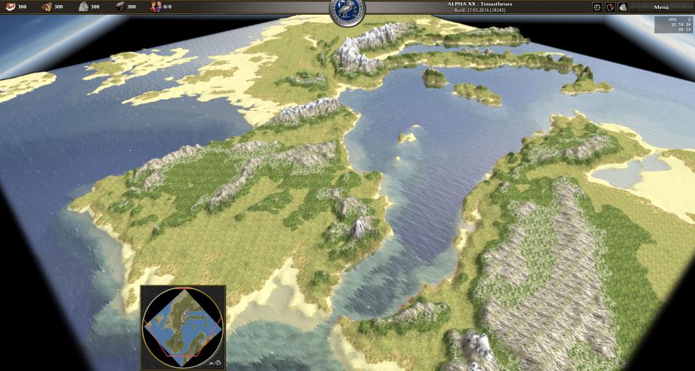
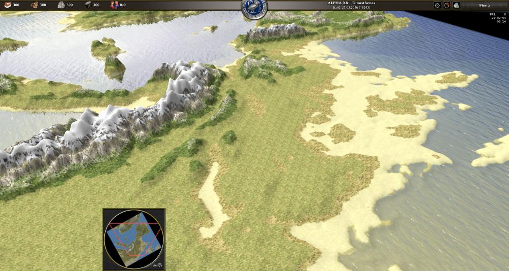
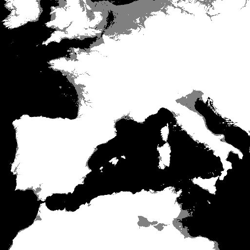
Some pictures of height-based texturing using a script I am planning to do a good amount of tweaking, but if someone (@Player1) can't wait to test the map himself in Atlas, here are the files: WesternMediterraneanDemo.zip - Have fun! BTW what do you think about square vs circle map shape? A pretty big problem is the shoreline because of the limited resolution of the 8-bit grayscale heightmaps. The topography heightmap says the grey areas are under water, the bathymetry (ocean floor) heigtmap says they are above sea level... I probably need to combine them with another source1 point
-
Excellent Sighvatr, Assyria will be a fun one no doubt. I think those "field fortifications" are actually the Assyrian siege tower/rams we see in the main game. They bear some resemblance1 point
-
You guys are the best ever; only the open-source people want their stuff to be the absolute best. Otherwise, they won't get donations. In the paid-game industry, all they want is to sell games. Period.1 point


.thumb.png.ce58cea22940c255f5b0a735d5abee36.png)

