Leaderboard
Popular Content
Showing content with the highest reputation on 2017-08-20 in all areas
-
From my personal player pov, 200 would be ok for me and 300 have always appeared like pure spam games. (Also often players just the 8 players without reducing the population limit, which totally doesn't work performance wise if everyone reaches the limit.)2 points
-
"Will have won" is in future perfect tense which is slightly different than the regular future tense. Future perfect tense implies that the event will occur by a certain time, not necessarily exactly at the time mentioned. Future tense implies that the event will occur at that time. So in our case, the future perfect tense "will have won" means that victory will occur by the time the timer finishes, whereas the future tense "will win" implies that victory will occur when the timer finishes.2 points
-
I don't like to criticize devs work but It is quite obvious that in the last 3 alphas the best strategies were all based on the race to train the most OP units of the moment. f.e. Alpha 20 was about training champions as fast as possible, in particular Britons since they build faster and save wood with slingers. the other units weren't even used in depth since buildings arrows were lethal against citizen soldiers and prevented any kind of rush. Alpha 21 was about spamming slingers because they are cheap and incredible fast workers in any case. Matter of fact having the stone near the cc facilitate their training and keep workers safe from any kind of rush. The overall buildings arrows damage was nerfed by 20% and this allowed people to rush. Rushes that brought up the strength of the spear cavalry since they can ruin food production and totally block a player and their weakness since thats the only situation where they are worth to train. What does it means? that the buildings are effective against infantry but cavalry, thats why cavalry needs an hp nerf instead of tweaking buildings. Alpha 22 is all about cavalry rush and keep women safe from the raiders which is really hard since they die fast and there is no space to garrison them all, plus any kind of building is useless against 10+ cavalry because the more units the building hits the less chance it has to kill an unit and low the attacker DPS (this has been the issue with slingers able to totally absorb the damage of a fortress with cunobelin hero). Indeed I can't know what boil under the pot but i assume that the various balancing tweaks over the alpha versions have been done to make more valuable some unused units and keep people interest at least in multiplayer games since it looks like AI, despite its complexity, is easy to beat once a player plays a couple of multiplayer games where the mechanics are pushed to their limit (like a pilot on a racing car). Since the bases are been given already, the easiest and perhaps the most coherent way to move would be to use the bases and make them deeper through new technologies and perhaps tweaks to units and formations (which would make the game even deeper with their strengths and weaknesses). F.e. since infantry skirmishers are really strong into hunt, wouldn't make sense to have them to be able to hunt and make closer the gap with civs using skirmish cavalry? you have a new way to use them. The difference between civs is already on their buildings build time and perhaps it could kept deeper from the economy growth point of view while the role of units are already defined in the game.2 points
-
It seems like to me in these balance discussions that people keep piling on more tweaks upon all previous tweaks which just creates a giant stack of tweaks which like Jenga is prone to continue to fall over if the base is not solid. Create a solid conception of the roles of each unit and the web of counters in which they reside. Something that makes sense. Build the stats upon that.2 points
-
(Isn't a discussion about some numbers - 20 or 21 or 20.5 - a bit premature just after a release?)2 points
-
I've been playing on both 200 and 150 pop recently. A lower population limit makes it more difficult to defeat another player by using quantity of units alone. A variety of units types and some tactics are required. This makes it easier to survive the computer player's attacks because while the AI's growth is good, its tactics are average. This increase in survivability allows the game to be more accessible to new players. It also increases performance by quite a lot. Because of this, I think we should lower the default population limit from 300 to 150 (or maybe 200). One caveat with a lower population limit is that wonders become necessities for longer games because of the hardcoded population increase. Perhaps the population provided by a wonder should be a percentage rather than an absolute? (Would be nice if there were some visual indication when the max population limit was reached. This would prevent building additional houses just to see if the limit increases when the max is not readily known. For example, because the Persians have a 10% bonus, their max pop is 165 when the global pop limit is 150.) I think the AI should be encouraged to build wonders more often when the population is constrained. Even with deathmatch resources, the AI does not tend to build wonders. I found a workaround: wonder victory with a maximum timer forces the AI to include a wonder in its strategy and the long timer provides enough time for the players to be defeated naturally. It would be nice if a workaround were not required so that wonders would be built with other victory conditions.1 point
-
Facebook now allows to add short videos instead of a static image in the banner. Example: https://www.facebook.com/exorstudios/ From what I have read (I am not 100% sure of these details), it can be 20-90 seconds long and should be at least 820x312 pixels (but maybe Facebook resizes the video to fit the banner dimensions). I just think that you could also add a nice battle video on your https://www.facebook.com/play0ad/ page. PS: avatars can also be (7 seconds) animated GIFs.1 point
-
Hi there, I play the ptolemies in the most matches and i notice a quite possibly bug. If is staying a catapult in the aura of Cleopatra it doesn´t shoot faster. There are a modification (Default shoottime: 5 > 4 sec) in unit display, but the Lithobolos shoots like before. Thx to notice my comment.1 point
-
1 point
-
lol in what world are crossbows a moderate counter to pikemen. I think the only stronger counter there is are handcannons1 point
-
1 point
-
i'm afraid that the aura actually works EDIT: actually it is true that the catapult doesn't befit from the aura unless the player doesn't press H to halt the unit while the catapult is still unpacked. (the catapult continues to benefit from the hero aura despite it is away from the hero aura range.1 point
-
1 point
-
In AoK it can be countered by champions, siege and some unique units, see Trash Resistance1 point
-
The problem only appears to people who administrate a multiplayer lobby (almost noone) and who sends a "message of the day" (almost noone of that subset), so got an ocean of bigger fishs to fry. Stopping to send messages you don't want to receive is probably the thing you want But I agree that implementing "message of the day support" is to address any claims that our code is broken, so committed support of these messages in r20005. You will now get a message box instead of an error. If you don't want those, don't send the messages.1 point
-
What would happen if I train the top and right units together and spam that composition?1 point
-
(Also not at the final release, not even at beta, but at 'alpha'.)1 point
-
I understand where you're coming from on wanting to be accurate, but the kind of distinction you want to make will likely just be lost to the player. What if there was some way to make it explicit? What if the player was to have to make a choice: stay united with the Amun cult and its priesthood by building an Amun temple first, or build an Apedemak temple and break from the stranglehold of the priests.1 point
-
barracks trained champions have longer train times, ergo needs a different template, same with women trained from houses and the CC1 point
-
I don't have anything against spreading the word on other platforms But that doesn't include embedding those on our website.1 point
-
Not sure that's a good idea as anyone can post anything there, without us being able to control it in the slightest. It could be both offensive and spam and so on, so it would have to be closely watched if that's to be added.1 point
-
Hmmm, here's the real problem: Apedemak and Amun are totally separate, competing gods. The temple of Amun represents the theocratical nature of the Egyptian styled cult of Amun. The temple of Apedemak represents the increasingly secularised Kingship of Meroe. The establishment of Apedemak as a god represent the move away from the dogmatic Egyptian character of the Amun cult. But Amun remained very important throughout this period nonetheless. (this means upgrading from Apedemak to Amun is a no-go, seen as Apedemak came after Amun. This should be the other way around for your plan to work) What is more unique than having totally accurate and relevant 3D models of buildings never before modelled for a computer game?? Having these 2 temples (the most important two), represents the fundamentally theocratic nature of Kushite society very well. Apedemak was a war-god, so units could definitely be recruited there. Temple to Amun does indeed fulfil an important civic duty, and new, unique technologies should be researched there, as well as recruit the Napatan Temple Guard. Also, the textures of the king smiting his enemies on the front of the temples, is perfect for the Amun temple, BUT, for the Apedemak temple that texture will be replaced, in time, with Amanirenas and Amanishakheto smiting their enemies. This will be the perfect opportunity to showcase two of the most iconic (female) rulers of Meroitic Kush in their full glory. + those will be the actual reliefs from one of the lion temples. I also think the pyramids being tied to phasing and territory expansion is more than unique enough, if the Kushites weren't unique enough in virtually every other aspect... PS: If you really want to implement this mechanic in Delenda Est, that would be cool, to see different gameplay mechanics for the same civ. For vanilla though, I'd like to keep it as historical as possible.1 point
-
Dear AudaciousTUX, i have to disappoint you, earth in fact is not spherical. It's flat. No, im just joking, its not flat but its also not sperical, its flying through space on the back of a giant turtle. Ok, thats also not the truth. In fact earth has potato shape (its a Geoid). Concerning the flat map, well earth curvature doesnt need to apply to it, because earth is too big and 0ad maps are too small to even notice it. That is if you want to apply earth curvature to 0ad maps with realistic proportions.1 point
-
From the templates in-game, yes. The place where "blacksmith" is mentioned as a first-phase building for the Celtic civs is on the website (https://play0ad.com/game-info/factions/) which, although nice to read, is either out of date or wishful thinking. (At the moment there's no point in moving the blacksmith to the first phase as none of the techs can be researched until the second.) The Spartan team-bonus text found in-game as part of the "Civilisation Info" or "History" page was rewritten in May to reflect the actual implemented bonus. (As were all the descriptions of all the team bonuses found via that page. They should now all be accurate. The information about special buildings/techs, heroes, and civbonuses... not so much. We're working on it.) The only place the "Allies can train Spartiates" thing is still mentioned is in the original design documents on trac, where it serves as part of the project's history and thus is not likely to be changed. (If you happen to find it written elsewhere, do tell us so we can correct it.)1 point
-
This wasn't answered yet, right? (I don't see any follow-up discussions skimming over the subsequent posts) There are no videos, nor video support in 0 A.D. as far as I know, and I even don't remember (and can't find) any discussions or tickets related to it. I think the current (maybe somewhat vague) plan is to have in-game cinematic scenes for campaigns. On the other hand it's a somewhat basic and expected feature for a game engine. Also it's self-contained enough so shouldn't be hard to maintain. I've created a ticket (#4724 (Video playback)) and will try to do some basic research for it unless someone else would do it faster or will link to an existing implementation / discussion etc.1 point
-
You need to add a few lines to simulation/data/placeablesFilter.json. I do however dislike that we do have to explicitly specify most things there, so I guess we should change the code to either allow recursive inclusions, or invert the logic and only specify things (using wildcards) that should be excluded. I think I prefer the latter option. When saving there's two tabs "Scenarios" and "Skirmishes", select the latter and save.1 point
-
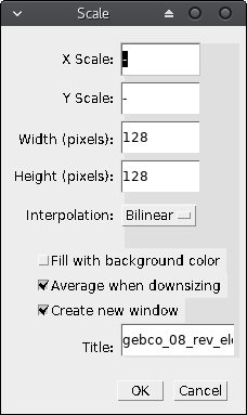
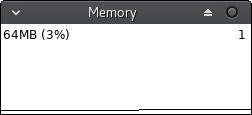
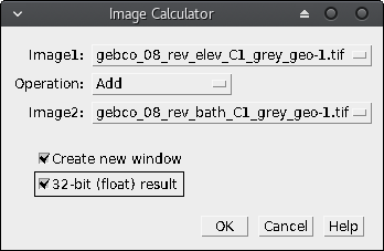
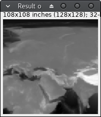
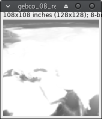
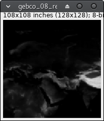
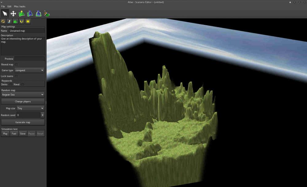
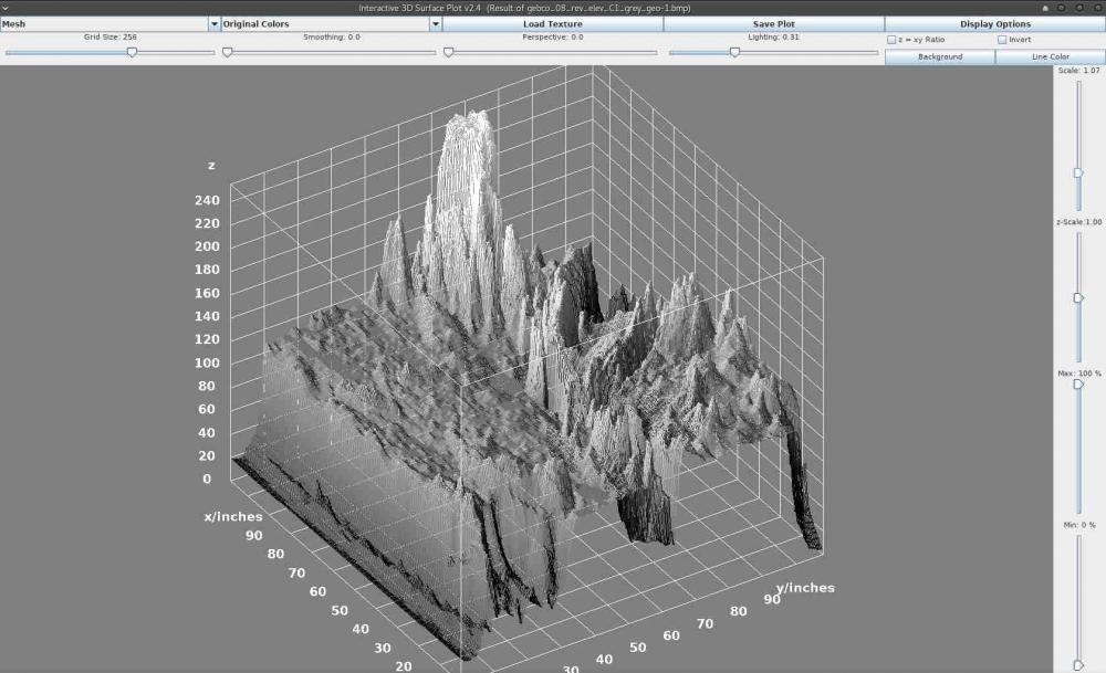
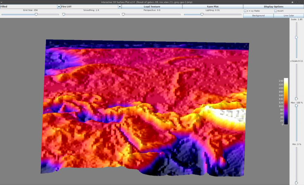
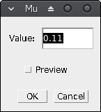
Been trying to master the Heightmap import from the editor, found quite limited in input options as Palaxin's noted in the Height guide. As I have some background on scientific imaging software I started playing around with elevation data here and there and found that there is need for more control on horizontal scaling (the map) related to height scaling. Aswell as (maybe) simpler way of preparing image data for heightmap import in the 0ad editor. ImageJ is an open-source image processing and analysis software written in Java. It is a multi-purpose piece of software very well suited when working with (very) different types of images, specially for scientific analysis. It has the advantage of allowing the extension of software via macros (very simple scripting language for repeated processes) and plugins (Java coding), so anyone can share any piece of code for automating the preparation of geospatial data for the (great but currently limited) heightmap import in the 0ad editor. One of the problems I found first is when I try to prepare a very small map (e.g. 128*128 pixels) having the height values from 0 to 255 (8-bit per pixel) the elevation (z-axis) has too much range whereas the map surface (x,y axis) has too little. Moreover, even if you don't have this problem, you may find in the need of controlling the z-axis scale independently from x,y (to obtain not too steep mountains or not too shallow cliffs, etc. depending on the case). This is precisely the problem I am going to address below. Preparing your system Install ImageJ from its download website (I recommend using your distribution repository if you use GNU/Linux or the platform independent download for other system if you already have Java already installed as ~99,99% people does , if it does not work refer to the documentation or try your platform download ). Download elevation and/or bathymetry data. For simplicity I've selected NASA Blue Marble image series as with this data source you have elevation and bathymetry on the same scale so both maps fit perfectly. I'll use the C1 area that includes the Mediterranean Sea as can be seen here. And download both the topography and bathymetry. Remember using right-click/save-link-as... cause the images are huge and you don't want to crash your browser. Select in both the same areas. I've picked C1. Basic map preparation Start ImageJ, you should see something similar to this: It's a tiny window for a great program don't let you misunderstand this: size in this case DO NOT matter. Open the elevation file, either using menu File/Open... or drag and drop. It is quite big, I strongly recommend you downsample (scale) it before continuing. So click menu Image/Scale... or just press Ctrl+E. I'll pick 128x128 px for showing you the problem with this kind of tiny sizes. I recommend "create a new window" option as I have experienced some weird problems if not. Just close the source image after finishing. If you believe your machine and patience can stand huge images skip scaling. If you prefer cropping than scaling try yourself, this is beyond the scope of this basic tutorial. Just try menu Plugins/Macros/Record... before cropping and guess how to repeat exactly the same crop in the bathymetry image. Further on this: write me or comment this and I will try to post and advanced tutorial on this. Maybe you've seen an error in the log: <Out of Memory>. If so you will have to close ImageJ and start it from the command line with the memory option. In my GNU/Linux it is -x (I guess is the same in other systems, but maybe with whole path before the command in windows): imagej -x 2048 As 768 MB is currently the default limit, and I have 6GB I guess 2GB will suffice (2048 MB). Of course do not reserve too much memory or your system might crash (you can see the free available memory in your task manager or sort-of). Now you can repeat 2, 3 steps until you achieve your wanted image. Close the big one, you want to preserve your memory. If you want to check the available memory ImageJ ships with a tiny monitor: menu Plugins/Utilities/Monitor Memory. You'll see a new tiny window and if you click on it the program will force garbage to be collected and reduce the memory used. This is very handy, if you find the memory usage is growing too much just click the monitor. Also you can click the status bar of the main window and there will appear the program info including its memory usage. Save your file. Either using menu File/Save... or hitting Ctrl+S. The default tiff file will suffice and preserve our original 8-bit pixel depth data. Repeat steps 2-5 with the bathymetry data. You should end up having two (not so big) images with the desired data. Now the magic comes. As I've mentioned above as NASA data uses the same scale and regions for all maps, now we have both elevation and bathymetry data from the very same region. Let's join that. We will use the image calculator. Think of it as a per-pixel calculator, so having 2 opened images of the same size from the same region you can combine it's data and finish having a bathymetry+elevation image. If you hover your mouse over any of the images you will see the value of the pixel under the mouse in the status bar, such as: x=23, y= 46, value = 125 note that x,y coordinates might be expressed in pixels or in inches or any length measure. Remember the value is the 8-bit value (0-255) for each pixel. If you explore a bit, you'll note the elevation image store 0 in the sea level whereas in the bathymetry the earth (above water) level is stored as 255. This gives us the clue to guess the kind of calculation we should choose. Now click menu Process/Image Calculator: So if we add the two images we will have both bathymetry data (from 0 to 255) and elevation data (from 256 to 511) merged into a new image. Please, note that if you do not use 32-bit result you will obtain an 8-bit data with the result of data loss (because with 8 bits you can store up to 256 values). Create a new window is also recommended option always. bathymetry + elevation = result + = Now, when you start thinking you have the perfect image to import on the 0ad editor, you save it (tiff will maintain all your precious data), then you just need to change the image type to RGB (menu Image/type/RGB color), then save it (menu File/Save as/BMP). Go to the 0ad editor import heightmap and get a horrid result: But this is not the end of the tutorial. Remember the z-axis (or height) scaling problem? Here you can see it. Let's address that. Ok, let's return to ImageJ and close anything but the result window (or reopen the tiff saved in 8). Click menu Plugins/3D/3D Surface Plot) There goes the result. The appearance is similar to the map generated by the editor, but you have now 3D superpowers. Have a look and play around: above you can change the visualization type (drawing as a mesh, dots, etc. and colors). At the right you can see Scale (zoom the visualization) and the most important z-Scale. Change the z-Scale value until you like the result and take note of the z-scale value (in my case 0.11). Return to the result window (elevation+bathymetry). Click menu Process/Math/Multiply... Type your desired value, OK and voilá! The image might have appear to become invisible, but the data just have changed (each pixel value has been multiplied by 0.11) You can save this tiff with another filename, such as "corrected" or -0.11 or as you want. Then repeat step 8 (type RGB save as BMP) and import it in the editor. THIS IS INCOMPLETE. SORRY FOR THE INCONVENIENCE BUT I'LL TRY TO FINISH THE TOPIC WHENEVER POSSIBLE.1 point
-
palisades upgrading into spiked wooden walls would be fun to have.1 point
-
Stables, cash crops, and... Kushites… I know, I know, you said think realistic, but one can only dream…1 point
-
I can't agree with a so closed view of the developement of the game.0 points


