-
Posts
2.425 -
Joined
-
Last visited
-
Days Won
87
Everything posted by Genava55
-
.thumb.jpg.b21ca1d0c15fb56b42c39b25a0a40815.jpg)
Civ: Germans (Cimbri, Suebians, Goths)
Genava55 replied to wowgetoffyourcellphone's topic in Delenda Est
@nifa The only idea I can have specifically about the Cimbri, is the Hjortspring deposit. The boat was deposited in a small bog of approx. 50 m in diameter, in the middle of an island. I don't know if it is more practical. -
I don't know. But I know the Germans from this time period didn't make new burial mounds, because they are practicing cremation, deposing the ashes in urns, which are then buried. At the best, they used older mounds to bury their urn in the upper layers.
-
I tried the nightly build and they had one. https://wildfiregames.com/forum/topic/26110-civ-germans-cimbri-suebians-goths/?do=findComment&comment=582009
-
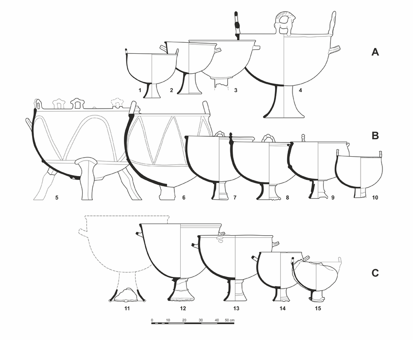
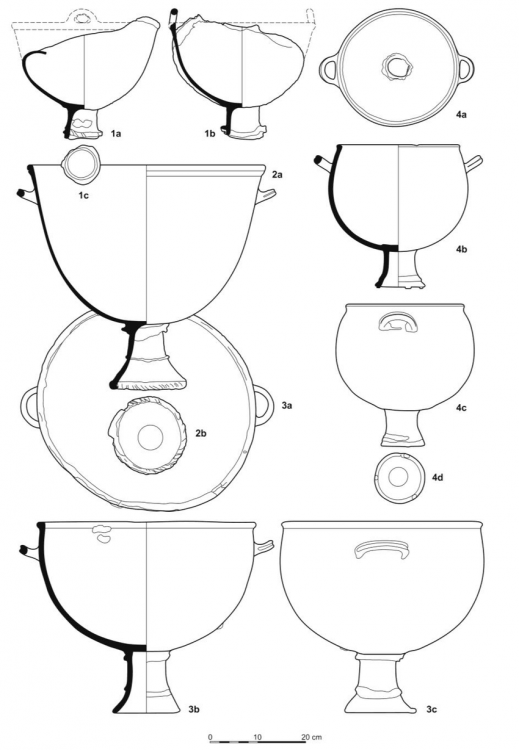
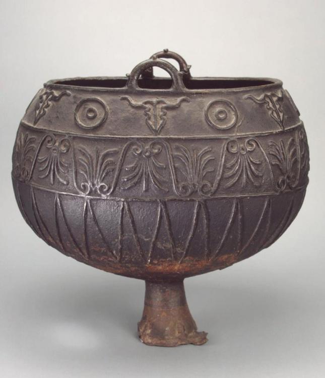
Herodotus (Histories, IV, 82) tells the account of a large Scythian cauldron (which could contain up to 600 Greek amphorae) built for the king Ariantas.
-
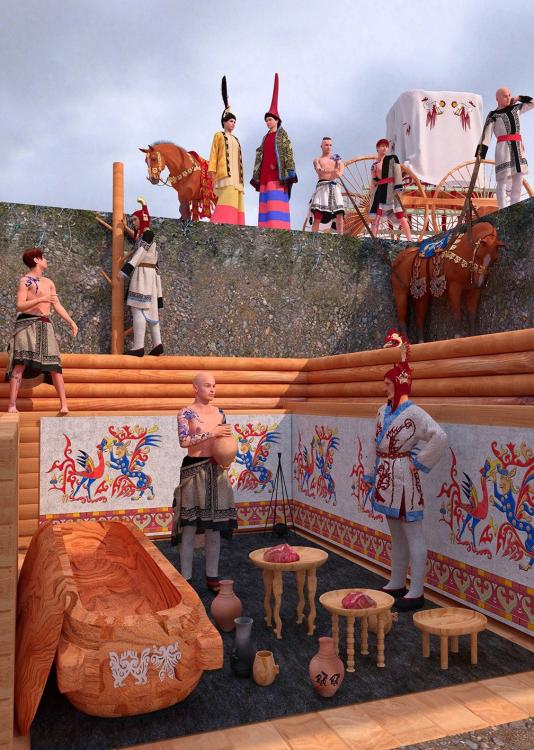
The burial chamber was decorated and we can imagine they used similar decoration outside when they performed ceremony celebrating their ancestor:
-
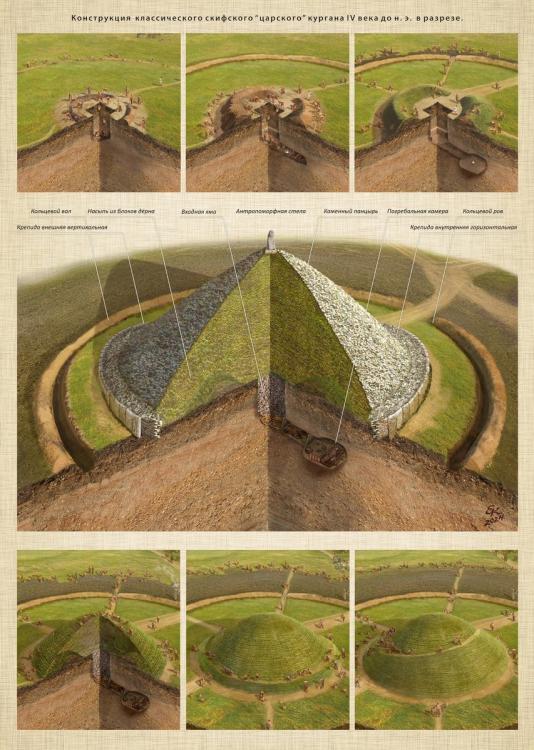
You can have a stele at the top, it seems to have been the case in a few kurgans. It is also plausible that ceremonies were performed around the kurgans. Notably with drink distribution, animal sacrifices, rites, music etc. If you are depicting the kurgan during a ceremony, it adds more opportunities for props.
-
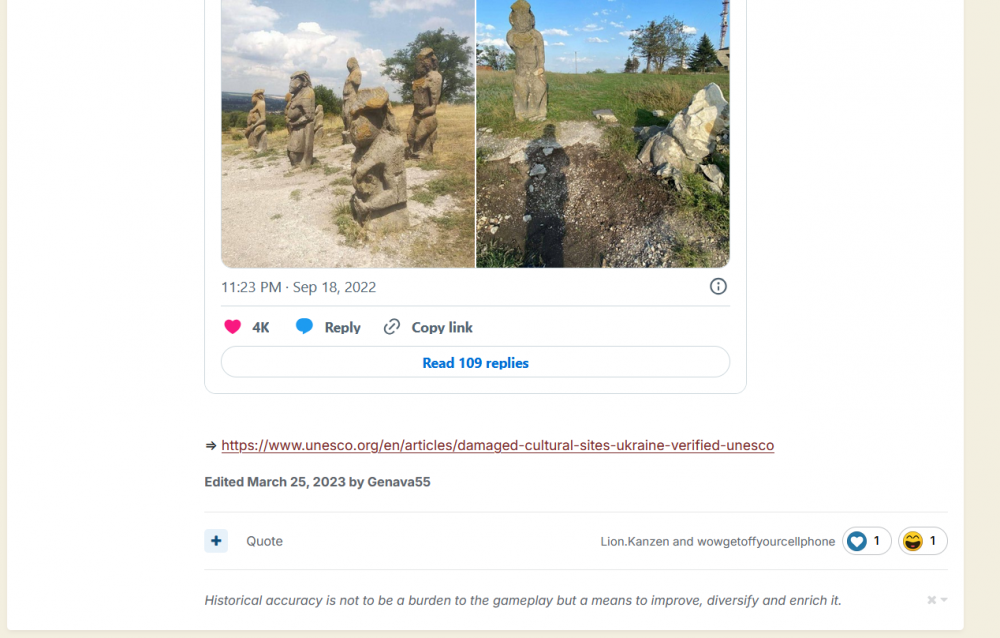
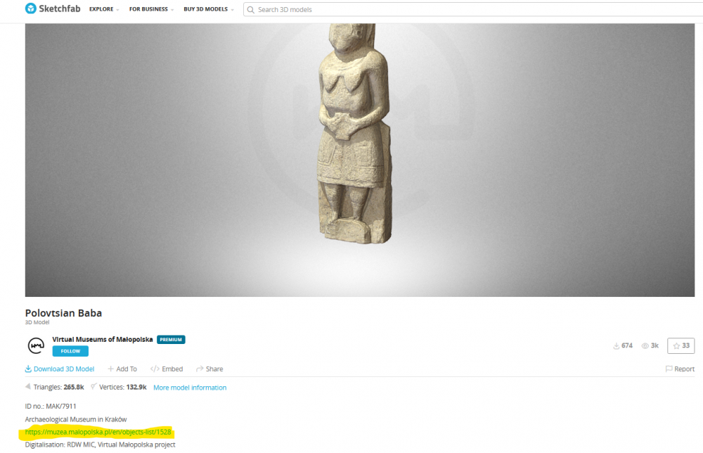
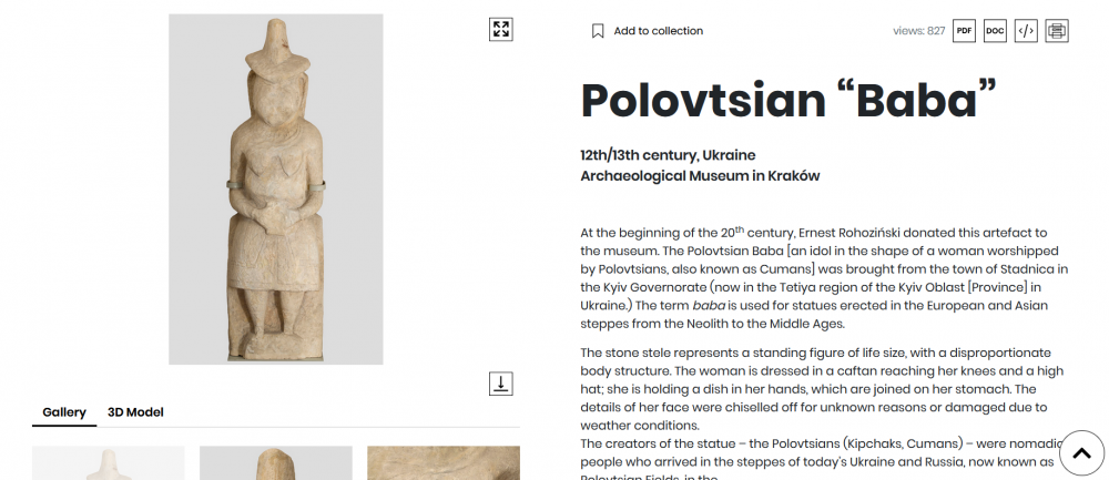
The origin of the designation 'baba' for such stele is debated. Indeed it is related to the word for lady or old woman in Slavic languages, but it is also related to the Turkic word 'balbal' meaning ancestor. Turks called those statue 'balbal' : https://tr.wikipedia.org/wiki/Balbal and in Kazakh the word 'baba' means ancestor. The most probable is that Slavic people heard the word balbal from Turkic people, notably the Cumans. And since the Cumans mostly depicted women on their statues, an association has been made between the two. And finally the Russians called ALL those ancient statues 'baba' : https://ru.wikipedia.org/wiki/Каменная_баба This is why I couldn't tell if you were talking about the Scythian or the Cuman stele.
-
If you can't take criticism, don't participate in a community project. Besides the two Cuman statues, yes I think the others are not anachronistic.
-
I am pretentious but I explained something in March 2023 and still you made the same mistake in October 2023: And I know you saw the post I made in March 2023:
-
Polovtsian is related to Polovtsy, it is how the early Russians called the Cumans.
-
What do you think Polovtsian Baba means?
-
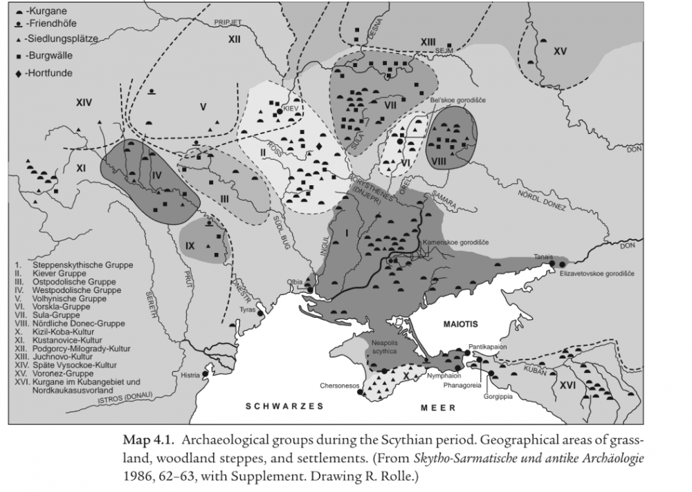
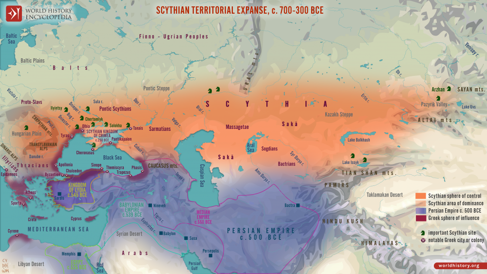
Delenda Est doesn't restrict itself to the period 500 BC - 1 BC. This is why I am asking where do you want to create this thread because the framework is not the same. You seem to focus on the earlier periods of the Sarmatians. And to explain a bit the confusion about the various nomads, it is due to different interpretation from ancient and modern historians. Herodotus mentionned different tribes related to the Scythians, for him it seems they were the same ethnical group. The same for the Persians who seem to have mentionned various Scythian tribes (called Saka by the Persians) which seem to correspond to a very large area and very distant tribes. So for them, the Scythians or Sakas were related. For them, the Pontic Scythians, the Sauromatians, the Dahae, the Massagetae and other Saka tribes were labeled under the same name. In archaeology, it is sometimes called 'Scythian phenomenon' to avoid using the term of Scythian culture.
-
https://puri.sm/posts/pureos-crimson-august-2025-alpha-released/
-
Here this current topic is in the section "Delenda Est". Are you asking for a dedicated topic for this mod or for another mod?
-
Do you know how to install through a flatpak?
-
This is the same issue:
-
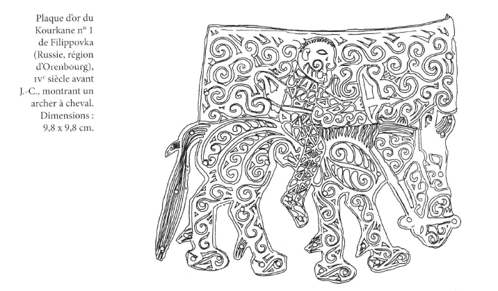
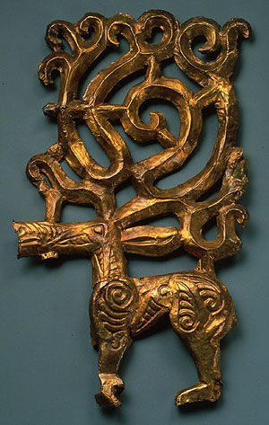
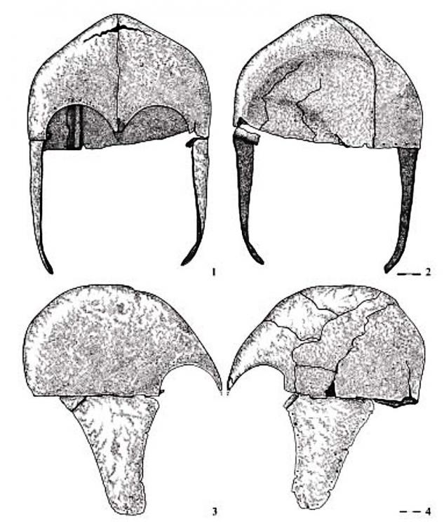
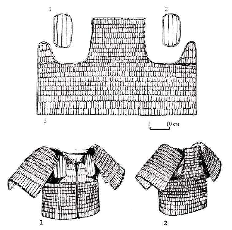
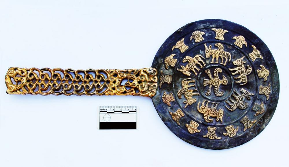
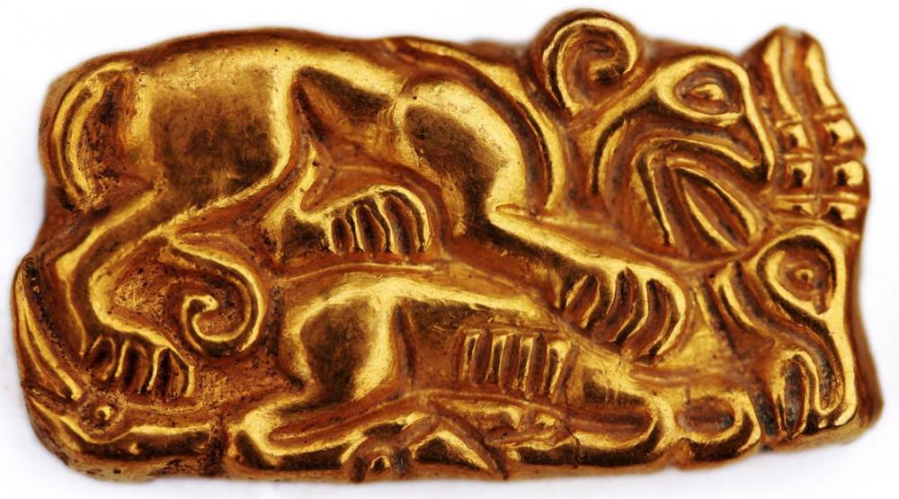
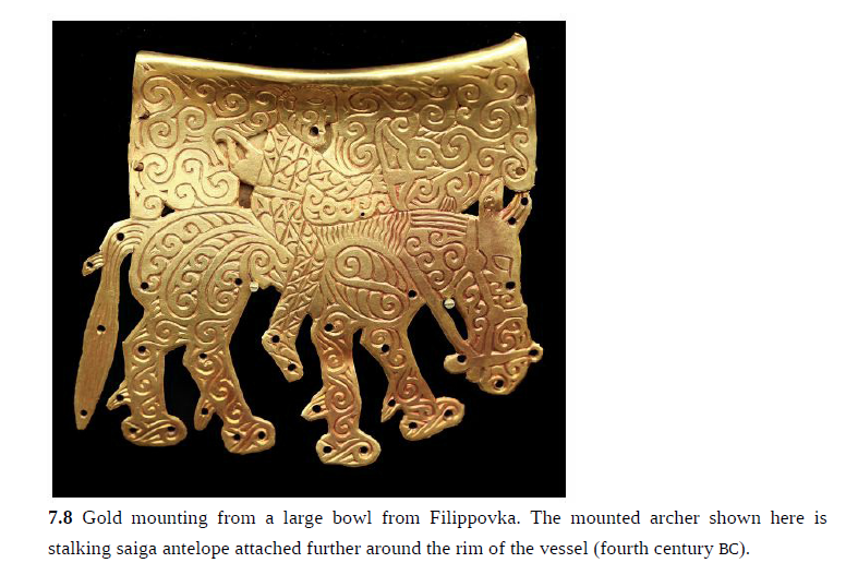
The Sarmatians are very closely related to the Scythians. They share a similar language that belongs to the Iranian language family. The real differences between the Sarmatians and the Scythians stem from the fact that the Scythians dominated the steppes between the 8th and 3rd centuries BCE, while the Sarmatians dominated the steppes between the 3rd century BCE and the 4th century CE. From an archaeological point of view, the material is divided chronologically into different periods: The Sauromatian period (6th-4th century BCE). The Early Sarmatian period (4th century BCE-1st century BCE). The Middle Sarmatian period (1st century BCE - 2nd century CE). The Late Sarmatian period (2nd century CE - 4th century CE). There is one iconic site for the first two periods: the Filippovka kurgans. As you can see below, it is quite close to the Scythian material culture. There are two known characters from the early period: Tasius, a king of the Roxolani (Strabo, Geographie, 7.3.17) Amage, a queen of the Sarmatians (Polyaenus, Strategemata 8.56)
-
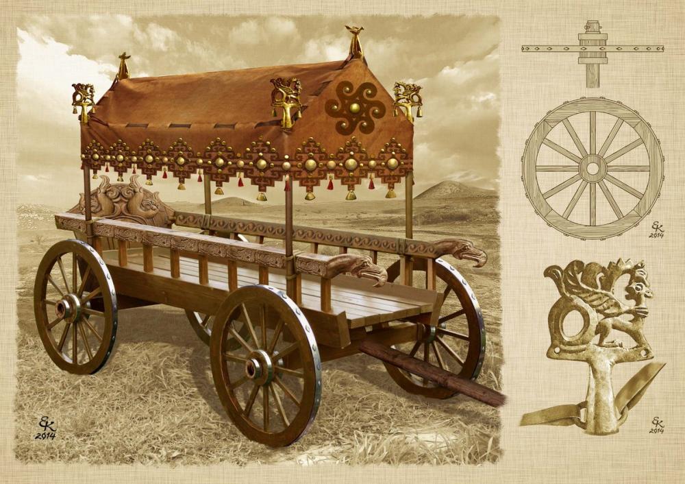
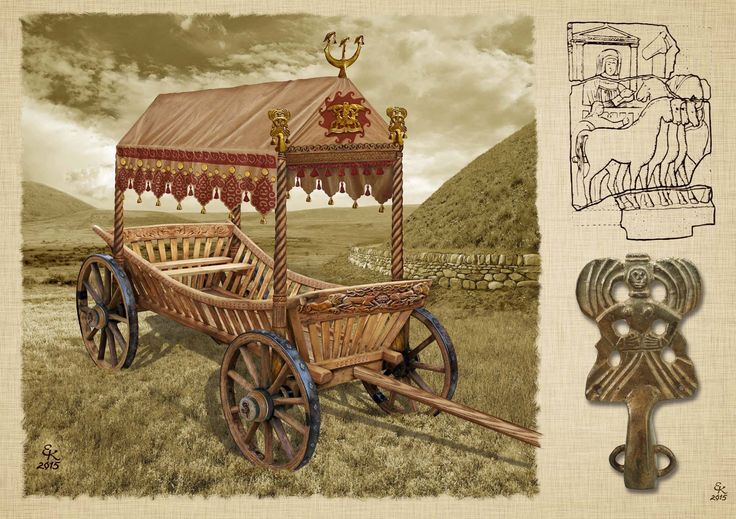
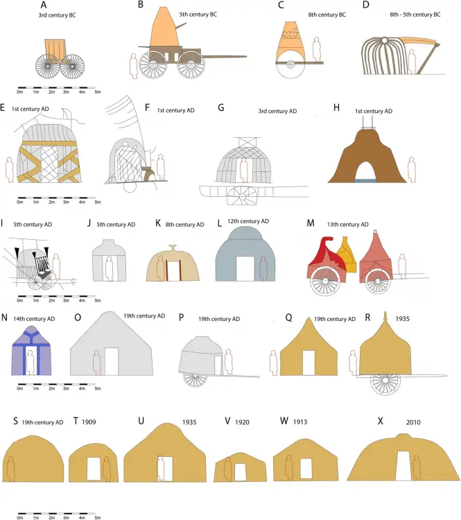
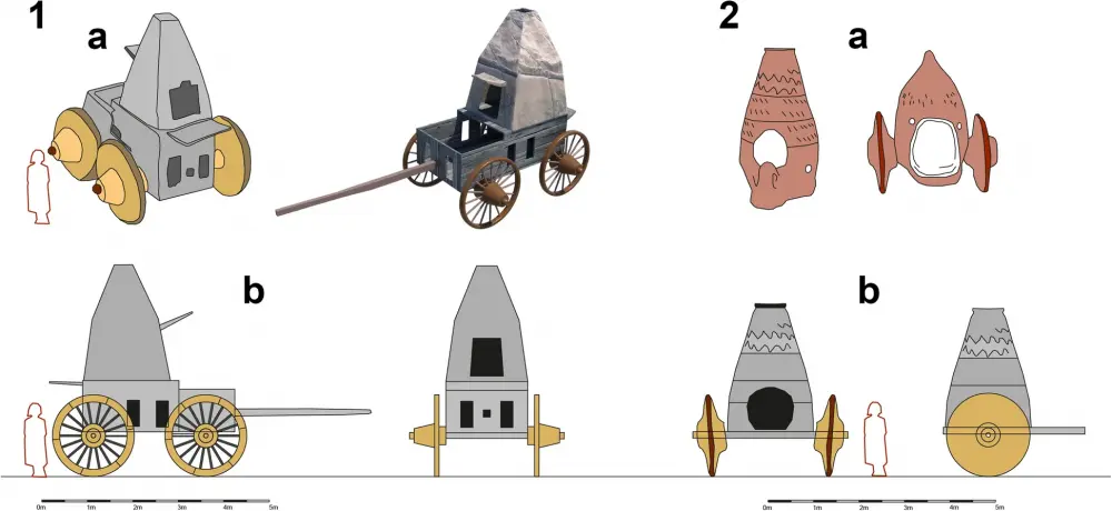
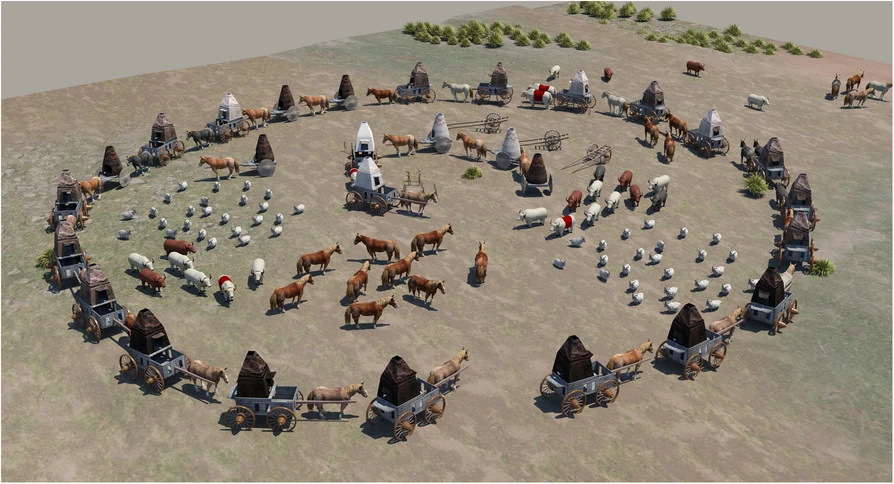
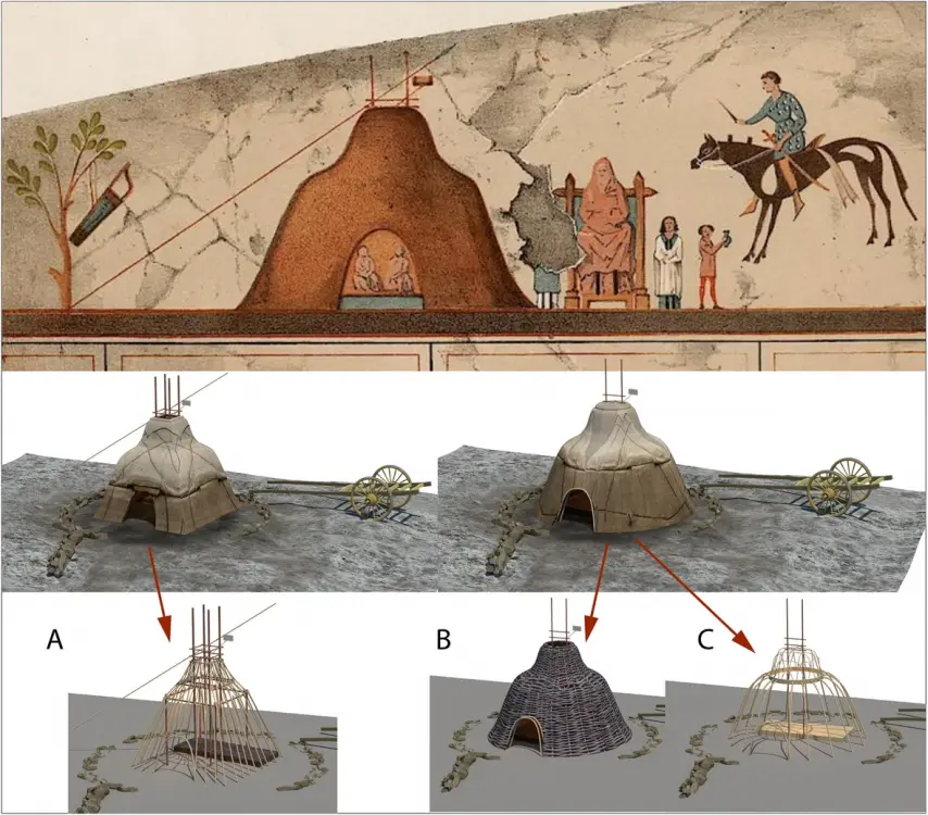
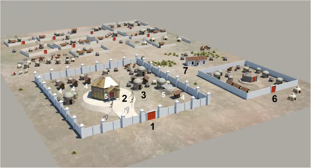
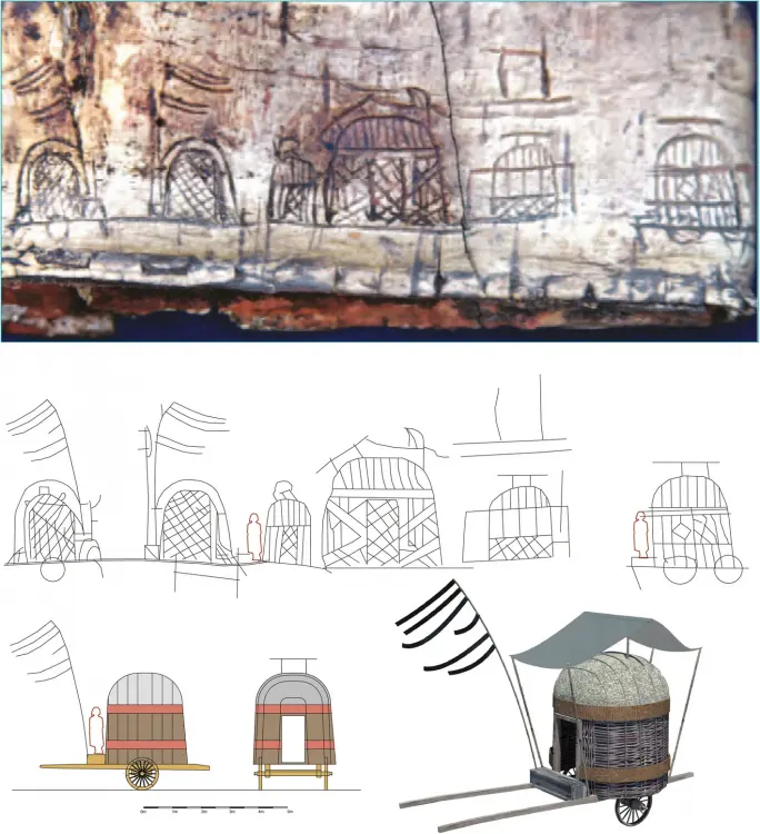
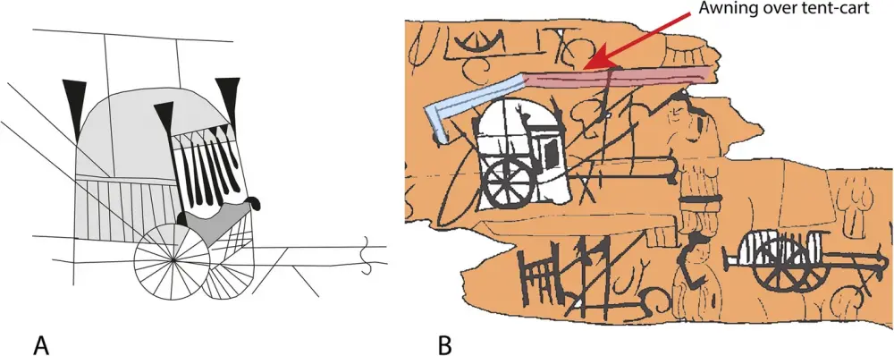
https://built-heritage.springeropen.com/articles/10.1186/s43238-025-00191-2 Inner Asian and Eurasian nomadic camps comprise different types of guyed tents, mobile wood-framed dwellings and carts of various forms. One of the first available depictions originated from the Arjan Bowl, which was found in an Elamite grave in Iran and was dated 800–500 BCE (Majidzadeh 1992). It shows a rib tent (which would be dismantled for transport) with struts and a roof hoop (Fig. 3-D). Greek sources mention Scythian nomads residing in carts, e.g., Hesiod (eighth century BCE), in which Phineus is carried by the Harpies ‘to the land of the men who live on milk and who have their home in wagons’ (Hesiod, The Poems and Fragments (1908, 89, frag. 54). Aeschylus (525–456 BCE) mentioned ‘wattled dwellings, poised high on true wheeled carts’ (Aeschylus 1922, i, 278–279; Andrews (1999, 14) interpreted this passage as indicating that the dwellings were made of a frame woven from twigs or sticks (probably from willow), which was then fixed to the cart and covered by felt. The latter fact was noted by Hippocrates (ca. 460 to ca 377 BCE): Comparison of the shapes and sizes of tents and tent carts from historical finds, depictions or photographs. All tents are scaled to the same size (as far as it was possible to determine the exact size). A Pazyrik cart, real find; (B-C) after clay models; (D) rib tent from the Arjan Bowl; (E-F) Xiongnu carts, birch-bark container in Tsaram; (G) Xiongnu carts, Shancheng coffin painting; (H) Sarmatian tent, tomb of Anthesterius, Crimea; (I) cart from a Tuoba coffin in Datong; (J) Tuoba tent from a grave in Datong; (K) Tibetan tent from a coffin painting in Delingha, Qinghai; (L) Khitan tent from the Wen-Chi scrolls; (M) Cuman carts, Radziwill chronicle; (N) Genghis Khan´s tent, Persian miniature; (O) Kalmyk, 1806 Bertuch Bilderbuch für Kinder; (P) Nogay cart, engraving; (Q) Turkoman tent in Afghanistan, drawing by William Simpson; (R) Chomchugh, refer to the text and Andrews (1999); (S) Kyrgyz kibitka (yurt) drawn by painter Vasily Vereschagin; (T) Avsar tent in Kayseri, photo by Gertrude Bell; (U) Kazakh tent, photo by Owen Lattimore; (V) Mongol yurt/tent, photo from the 1920s; (W) Mongol yurt/tent near Kalgan, photo by Stéphane Passet (1913); (X) Shasavan rib tent, Mount Sabalan, photo obtained in 2010 ‘There too live Scythians who are called nomads because they have no houses but live in wagons. The smallest wagons have four wheels, others six wheels. They are covered with felt and are constructed like houses, sometimes in two compartments and sometimes in three, which are proof against rain, snow, and wind’ [refer to Hippocrates Vol I, De Aere xviii, translated by Jones (1923, 119)]. Models of four-wheeled wagons with tent-like superstructures dated to 600 BCE were found in Kerch in East Crimea. These were made of clay with small windows in their lower structure. The author´s reconstruction is based on such a clay wagon mock-up (Figs. 4, 5). Hippocrates also stated that women and children lived in carts, whereas men spent most of their time on horseback and tended to flock. No depictions of Scythian dwellings (apart from clay models) have been discovered, although in the Pazyrik Kurgan (third century BCE), a complete wooden ceremonial wagon was found. The wagon was preserved exceptionally well and is now on display in the Ermitage in Moscow. Reconstructions (1-2 b) of a Scythian wagon (1) and Mingachevir cart (2) drawn by the author after clay models (1-2 a) Reconstruction of a Scythian wagon camp The first suggestion of tents that represent separate entities and are not part of carts is given with respect to Sarmatians. Strabo (53 BCE to ca. 21 CE) reported, ‘As for the nomads, their tents, made of felt, are fastened on the wagons in which they spend their lives, and round about the tents are the herds which afford the milk, cheese and meat on which they live, and they follow the grazing herd, from time to time moving to other places that have grass…’ (Strabo 1960), vii, 3, 17). Whether these tents fastened to carts were frequently removed and placed on the ground, as the tent components of tent carts in later times would have been, is unclear. There is only one known depiction of a Sarmatian tent, which is set on the ground. It was depicted in a wall painting in a grave chamber in Kerch on the Crimea Peninsula. Unfortunately, it does not exist anymore. Relevant documentation can be found in Minns; Wajnstein (1996) attempted a rectangular reconstruction of the tent. In this work, the author aimed to reconstruct rectangular and round variants, as no definitive hint regarding the ground plan is given in the depiction (Fig. 6). A structural system was also reconstructed, with the following options: A: rectangular variant, 4-post inner structure; B: round variant, woven/wattled structure; C: round variant, rib-tent structure. Depictions of a Sarmatian tent on a wall painting in Crimea (Source: Minns 1913). Shown below are reconstruction possibilities (Source: the author). It is possible to reconstruct the shape as a rectangular (A) or a round tent. For the round variant, a woven/wattled structure (B) or a rib-tent structure with a roof hoop (C) is possible According to Priscus of Panium, who was a diplomatic envoy and therefore eye-witness of the camp of Attila the Hun, Attila’s wife Hereka lived in a circular building with a wooden frame covered in skins or leather. This passage is the only reference in which Hunnic dwellings are described as circular and possessing a wooden frame. However, this passage has been debated as the text is not clear, but recent work (Carolla 2019) supports both the circular shape and skin/leather covering. Elsewhere in the text, Hunnic buildings are described as huts (Greek: kalube), which indicates that they are semipermanent buildings. Alternatively, although they comprise a wooden frame, they could be covered with reeds (mats) or similar material (but not felt or skins). However, no indication of their shape is given. Later, sixth-century Greek emissaries to the Western Turk ruler also described framed tents as huts (kalube) (Andrews 1999). Thus, it is not completely clear what type of building or tent (?) Priscus had observed. The building of Attila was described as being made of wood, but again, no definite indication of the ground plan form was given, only of its material (‘it had been fitted together with highly polished timbers and boards’ (Priscus of Panium in Gordon 1960, 84). The dwelling of Hereka is described as follows: ‘Inside the wall [of the compound of Attila], there was a big cluster of buildings, some made of planks carved and fitted together for ornamental effect, … the other [houses were made] of leather polished and cut straight/upright, put into some wooden circular basis. I gained entrance through the barbarians at the door and came upon her lying on a soft spread. The floor was covered with mats of felted wool’ (Priscus of Panium trans. Carolla 2019). Please also refer to Fig. 7. The extensive use of felt inside Hereka’s dwelling indicates a nomadic building context in any case. The custom to cover trellis tents in skins or furs and not felt exists ina nomadic historical context, e.g., there is a trellis tent of the Mongolian Bogd Khan from the 19th century covered in snow leopard skins (furs) on display in the Winter Palace of the Bogd Khan in Ulaan Bataar. Highly hypothetical drawing containing all the elements mentioned by Priscus of Panium, as observed by him in Attila’s capital during the fiveth century. 1, Attila’s compound with gate doors and wooden palisade with towers; 2, Attila’s dining hall/house at an elevated location; 3, Hereka’s tent; 4, buildings made of carved wood; 5, porticoes; 6, Onegesius' compound with a wooden enclosure without towers; 7, Roman bath built of stone by a captive architect from Syrmium In East Asia, there are several depictions of Xiongnu dwellings from the first century. To date, three scratched drawings/decorations of birch-bark containers show Xiongnu dwellings. These depictions all show the same dwelling type (Fig. 8): a round, domed hut with walls made of diagonally crossing lines (probably twigs or sticks). In some cases, this diagonally crossing structure extends to form the dome of the building. The dwelling comprises vertical walls, which, in every case, terminate in a horizontal band spanning the whole dwelling (a textile band holding the hut together, as in the case of modern trellis tents?). If there is a drawn door, it also reaches this horizontal band. The dome is often covered with what seem to be vertical stripes of different materials. At times, the walls are additionally wrapped with crosswise textile bands, and the walls can contain windows. An opening at the apex of the dome-like roof is not shown in any depiction (But its presence cannot be ruled out either). There are always two vertical sticks connected by a horizontal stick above the roof. The function of this construction is described later and is very similar to that in Tuoba Xianbei depictions (Fig. 9): very likely, an awning spanned above the dwelling to shade it (However, there is no Xiognu depiction were we actually can see such an awning in the drawing itself). The dwellings are often shown placed on carts. Moreover, the cart wheels encompass spokes, and the cart type is a two-wheeled cart. Written sources support the conclusions drawn from the images: The Xiongnu also employed ‘domed huts for homes’ (Huan 1994, 38) and ‘woven branches to make houses’ (Huan 1994, 52; Miller 2012). Depictions of Xiongnu carts found on a birch-bark container in Tsaram (after Minyaev (2009). Shown below is a line drawing of the scratchings and a reconstruction by the author. The awning above the cart was added as an analogy from fifth-century Tuoba Xianbei cart depictions Tuoba Xianbei cart depictions from coffin planks from Zhijiapu (Source: Liu and Gao 2005) @wowgetoffyourcellphone@Lopess I highly recommend to read the entire article.
-
-
.thumb.jpg.b21ca1d0c15fb56b42c39b25a0a40815.jpg)
Civ: Germans (Cimbri, Suebians, Goths)
Genava55 replied to wowgetoffyourcellphone's topic in Delenda Est
The Forsaken Gods fantasy and art by Didrik Magnus-Andresen are really nice -
The position of project leader is vacant for two years.


