elexis
-
Posts
3.644 -
Joined
-
Days Won
59
Everything posted by elexis
-
If there is relevant actual network lag, it is seen in the upper right corner of the screen, mentioning the latency and affected playername.
-
Select the mapsize normal and a population limit of 150 and it should work without huge problems. and besides pathfinding, and rendering, the AI is slow too.
-
You can locate the replay directory too by selecting a replay in the ingame replay menu.
-
The game being computed too slowly when the number of units or mapsize is too large is an algorithm problem. Losing the network connection only occurs if a player has a network problem, except the part where it occurs after the loading screen, that is a bug.
-
Scenario Games/custom map - can't remove the ceasefire timer
elexis replied to Apeterson's topic in Help & Feedback
Not the 'perisstmatchsettings' feature, but the equal persisting of settings when changing the map. I couldn't find any map that specifies a Ceasefire timer currently, so if this is truly happening with scenario maps only, I guss you have some custom maps with ceasefire timers. Basically this one, besides that all of the hardcoding should be removed. diff --git a/binaries/data/mods/public/gui/gamesetup/gamesetup.js b/binaries/data/mods/public/gui/gamesetup/gamesetup.js index 7096014..fc7a3d3 100644 --- a/binaries/data/mods/public/gui/gamesetup/gamesetup.js +++ b/binaries/data/mods/public/gui/gamesetup/gamesetup.js @@ -2054,6 +2054,7 @@ function selectMap(name) delete g_GameAttributes.settings.WonderDuration; delete g_GameAttributes.settings.LastManStanding; delete g_GameAttributes.settings.RegicideGarrison; + delete g_GameAttributes.settings.Ceasefire; } if (mapSettings.PlayerData) One may argue that scenario maps should persist some settings such as the gamespeed, or argue that none of them shoud be persisted. The problem is that every setting has a different character, it was and still is hard to unify them because they are inherently different. Anyway; you can add a workaround for the map and just force 0 ceasefire for your scenario map. You can see the format of the gamesettings in the first line of the replay file commands.txt. One can format that line with https://jsonlint.com: start { "settings": { "PlayerData": [{ "Name": "elexis", "Civ": "iber", "Color": { "r": 21, "g": 55, "b": 149 }, "AI": "", "AIDiff": 3, "AIBehavior": "random", "Team": -1 }, { "Name": "Player 2", "Civ": "rome", "Color": { "r": 150, "g": 20, "b": 20 }, "AI": "", "AIDiff": 3, "AIBehavior": "random", "Team": -1 }, { "Name": "Player 3", "Civ": "ptol", "Color": { "r": 86, "g": 180, "b": 31 }, "AI": "", "AIDiff": 3, "AIBehavior": "random", "Team": -1 }, { "Name": "Player 4", "Civ": "ptol", "Color": { "r": 231, "g": 200, "b": 5 }, "AI": "", "AIDiff": 3, "AIBehavior": "random", "Team": -1 }, { "Name": "Player 5", "Civ": "ptol", "Color": { "r": 50, "g": 170, "b": 170 }, "AI": "", "AIDiff": 3, "AIBehavior": "random", "Team": -1 }, { "Name": "Player 6", "Civ": "cart", "Color": { "r": 160, "g": 80, "b": 200 }, "AI": "", "AIDiff": 3, "AIBehavior": "random", "Team": -1 }, { "Name": "Player 7", "Civ": "iber", "Color": { "r": 220, "g": 115, "b": 16 }, "AI": "", "AIDiff": 3, "AIBehavior": "random", "Team": -1 }, { "Name": "Player 8", "Civ": "gaul", "Color": { "r": 64, "g": 64, "b": 64 }, "AI": "", "AIDiff": 3, "AIBehavior": "random", "Team": -1 }], "VictoryConditions": [], "CircularMap": true, "Size": 320, "PopulationCap": 300, "StartingResources": 300, "Ceasefire": 0, "RelicCount": 2, "RelicDuration": 20, "WonderDuration": 20, "RegicideGarrison": false, "Nomad": false, "RevealMap": false, "ExploreMap": false, "DisableTreasures": false, "DisableSpies": false, "LockTeams": false, "LastManStanding": false, "CheatsEnabled": true, "Name": "African Plains", "Script": "african_plains.js", "Description": "The central region of the vast continent of Africa, birthplace of humanity. Players start in a lush area teeming with vegetation and wildlife.", "Preview": "african_plains.png", "Keywords": [], "RatingEnabled": false, "TriggerScripts": [], "VictoryScripts": [], "mapType": "random", "Seed": 2739431346, "AISeed": 100161980 }, "mapType": "random", "mapPath": "maps/random/", "mapFilter": "all", "script": "african_plains.js", "gameSpeed": 1, "map": "maps/random/african_plains", "matchID": "77899E47129312ED", "timestamp": 1531835751, "engine_version": "0.0.23", "mods": [ ["public", "0.0.23"] ] } -
Yes, -10% sparta pop limit still exists, also mauryan and persian +10%. You can see it in the population tooltip ingame too. It should also be seen (someday if not already the case) in the ingame civ history page thing. For the formation questions, @temple knows the current state best probably.
-
We're not alone
-
I didn't say B > A, I said C = A+B
-
Persian temple textures missing?
elexis replied to Hidan's topic in Eyecandy, custom projects and misc.
(The screenshot showed that the playercolor ban on one side of the persian temple had golden stars on it but the other side didnt.) -
Either too hot or no more remaining battery power.
-
Scenario Games/custom map - can't remove the ceasefire timer
elexis replied to Apeterson's topic in Help & Feedback
Not all gamesetup options are present in the Atlas editor. These have to be changed in the XML file of the map. -
A DunePainter is something that was missing on Elephantine and Jebel Barkal. To fix the resource problem and increase aesthetics, could have half of the map dunes, the other half something else. Finding a geographic location that the map represents can inspire further content.
-
Same error was reported at #5252. It reminds me of D1274, there was an uncaught wtruncate error too.
-
Adding more letters to words or refering to other games doesn't make the proposition true. That onagers are dangerous isn't relevant here because none of our units deal friendly damage currently. I could not find the information online: how did they change onagers exactly? Did they change the default stance to passive or did they change the behavior of the stance for onagers? I read that in HD that onagers only attack enemies if they would not deal friendly fire. Sounds unrelated. It seems the discussion is which view to force upon the player, not enabling the player to chose for himself whether he wants to ambush or clean an area of violent animals to establish a safe area for economic units that can't defend themselves. (If we are to throw in exotic examples, consider maps where dangerous animals are reoccuring.) If the only actual argument is that a single click is too much effort in case you want to do ambush and if aggressive stance is a default that is a must have that the user may not change in the options and if a stance hotkey is considered equally complicated to a single click, at least keep the animal cleaning behavior for the violent stance (although I still don't see the issue and that wow still has to click the defensive, standground or passive button when he actually does want to do an ambush without his units walking away or revealing themselves, because the units still walk away when they see anything other than a dangerous animal that is a target).
-
The TerrainPainter choses a random array element each tile, so you can change the ratio of trees to free space by adding or removing items. The nomad call should be prior to the createArea call, so players dont end up in trees. (The grass and dirt patches calls are ineffective because the terrain call overwrites it.)
-
I can hardly imagine the problem being restricted to one civ, but it's possible. You mean the wallbuilding preview mode I guess. That's certainly slow and it becomes slower with the length of the wall to be built and number of mouse movements I believe.
- 1 reply
-
- 1
-

-
There are two use cases, in one situation one thing is good, in the other situation another thing is good (berserk vs ambush). It's not mutually exclusive, it's not an either-or. Settling on one of the two given choices means replacing a situational disadvantage with a differently situational disadvantage. Supporting both would remove any restriction. There could be multiple implementations serving both use cases. But the most nearby implementation that satisfies the definition of unit stances seems like: Use aggressive stance if you want to attack any visible foe (berserk) and click on passive if you plan an ambush and don't want your units to follow visible targets (such as bears, scouts, traders, females)
-
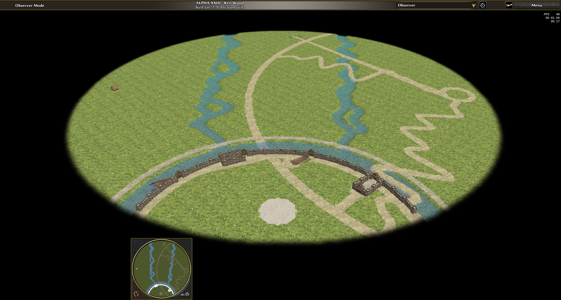
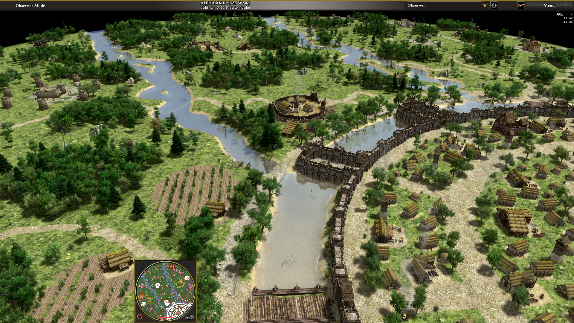
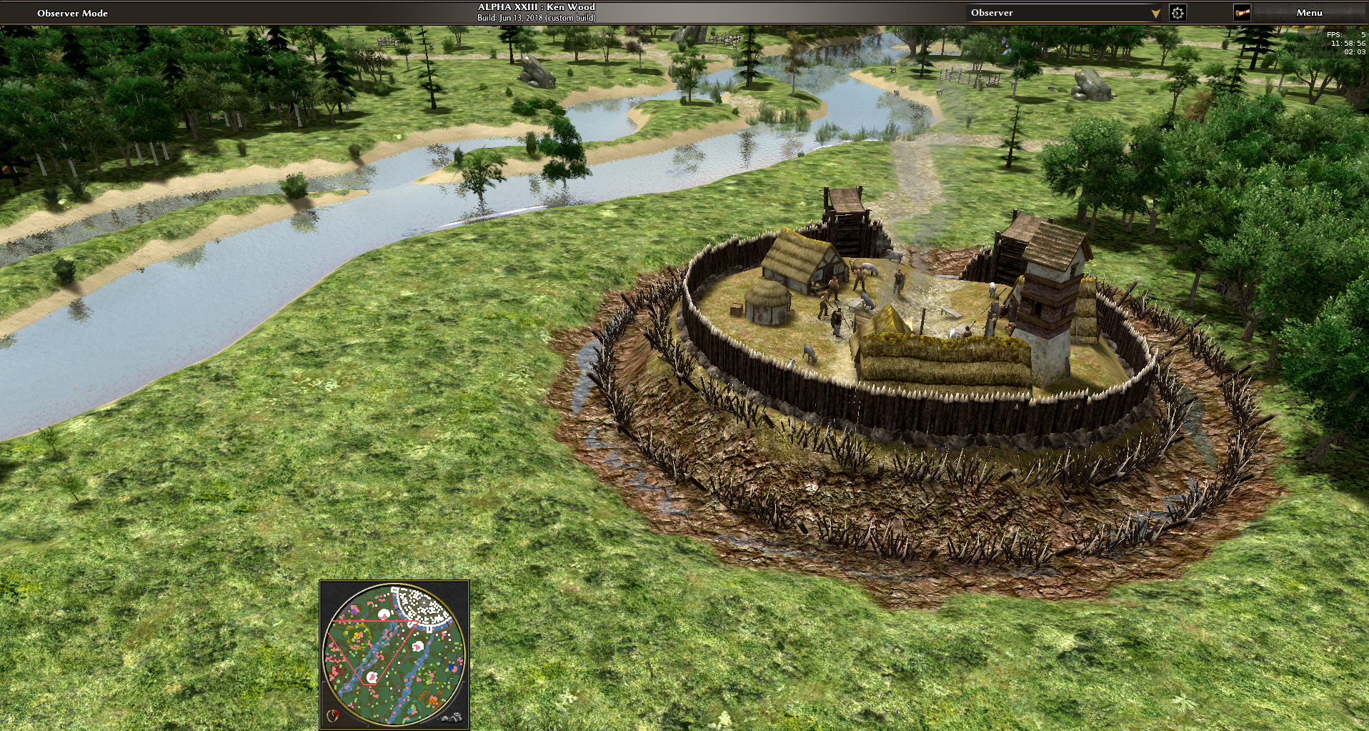
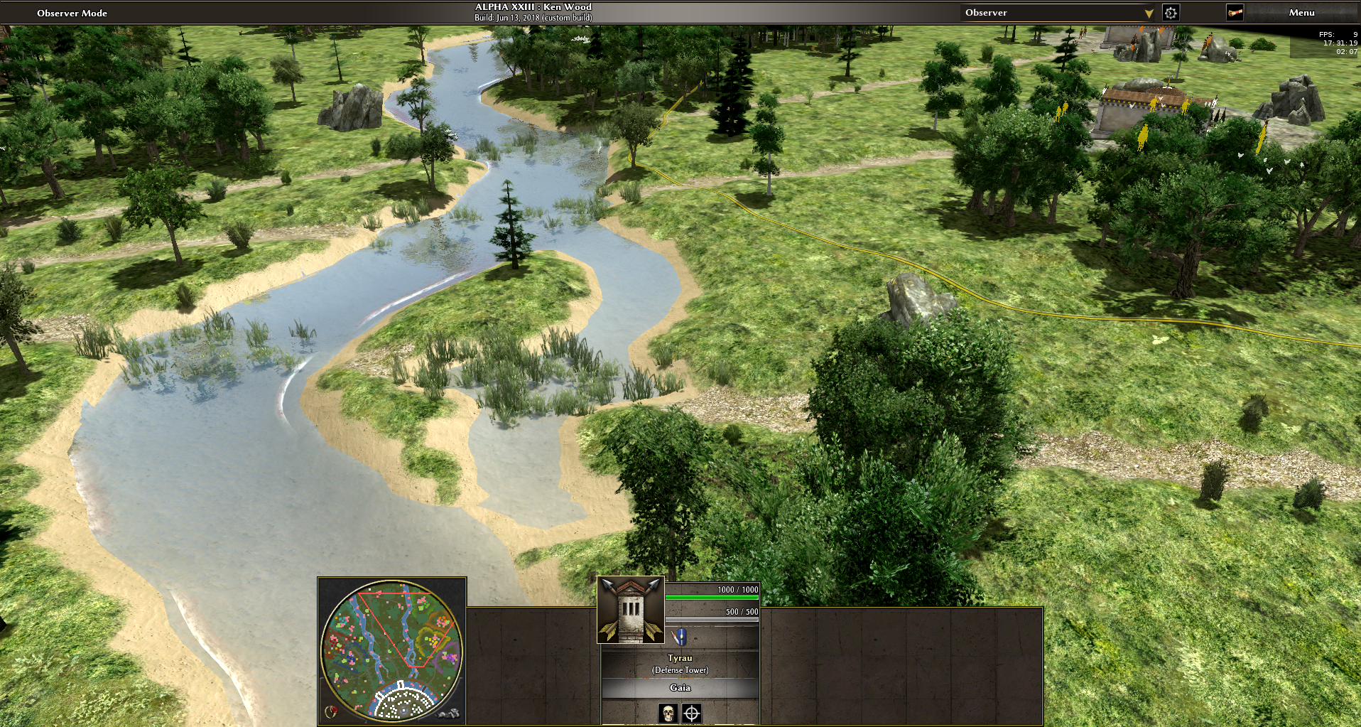
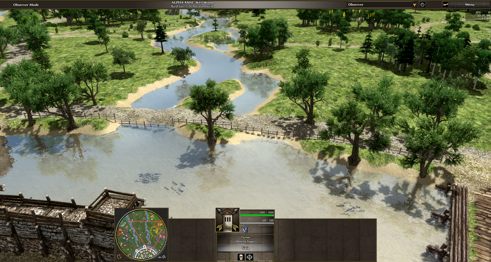
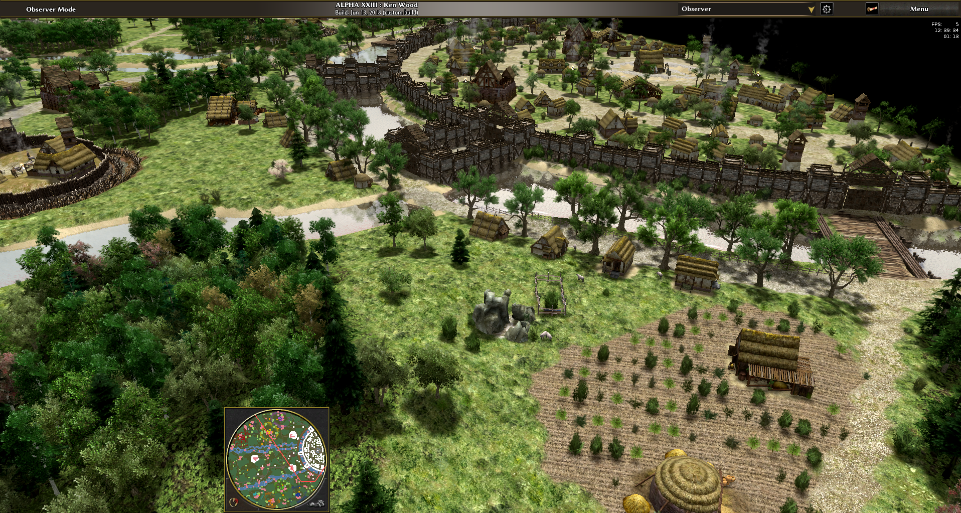
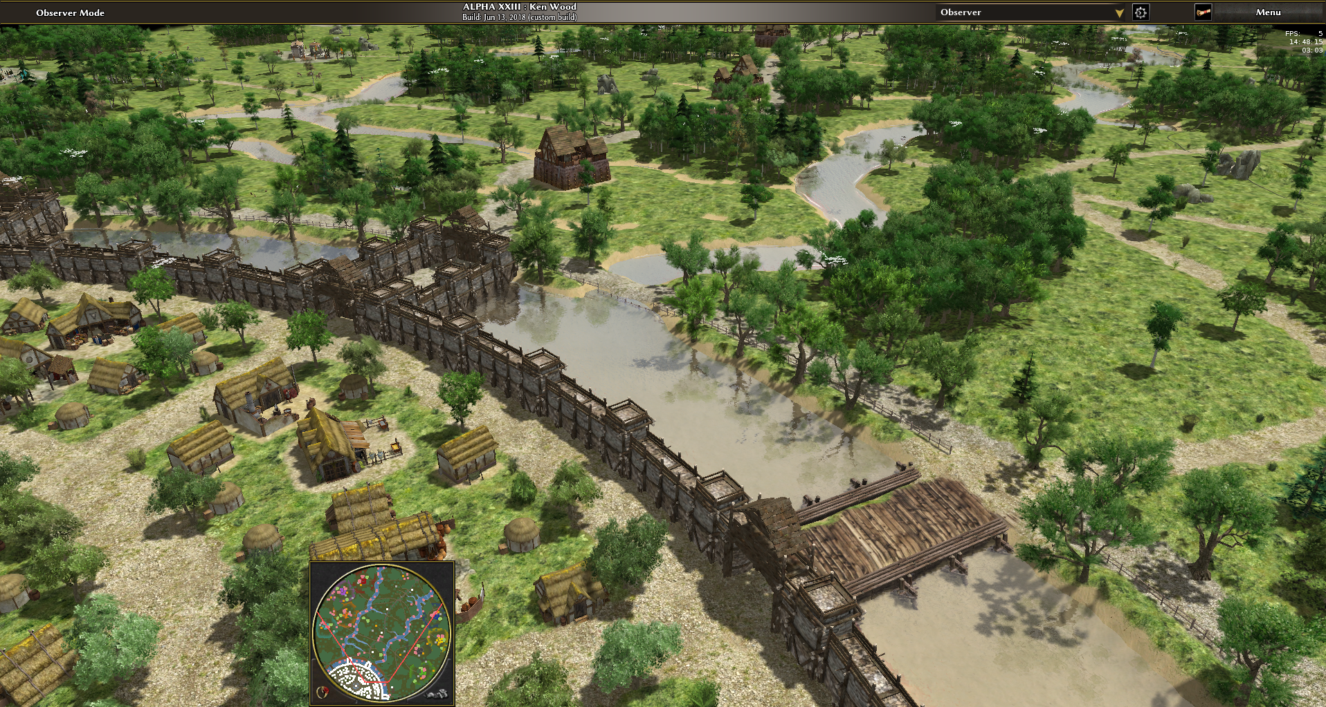
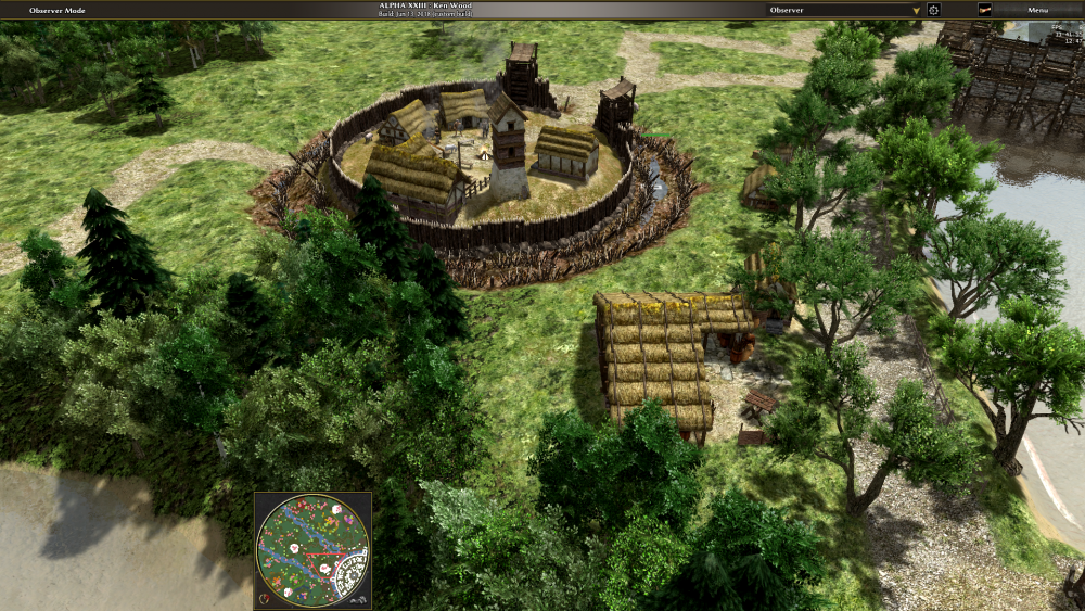
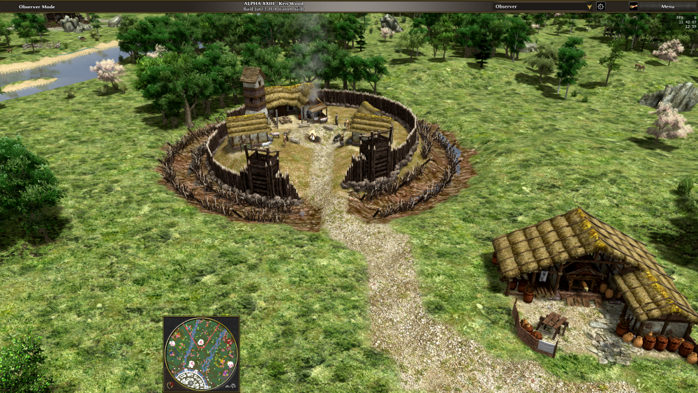
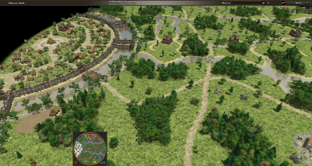
Step 17: Write a second stream with a different meandering on the same direction, thus yielding something like a braided river. Temporarily remove the 'vertical substreams'. Step 18: Fully randomize map angle. Step 19: Some campfires, houses around them, palisade around the houses. Step 20: Fortify remote settlements with a small hill, a muddy ditch with a bit of water in it; two layers of spikes. Benches, soldiers and sheep are found inside the mini-oppidum. Place a nearby gaul siege workshop to increase map difficulty and balance. Step 21: Place bushes parallel to the farmland texture. The farmsteads are placed at the closest path. Step 22: Houses close to, but outside of the oppidum.


-
The second one is resolved in svn.
- 1 reply
-
- 1
-
-
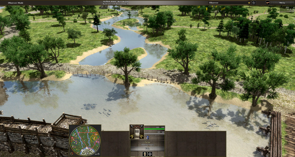
It seems realistic that people would have connected nearby streams with their oppidum ditches if there wasn't a hill nearby. So it's not a representative oppidum, but a unique one. That's actually good (but for the next oppidum map, better no more water inside the oppidum). Step 16: Connect the two streams with the ditch. More space between bridges, more space between buildings, random building angles instead of alignment. Second row of oaks near the bridge path. Different grasslands textures.

-
So it should be impossible to move a single unit?
-
RANDOM MAP: Fert - King of the hill variant
elexis replied to nani's topic in Scenario Design/Map making
If it's wanted to prevent this issue, that can be done by having a really large cliff there- 30 replies
-
- 1
-

-
- king of the kill
- random map
- (and 1 more)
-
RANDOM MAP: Fert - King of the hill variant
elexis replied to nani's topic in Scenario Design/Map making
You can create a path from the civic center to the entrance of the hill and have trees avoid that, thus ensuring that siege engines can pass. Probably too much fish. You can also pass 4 mines as an argument to to placePlayerBase function if you want to compensate missing or imbalanced random mines. There are some trees at slopes, they ought to be removed (otherwise you get units trying to reach them but never achieving that), it could be done with a SlopeConstraint if you don't know the affected positions computationally alread. The main problem with the map I see is that it may be too easy to defend once the hill is reached due to the elevation advantage and the length that enemies have to travel until they can start attacking. Changing that (by adding passages in between somewhere) changes the concept however, so might just leave it as is if you prefer. The other aspect is realism and historical accuracy, but I guess it's not intended to be that, so it should be fine (I'm a bit reluctant to add such maps to the main game however). Some g_Map.log() entries document the purpose of the for-loop blocks and also add timing information to the logfiles / commandline output. Math.PI*Math.pow(r,2) is diskArea(r). Replied to #5258, you just need a different special filter. Code looks good, nice to see that you had no problems getting it touch with it!- 30 replies
-
- 1
-
-
- king of the kill
- random map
- (and 1 more)
-
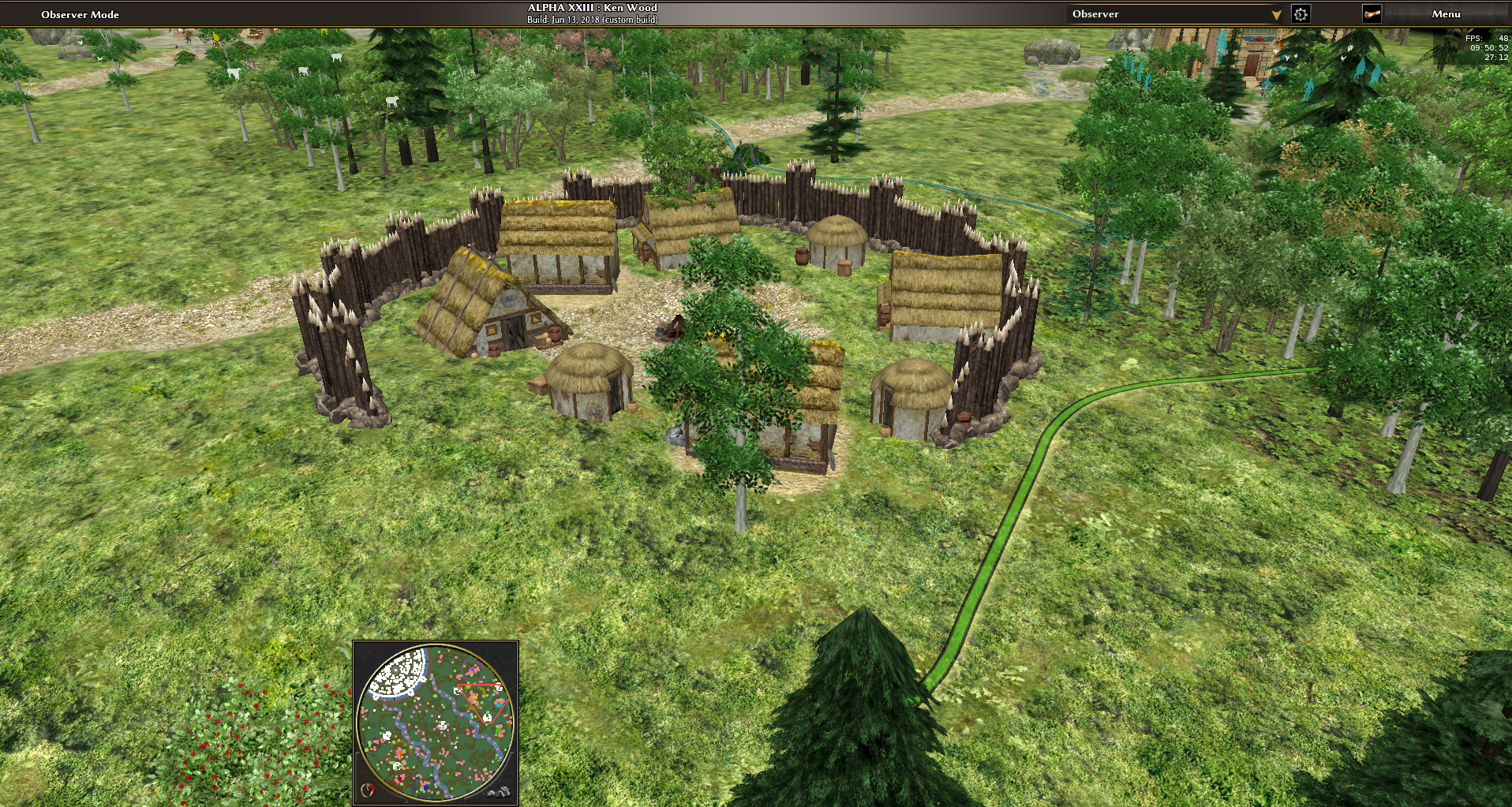
Step 15: Checking for historical accuracy and realism of the map so far, articles, two documentaries about ancient celts and compared artists depictions were used as reference material. I could not find any indications for celts using (yet) ditches wooden bridges or fortified bridges planted trees near paths or fences near paths paved roads city architecturing, radially symmetric city shape or central structures in the city These properties seem to fit more to romans. What I could find indications for (including artist depictions): oppidums had a small population density, contained maybe 20 houses houses were not aligned and side by side but scattered, had some private space, trees, bushes and grassland between houses, even palisades between houses in some depictions Domesticated animals lived with celts in and around the longhouses inside the oppidum oppidums were mostly on hills and sometimes had multiple layers of palisades. (We can't have water inside the oppidum and the oppidum on a hill simultaneously unfortunately) there were some city-sized oppidums too (supposedly 80k men women and children at the time of the siege of alesia, something like 6km diameter) The greatest restriction for implementing maps depicting historical sites is the limited mapsize.
-
I want paths where there's a texture in the middle, to the right of the path a parallel stream and then trees parallel to that path. Just using BFS to extend the area of some PathPlacer doesn't cut it, because we want the trees only parallel to the direction of the path but not at the start and end of the path. These were unintended artifacts in most use cases. So the only way to accomplish that would be to have the PathPlacer return the direction of the path at every position that is part of the placed area. Since not every placer has a direction information, this metadata would have to be optional. So it seems including yours, there are two use cases of Placers generating custom position metadata that Painters should use, so maybe createAreas should be able to support passing arbitrary position metadata from the Placer to the Painter? Painters should still be able to work as independent of such metadata as possible and only parse it if its technically inevitable because the information would be lost after the Placer ran or would be too time-consuming to recreate. Can we test the hypothesis and find more use cases? Edit: It seems the catch is that the Area needs to save the metadata and changing the Vector2D object seems messy, so all Placers and Painters would have to construct and parse { "position": vector2d, "metadata:" foo } everywhere which is not too attractive either. Edit 2: The paintRiver function does such a thing for instance and it was already used for one non-river for that reason (the transition of the fertile land to desert on jebel barkal consisting of parallel textures). Started converting it to a BFSPathPlacer, but it's also limited, because one can't use it for a circle segment area for instance. Meh.