Leaderboard
Popular Content
Showing content with the highest reputation on 2016-03-23 in all areas
-
That's what happens now, they get expelled from the structure, or killed if there is no valid space where the units can be placed. But killing shouldn't happen often on land, but it would happen if ships could be captured in plain sea, and also happens when ships are sunk. In any case, as the game is now, the units never convert to the enemy. Now about the thread in general In my original patch, I even disabled attacking buildings for units. I found it very unrealistic that a few units would just be able to destroy a structure like they do. But anyway, players can now chose to either capture or attack, and the choice ultimately depends on the defence of your opponent. If he garrisons his important structures, it will probably be easier to destroy them, otherwise, capturing would give you more advantage. So it is a strategically important choice you need to make, and we're making a strategy game after all. I do understand that there are some problems with it, and there are some nice suggestions offered here (I particularly like the aura to protect siege engines). But I'm not very good at balancing the micro game, so I won't (f.e.) make a decision on what buildings should be capturable. Though I do still have something l don't like about capturing: That's when players use the capture-and-delete tactic. They don't want to take over the base, but they want to deal economical damage to the opponent. And because the opponent can't defend all buildings, first capturing the undefended buildings, and deleting them when you own them becomes faster than destroying them through the attack command. Another problem with delete is when players delete their buildings just before they lose control over it. Removing the "delete" option isn't possible either. When you've gathered all trees or mines in an area, there's no reason why you shouldn't be able to delete that storehouse, and use the space to build something else. Certainly in dense maps this is often necessary. So my choice is now leaning towards a "slow delete" or "deconstruction" model. Where the player can choose to delete any building he owns (even if he lost almost all his capture points), but where it takes time to delete the structure. Adding yet another unit command to "deconstruct" buildings sounded like it was very bloated (another hotkey taken, other units occupied with certain tasks you don't want, ...). So I opted to keep the delete button, but just make it slower. In the mod below, when you press delete, a timer will start that will continuously take health from the structure, until it's destroyed. But if the structure gets captured or reconverts to the territory owner, the timer stops. It's still very early and unbalanced, but it should give you an idea. I think that this will make the capture vs. attack choice even more strategically, and I hope you like this change. To install the mod, unpack it in your mods directory ( http://trac.wildfiregames.com/wiki/GameDataPaths ), so you have the path mods/structureDestroy/... And then enable the mod in the game by going to "Tools & Options"->"Mod Selector" (don't forget to save your changes). structureDestroy.zip4 points
-
Hi guys. I give Gallic Fields and Alpine Valleys a "autumn" skin. Would be cool to be able to "bundle" multuple maps together into one file and they could be randomly chosen on launch (like different variations of the same skirmish map). But that's a idea for another day. In meantime, enjoy screenshots:3 points
-
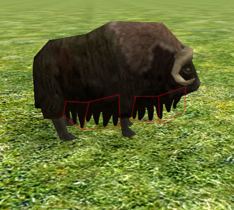
Hello, I launched Atlas recently to see existing animals, and I noticed one who looked a bit "weird" to me : the musk ox. In fact I found the texture a bit too "hand-painted" (sorry for the random English <:) ). I think I can put the accent on the fur aspect of this animal (so the texture will be totally new, and seamless of course). I also though it could improve the silhouette to add extra tris on its belly with some fur texture with alpha...3 points
-
I am glad I am not the only one who has issues with the new capturing system. It's far too easy to capture, vs destroy. Attacking should be the primary function, not secondary to capturing. Fully garrisoned Iberian towers with 10 soldiers easily get swarmed and captured. In fact, I dislike the entire capture feature altogether and would like to see the ability to turn it off completely. Defending against siege weapons with units that I previously could easily defend with, is now next to impossible as they try and capture the siege weapons instead of simply destorying them. The entire game has just turned into a huge capture-fest.2 points
-
1 point
-
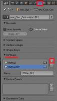
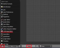
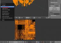
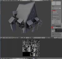
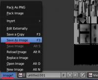
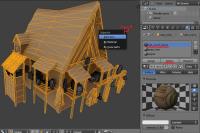
Introduction This is a guide covering how to import assets from the game to blender, create a second UV coordinates, bake the AO maps and export again. The game's buildings are usually divided in different .dae files (one per diffuse texture used) Usually, they consist in one main ".dae" file located in "meshes/structural" and one or more ".dae" children (props) that are attached to the main file, this "prop" daes are located in "meshes/props". (this is not always the case) In this example, we're going to bake the AO map for the celtic civil centre. 1.- Import the mesh into blender3D Inside blender, remove the starting cube, camera and point light. Go to file->import-> Collada (.dae) and select the .dae file to import. This building consists on three files: celt_civic3.dae, celt_civic3_props_1.dae and celt_civic3_props_new.dae If blender shows an error importing: *Note: The file may be imported rotated -90º in the X axis. To solve this, simply center the pivot point at the origin with SHIFT+C, select the cursor for your pivot point, select the asset and hit "R" for rotate, "X" for the axis, and then type "90" on the numpad and hit enter. Each time you import an asset, it is important that you create a new material with the name of the .dae or the texture that is going to use if you know it. This will let us separate the object again after we join all the meshes together. 2.- Set up a new UV coordinates. Select all your meshes and join them with CTRL+J Go to "object data" panel, scroll down to UV Maps menu and click the "+" sign to create a new UV coordinates. --Select the building, enter in edit mode with TAB. --Open a window with the UV/Image editor. Click in "new image" and "ok" in the pop-up menu. This creates a new 1024*1024 black image where we will bake the Ambient occlusion. --Now let's unwrap the model automatically. Go to object mode, select the model, use "CTRL+A" and select "apply scale" this will recalculate the scale of our building, so the polygons could be unwrapped nicely. --Enter "edit mode" with TAB. select all with "A" and hit "U" and select "Smart UV Project" in the pop-up menu. --In the next menu select the following settings: 3.- Baking the AO into our new generated black image. Preparing the AO settings: go to the "world" tab in the settings panel, mark the checkbox of Ambient occlusion and set it to "multiply". Scroll down to the "Gather" pannel and change the samples to something between 20-25 --We have the model ready to bake the AO map. Go to the render tab, scroll down to the "bake" panel (click on the "bake" pannel if it is closed) and use the following settings: --Then click "bake" and wait until the baking process is completed (this will take a while depending on your machine) --Once finished, you can hit "N" in the viewport to open a toolbar, go to the "display" menu, and click in the "texture solid" checkbox. This way you can see the AO map we have just generated on the model and check if it has been correctly generated. ------If you see black strange black faces where it shouldn't, the polygon normals are probably facing the wrong direction. This could be fixed selecting the black faces and then hit "W" and select in the pop-up menu "flip normals". ------If you find the problem where there are dotted black parts, it's probably because there are two or more polygons overlapping each other. You'll have to tweak the model sightly to fix this issue. --Once the bake is finished and you're happy with it, remember to save the image generated so it doesn't get lost. In the UV editor select Image->save image As... 4.- Separating the mesh by materials Now that we have our AO map, and the model has a second UV coordinates for the AO, we have to separate it's pieces again and export the parts one by one. To separate by materials, enter "edit mode". Make sure you don't have anything selected hitting "A" twice. Go to the materials tab, select the first material on the list, and click "select" button. This will select all the faces that have that material assigned. Once selected hit "P" and select "selection" in the pop-up menu. Repeat this step for each material (prop) you have imported. NOTE: Now that you only need to export the objects into .daes again, is a VERY NICE moment to save the .blend file in case the export process goes wrong. 5.- Exporting the meshes back to .dae files. This is the last part. You have to export the objects one by one. Make sure the following requirements are met: - There's nothing else on the scene except the mesh you want to export (even hid objects breaks the export) - You have to remove every material applied on the mesh. - There are no lights, armatures or other objects in the scene. - You have your object selected. Then you simply go to File->export-> Collada (.dae) and select the file to export or overwrite the old one. After that, reload the .blend file and repeat this step with the rest of the objects (or hit CTRL+Z a few times until you get back the other meshes and repeat the process with the next one) I hope it's somewhat understandable and useful .1 point
-
And is the first appreciation , the color contrast, conceptual contrasts. And the abuse of effects...1 point
-
1 point
-
No isn't, that is why many users like us, ask a solution for this, A19/A18 will be older soon, so I don't understand the excuse about, give capture a so much importance.1 point
-
so the only way is ctrl right klick, there is no gamemode where everything is just how it was? .... its kinda annoing to press those buttons all the time1 point
-
Meshes, textures and animations can all be found in the art directory: http://trac.wildfiregames.com/browser/ps/trunk/binaries/data/mods/public/art Note that our animation model uses a "skeleton" that requires certain names from your animation bones. It allows to reuse animations across different meshes. Maybe it would be nice to animate the musk ox? As next to an ugly texture, it also has no animations so far: https://wildfiregames.com/forum/index.php?/topic/20583-musk-ox-model-texture-enhancement1 point
-
1 point
-
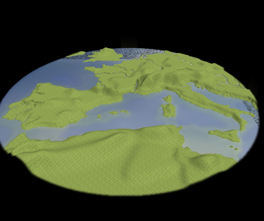
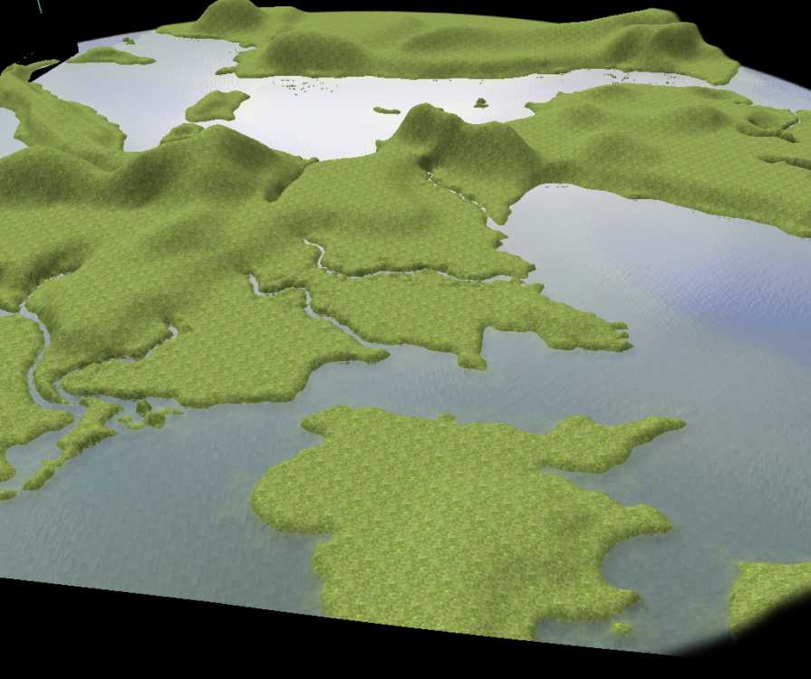
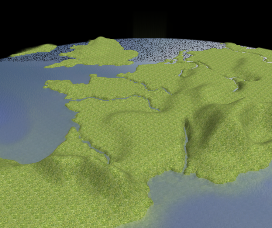
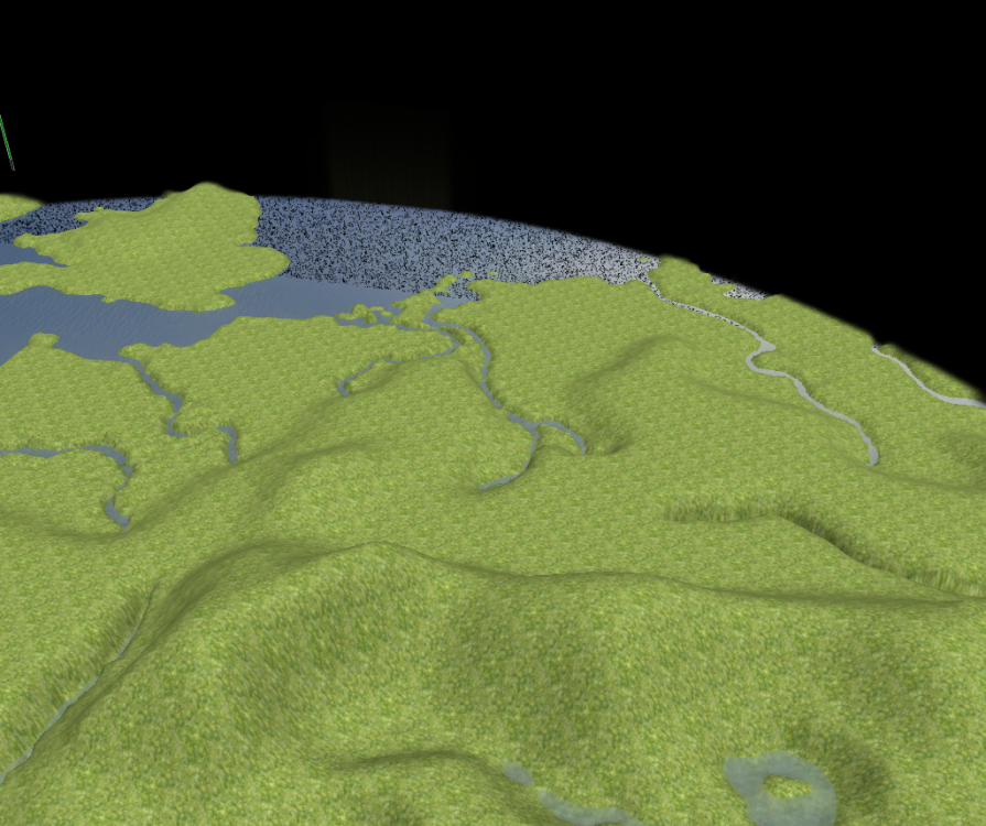
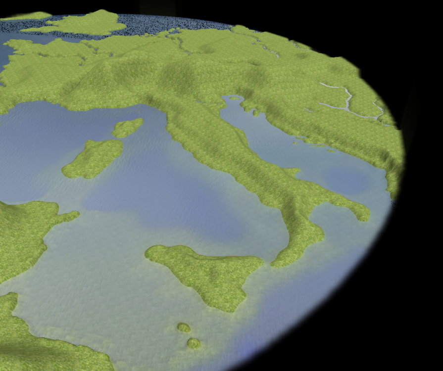
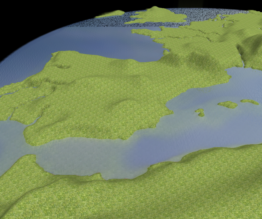
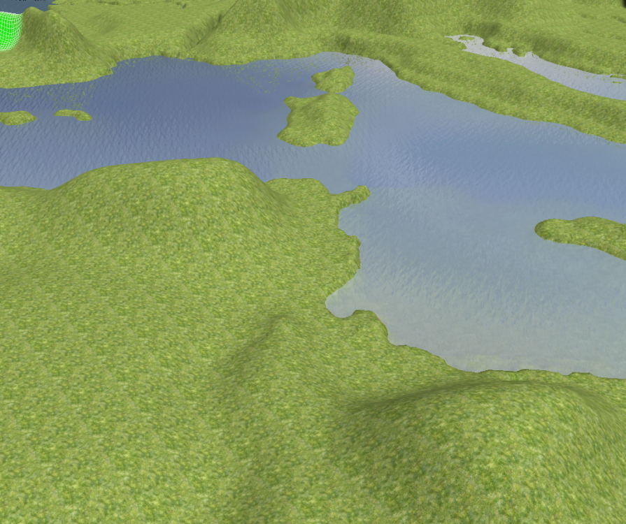
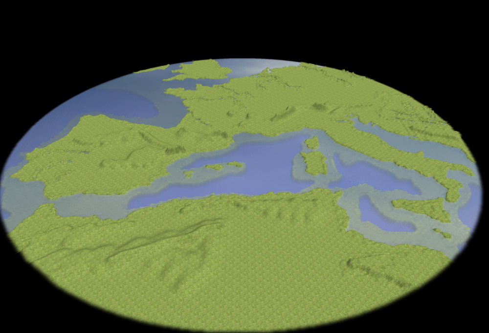
Well you're quite impatient ! As I said, it was just a preview of the ongoing work : I improved it, it will more look like this: Global map: From UK, north Africa looks smaller: France, with Alps and Pyrenees: Deutschland wieder alles im der Zeit: Italy, Caspian see, Sicilia, Corse and Sardinia: Spain: Tunisia: I followed your schema, I did actually start from an area a bit more in the north than you (you'll see more Ireland, and even Denmark on my map) to make North Africa smaller. Moreover if I move the area more in the North, Ships won't be able to pass on the weast of Spain, or on the east of Italia to Caspian sea. Well actually, it is not so easy to do, it doesn't work like a frame that you move on a map.. If I would make "a bit smaller" that part, I need to redraw everything from start... That would be lots of work for a minor modification. I won't do that. Moreover, that part will be mostly some desert, so players won't move much there. It will be mostly an area in shadows. You could also use this specificity to make some interesting game features. For example you can create some oasis in the desert with some treasures, to reward players who explore this area. I'll try to add this example while texturing. As I said, it was an ongoing work.. There is one pass in the Alps now (I'll make it better a bit later), and you can pass in the north of the beach. It doesn't look like a terrace now. You'll see better with the right texture. If you flatten the beach, take care not to destroy the shore line... Modifying areas close to river or coast will be very dangerous if you're not experienced. It is easier to start on mountains and underwater areas. Haha don't worry, I won't do stuff if I don't have the time to do so. But as I am waiting for the A20 release, most of my other projects are sort of suspended for now. And I also like to make some pauses, by working on different things, to improve my creativity on projects. But ok, if you're not sure to work on the other one for now, I might wait before doing it. Or maybe I'll do it if I'm bored. We'll see. I should be able to post the playable map in the next few days. @wowgetoffyourcellphone: Guys, I don't think you understand how the heightmap tool works. I think you should try to import maps by yourself, and also try to create realistic maps with your own hands: this way you'll see how messy and how highly difficult it is. I need to draw everything by hand to get satisfactory results. It takes me hours to get some realistic map, only for the topography modeling. So my work is not a simple heightmap import, It is a full 3D model.1 point
-
By all means, go for it. There are a number of animals that would improve a great deal by having a better texture. Try to keep the texture size reasonable though, and make optimal use of the image surface. The design doc advises 128 or 256 px for units (though that may be based on slightly older specs). So I'd guess that would be the same for an animal (as they aren't too different in size or in needed detail). Thanks for wanting to work on this.1 point
-
A positive change would be to just make capturing the secondary attack instead of primay. And then focus the capturing to only Civic Centers (and maybe houses and Temples; I make this happen in Delenda Est mod).1 point
-
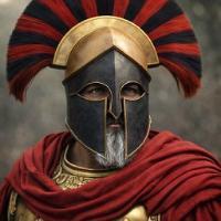
How about the shield and crossed spears on the side? That is a sure sign of a barracks. Most Hellenistic factions have that.1 point
-
So here we go! The map will actually look like this (just a shore prototype, still need some work, especially with mountains): So it should cover the area you are expecting. Size 512x512. About your schema, it's a bit surprising to imagine land unit coming by feet from morocco to spain, or from sicilia to italia, but well, it is up to you. Actually, these areas are very close to each other as you can see on the screenshot, so it will be easy to set up. Anyway if such very small areas doesn't fit your need, you'll be able to adjust them very easily, even after the 3D model will be done: lowering only a few squares to allow land units to pass is really easy. But I'll try to do it by myself. About the mountains, I will draw them from real maps, so it will be some natural walls to units. I just have to set up the right height for them. But there should be more passages ways than you think, if we respect the reality (eg. units should be able to pass from italia to france by the south of the alps), but again, it might be easily modified to fit your gameplay needs, if you find it relevant. About the swamps/forests, you'll put them by yourself. Setting the whole netherland, north germany, and south denmark under the swamps it a little bit rude for these countries but again, if you find it fun, it's up to you. There will still be natural rivers there. It should be easy to expand them into swamps. As you can see, the 3D models (boths west and east) should be ready when you'll be back, in one month. I have some important recommendations, however: You'll obviously start by completing texturing. But then don't head directly to put units and buildings everywhere. Even if you have a scenario in mind (whatever if you plan to use triggers or not), first complete the map in a skirmish mode. What I mean is just some CC from each factions, to easily test the playability of the map. I'll put some on the 3D model, and I'll deliver the map as a skirmish. You'll need to add and balance the resources, forests, etc. This way, you'll see the features of the map, in term of relief especially, if you need to improve some road, block some access, etc. You can even simulate battles with AI only. This way you'll realy realize how the game will go on this map. If you put already units everywhere, you won't be able to easily see issues, and if they comes from the land, resources, or units. Modifying textures and land will be a pain, too. From the skirmish file, you'll be able to easily resave it as a copy and work on it as a scenario without any problem. That's an important advice I should tell, because I did make this error. Proceed step by step, you'll gain some time in the end. But for now, think about your thesis1 point
-
1 point

.thumb.png.ce58cea22940c255f5b0a735d5abee36.png)
