Julianosore
-
Posts
9 -
Joined
-
Last visited
Julianosore's Achievements
")
Tiro (1/14)
8
Reputation
-
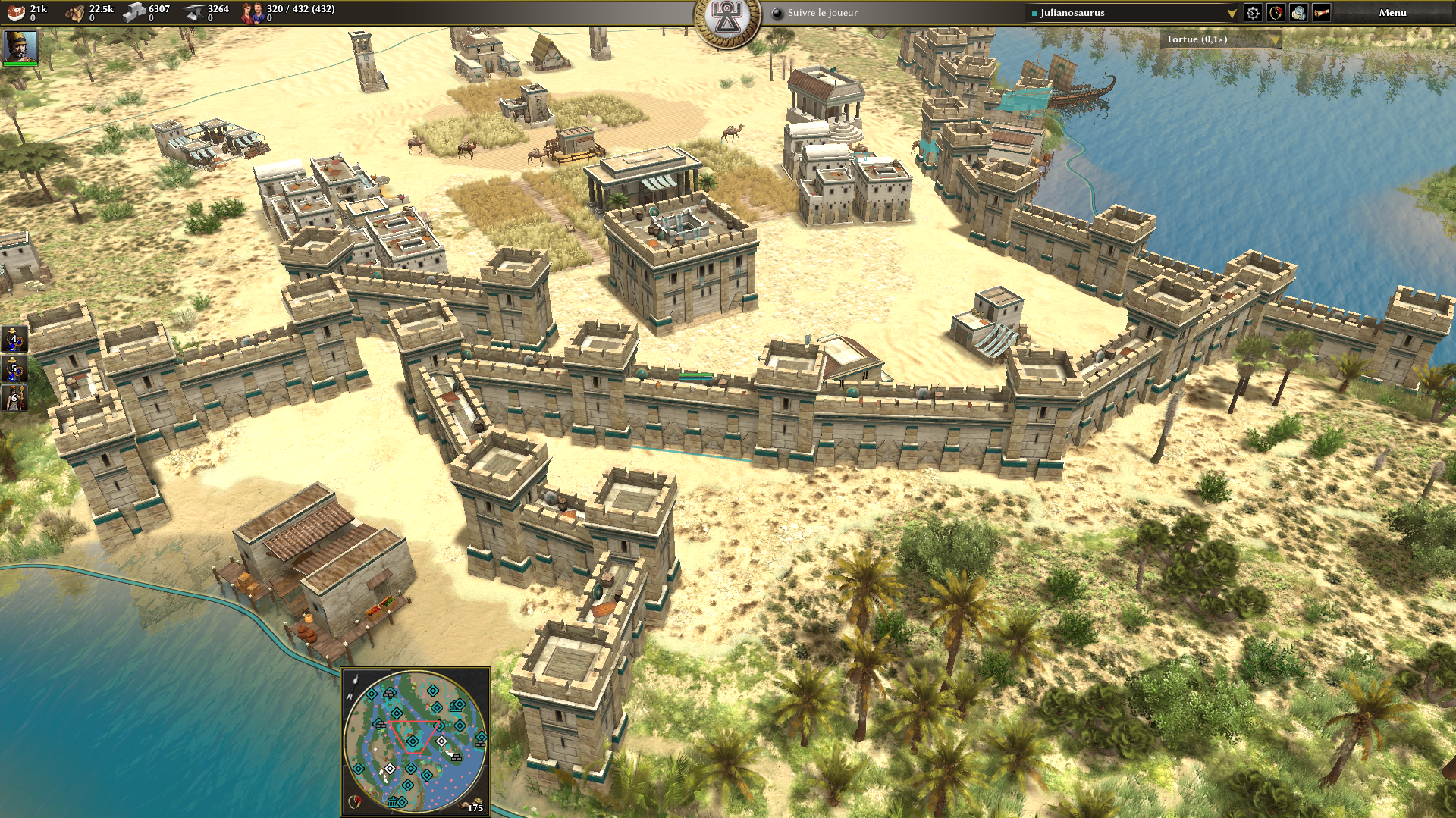
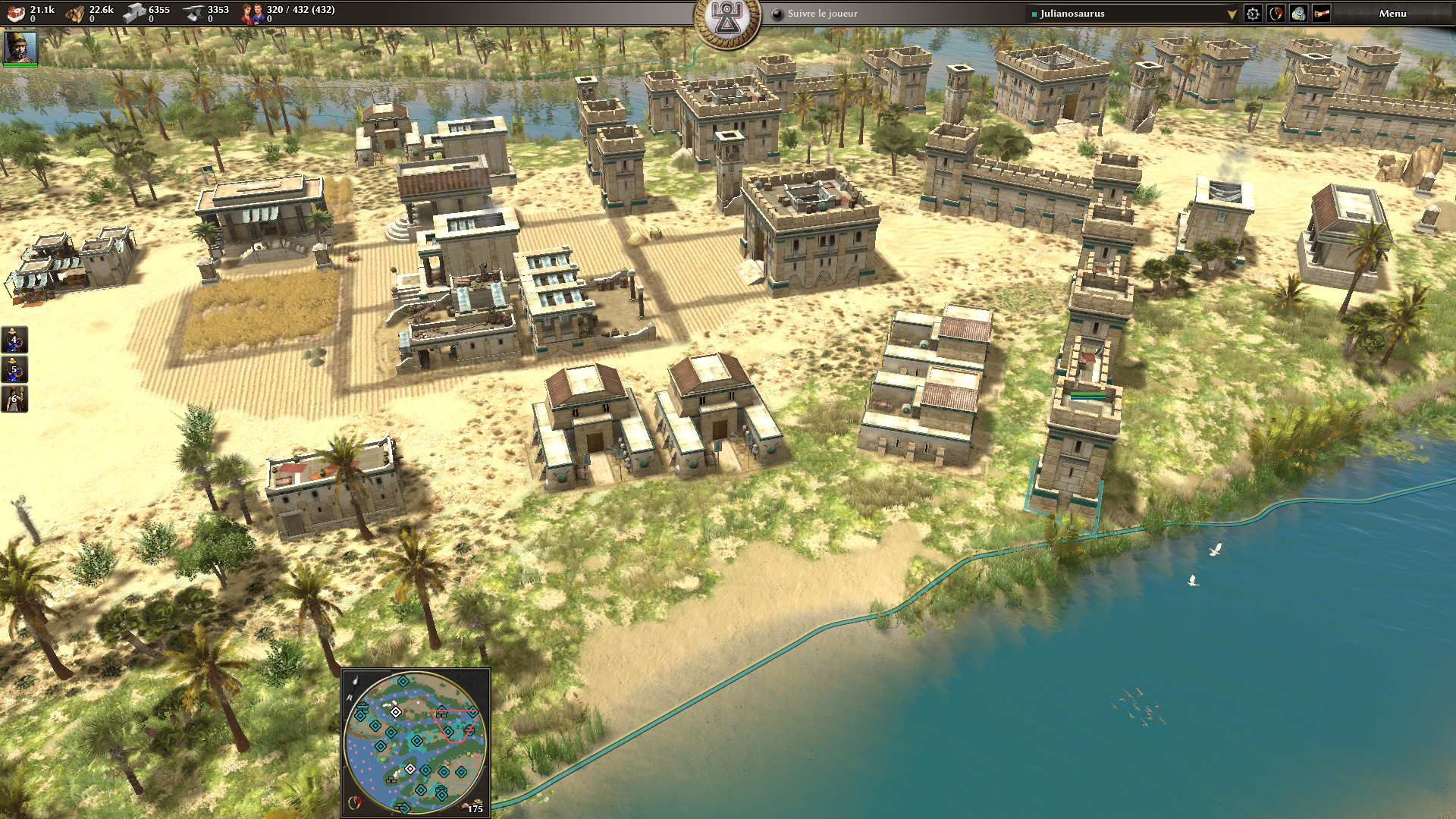
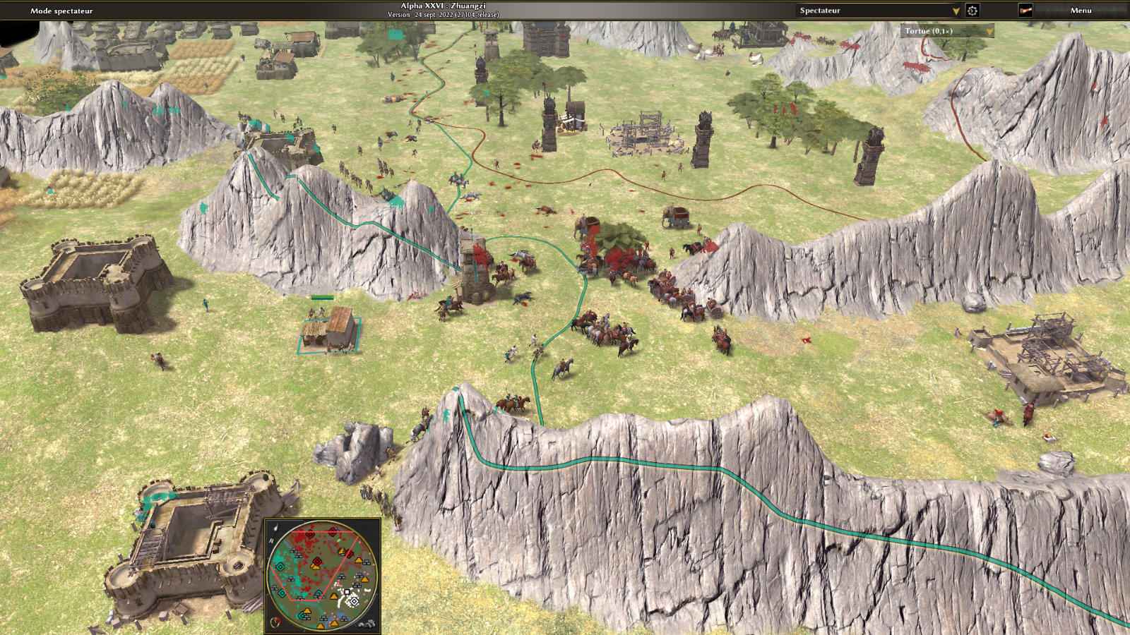
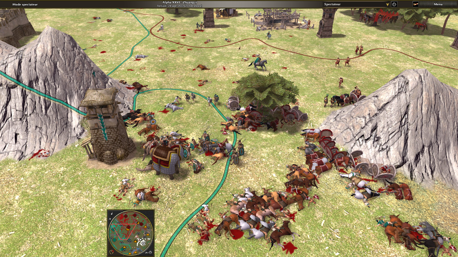
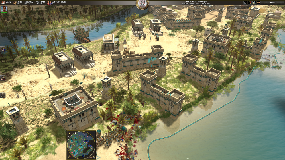
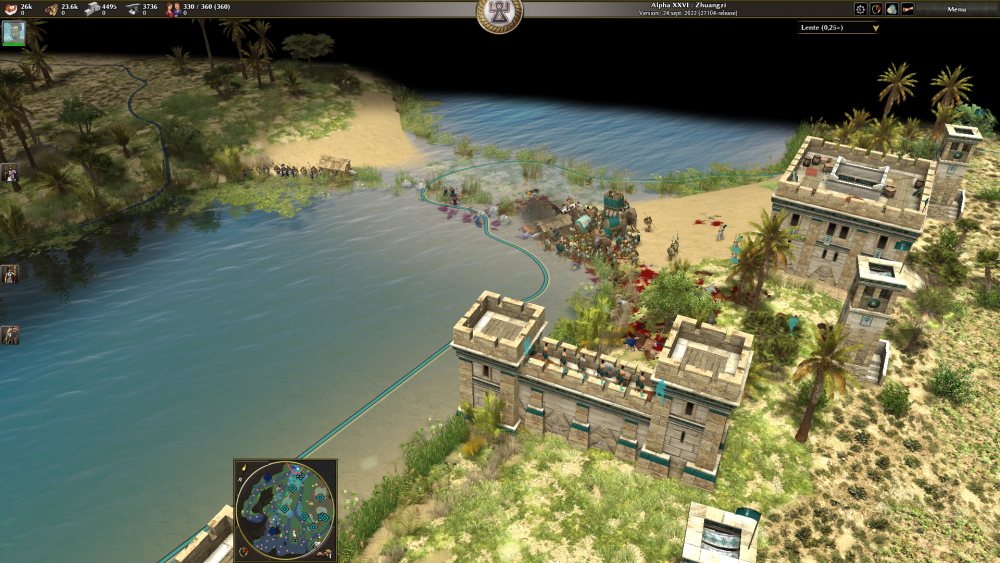
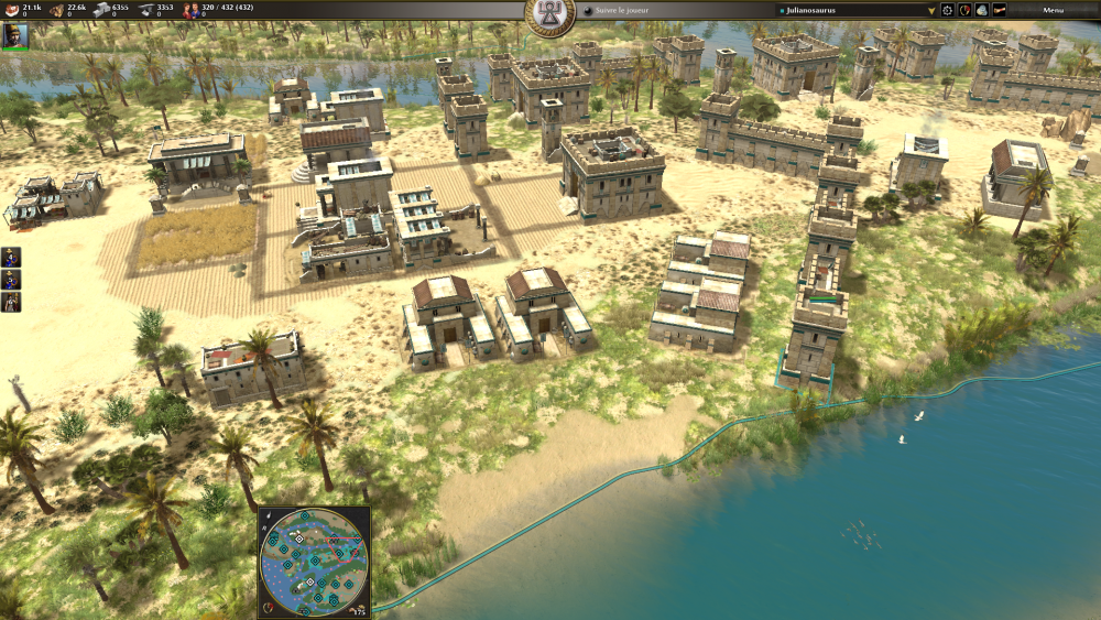
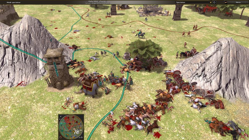
Battle report: RIVER DELTA (4P) My Carthaginians defeated 3 Petra of average level and random behavior: 1 Theban, 1 Macedonian, 1 Iberian. Conquest mode / map not revealed. Playing time = 3h08mn15sec, at an average speed of 0.25 (0.5 when all is quiet and 0.1 in the event of invasion or reorganization): I like to play slowly to give myself time to react and build. 118 saves made for this game. This delta is a very beautiful and immersive map, meandering through land crossings between peninsulas. I played it without using the mini-maps, which reveal resource locations. The development of a fleet allows you to harass Petra on its shores, as well as the rapid and massive movement of units to the delta's various peninsulas. Starting in the center of the map (with player 1) is unusual, and stimulates exploration. As the topography doesn't allow quick access to enemy territories, these sometimes far-flung confrontations require the ability to consolidate distant territories. If the 3 Petras neglect the maritime aspect, this will leave you little respite between their frequent invasions. In short, a great map! [Translated with DeepL.com (free version)]
-
 Thank you Gurken Khan for the tip!
 -
In fact, the problem was the maximum weight limit available for a single Topic. By publishing the 2 maps (2 XML files + 2 PMP files), the other day I had almost reached this maximum, leaving no possibility of posting an image. But today, it seems possible to upload images, so here's a global preview of the "Kushite Bay" map + screenshots of the "Duel in Iberia" map during a Petra vs Petra game.


-
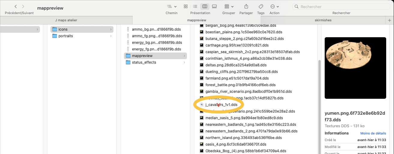
Note: it's pathetic, but I can't figure out how to show large images of the maps here... (without attaching them to the message, which would saturate the Max total size).
-
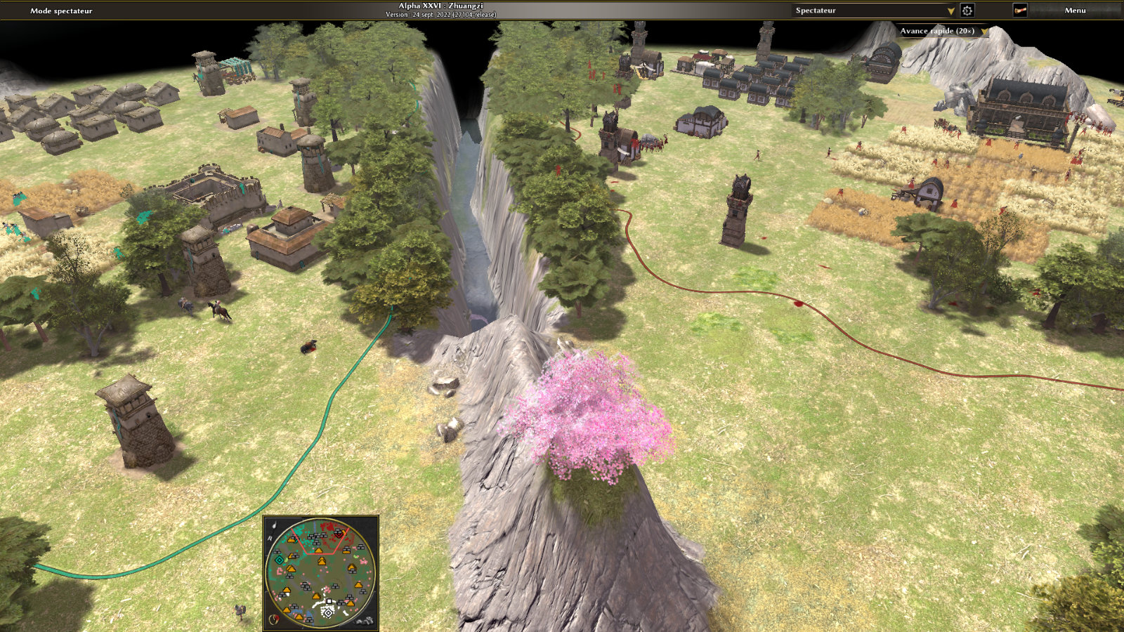
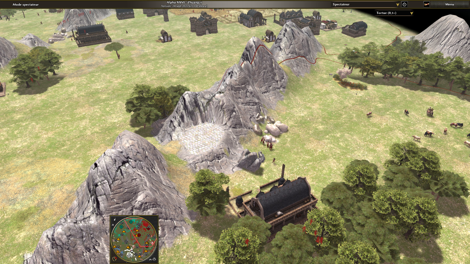
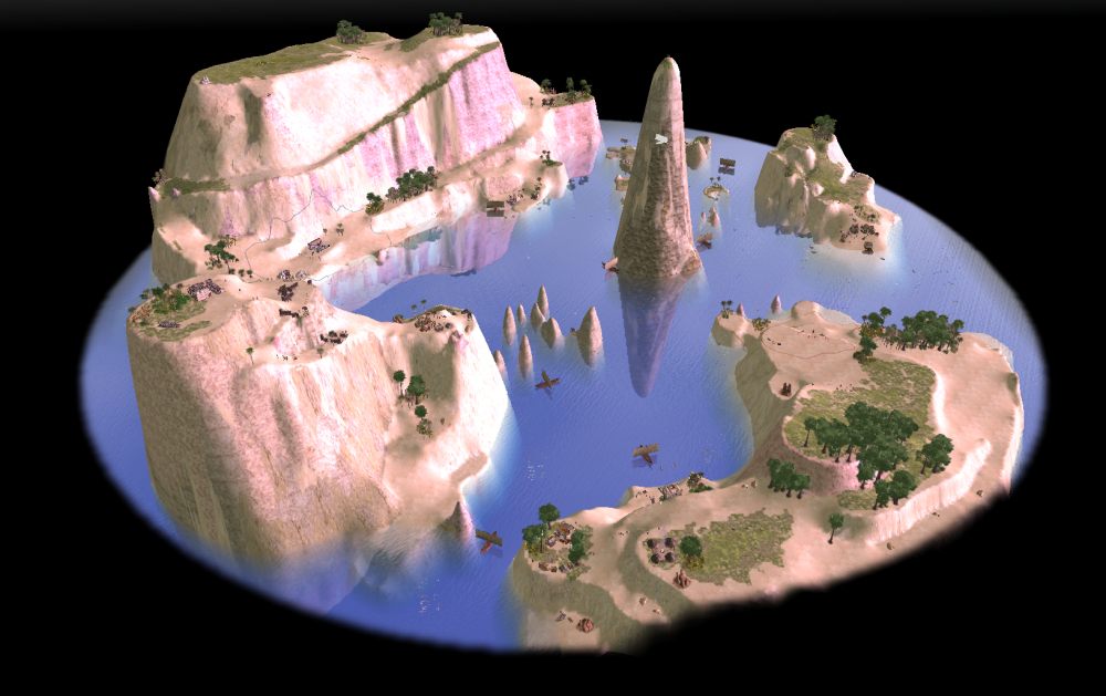
Thanks Diyakaruza! Yes, for "Kushite Bay", I tested the creation of very steep slopes, following a great gaming experience discovering the magnificent "Buttes Sahyadry" map; this map has a very high plant density in addition to the beautiful, highly worked mountains. For "Kushite Bay", I left a sort of central rocky peak, topped by the Kushite statue of an ibis; this peak allows the camera to get a quick overview of the different islands on the map.
-
Hello Community, First of all, congratulations and thanks to the different teams for this wonderful game! I'm happy to publish these 2 maps made with Atlas, "Duel in Iberia" & "Kushite Bay". For these 2 maps, in order to balance topography and accessible resources, I carried out numerous "Petra versus Petra" type tests. ———————————— « Duel in Iberia » Normal size map 2 players This skirmish is not intended to be realistic, but rather playful and pleasing to the eye, and this map can produce short but intense games. ———————————— « Kushite Bay » Naval map 2 players This map is designed for long games, since victory requires conquest by landing on the main opposing island. The topography of this map tests the use of high cliffs and slopes to allow unit movement; thus Petra sometimes fails to resolve rendezvous, as a boat may remain at the foot of a cliff, overlooking units wishing to embark from a cliff-side path. So Petra seems to have preferred a direct vertical distance that was impossible to cross, rather than a gently sloping path that was passable but created a long, hook-shaped detour (effective distance considerably increased). ———————————— So I'm hoping for some feedback on this first publication, about the gameplay of course, but also about the technical side of creating maps. I'm a graphic designer, I can't write computer code, and I work with Mac M1 os 13.2. Recently, topics relating to the use of Atlas seem to have disappeared from the forum... (?) Here's my own experience of the "mappreview" creation problem; all attempts have failed: - a screenshot of dimensions 400x300px, inscribed in a 512x512px canvas, saved in PNG format and placed in the [0add/art/textures/.../mappreview] folder, it doesn't work (magenta thumbnail substituted). - Manually adding the PNG file name to the map XML file produces an error in the 0AD program (program frozen), forcing it to stop. - Changing computer in order to open the PNG with the Gimp 2.1 and save it as DDS, then placing it in the [0add/art/textures/.../mappreview] folder, doesn't work (magenta thumbnail substituted). It seems that neither DDS nor PNG files are used here, but rather "xxxxx.PNGxxxxx.DDS" (see attached image "mappreview_location.png"); I don't know how to generate that (?). Thank you for reading this long message,j_kushite_bay.xmlj_kushite_bay.pmpj_Duel in Iberia.xmlj_Duel in Iberia.pmp Julianosore Nota bene: all my publications are translated from French into English by DeepL, thank you for your understanding. [https://www.deepl.com/]

-
New Map: The Legend of Mali (Scenario)
Julianosore replied to Yavin's topic in Scenario Design/Map making
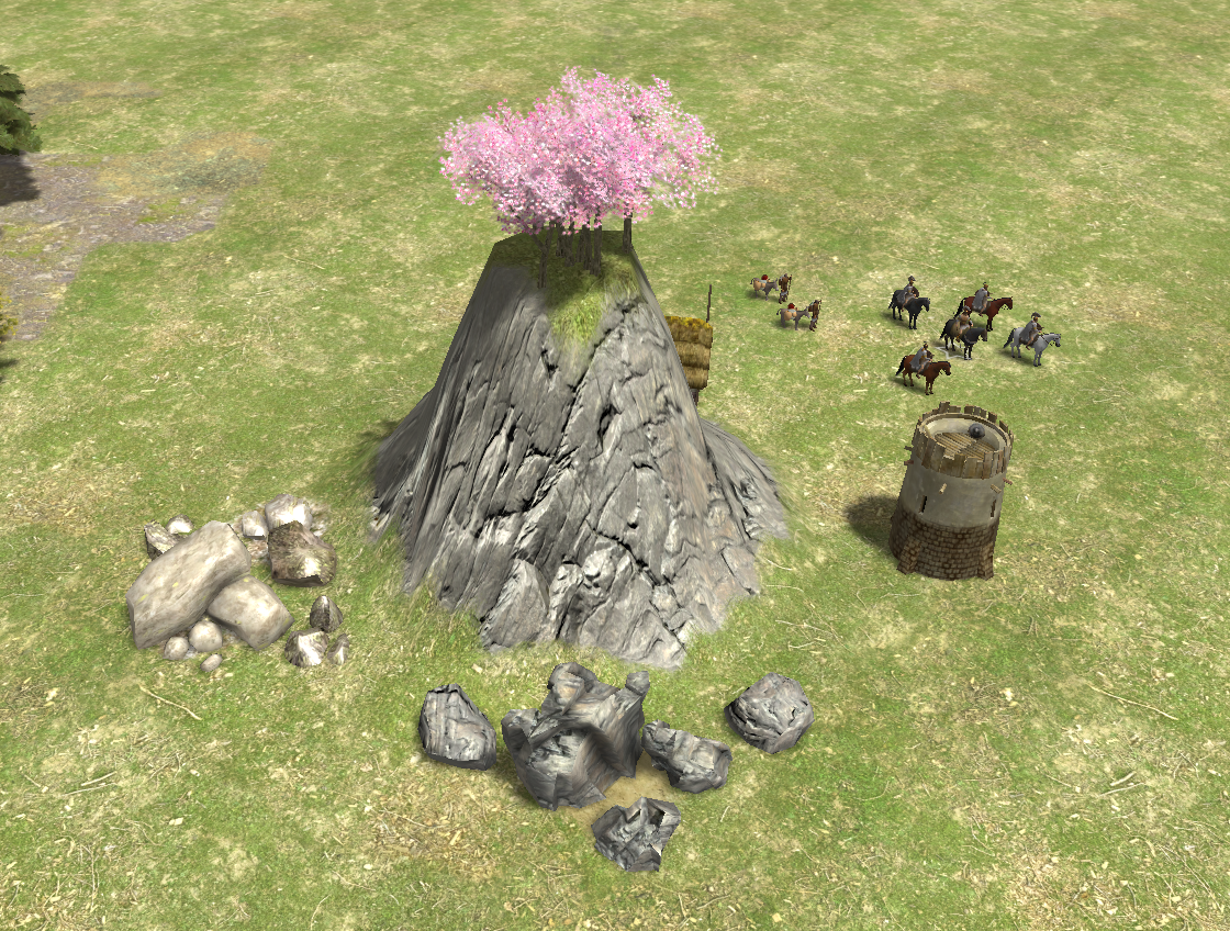
Sorry, all I had to do was hold down the option key during manipulations (move/rotate) so as not to lose the Actor select by option-click. Thanks for your answers! -
New Map: The Legend of Mali (Scenario)
Julianosore replied to Yavin's topic in Scenario Design/Map making
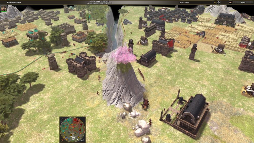
I can't find any mouse-keyboard combination to select (and therefore move) an Actor present on the map (under mac M1 os13.2). Deleting an actor (like these beautiful cherry blossoms) from the xml file is indeed possible, thanks Stan!
-
New Map: The Legend of Mali (Scenario)
Julianosore replied to Yavin's topic in Scenario Design/Map making
Hello ! It is possible to delete a "territory_pull" by deleting the appropriate line in the xml file; is this the right way? Langbart, are there any other functions that can be used in "Filter"?