.png.a9ae33b5e5ddb0eb2b142b612b99c428.png)
Lion.Kanzen
-
Posts
25.684 -
Joined
-
Days Won
302
Everything posted by Lion.Kanzen
-
.thumb.png.ce58cea22940c255f5b0a735d5abee36.png)
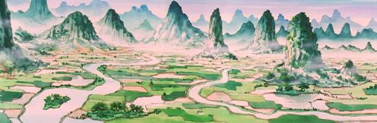
Biomes : South China conceptual maps.
Lion.Kanzen replied to Lion.Kanzen's topic in Scenario Design/Map making
Another anime that I remember that includes this geography is Saint Seiya, which was popular in Latin America and France. I was researching (as usual, I'm very curious). Chūgoku Rozan Go Rō Hō. 中国.廬山五老峰 → (ちゅうごくろざんごろうほう) “China, Lu Shan, 5 Ancient peaks”. Gorōhō. 五老峰 → (ごろうほう) “Los Cinco Antiguos Picos” in Spanish translation. "In Saint Seiya, the Rozan region in China is evoked. It is the place where Dohko of Libra lives in the 20th century, who trained Shiryu to obtain the Dragon armor. This region exists in China under the name Lu Shan or Lu (Rozan is the Japanese retranscription, GORŌHŌ 五老峰 pron. jp. rozan goroho, (Gorōhō: The Five Ancient Peaks) Go: Five (5), globally erroneously translated as 5 peaks) as well as "The Peak of the Five Elders" or "The Five Ancient Peaks" (included in the World Heritages in 1996), where according to legends the Dragon god dwelt". Shiryu's training place, the 5 Elderly Peaks is probably based on the five sacred mountains of Taoism, also called the Five Great Mountains, which are distributed according to the cardinal directions of Chinese geomancy, which includes the center as a direction. According to Chinese mythology, these five great mountains were originated from the body of Pangu (盤古/盘古 Pángǔ), the first being and creator of the world. Due to its location to the east, Mount Tai is associated with sunrise, signifying rebirth and renewal. Because of this, it is considered the most important of the five and is believed to have been formed from the head of Pangu. Mount Heng in Hunan would come from the right arm. Mount Heng in Shanxi, from the left arm. Mount Song would be its navel, and Mount Hua would be its feet. 1 East: - Mount Tai Tài Shān "Mount of Supreme Peace". 2 West: - Mount Hua Huà Huà Shān "Mount of Splendor". 3 South: - Mount Heng (Hunan) (Nán) Héng Shān "Mount of Equilibrium". 4 North: - Mt. Heng (Shanxi) (Běi) Héng Shān "Mount of Constancy" 5 Center: - Mount Song Sōng Shān "Mount of Nobility." These are high mountains about 2,000 meters above sea level, with bizarre ridges and steep crags, which make them majestic and impressive. They have many wonderful views and are tourist attractions. Hua-Shan is the name of one of the five sacred mountains of China, to ascend to the Taoist temples at its summit, it has one of the steepest and most dangerous trails on the planet. GO (five) ROO (ancient) HAU (mountains) is a small valley located in China and surrounded by mountains where five pointed peaks protrude and where there is a huge waterfall (according to the manga, pron. jp. rozan no daigakufu). The name comes from the poem "GoRoHo" (Five Ancient Peaks) by the famous poet Rikaku (Li Bai), which praises the Great Rozan(Lushan) Waterfall. Lushan is the Chinese name of a mountainous region that actually exists in China, in Chinese it means "Mount Lu" or hermit mountain, and means exactly the same in Japanese. They are written the same in both languages, just the reading of the characters varies. Rozan / Lu Shān (in Chinese) 廬山 (Lu Shan, Lushan, Lu Mountains) Mount Lu or Lu Shan (shan means mountain in Mandarin language) is a mountain in China, located 36 kilometers south of the city of Jiujiang in Jiangxi province, between the Yangzi and Poyang Lake. It is home to numerous natural riches (flora, fauna, geology); moreover, it is a prominent place for history, religion, painting and poetry. All these characteristics led Unesco to declare Lu Shan National Park a World Heritage Site in 1996. Lushan mountain is actually located in the Chinese province of Jiangxi, in the southern part of the city of Jiujiang, along the shore of Poyang Lake, and occupies an area of 302 km². Solitary and imposing, it flanks the southern bank of the Yangtze River, near its slope, like a silver mirror is the Poyang Lake. Lushan integrates mountain, river and lake, in this picturesque and elegant place Kurumada(Autor of Saint Seiya) was inspired to create the five peaks of Rozan. In fact Rozan is the name by which the Japanese call Lushan. https://snk-seiya.net/guiasaintseiya/Cinco-Picos.html?utm_source=pocket_mylist Highlights of the Mt. Lushan Mount Lu is a typical a horst-style block mountain. With its 12 scenic sites, its 37 special attractions, and its 370 various other noteworthy sites, Mount Lu is a popular tourist destination, thanks in no small part to its many spectacular natural features that result from the mountain's horst origin, such as ravines, grottoes, rock outcroppings, mountain streams, waterfalls, etc. 1. Peaks Mount Lu's highest peak is Dahanyang Peak, at roughly 1500 meters above sea level. Another renowned peak on Mount Lu is Five Old Men Peak, so named because the five peaks in question all sit side by side, as it were, forming an almost straight line. 2. Waterfall The most famous waterfall on Mount Lu is Three-Step Waterfall, which name is a reference to the fact that the waterfall spills over three glaciation-formed, natural terraces, en route to the pool below. Zhao Ziang, a painter in the Yuan Dynasty (1271 - 1368), recorded the following description of Three Step Waterfall: Flowing like a jade curtain, it falls a thousand feet. The crescent moon is the curtain hook, hanging high in the night sky. Countless writers, artists, calligraphers, and other famous personages have written similar poems in homage to Mount Lu, or to specific sites on the mountain, just as there are over 900 cliff inscriptions and over 300 stelae on Mount Lu with poems and couplets in praise of this famous mountain..jpg.053bce8a6ff4773a9a3341383ddb6a16.jpg)
.jpg.b7637ac805f9ba23ef0a6cb0274aada9.jpg)
.jpg.138e15e16f0bf6ada89e020e05e8d06d.jpg)
.jpg.8d25addd88dda7946859e7e841114f46.jpg)
.jpg.244ebe8f8f1d6882eb33b7042c2af439.jpg)
-
Biomes : South China conceptual maps.
Lion.Kanzen replied to Lion.Kanzen's topic in Scenario Design/Map making
https://en.m.wikipedia.org/wiki/Sacred_Mountains_of_China Sacred mountains of China. -
Biomes : South China conceptual maps.
Lion.Kanzen replied to Lion.Kanzen's topic in Scenario Design/Map making
Guilin montains...inspiration for dragon ball mountains scenarios. Pretty iconic for our maps. https://en.m.wikipedia.org/wiki/Guilin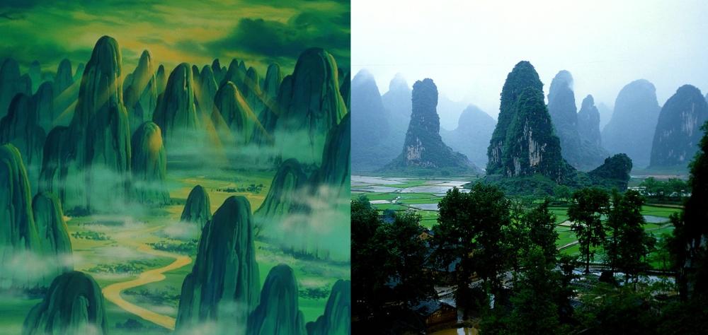
-
true, I had forgotten. Thank you.
-
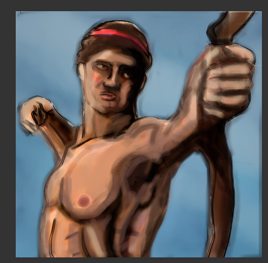
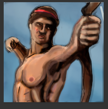
it is difficult to find bodybuilding ir fitness with the topic of archery.
-
it is difficult to find bodybuilding ir fitness with the topic of archery.
-
this is just a proposal. I need a programmer to accept it.
-
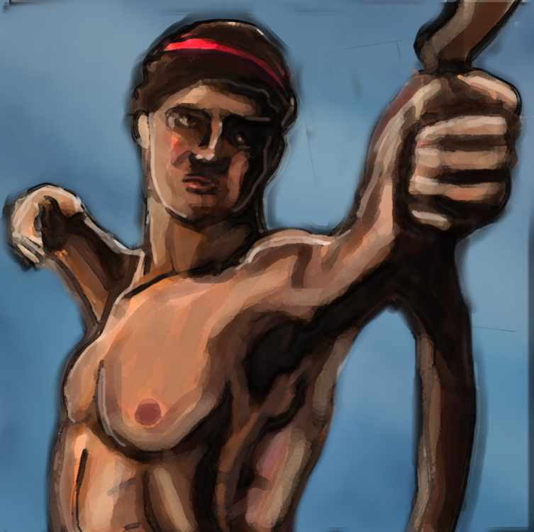
I have to admit this is difficult because I don't have a clear reference. It's pretty much made up of my imagination. Except for the statue it's based on.

-
there are many places. many are so cute and different that they are included in cartoons or anime. https://en.m.wikipedia.org/wiki/Guilin

-
This is unlike anything I've ever seen.

-
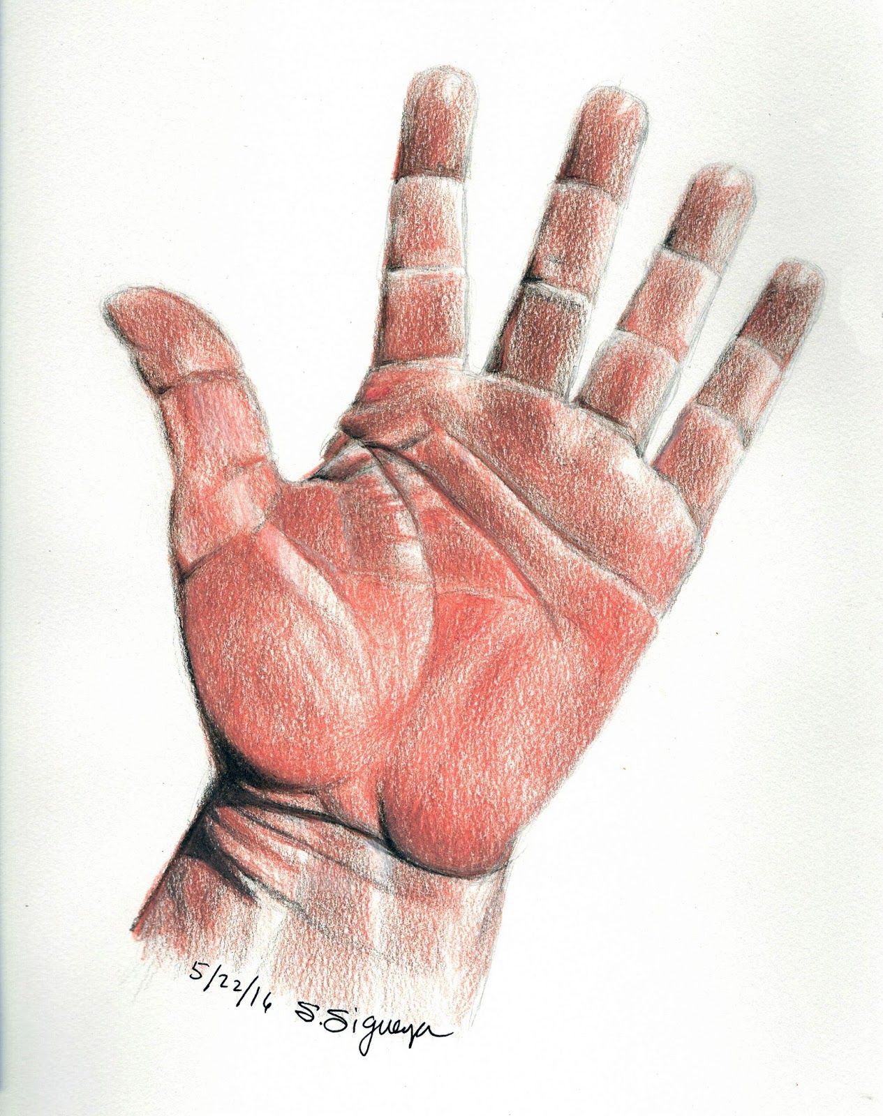
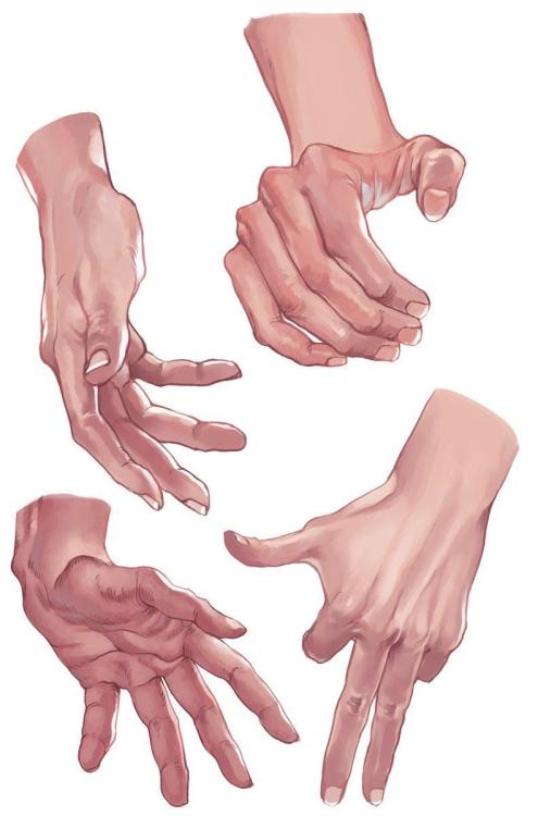
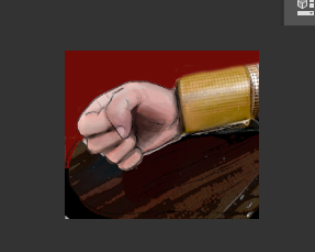
Reference style to hands.


-
this technology doesn't exist but I'm going to make the icon. despotism or tyranny. it is like authoritarianism.
-
Despotism. Autoritarism Tyranny

-
-
anyone want to pose nude? JOKE.

-
Wow es de Indianápolis.
-
Biomes : South China conceptual maps.
Lion.Kanzen replied to Lion.Kanzen's topic in Scenario Design/Map making
The Guizhou Plateau broadleaf and mixed forests are a subtropical moist broadleaf forest ecoregion in the Yungui Plateau of China. Much of the original forest has been replaced by secondary forests Broadleaf and mixed forests on karst topography in Wulingyuan forms part of the Wuling Mountain Range. The scenic area consists of four national parks, which are the Zhangjiajie National Forest Park, Suoxi Valley Nature Reserve, Tianzi Mountain Nature Reserve and the recently added Yangjiajie Scenic Area. Overall there are over 560 attraction sights to view. https://www.travelchinaguide.com/attraction/hunan/zhangjiajie/wulingyuan.htm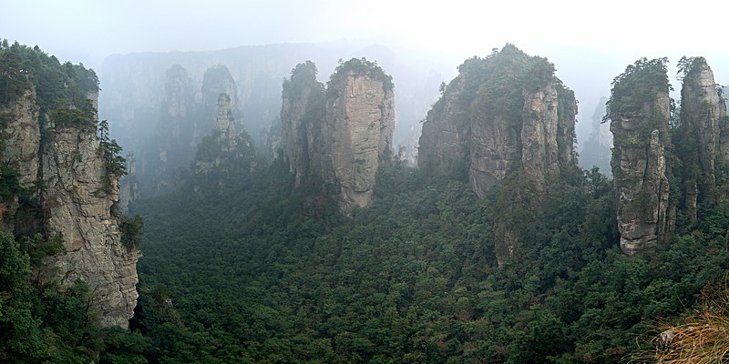


-
Biomes : South China conceptual maps.
Lion.Kanzen replied to Lion.Kanzen's topic in Scenario Design/Map making
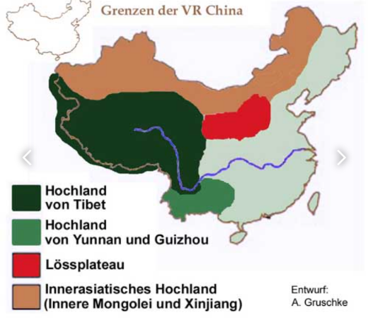
Guizhou is a mountainous province, with its higher altitudes in the west and centre. It lies at the eastern end of the Yungui Plateau. Demographically, it is one of China's most diverse provinces. Minority groups account for more than 37% of the population, including sizable populations of the Miao, Bouyei, Dong, Tujia and Yi peoples, all of whom speak languages distinct from Chinese. The main language spoken in Guizhou is Southwestern Mandarin, a variety of Mandarin. The Yunnan–Guizhou Plateau or Yungui Plateau. The Yunnan–Guizhou Plateau or Yungui Plateau (simplified Chinese: 云贵高原; traditional Chinese: 雲貴高原; pinyin: Yúnguì Gāoyuán) is a highland region located in southwest China. The region is primarily spread over the provinces of Yunnan and Guizhou. In the southwest, the Yungui is a true plateau with relatively flatter highland areas, while in the northeast, the Yungui is a generally mountainous area of rolling hills, gorges, and karst topography. -
It would be good if you help me with this, let's start with the south of China. https://en.m.wikipedia.org/wiki/South_China_tiger
-
This is a very good idea.
-
It is very small again the problem of not being able to close them with walls in the game (or forests). it is difficult to enclose a large area with walls.
-
Reserved for an intro. List Changjiang Plain evergreen forests Daba Mountains evergreen forests Jian Nan subtropical evergreen forests Qionglai-Minshan conifer forests Sichuan Basin evergreen broadleaf forests Yunnan Plateau subtropical evergreen forests Sources to start. https://blog.theaga.org/tigers/ https://news.cgtn.com/news/2021-04-22/Journey-to-the-karst-in-SW-China-s-Guizhou-ZEX5FKvdTO/share_amp.html
-
Does any specific biome or map upload, do you recommend any region?
-
that's right, in its beginnings 0 AD was heavily influenced by AoM.
-
Add more Asian and Romano-Roman music, something similar to clichés, something that does not remind us of epic cinema. military marches always give it a touch. Gregorian chant is from pagan origin. https://www.catholicworldreport.com/2013/01/30/the-hellenic-origins-of-church-music/ https://www.wilmingtonfavs.com/pagan-christianity/the-origins-of-the-choir.html I don't see why not include a little choir.