Search the Community
Showing results for 'age of the aegean'.
-
About trade and society Fresco showing three women who were possibly queens.[citation needed] The Minoans were primarily a mercantile people engaged in overseas trade. Their culture, from 1700 BC onward, shows a high degree of organization. The Minoan trade in saffron, the stigma of a mutated crocus which originated in the Aegean basin as a natural chromosome mutation, has left fewer material remains: a fresco of saffron-gatherers at Santorini is well-known. This inherited trade pre-dated Minoan civilization: a sense of its rewards may be gained by comparing its value to frankincense, or later, to pepper. Archaeologists[who?] tend to emphasize the more durable items of trade: ceramics, copper, and tin, and dramatic luxury finds of gold and silver. Objects of Minoan manufacture suggest there was a network of trade with mainland Greece (notably Mycenae), Cyprus, Syria, Anatolia, Egypt, Mesopotamia, and westward as far as the coast of Spain. Minoan men wore loincloths and kilts. Women wore robes that had short sleeves and layered flounced skirts. The robes were open to the navel, allowing their breasts to be left exposed.[37] Women also had the option of wearing a strapless fitted bodice. The patterns on clothes emphasized symmetrical geometric designs. Given the fragility of organic materials, other forms of dress may have been worn of which no archeological evidence exists. ---here we can see egyptian influence in Minoan culture--- The Minoan religion focused on female deities, with females officiating.[38] The frescos include many depictions of people, with the genders distinguished by colour: the men's skin is reddish-brown, the women's white.[39] The earliest dated writing found on Crete is the Cretan hieroglyphs. It is not known whether this language is Minoan or not and its origin is still a topic of debate. These hieroglyphs are often associated with the Egyptians, but they also show relation to several other writings from the region of Mesopotamia.[41] The hieroglyphs came into use from MMI; they were used at the same time as the emerging Linear A from the 18th century BC (MM II). The hieroglyphs disappeared at some point during the 17th century BC (MM III). Evidence of human sacrifice by the Minoans has been found at three sites: (1) Anemospilia, in a MMII building near Mt. Juktas, interpreted as a temple, (2) an EMII sanctuary complex at Fournou Korifi in south central Crete, and (3) Knossos, in an LMIB building known as the "North House." (explanation of abbreviations) Similar to archaeological finds of the Bronze Age, burial remains constitute much of the material and archaeological evidence for the period. By the end of the Second Palace Period, Minoan burial practice was dominated by two broad forms: 'Circular Tombs', or Tholoi, (located in South Crete) and 'House Tombs', (located in the north and the east). Many trends and patterns within Minoan mortuary practice do not conform to this simple breakdown. Overall, inhumation was the most popular form of burial; cremation does not seem to have been as popular.[47] Throughout this period the trend was towards individual burials, with some distinguished exceptions. These include the much-debated Chrysolakkos complex, Mallia, consisting of a number of buildings forming a complex. This is located in the centre of Mallia's burial area and may have been the focus for burial rituals, or the 'crypt' for a notable family.
-
Intro The Minoan civilization was an Aegean Bronze Age civilization that arose on the island of Crete and flourished from approximately 2700 to 1450 BC. It was rediscovered at the beginning of the 20th century through the work of British archaeologist Arthur Evans. Will Durant referred to it as "the first link in the European chain." -wikipedia The influence of the Minoan civilization outside Crete has been seen in the evidence of valuable Minoan handicraft items on the Greek mainland. It is likely that the ruling house of Mycene was connected to the Minoan trade network. After around 1700 BC, the material culture on the Greek mainland achieved a new level due to Minoan influence.[19] Connections between Egypt and Crete are prominent. Minoan ceramics are found in Egyptian cities and the Minoans imported several items from Egypt, especially papyrus, as well as architectural and artistic ideas. The Egyptian hieroglyphs served as a model for the Minoan pictographic writing, from which the famous Linear A and Linear B writing systems later developed.[17] Bengtson has also demonstrated Minoan influence among Canaanite artifacts. Minoans were traders, and their cultural contacts reached far beyond the island of Crete to Egypt's Old Kingdom, to copper-bearing Cyprus, Canaan, and the Levantine coasts beyond, and to Anatolia. In late 2009, Minoan-style frescoes and other Minoan-style artifacts were discovered during excavations of the Canaanite palace at Tel Kabri, Israel, leading archaeologists to conclude that the Minoan influence was the strongest foreign influence on that Caananite city state. These are the only Minoan remains ever found in Israel.[30] The Cyclades were in the Minoan cultural orbit, and, closer to Crete, the islands of Karpathos, Saria and Kasos, also contained Minoan colonies, or settlements of Minoan traders, from the Middle Bronze Age (MMI-II). Most of them were abandoned in LMI, but Minoan Karpathos recovered and continued with a Minoan culture until the end of the Bronze Age.[33] Other supposed Minoan colonies, such as that hypothesised by Adolf Furtwängler for Aegina, were later dismissed by scholars.[34] There was a Minoan colony at Ialysos on Rhodes.[35]
-
This ship is typical of the vessels used during the reign of Pharaoh Sahure over 4400 years ago. Egypt's expanding interests in trade goods such as ebony, incense such as Myrh and frankincense, gold, copper and other useful metals inspired the Egyptians to build suitable ships for navigation of the open sea. The navy of Sahure traded with Lebanon for cedar and traveled the length of the Red Sea to the Kingdom of Punt, modern Ethiopia and Somalia for ebony, ivory and aromatic resins. Ship builders of that era did not use pegs (treenails) or metal fasteners, but relied on rope to keep their ships assembled. Planks and the superstructure were tightly tied and bound together with rope binders. Joints and cracks in the superstructure were sealed with pitch and bitumen. Historical records show that Pharaoh Sahure the second king of the 5th Dynasty established an Egyptian navy and sent a fleet to Punt and traded with cultures in the Eastern Mediterranean. His pyramid has colonnaded courts and relief sculptures which illustrate his naval fleet and record his military career consisting mostly of campaigns against the Libyans in the western desert. He is credited to have begun the cemetery complex at Saqqara and he also had a diorite quarry just west of Abu Simbel. Model Picture Provided By Hobby World Of Montreal King Sahure's Ship 2458-2446 BCE 5th Dynasty King Sahure purchased cedar timbers and commissioned the ship builders from the area of ancient city Byblos to create his ships; the importance of the Phoenician culture in seafaring technologies and trade throughout the eastern Mediterranean should not be underestimated. Bigger ships of seventy to eighty tons displacement suited to long voyages became quite common (In size they can be compared to Columbus's Santa Maria with a displacement of 100 tons or his smaller ships with about fifty). How and where these types of ships were used other than the expeditions where records are available is a matter for speculation and conjecture. The adventures of seafarers were the subject of Egyptian literature and the story of the shipped wrecked sailor recordered in approxiametely 2200 BCE is but one example that sheds some light on the matter. Front View of Sahure's ships Circa 2500 BCE The next ship is a model constructed from illustrations on wall panels at the funerary complex of Hapshetsut. One thousand years of Egyptian history and the evolution of ship building in Egypt separates the two ships. It is interesting to make a comparison of the results of the shipwrights craft in the two different millennia. Hatshepsut's ships are generally larger and more complex in their superstructure. Most noteworthy is the fact that Sahures ship used larger sections in their planking. Egyptian Seagoing Vessel XVIII Dynasty (1580-1350 B.C.) August F. Crabtree Collection of Miniature Ships Mariners' Museum, Newport News, Virginia A modern model of an Egyptian sea worthy ship created on the basis of information from the funerary temple of Hatshepsut. This model of a 15th century BCE merchant ship was made after the wall relief at Deir el Bahri. The ship was about 22 meters long and 5 meters wide. It didn't have a wooden keel but got its stability from a thick rope fastened under tension at either extremity of the ship. There were fifteen rowing oars on either side, two connected oars used as rudder, a single mast and a 15-meter wide horizontal sail. The stern was decorated with a carved lotus flower. A major expedition to the Land of Punt (probably modern day Somalia) down the Red Sea and into the Indian Ocean was undertaken under Queen Hatshepsut. Another story of seafaring trade is the journey of Wenamen in 1100 BCE, a trading expedition gone wrong in Egypt. This story illustrates the extent to which cultures bordering the seacoasts relied on ships and boats for their transportation and trade. Seafaring was the cheapest and fastest means of transportation, which meant the majority of trade was conducted by shipping by boat. In the Eastern Mediterranean cultures generally established cities and towns close to coastlines in order to take advantage of this phenomenon. Rameses III recorded his conflict and defeat of the sea peoples at Medinet Habu. This model of a 13th century warship was made after wall paintings at Medinet Habu depicting the victory of Ramses III over the Sea Peoples. The high bulwarks protected sailors and soldiers from enemy missiles. Egyptian Ship used during the conflict with the Sea Peoples 1250 BCE Eighteen oars gave it the maneuverability, which was a decisive factor in the Egyptian victory. Like all Egyptian ships of this period, it was not laid on a keel, but got its structural strength from a gangway-connecting stern to bow. It had a single mast with gangway connecting stern to bow. The single mast was hung with a horizontal sail. The stern was decorated with a lion's head crushing a human skull. This model of a Philistine man of war was equally constructed according to the Medinet Habu paintings. This is the kind of vessel the Sea Peoples would have used in their attempt to invade Egypt in 1280 BCE. This implies that this kind of ship may have been used and available to the entire confederation of Sea Peoples, therefore this kind of vessel structure may have been used throughout the Aegean and Black Sea Regions. Its lack of rowing oars may have been a distinct disadvantage in the confined space of the Nile delta where they must have been incapable of using their ram against the more maneuverable Egyptian vessels. This also indicates that this design was not created primarily for military use. The sea people depended heavily on land forces for the success of their military campaigns. Although not as effective in its design for Naval battles this ships overall structural design was superior to that of the Egyptian ships, having a proper keel and body ribs to make the hull ridged. Modern model of a ship of the sea peoples created after the illustrations on wall panels at Mendinet Habu. Circa 1250 BCE . The model is at the Haifa Naval Museum, Israel.
-
For now, I am putting basically complete PDF civ profiles here, as well as work-in-progress files, until I've figured out where to upload them to on GitHub. Aristeia will tentatively be divided into three 500-year spans, as follows (the listings, inclusions, and classifications are still very much a WIP): FATHERS OF NATIONS (2000-1500 BC) THE OLD KINGDOM EGYPTIANS THE NUBIANS THE AKKADIANS THE SUMERIANS THE HEBREWS THE MAGADHAN INDIANS THE SHANG CHINESE TUMULT OF NATIONS (1500-1000 BC) THE AMU HYKSOS THE THEBAN EGYPTIANS THE MINOAN CRETANS THE HEBREW ISRAELITES THE PHILISTINE SEA PEOPLES THE SIDONIAN CANAANITES THE ANATOLIAN HITTITES THE ZHOU CHINESE ZENITH OF NATIONS (1000-500 BC) MAJOR REGIONAL POWERS THE NEW KINGDOM EGYPTIANS New Kingdom Egypt Civilization Profile.pdf New Kingdom Egypt Civilization Profile.doc THE KUSHITE NUBIANS Kushite Nubian Civilization Profile.doc (work in progress) THE ANATOLIAN HITTITES Hittite Civilization Profile.doc (work in progress) THE NEW EMPIRE ASSYRIANS Neo-Assyrian Civilization Profile 0.4.pdf Neo-Assyrian Civilization Profile 0.4.doc THE CHALDEAN BABYLONIANS LEVANTINE STATES THE PHOENICIAN CANAANITES THE UNITED MONARCHY ISRAELITES United Monarchy Israel Civilization Profile 0.3.pdf United Monarchy Israel Civilization Profile 0.3.doc THE DIVIDED KINGDOM JUDAHITES THE DIVIDED KINGDOM EPHRAIMITES THE ARAM-DAMASCUS SYRIANS AEGEAN & MEDITERRANEAN CIVILIZATIONS THE PHILISTINE SEA PEOPLES THE TARTESSIAN IBERIANS THE TROJAN LYDIANS THE MYCENAEAN GREEKS THE TYRRHENIAN ETRUSCANS
-
Mint is more difficult to find, as single word, I add keywords like: currency, coin,coinage: Coinage probably began in Lydia around 600 BC, and circulated in the cities of Asia Minor under its control;[3] early electrum coins have been found at the Temple of Diana at Ephesus. The technique of minting coins arrived in mainland Greece around 550 BC, beginning with coastal trading cities like Aegina and Athens. Their use spread, and the city-states quickly secured a monopoly on their creation. The very first coins were made from electrum (an alloy of gold and silver), followed by pure silver, the most commonly found valuable metal in the region. The mines of the Pangaeon hills allowed the cities of Thrace and Macedon to mint a large quantity of coins. Laurium's silver mines provided the raw materials for the "Athenian owls", the most famous coins of the ancient Greek world. Less-valuable bronze coins appeared at the end of the 5th century. Coins played several roles in the Greek world. They provided a medium of exchange, mostly used by city-states to hire mercenaries and compensate citizens. They were a source of revenue: foreigners had to change their money into the local currency at an exchange rate favorable to the State. They served as a mobile form of metal resources, which explains discoveries of Athenian coins with high levels of silver at great distances from their home city. Finally, the minting of coins lent an air of undeniable prestige to any Greek city or city state. ------------other source-------- In 600 B.C., Lydia's King Alyattes minted the first official currency. The coins were made from electrum, a mixture of silver and gold that occurs naturally, and stamped with pictures that acted as denominations. In the streets of Sardis, circa 600 B.C., a clay jar might cost you two owls and a snake. Lydia's currency helped the country increase both its internal and external trade, making it one of the richest empires in Asia Minor. It is interesting that when someone says, "as rich as Croesus", they are referring to the last Lydian king who minted the first gold coin. Unfortunately, minting the first coins and developing a strong trading economy couldn't protect Lydia from the swords of the Persian army. (To read more about gold, see What Is Wrong With Gold?) http://www.investopedia.com/articles/07/roots_of_money.asp ------- different source------ Coins were introduced as a method of payment around the 6th or 5th century BCE. The invention of coins is still shrouded in mystery: According to Herdotous (I, 94), coins were first minted by the Lydians, while Aristotle claims that the first coins were minted by Demodike of Kyrme, the wife of King Midas of Phrygia. Numismatists consider that the first coins were minted on the Greek island of Aegina, either by the local rulers or by king Pheidon of Argos. Aegina, Samos, and Miletus all minted coins for the Egyptians, through the Greek trading post of Naucratis in the Nile Delta. It is certain that when Lydia was conquered by the Persians in 546 BCE, coins were introduced to Persia. The Phoenicians did not mint any coins until the middle of the fifth century BCE, which quickly spread to the Carthaginians who minted coins in Sicily. The Romans only started minting coins from 326 BCE. Coins were brought to India through the Achaemenid Empire, as well as the successor kingdoms of Alexander the Great. Especially the Indo-Greek kingdoms minted (often bilingual) coins in the 2nd century BCE. The most beautiful coins of the classical age are said to have been minted by Samudragupta (335-376 CE), who portrayed himself as both conqueror and musician. The first coins were made of electrum, an alloy of silver and gold. It appears that many early Lydian coins were minted by merchants as tokens to be used in trade transactions. The Lydian state also minted coins, most of the coins mentioning king Alyattes of Lydia. Some Lydian coins have a so-called legend, a sort of dedication. One famous example found in Caria reads "I am the badge of Phanes" - it is still unclear who Phanes was. In China, gold coins were first standardized during the Qin dynasty (221-207 BCE). After the fall of the Qin dynasty, the Han emperors added two other legal tenders: silver coins and "deerskin notes", a predecessor of paper currency which was a Chinese invention. http://www.ancient.eu.com/coinage/ ---------------------------------------------------------------------------- Gold and silver were an integral part of business and trade as far back as in the early civilisations of Sumer (the land between the rivers Euphrates and Tigris in what is now Iraq) and Egypt. The great French historian Fernand Braudel saw these precious metals as the "lifeblood of Mediterranean trade in the 2nd millennium BC". Initially, however, they were traded simply by weight in the form of ingots, which could then be cut up into small chunks or drawn into wire. And the metals, particularly silver, were regarded more as standard of accounting or for taxes to rulers or temples, rather than for general circulation among the population. The first real coins were not struck until the 6th century BC in Lydia (Western Turkey). They were made from electrum, natural alloy of gold and silver found in the rivers of the region. They usually had a lion or a bull on one face and a punch mark or seal on the other, and weighed from 17.2 grams (0.55 troy oz) to as little as 0.2 grams (.006 troy oz). Their introduction is attributed to the Lydian king Croesus (561-547 BC). Improvements in refining soon led to the distinct minting of gold and silver coin. Coinage was swiftly taken up in the blossoming Greek city states just across the Aegean sea, though it was predominantly of silver until Philip II of Macedon (359-336 BC) acquired gold and silver mines in Thrace (now Bulgaria). His son, Alexander the Great (336-323 BC) then consolidated the Greek empire with his conquest of the Persian empire, securing an immense gold treasure built up by the Persians from gold sources on the river Oxus in northern Afghanistan. Alexander is reputed to have taken over 22 metric tonnes (700,000 troy ounces) of gold coin in loot from the Persians. For both Philip II and Alexander, gold coin became an essential way of paying their armies and meeting other military expenses. Under the Greek empire, the coins were stamped with the head of the king instead of lions, bulls and rams that had previously adorned gold coin elsewhere. The Romans, for whom gold coin became the crucial way of paying their legions, also adopted the custom of striking the emperor's head on their gold aureus coin. The aureus was usually 950 fine (22 carat) and weighed 7.3 grams (0.23 troy oz); 45 aurei weighed one roman pound (libra). Although this coin was too valuable for most daily transactions, they were used by administrators, traders and for army pay (a legionnaire was paid one aureus each month). In Britain, one aureus bought 400 litres (28.57 gallons) of cheap wine or 91 kilos (200 pounds) of flour. A smaller gold coin, the solidus, weighing 4.4 grams (0.14 troy oz) was introduced after 300 AD, as gold supplies from Spain and Eastern Europe declined. The Romans minted gold coin on a scale not seen before and not equalled until modern times. Between 200 and 400 AD hundreds of millions of coins were struck and distributed throughout the empire. The extent of circulation is demonstrated by the hoards of roman coins that have turned up across Europe, particularly in Britain, which can be seen in many museums, notably the British Museum in London. The British Museum's HSBC Money Gallery provides a unique display of the evolution of early gold coin. The Roman empire brought a remarkable unity to much of western Europe through coherent public institutions and coinage. When that empire fell apart soon after 400 AD, it was almost one thousand years before widespread gold coinage returned. The solidus survived as the main gold coin of the Mediterranean world, being minted by the Byzantine emperors in Constantinople as the nomisma or bezant. The bezant personified gold coinage from the fall of the Roman empire until the rise of Venice with its famous gold and silver ducats. "It is admired by all men and in all kingdoms, because no kingdom has a currency that can be compared to it," noted a 6th century observer. But due to a shortage of new gold supplies, minting was very limited and the coins were increasingly debased. By 1081 the gold content was only 250 fine (six carats). The Emperor Comenus restored some credibility in 1092 with a new coin of 4.4 grams (0.14 troy oz) called the hyperpyron, which many still nicknamed bezant and the Venetians called perpero. The coin never attained much prestige, however, as gold supplies were still limited. http://info.goldavenue.com/info_site/in_glos/in_glos_coinshistory.htm
-
By "all we know about Dorians is them being a part of ancient Greeks" I mean we only have documented accounts of them as migriting and mostly living in the Aegean/Greek region. This does not include all of their background of course, which we don't know currently and might never learn. But what you claim makes no perfect sense, maybe no sense at all, especially the way you support it. Other people moved from the north to Greece as well. Other people moved elsewhere from other regions. See, if I say that Huns, Celts, Turks, Parthians, Mongols, Assyrians, Babylonians and Persians are subgroups of the Ionians or Slavs or Goths, it makes exactly the same amount of sense as saying all those people were subgroups of Dorians.
-
This was from the textbook It states that the Dorians in 1000-1100 BC from north-west of Greece invaded and conquered in quote "the sophisticated Myceneans" and settled in an arc stretching from the Peloponnese through the Southern aegean islands to mainland Anatolia (Turky) _____________ The paragraphs below that I included based on my views
-
Yeah according to a text book I have here which is in actual fact a type of atlas. It states that the Dorians in 1000-1100 BC from north-west of Greece invaded and conquered in quote "the sophisticated Myceneans" and settled in an arc stretching from the Peloponnese through the Southern aegean islands to mainland Anatolia (Turky) Now technically the Myceneans weren't technically Greek in the sense we know it, or before Greece was even born into a nation identified as Helenes. And one can only imagine that note it said "sophisticated" which all this was was the first barbaric incursions reminiscent of the early Goth and Hunic invasions. Like a type of cycle that repeats every 1000 years or so. The Huns and the like were the later descendants of the Dorians. This also explains the Mysterious appearance of the Turkish horse archers that overran the Byzantine Empire in Anatolia. Horse archery was the art of the Mongols and the Huns and I bet the Turkish horse archers were Huns. Here's the thing, after Atilla's war what happened to the Huns? They had to of gone somewhere and because they didn't have a country, colony or city you can know exactly or pin point a place of origin. Parthia were exceptional horse archers but these people too were composition of assyrians/babylonians/persian and definitely the Dorian Hunic variants But talking about the expanse and movement of peoples in a by-gone-era are just tautologies and its like talking about race and the Aryans and soon this crosses the line of controversy and certainly becomes folklore.
-
.thumb.png.0d87fc71cb8a644c5d862ceabac1e0d5.png)
Alpha XVI Name Ideas
Lion.Kanzen replied to Thorfinn the Shallow Minded's topic in General Discussion
Sorry. He he, i was posted this before over sleep.Perdiccas :Alexander the Great died without a successor in Babylon on June 10, 323 BC. His general Perdiccas became the regent of all of Alexander's empire, while Alexander's physically and mentally disabled half-brother Arrhidaeus was chosen as the next king under the name Philip III of Macedon. Alexander's unborn child (Alexander IV) was also named his father's successor. In the "Partition of Babylon" however, Perdiccas effectively divided the enormous Macedonian dominion among Alexander's generals. Seleucus was chosen to command the Companion cavalry (hetaroi) and appointed first or court chiliarch, which made him the senior officer in the Royal Army after the regent and commander-in-chief Perdiccas. Several other powerful men supported Perdiccas, including Ptolemy, Lysimachus, Peithon and Eumenes. Perdiccas' power depended on his ability to hold Alexander's enormous empire together, and on whether he could force the satraps to obey him. Philopator: for the name of 2 Succesors kings. "He who loves his father" Seleucus IV Philopator (Greek: Σέλευκος Δ' Φιλοπάτωρ) (c. 218 175 BC),[2] ruler of the Hellenistic Seleucid Empire, reigned from 187 BC to 175 BC over a realm consisting of Syria (now including Cilicia and Judea), Mesopotamia, Babylonia and Nearer Iran (Media and Persia). He was the second son and successor of Antiochus III the Great and Laodice III. The wife of Seleucus IV was his sister Laodice IV, by whom he had three children: two sons Antiochus, Demetrius I Soter and a daughter Laodice V. And Ptolemy IV Philopator Ptolemy IV Philopator (Greek: Πτολεμαῖος Φιλοπάτωρ, Ptolemaĩos Philopátōr, reigned 221205 BCE), son of Ptolemy III and Berenice II of Egypt, was the fourth Pharaoh of Ptolemaic Egypt. Under the reign of Ptolemy IV, the decline of the Ptolemaic kingdom began. Philometor was a name of 2 Successor kings one Ptolemaic and his counterpart Seleucid. Ptolemy VI Philometor (Greek: Πτολεμαῖος Φιλομήτωρ, Ptolemaĩos Philomḗtōr, ca. 186145 BC) was a king of Egypt from the Ptolemaic period. He reigned from 180 to 145 BC. Philometor."He who loves his Mother" Ptolemy VI succeeded in 180 BC at the age of about 6 and ruled jointly with his mother, Cleopatra I, until her death in 176 BC, which is what 'Philometor', his epithet, implies; "he who loves his mother", φίλος (beloved,friend) + μήτηρ (mother). The following year he married his sister, Cleopatra II, as it was customary for Pharaohs, for the Ptolemaic Greek kings had adopted many customs of the Pharaohs.[2] He had at least four children with her: Ptolemy Eupator, Ptolemy Neos, Cleopatra Thea and Cleopatra III, and possibly Berenice. Philip II Philorhomaeus ("Friend of the Romans") or Barypous ("heavy-foot"), a ruler of the Hellenistic Seleucid kingdom, was the son of the Seleucid king Philip I Philadelphus. Philip II himself briefly reigned parts of Syria in the 60s BC, as a client king under Pompey. He competed with his second cousin Antiochus XIII Asiaticus for the favours of the great Roman general, but Pompey would have none of them and had Antiochus murdered. No coins of Philip II are known, which is unusual for Seleucid rulers (the ephemeral Seleucus V Philometor is the only other king for which this is the case). This may indicate that Philip did not rule in any of the mint cities. Philip may have survived his deposition: a Seleucid prince Philip is mentioned as a prospective bridegroom to queen Berenice IV of Egypt, sister of Cleopatra VII in 56 BC. The union was however checked by the Roman governor of Syria Aulus Gabinius who probably had Philip II killed. Philip himself was indeed an insignificant pawn, but with him ended eleven generations of Seleucid kings, arguably some of the most influential rulers of the Hellenistic world. Pergamon (Ancient Greek: τὸ Πέργαμον or ἡ Πέργαμος), or Pergamum, was an ancient Greek city in Aeolis, currently located 26 kilometres (16 mi) from the Aegean Sea on a promontory on the north side of the river Caicus (modern day Bakırçay). Today, the main sites of ancient Pergamon are to the north and west of the modern city of Bergama in Turkey. Some ancient authors regarded it as a colony of the Arcadians, but the various origin stories all belong to legend. The Greek historians reconstructed a complete history for it due to confusion with the distant Teuthrania.[1] It became the capital of the Kingdom of Pergamon during the Hellenistic period, under the Attalid dynasty, 281133 BC. Pergamon is cited in the Book of Revelation as one of the seven churches of Asia. The Attalids were among the most loyal supporters of Rome in the Hellenistic world. Under Attalus I (241197 BC), they allied with Rome against Philip V of Macedon, during the first and second Macedonian Wars, and again under Eumenes II (197158 BC), against Perseus of Macedon, during the Third Macedonian War. For support against the Seleucids, the Attalids were rewarded with all the former Seleucid domains in Asia Minor. Pontus Pontus (/ˈpɒntəs/; Greek: Πόντος, "sea",[1] Turkish: Pontus) is a historical Greek designation for a region on the southern coast of the Black Sea, located in modern-day northeastern Anatolia, Turkey. The name was applied to the coastal region and its mountainous hinterland (rising to the Pontic Alps in the east) in antiquity by the Greeks who colonized the area, and derived from the Greek name of the Black Sea: Πόντος Εύξεινος Pontos Euxeinos ("Hospitable Sea"[2]), or simply Pontos. Having originally no specific name, the region east of the river Halys was spoken of as the country εν Πόντοι en Pontôi, "on the [Euxeinos] Pontos", and hence acquired the name of Pontus, which is first found in Xenophon's Anabasis. The extent of the region varied through the ages, but generally it extended from the borders of Colchis (modern Georgia) until well into Paphlagonia in the west, with varying amounts of hinterland. Several states and provinces bearing the name of Pontus or variants thereof were established in the region in Hellenistic, Roman and Byzantine periods, culminating in the late Byzantine Empire of Trebizond. Pontus is sometimes considered as the home of the Amazons, with the name Amasia not only used for a city (Amasya) but for all of Pontus in Greek mythology. Prometheus. In Greek mythology, Prometheus (Greek: Προμηθεύς, pronounced [promɛːtʰeús]) is a Titan, culture hero, and trickster figure who is credited with the creation of man from clay, and who defies the gods and gives fire to humanity, an act that enabled progress and civilization. Prometheus is known for his intelligence and as a champion of mankind. Pelusium was an important city in the eastern extremes of Egypt's Nile Delta, 30 km to the southeast of the modern Port Said. Alternative names include Sena and Per-Amun (Egyptian, Coptic: Paramoun meaning House or Temple of Amun), Pelousion (Greek, Πηλούσιον), Sin (Chaldaic and Hebrew), Seyân (Aramaic), and Tell el-Farama (modern Egyptian Arabic). Pelusium was the easternmost major city of Lower Egypt, situated upon the easternmost bank of the Nile, the Ostium Pelusiacum, to which it gave its name. It was the Sin of the Hebrew Bible (Ezekiel xxx. 15); and this word, as well as its Egyptian appellation, Peremoun or Peromi, and its Greek (πήλος) connote a city of the ooze or mud (cf. omi, Coptic, "mud"). Pelusium lay between the seaboard and the Deltaic marshes of the Delta, about two and a half miles from the sea. The Ostium Pelusiacum was choked by sand as early as the first century BC, and the coastline has now advanced far beyond its ancient limits, so that the city, even in the third century AD, was at least four miles from the Mediterranean. Pelusium was attacked and taken by the Persians, 369 BC. The city contained at the time a garrison of 5,000 Greek mercenaries under the command of Philophron. At first, owing to the rashness of the Thebans in the Persian service, the defenders had the advantage. But the Egyptian king Nectanebo II hastily venturing on a pitched battle, his troops were cut to pieces, and Pelusium surrendered to the Theban general Lacrates on honorable conditions. (Diodorus Siculus xvi. 43.) In 333 BC, Pelusium opened its gates to Alexander the Great, who placed a garrison in it under the command of one of those officers entitled Companions of the King. (Arrian, Exp. Alex. iii. 1, seq.; Quintus Curtius iv. 33.) In 173 BC, Antiochus Epiphanes utterly defeated the troops of Ptolemy Philometor under the walls of Pelusium, which he took and retained after he had retired from the rest of Egypt. (Polybius Legat. § 82; Hieronym. in Daniel. xi.) On the fall of the Syrian kingdom, however, if not earlier, Pelusium had been restored to the Ptolemies. In 55 BC, again belonging to Egypt, Mark Antony, as cavalry general to the Roman proconsul Gabinius, defeated the Egyptian army, and made himself master of the city. Ptolemy Auletes, in whose behalf the Romans invaded Egypt at this time, wished to put the Pelusians to the sword; but his intention was thwarted by Mark Anthony. (Plut. Anton. c. 3; Valerius Max. ix. 1.) In 48 BC, Pompey was murdered in Pelusium. In 30 BC, more than half a year after his victory at Actium, Augustus appeared before Pelusium, and was admitted by its governor Seleucus within its walls. (I love this one, because all Historic events related with the time frame) -
There! Those kind of culture maps should precisely help you differentiate true Germans from true Celts. Please, don't mix true Germans with people who lived in what Caesar called Germania in the 2nd part of the 1st century BC. and do use fragmentary (a few occurrence) late (posterior to Caesar) accounts with care as far as the epoch 1 is concerned. In other terms, don't mix people of true Nordic ascendancy with people who were only germanized by contact or by sharing a common ancestry who could barely be qualified as Germanic. To this account, better call the Roman, the Cimbri and the Britton cousins and stop this thread! We surely all know that people migrated, were acculturated or even absorbed in that period. 500 BC - 0 AD witnessed the Celtic raids and late migrations, and the Cimbri event, but because of the incredible mix/push that occurred after 0 AD, we lack informations. To my point of view, the most conservative stanza is to clearly identify which people were truly Germanic when they were quite enough depicted and referenced, and only speculate on what happened before, centuries before, to their predecessor. Now, on the arguments: my sources are various Wikis I deem documented and rational enough, as well as an interresting discussion on the Rome:Total War Europa Barbarorum ("What are the Cimbri"). Take care that I will use "Germania" in the sense of Caesar and post-Caesar authors' "Germania Magna": all the land east from the Rhine, north from the Danube and west from Belarus. * Archeology: The Celtic and Germanic iron age central spots are VERY clearly separated. However, in the late La Tène age, a Celtic centre seemed to have came in direct contact with another emerging culture that will be called Germanic. Those Germans were expanding south in the river valleys. In those area at the same times, we find both remains of Celtic oppida and a lot of Germanic artifacts, but that could only mean commercial exchanges. Don't forget about all the Celtic artifacts retrieved in Jutland Germanic tombs, dated from after the Cimbri raid, although trade might not have been the only mean used to acquire them. http://en.wikipedia.org/wiki/Jastorf_culture * Linguistics: There are three theories to locate the "heartland" where the Indo-Europeans came from in several waves. First is Kurgan (Ural), second is Anatolia, and third is Balkans, the latest being maybe backed by genetic studies. The map shows the first one but the other would be merely shifts from it (with an Aegean/Bosphoran route for the Anatolian's). In short, what is shown is that after the early separation of the Anatolian and Hellenic groups two western group diverged into Proto-Germanic and Celto-Italic. The first went north to the Baltic, the second to the balkans and then separated from each other. Also, the Celts had been given a specific name by the German (Waal or Gaul), maybe based on the Volcae, a tribe that settled in the northern Celtic area, near the Boii. That's nothing to do with the Rhine valley, and now France. Also, do you know the Nordwestblock theory? It seems that all recent maps take account of it. - Belgian anthroponyms and toponyms don't show much evidences of Germanic influence until the Germans started to fight the Roman. - They are much more akin to Gaulish with an anomaly in some words that would antecede P-Celtic. - Maybe only the elite would have spoke Celtic, while the other would have only spoke a language akin to the Italic languages (such as Indo-European(ized) Liguric). - However, Cesar used translators from Iberia and Narbonensis to communicate with the Belgian (and the whole Belgica is considered being populated with peoples using a distinctive dialect). - Some "Celtic" Belgian would call neighbor tribes as "german", that could mean "brother" in Gaulish. At the same time they would boast about their "germanic" origin (in the sense: "we were like them before"). However, they felt Gallic in dire situations. - Cesar naturally called those neighbor land : "Germania", and this was west from the Rhine at first, or a little beyond it (as far as Belgian settled). Then, for the political reasons you explain, the Rhine became a border, and the unknown lands in the NE became Germania (the same for the Danube). - The Belgian formed a federation of peoples either fully, or only partially (or non) celticized. As a result, this theory speculates that the Belgian were Proto-Indo-European people, a bronze age Celtico-Italic branch isolated before the migration of some of them to the Italian peninsula, that were celticized to some extent by eastern and southern Celts as those expanded in Gaul and Britain. A pocket between Main, Rhine, and the North Sea would have been barely touched, however. Thus, the first German ever Cesar encountered in Belgica would be Belgian, both west and east of the Rhine, except maybe some remnants of the Cimbri raid, and the Batavian, further north on the Rhine (they could be the least integrated Belgian too). Then only during 1st century BC, did form or come what will become the Frankish League and the Chatti, truly Germanic speakers. This lead to a Belgian migration in SW Britain, and maybe in all the NW coastal area of Gaul, Armorica included. The same hypothesis might apply to the most southern "germanic" people that really departs from mainstream Germanic penetration. So to say, as soon as German-speaking people (true German, germanized PIE and germanized Celts) appeared near the limes, they would be called... "Germans", that is brothers among the Belgian, which become more ridiculous, the farthest you are from the Rhine valley. A corollary of this is that we are not sure who, east from the Belgian federation, were non federated celticized PIE, germanized PIE or "true" German. As an example, the Sicambri are sometimes depicted as "Celtic", but does it mean that they were not federated Belgian, or another partly celticized local isolate, or a migrating celiticized Proto-German? But they disappeared at the advent of the Frankish League. It is probable that all ended in merging with the pushing German, in the first centuries AD. By the way, in the above I use indistinctly "Belgian" and "Belgian federation" to refer to all the people the Belgian felt akin to (NW PIE in the exposed theory), not to the specific Belgae tribe.
-
Hey y'all. Still learning the ins and outs of the scenario editor. The idea here is competition for resources, which are clustered equally distant from all factions. Greek on greek action somewhere in the Aegean ( wait a minute, that sounds like a low budget porn flick... ) Hellenic_chaos.pmp.zip
-
Translation French language
Loki72 replied to Loki72's topic in Game Development & Technical Discussion
Feedback Transifex : The string "none" (https://www.transife...public/16628371) can be 'male or feminine'. It will translate : "Aucun" into : binaries/data/mods/public/gui/aiconfig/aiconfig.js:9 "Aucune" into : binaries/data/mods/public/gui/gamesetup/gamesetup.js:7 ...................... binaries/data/mods/public/gui/gamesetup/gamesetup.js:292 Unaudited for : binaries/data/mods/public/gui/session/menu.js:267For the French language (inter alia), so we need 2 two separate strings for "none" ------------------------------------------- There are 2 different strings for the description of the Theater, then there is no major difference. - Constructing an expensive Theatron increases the territory expanse of all buildings by 25%. - Constructing a Theatron increases the territory expanse of all buildings by +25%. This description should be common in .json files of: Athenians, Hellenes, Macedonians, Spartans and Thebans, and have only one string in Transiflex. ------------------------------------------- The translation of the string https://www.transife...public/16628388, causes an error because a "%..." is identified as a function : Metal mining gathering rates increased by +10% for each passing age. This error will prevent the registration of all translations do not contain the term % f ditto for : https://www.transife...public/16628394 etc ... ------------------------------------------- There are 2 different strings for the history of the Delian League, then there is a minor difference. - Shortly after the great naval victories at Salamis and Mykale, the Greek city-states instituted the so-called Delian League in 478 BC, whose purpose was to push the Persians out of the Aegean region. The allied states contributed ships and money, while the Athenians offered their entire navy. - Shortly after the great naval victories at Salamis and Mykale, the Greek city-states instituted the so-called Delian League in 478 B.C., whose purpose was to push the Persians out of the Aegean region. The allied states contributed ships and money, while the Athenians offered their entire navy. This description should be common in .json files of: Athenians and Hellenes, and have only one string in Transiflex. ------------------------------------------- There are 2 different strings for the history of the Long Walls, then there is a minor difference. - The Long Walls of Athens were constructed under the auspices of the wily Themistokles and extended 6 km from the city to the port of Piraeus. This secured the city's sea supply routes and prevented an enemy from starving out the city during a siege. - The Long Walls of Athens were constructed under the auspices of the wily Themistocles and extended 6 km from the city to the port of Piraeus. This secured the city's sea supply routes and prevented an enemy from starving out the city during a siege. I find this string only in athen.json (the 2nd had to appear since r13828), ... but should have only one string in Transiflex. -
The plan is to make heroes unique, with different bonuses, abilities, and "auras" that affect units around them. Most of these effects will be historically-based depending upon the character of that hero. A few examples:http://trac.wildfire...#ATHENIANHEROES Generic Name: Themistocles. Specific Name: Themistoklês. Class: Hero1. Hacker Armament: Xiphos. Ranged Armament: None. Appearance: Garb: Helmet: No helmet. Shield: Round shield with a coiled snake design. Figure(s): Think of a saltier Maximus from the movie Gladiator. [*]History: The general who persuaded the Athenians to invest their income from silver mines in a war navy of 200 Triremes. A key figure during the Persian Wars, he commanded the victorious Athenian navy at the decisive battle of Salamis in 479 BC. Later, he pursued an active policy against the Persians in the Aegean, thereby laying the foundations of future Athenian power. Ostracised by the Athenians, he was forced to flee to the protection of the Persians. [*]Garrison: 1. [*]Function: Naval Enhancement. [*]Special: "Hero" Aura (When garrisoned in a ship, all nearby war ships are 20% faster. Ships are also 20% cheaper during his lifespan). http://trac.wildfire...s#MAURYANHEROES Generic Name: Acharya Chanakya. Specific Name: Acharya Chanakya. Class: Hero3. Hacker Armament: None. Defenseless. Ranged Armament: None. Defenseless. Appearance: Garb: . Helmet: . Shield: . Figure(s): . [*]History: . [*]Garrison: 1. [*]Function: Technology enhancement. [*]Special: "Teacher" Ability (Has the ability to "empower" a building while it is researching a technology. Technologies will research 50% faster while Chanakya empowers the building.) "Philosopher" Ability (Has the ability to research 4 special technologies only available to him. These technologies are based on his philosophical treatises on economics, governance, and warfare.)
-
Pleshet or Peleset, were a people who as part of the Sea Peoples appeared in the southern coastal area of Canaan at the beginning of the Iron Age (circa 1175 BC), most probably from the Aegean region. According to the Bible, they ruled the five city-states (the "Philistine Pentapolis") of Gaza, Ashkelon, Ashdod, Ekron and Gath, from Wadi Gaza in the south to the Yarqon River in the north, but with no fixed border to the east.[2] The Bible paints them as the Kingdom of Israel's most dangerous enemy
-
Wonder: Dagon Temple: what you think guys? The results strongly support previous scholarly assertions that the Philistines likely originated from settlements on the Greek mainland, though some may have landed for a time in parts of Cyprus before settling in the land of Southern Canaan. These settlers carried notions of Aegean building traditions with them to their new settlements and built according to the practices of their homeland. While there is strong evidence for cultural contact, there is little support for any assertion that the indigenous populations controlled or built the structures of Philistia proper. Finally, the domestic architecture is used to suggest details regarding Philistine household structure. http://udini.proquest.com/view/philistine-domestic-architecture-in-pqid:1908118151/
-
 Perfect! Thx for letting me know Recollecting issues on random maps (to get an overview about how helpful player restrictions would be): Legend: Connected to number of players to map size ratio. Connected to wall_builder.js in general or specifically to Iberian Civ bonus defensive structures. Connected to not enough space for players bases Not really RMS related General issues: - Iberians on Tiny maps (General issue): By default tiny maps don't grand any defensive capacity to Iberian players. Fix: Only changing the start positions (so they are at least 20 tiles away from the map border) and add player caps can help here IMO so there is enough space to place the Iberian Civ bonus defensive structures. - 8 Iberians on Small maps (General issue): Iberian Walls are to close to each other (shooting at each other right from the beginning of the game). Fix: Only player caps would help here IMO. - Entities inside walls obstruction (General issue): Walls placed with wall_placer.js functionality may be placed on trees. Fix: Grand RMGEN access to the entity templates, add a "remove entity" function to RMGEN, add "remove obstructed entities" to wall_builder.js. - Walls in unreachable areas: Sometimes Iberian walls (or walls placed with wall_placer.js in general) may wind up on cliffs or in water. Fix: Grand players enough room for the walls (20 tiles radius) on Small or bigger maps (Irregularity of the wall still might cause issues). General fix: Make the wall builder check if walls can be placed in that area. For that RMGEN would need access to the entity template data and information about how step the terrain can be to place buildings. - Many RMS take long to be generated (historic_bruno thinks that is a big issue). Fix: More or less complete rewrite of all RMS and eventually the RMGEN API as well (I think this might help but is also a little drastic. Current RMS have issues but are far away from being unplayable). Map specific issues: - Aegean Sea: Unreachable trees on islands. Fix: Check in the Unit AI if target is reachable. - Alpine Lakes: Iberian Walls reach into cliffs and lakes. Fix: Grand the players more space. - Alpine Valley: Iberian Walls reach into cliffs. Fix: Grand the players more space. - Anatolian Plateau: OK. - Archipelago: Not sure how it should work. - Ardennes Forest: Iberian Walls reach into cliffs. Fix: Grand the players more space. - Atlas Mountains: Iberian Walls reach into cliffs. Fix: Grand the players more space. - Belgian Uplands: Iberians get no Civ Bonus defensive buildings. Fix: No idea. The map is not always fair. "Fix": Add a category for random maps that are not as balanced but more realistic or random than the "standard" RMS. - Cantabrian Highlands: Iberian Civ Bonus towers are placed on cliffs. Fix: Add a keyword argument to change the radius of the Iberian Civ Bonus to placeCivDefaultEntities() in rmgen/misk.js. - Canyon: This map causes an error when generated with 1 player. Fix: Hunt down the bug in the code. Iberian Walls reach into cliffs. Fix: Grand the players more space. - Continent: Iberian Walls reach into each other on Small maps with 8 players. Fix: Grand walls to Iberian players only on medium and larger maps or add player caps. - Corinthian Isthmus: Iberian walls/circle of towers excess the map border: Fix: Change players start positions. - Corsica vs Sardinia: Iberian Walls overlap each other and wind up in Cliffs. Fix.: Remove Iberian Civ Bonus defensive structures and add player caps. - Cycladic Archipelago: On Tiny maps islands sometimes are connected. Fix: Add Player caps. - Deep Forest: On big maps the many trees cause huge CPU/GPU usage. Fix: No idea. Formations get stuck in the forest. Fix: Fix Unit AI, Pathfinder and Formation functionality. With high player to map size ratios there is not much wood left on this map. Fix: Not really a bug, it's just nut much space left. The numbers of paths could be reduced though. - English Channel: Iberian walls/circle of towers excess the map border: Fix: Change players start positions or make it a rectangular map.. - Fortress: On tiny maps with 8 players walls overlap. Fix: Add player caps. On small maps with 8 players walls are so close to each other that they might shoot arrows right from the start of the game. - Gear: Iberian Walls reach into water. Fix: Place towers instead. Unreachable trees on island. Fix: Check in the Unit AI if target is reachable. - Guadalquivir River: Iberian Walls overlap. Fix.: Change start positions. - Gulf of Bothnia: Iberian Walls reach into cliffs. Fix: Grand the players more space. - WIP... NOTE: I am just summarizing issues and tell how they could be fixed. That does in no way mean that they have to be fixed like I suggest. IMO we have to gather ways to fix them and then decide what to do. Pointing out things are bad but then rejecting a way to fix them without telling an another suitable way to go does not help so please focus on (alternative) ways to fix issues (and at some point we have to agree on something ofc.).
 -

[Collection] Bronze Age Civ Pack. Put Your Civs Here.
Apkallu replied to Lion.Kanzen's topic in Aristeia
I support Mythos Ruler´s thinking, they are Minoans because, they Attack Egypt, the Levant People(Hebrws and Canaanites), Hittite Empire. and this people can reach Sicily and the Myceneans, perhaps they support them. and the description of warfare of those people, its very similar to Aegean and Mycenean armors and Weapons. -

[Collection] Bronze Age Civ Pack. Put Your Civs Here.
Rising replied to Lion.Kanzen's topic in Aristeia
http://en.wikipedia.org/wiki/Aegean_civilization some info say about early Minoans and the Islander in Aegean Sea -
[Collection] Bronze Age Civ Pack. Put Your Civs Here.
Atenmeses52 replied to Lion.Kanzen's topic in Aristeia
How about we split this mod into teams: One team works on one "DLC Pack" at a time. Each DLC pack can get a new thread (or we can request a new subsection within this subforum) This way it's more organized and easier to sort through all of the research. And of course everyone can collaborate between the teams, but your team would be the DLC pack you feel that you most would like to see in the game. Here is what I'm thinking: Africa DLC: Egyptians (New Kingdom) Nubians A Sub-Saharan Kingdom (not sure yet, but maybe Kush... any ideas?) Aegean/ European DLC: Mycenaeans Minoans Hittites Etruscans Mesopotamian DLC: Assyrians Babylonians Sumerians (maybe Elamites?) Canaanite DLC: Hebrews/ Israelites Phoenicians Nabataeans Any other ideas/ other civs to add? -
[Collection] Bronze Age Civ Pack. Put Your Civs Here.
Atenmeses52 replied to Lion.Kanzen's topic in Aristeia
Also, I was thinking, that way we can all focus on just a single aspect of the mod at a time and it makes organizing the workload a lot easier. (ex: we could all start with Aegean civs and then later move on to doing African civs) -
Crowd-Sourced Civ: Ptolemaic Egyptians (Ptolemies)
lilstewie replied to Mythos_Ruler's topic in Official tasks
Possibly this can influence the CC. A good blend of indigenous and Hellenic works. http://theseus-aegean.blogspot.com/2012/01/alexandria-ptolemaic-dynasty.html It is. http://en.wikipedia....ple_of_Kom_Ombo The Temple of Kom Ombo is an unusual double temple built during the Ptolemaic dynasty in the Egyptian town of Kom Ombo.[1] Some additions to it were later made during the Roman period. The building is unique because its 'double' design meant that there were courts, halls, sanctuaries and rooms duplicated for two sets of gods.[2] The southern half of the temple was dedicated to the crocodile god Sobek, god of fertility and creator of the world with Hathor and Khonsu.[2] Meanwhile, the northern part of the temple was dedicated to the falcon god Haroeris, also known as Horusthe Elder, along "with Tasenetnofret (the Good Sister, a special form of Hathor) and Panebtawy (Lord of the Two Lands)."[2] The temple is atypical because everything is perfectly symmetrical along the main axis. -
[2cents] Okay... how do we paraphrase stuff we learned in school? We don't. So if we write our own explanation, it comes from our head (ergo original). So if I go read about something on Wikipedia (the analogy is that its the school), and then I regurgitate that info, I wouldn't have to attribute it, right? And what if I learned about say the Aegean Sea in geography class or something. I'm not going to attribute my teacher. Yes I'd attribute Wikipedia if it contained analysis or information I didn't know before hand. [/2cents] So how is this... in the license file, we just say there is stuff from Wikipedia in several places. I don't fancy having attributions at the end of tooltips or description boxes.
-
Here's a couple of problematic files I just found: http://trac.wildfire...aegean_sea.json This file contains snippets from the Wikipedia article about the Aegean Sea. Contrary (perhaps) to popular belief, Wikipedia articles are not public domain. They are licensed under CC-BY-SA 3.0 and proper attribution and licensing notices must be given in the game if they are used. See here what that means. http://trac.wildfire...pine_lakes.json This file contains snippets from the Wikipedia articles titled Alps and History of the Alps. http://trac.wildfire...ine_valley.json Same as the above. http://trac.wildfire...an_plateau.json This file contains snippets from the Wikipedia article titled Anatolia. http://trac.wildfire...rchipelago.json This file contains snippets from the Wikipedia article titled Archipelago. http://trac.wildfire...nes_forest.json This file contains snippets from the Wikipedia article titled Ardennes. etc. (I don't mean to single out Spahbod here, these were just the instances I happened upon right now.)
-
 All I can say is it happened to both Zaggy and I in the same game, on Aegean Sea. It wasn't instant as soon as the game started, he noticed it first, then maybe 10-15 minutes later, I did. Here's how the map was situated near the end of the game, not sure if it provides any helpful info: http://i.minus.com/iDzkS1FexsrKJ.png Relevant info: both Zaggy and I have Radeon HDs, both on Windows 7 64-bit. We have different drivers though, he's on 8.92 and I'm using 8.98. I know there is a driver update available but I tend to not update due to potential breakage Also this bug is relatively rare so upgrading drivers might not make a noticeable difference.
 -

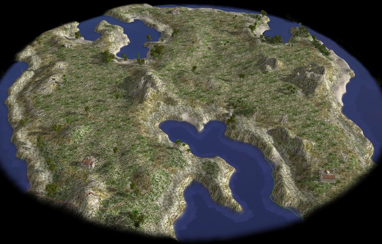
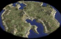
Previewing a map in the game setup screen.
Spahbod replied to Spahbod's topic in Game Development & Technical Discussion
Manually. I created a folder in session/icons/ called "mappreview" and placed the files there. There is a "nopreview.png" there that works as placeholder for maps that don't have a preview yet (which meant all maps except aegean sea). So that when someone creates a new random map and didn't make the screenshot, the game won't break. Edit: The name of the preview image is defined in the map's JSON file.