Search the Community
Showing results for tags 'mapmaking'.
-
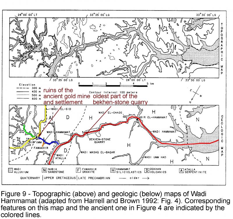
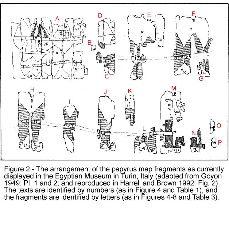
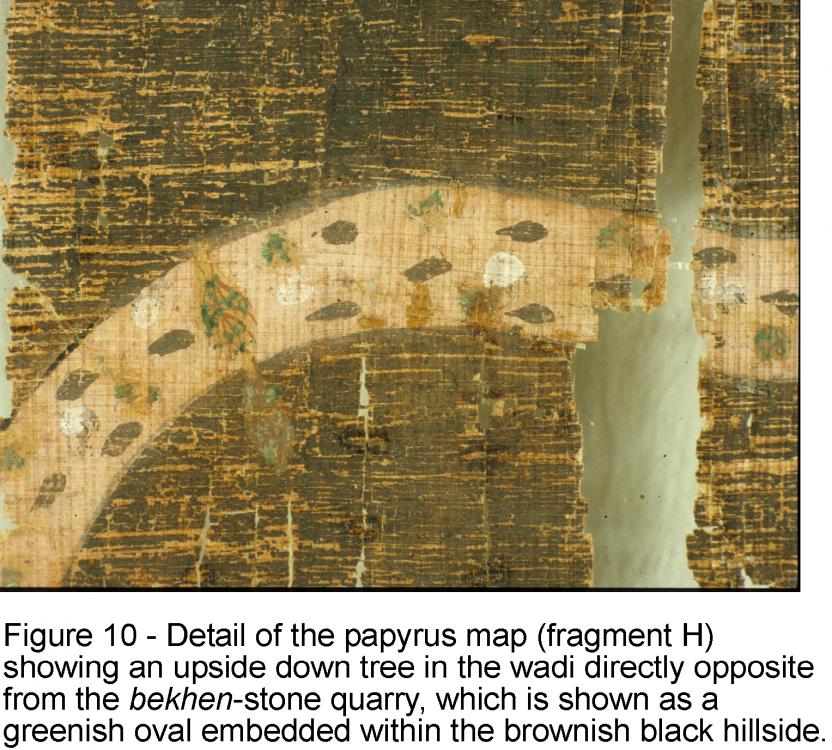
Hi, friends, I have come across the first known document of topographic cartography which apparently is the "TURIN PAPYRUS MAP FROM ANCIENT EGYPT". Details in a good article here. I will probably try to make a map inspired in this. Uploaded some images from the article in order to inspire others. By the way I feel a lack of leadership regarding map-making. More specifically I think a sticky post in Scenario Design/Map making with a list of desired maps is a MUST. If so, then you can have a ROADMAP of any campaign you want to design and anyone willing to start a map from scratch but lacking ideas can help better and quicker. Thanks, will post the map if I achieve it.
-
Hi, friends, I have come across the first known document of topographic cartography which apparently is the "TURIN PAPYRUS MAP FROM ANCIENT EGYPT". Details in a good article here. I will probably try to make a map inspired in this. Uploaded some images from the article in order to inspire others. By the way I feel a lack of leadership regarding map-making. More specifically I think a sticky post in Scenario Design/Map making with a list of desired maps is a MUST. If so, then you can have a ROADMAP of any campaign you want to design and anyone willing to start a map from scratch but lacking ideas can help better and quicker. Thanks, will post the map if I achieve it. P.S. I tried to delete this post because I should have posted it in the subforum "Design/mapmaking", but I do not know how to delete it. I have opened a new one in the subforum here.
-
Hi, everyone, I have been working for some weeks on mapmaking using the heightmap import from the atlas. I have found it great but found some problems I would want to be discussed here in the forum. Then (maybe) we will have a guide or tutorial with all the precious technical information about heightmap import involving all the process. Please correct me or comment as you wish, so I can edit the post and include more information. I followed the guide in the wiki, but found myself stuck some errors (my fault, but miss more technical information) before I learnt (thanks to vladislavbelov), the bit depth and format that the Atlas require for this import. However, still have questions about that: Which bit depth should I pick? 16-bit gray, 24-bit RGB (8-bit per channel)? In the guide in the wiki I can only read a generic "greyscale" Which formats are supported? BMP, PNG, JPEG, TIFF, RAW... not information about that neither, BMP appears to work, but the way bits are stored vary between these, may the results also vary? I would like to have more information or advice here aswell. Regarding the data sources I found good advise, but I would like to write a comprehensive guide on this also. The sources I found are: NASA blue marble: really great source, here you find loads of data. Specially interesting for 0ad the elevation, bathymetry and satellite images actual "colors" (to know where to apply a green or brown texture). Best of all, the images fit perfectly one onto the other cause all represent the same area and size. The disadvantage? Well... resolution might be enough for some maps, but if you want to make a big map from an small area (the island of Malta, for example), you may encounter the limits of this source. Moreover, I've noticed, the elevation is not proportional (yet should be enough for doing maps), cause Himalaya gets 255 (8-bit maximum) value, whereas greenland about 230, and Southamerica reaches 255 also. imagico.de: awesome, a search tool for various data sources. Sadly most sources only have data from America, while the civilizations present in 0ad are from Europe/Asia/Africa. Yet you get very very good resolution indeed, but only for elevation, bathymetry is missing. What can you do? Well, I have found no better solution but getting this greater resolution images for the most important in gameplay elevation (Earth part), and combine them with the coarse NASA blue marble bathymetry data. I have even written a macro in a scientific imaging analysis tool (ImageJ) for this purpose, given some coordinates and pertinent images, however, I have not been capable of doing a proper and beautiful heightmap import, tend to mess everything during my struggle. Perhaps, if I had more info about the required formats for the Atlas I could fix it. One thing really cool about the data I selected in this search tool (J. de Ferranti) is that images are in 16-bit, so data in Z-axis (height) can have a lot more resolution and (not sure about this, but tested on Sicily's mount Etna) it stores actual elevation in meters. In the case of mount Etna I measured values around 3200-3300 m which is really close to its true altitude. What about that? Well, if you know your image is 1 degree x 1 degree (width x height), the Earth's radius and that elevation values are real, you can work out a 100% REALISTIC MAP! when it comes to elevations. Cool, uh? Yet, I still struggle with the formats and Atlas import as I stated above. Global Data Explorer (powered by GeoBrain): thanks to niektb, for this source. He made a video tutorial about getting data from there and so on. Have'nt tried yet (needs login, and my laziness... well... ), but seems easy to navigate and download, but guess no bathymetry is found. What about its resolution, bit-depth, etc? ... there might be more data sources out there, any collaboration is welcome! Just a final comment regarding realistic maps (which is my goal to achieve realistic historic simulation). Does anyone knows where we can find data about sea level about 1st century A.D.? The coastline might have changed quite a lot. Other factors might have modified this also (read the text below the linked photograph). Well... what do you think? Suggestions? Can we push a bit further the heightmap import?


