Baelish
-
Posts
71 -
Joined
-
Last visited
Everything posted by Baelish
-
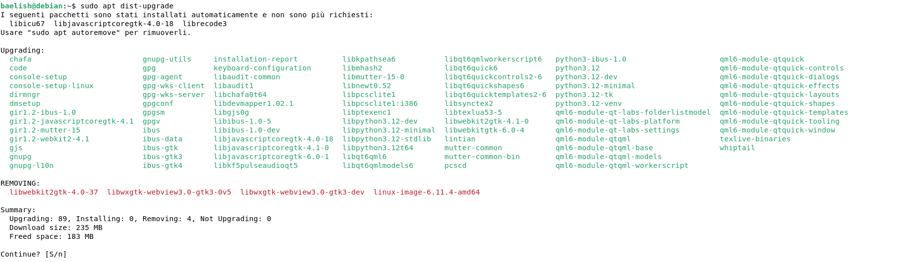
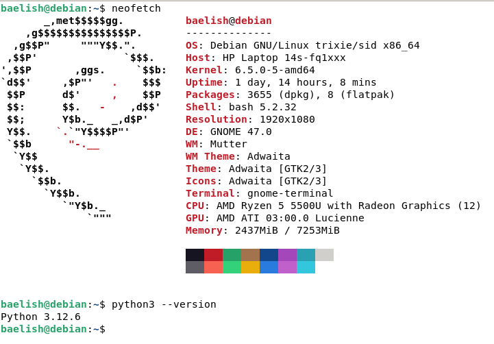
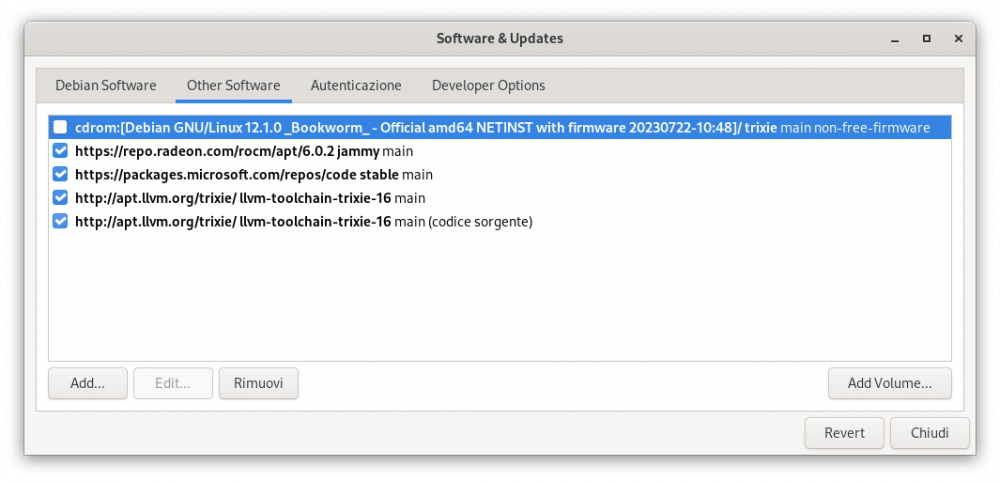
 I assure that I full-upgrade twice a month and this is my source_list: and avaiable upgrades:
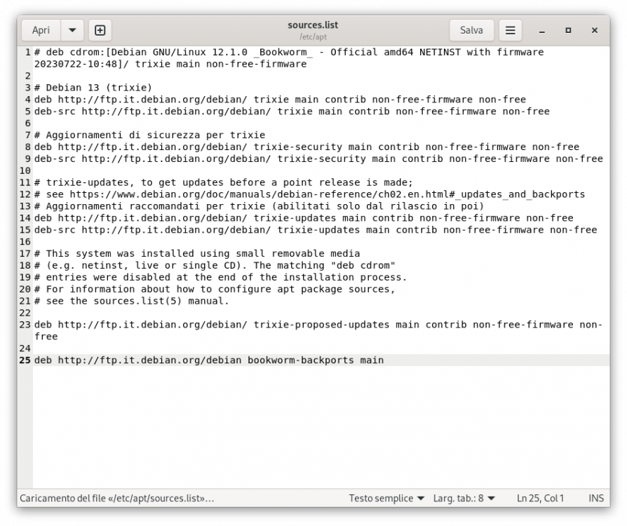
-
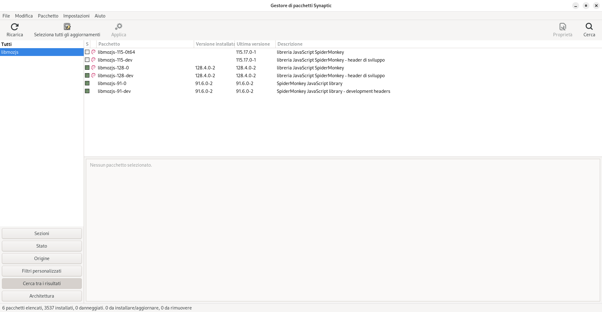
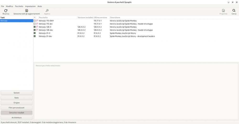
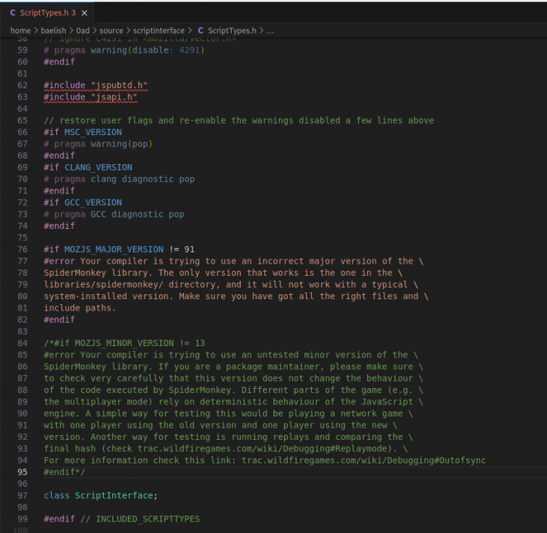
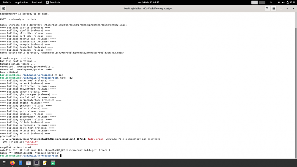
Firstly, this is my setup: If I try a standard build from source, I obtain ModuleNotFoundError: No module named 'six.moves' ERROR: SpiderMonkey build failed as well as in https://wildfiregames.com/forum/topic/118483-configure-fails-with-spidermonkey-error/ I tried to use --with-system-mozjs, but version 91 is not avaiable for debian (and I think they never will add it https://tracker.debian.org/news/1368939/removed-91130-1-from-unstable/ ) and during this try, I obtain another error in make in gcc directory (build sources and update workspaces worked both) fatal error: jspubtd.h: No such file or directory So I tried to install libmozjs-91 from ubuntu repos (not a perfect idea https://wiki.debian.org/DontBreakDebian#Don.27t_make_a_FrankenDebian ), and I installed libmozjs-91-dev 91.6.0-2: https://blueprints.launchpad.net/ubuntu/jammy/amd64/libmozjs-91-dev/91.6.0-2 and its dependencies: libmozjs-91-0 91.6.0-2: https://blueprints.launchpad.net/ubuntu/jammy/amd64/libmozjs-91-0/91.6.0-2 libicu70 70.1-2: https://blueprints.launchpad.net/ubuntu/jammy/amd64/libicu70/70.1-2 A new (and luckly last) error arise: I followed the solution proposed here: https://trac.wildfiregames.com/ticket/3039, but it does not work. So I thinked to force the buildiing deleting a part of source/scriptinterface/ScriptTypes.h IT WORKS! proof:
-
Ciao @Pippo_Baudo, è il posto giusto se hai dei problemi; se ti è possibile scrivi in inglese in modo che più persone ti possano aiutare. @Gurken Khan, I think he has this problem: Disable TLS cryptography worked for me, is it a good idea?
-
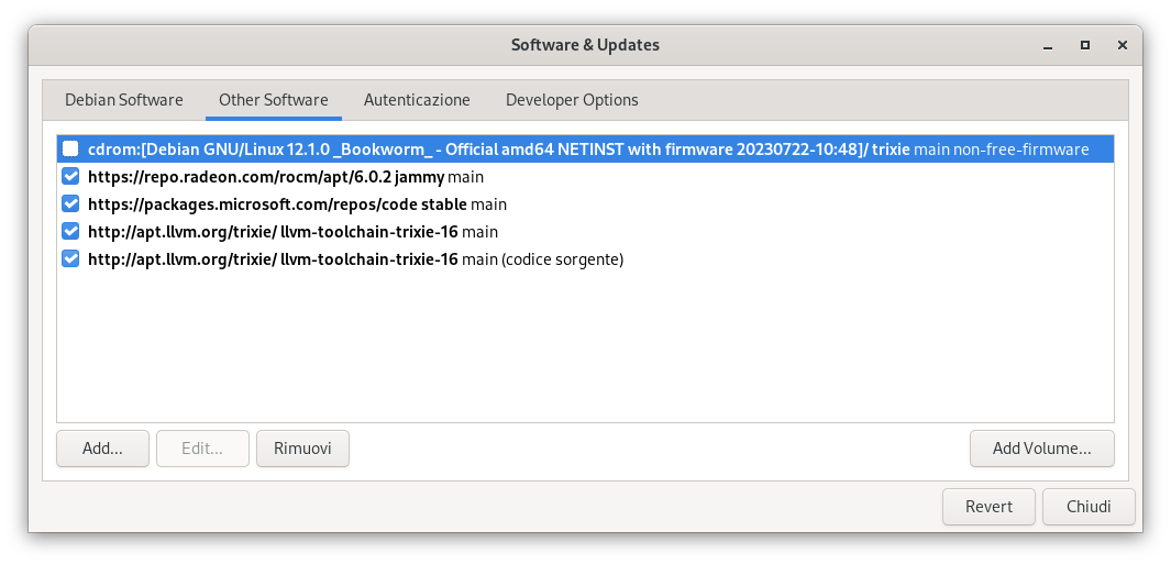
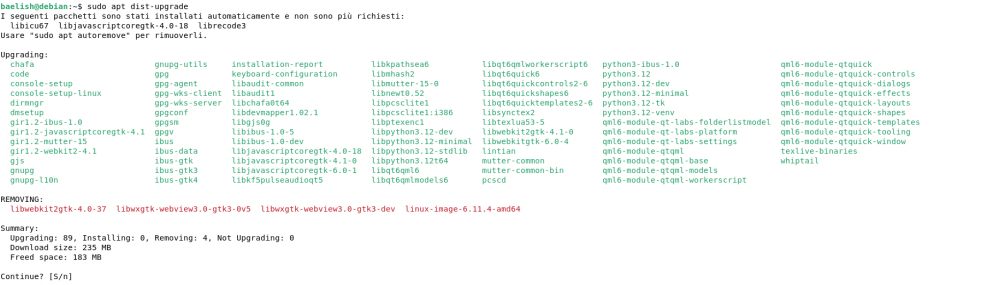
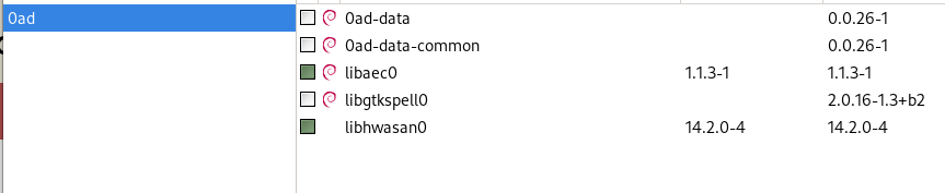
from synaptic: from terminal: baelish@debian:~$ sudo apt install 0ad Package 0ad has no versions available, but is named by another package. This may indicate that the package is missing, obsolete or it is only available within another source Error: Package "0ad" has no candidates to install my sources:
-
git clone https://gitea.itms.ovh/0ad/0ad.git in https://gitea.wildfiregames.com/0ad/0ad/wiki/BuildInstructionsGettingTheCode is not correct. It gives "fatal: impossibile accedere a 'https://gitea.itms.ovh/0ad/0ad.git/': Failed to connect to gitea.itms.ovh port 443 after 223 ms: Could not connect to server. I think it should be git clone https://gitea.wildfiregames.com/0ad/0ad.git In https://gitea.wildfiregames.com/0ad/0ad/wiki/BuildInstructions below CentOs paragraph "./b2 install" has a bigger font. I believe it is an error.
-
I know it would be reliable, but IMHO better than actual system anyway. I had not thought about maps, so I believe that a solution is: chose mainland as official map for classified games. So we can also take tournaments or fixed teams using discord (or other) for coordination in the team. Thank you very much for the suggestion, I'll try to create something and maybe more than one parameter because the strength of a player can't be defined by a single number.
-
I think that a multiplayer rating can be very useful to understand real power of a player to make a balanced game. In my experience I met overpower 1100 and weak 1300. I have no doubt that their ratings are real, but a team game is really different from a 1vs1 match. So, I want to propose a multiplayer rating, next to the already existent 1vs1. The main problem is: how to rate players? In my opinion we must take in consideration both who is the victory team and the results obtained by players in each team. calculate the sum of the points of each team: so if the stronger team wins, they gain less points; if the weaker team wins, they gain more points. use the overall ratings each 5 minutes to understand who played better in game (although he/she is in the loser team); create a classification based on previous point and give points to first 4 players, remove from least 4; finally give bonus points to all player of the winner team, based on point 1. In this way a good player of the loser team can earn points and a weak of the winner one can lose them. The only problem is that players on the borders are disadvantaged, because they usually grow slower. It's only a sketch, so can be improved with formulas to define all possible cases, but I think that the previous list contain all essential rules.
-
Same. It's very annoying, especially for animals queue
-
Has anyone heard about the XZ issue?
Baelish replied to ShadowOfHassen's topic in Introductions & Off-Topic Discussion
I'm on debian sid, so it affect my device. I suddenly checked my xz-utils and liblzma and debian community have already reverted to 5.4.5 For further infos read here: https://news.ycombinator.com/item?id=39866307 -
A good map, but not great: if you spawn on the small peninsula is very difficult to play. IMHO it can be resolved adding more building land.
-
I have just tried to install 0 ad on another emulator because Winlator is famous for a good user interface but slower that other emulators. This time I used termux, termux-x11 and proot-distro (is not an emulator, but it does not matter). I followed this simple guide: https://www.youtube.com/watch?v=mXkXzFqSeYE My GPU is MALI, so I have to use VirGL library, but it isn't supported by alpha 26, and I can't download the source code of alpha 27 beacuse it weight about 30 GB and it's difficult to build on a small screen. With MALI it will go wuth turnip, but it's slow. Can someone with a Snapdragon GPU follow this guide and say to me Mesa driver have good performance? I had an issue with termux: https://www.reddit.com/r/termux/comments/w0ixkp/how_to_solve_process_completed_signal_9_press/ I resolved it following first comment, LADB is downloadable from github without paying on play store. An other possibility is to use my device with a prebuilt version of alpha 27
-
In the last days, I sent a commit and so my source code is different from the original. If I want to start another ticket, I have to restore all my files to be the same of the original source code or arcanist knows that I had already sent a commit?
-
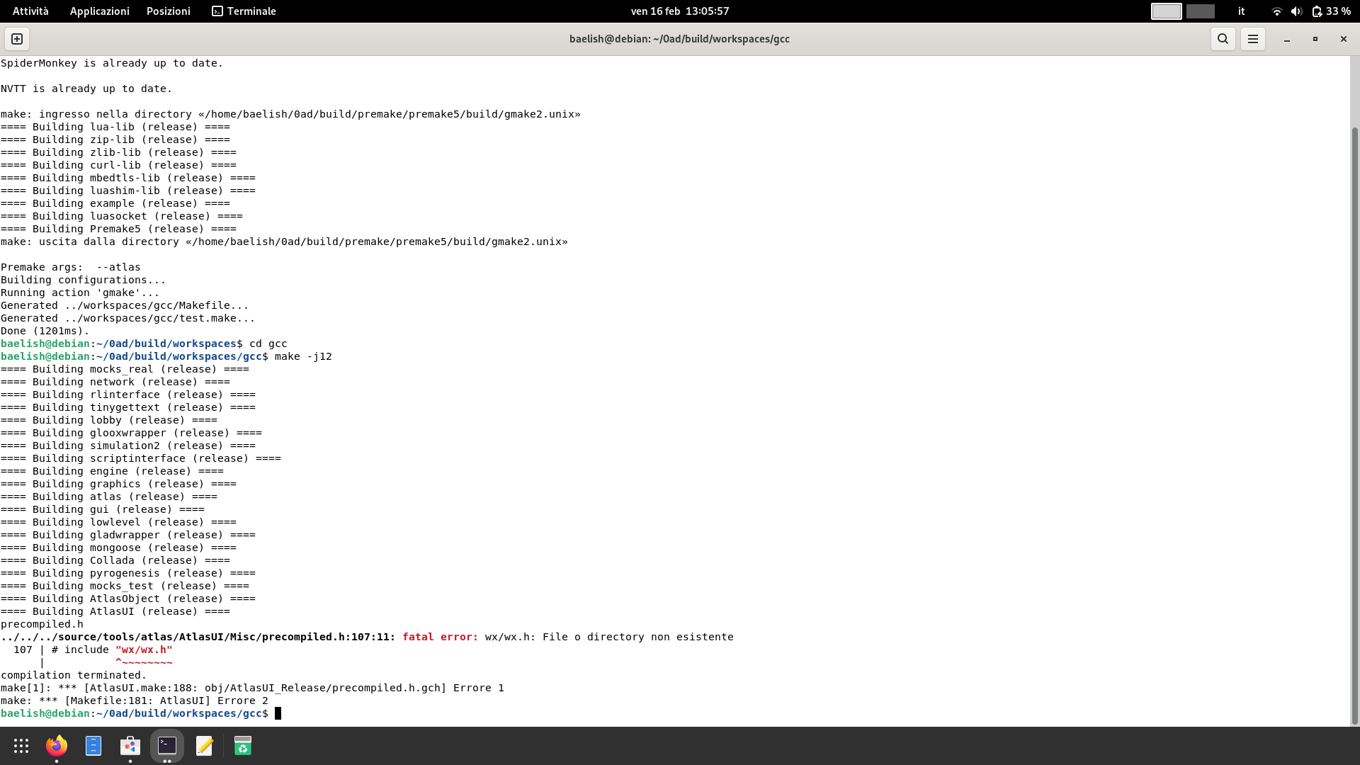
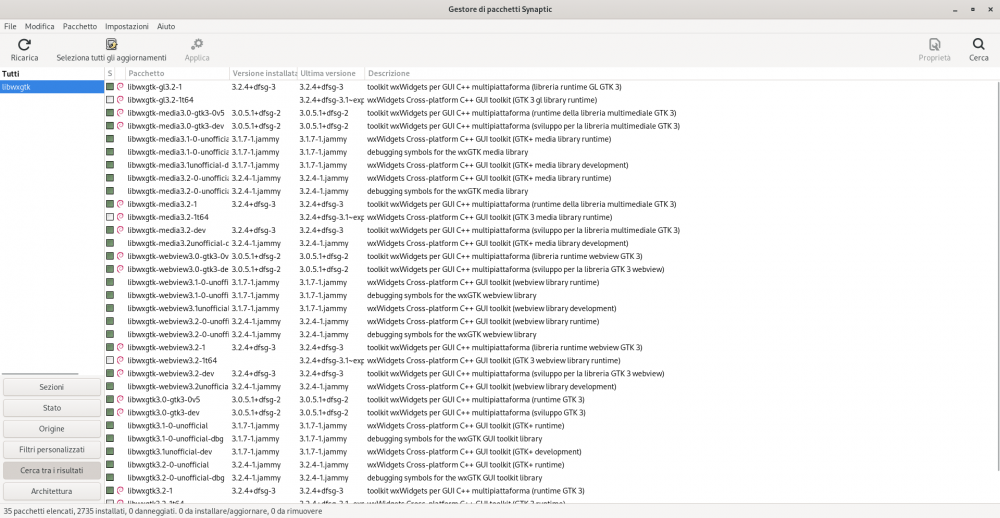
I'm on debian sid with experimental repositories. I follow the guide and It worked only without Atlas, using the flag --disable-atlas to update-workspaces.sh When I ran sudo apt install wx3.0-headers libwxbase3.0-dev libwxgtk3.0-gtk3-dev libwxbase3.0-0v5 libwxgtk3.0-gtk3-0v5 it returned the all packages were updated. Now I tried to resolve and I installed more packages from synaptic. I installed almost all, then reboot and cd build/workspaces ./update-workspaces.sh -j12 cd gcc make clean make -j12 I don't know the ones that resolved the problem, but now Atlas works well. It's only a problem that involved me or the guide needs to be changed?
-
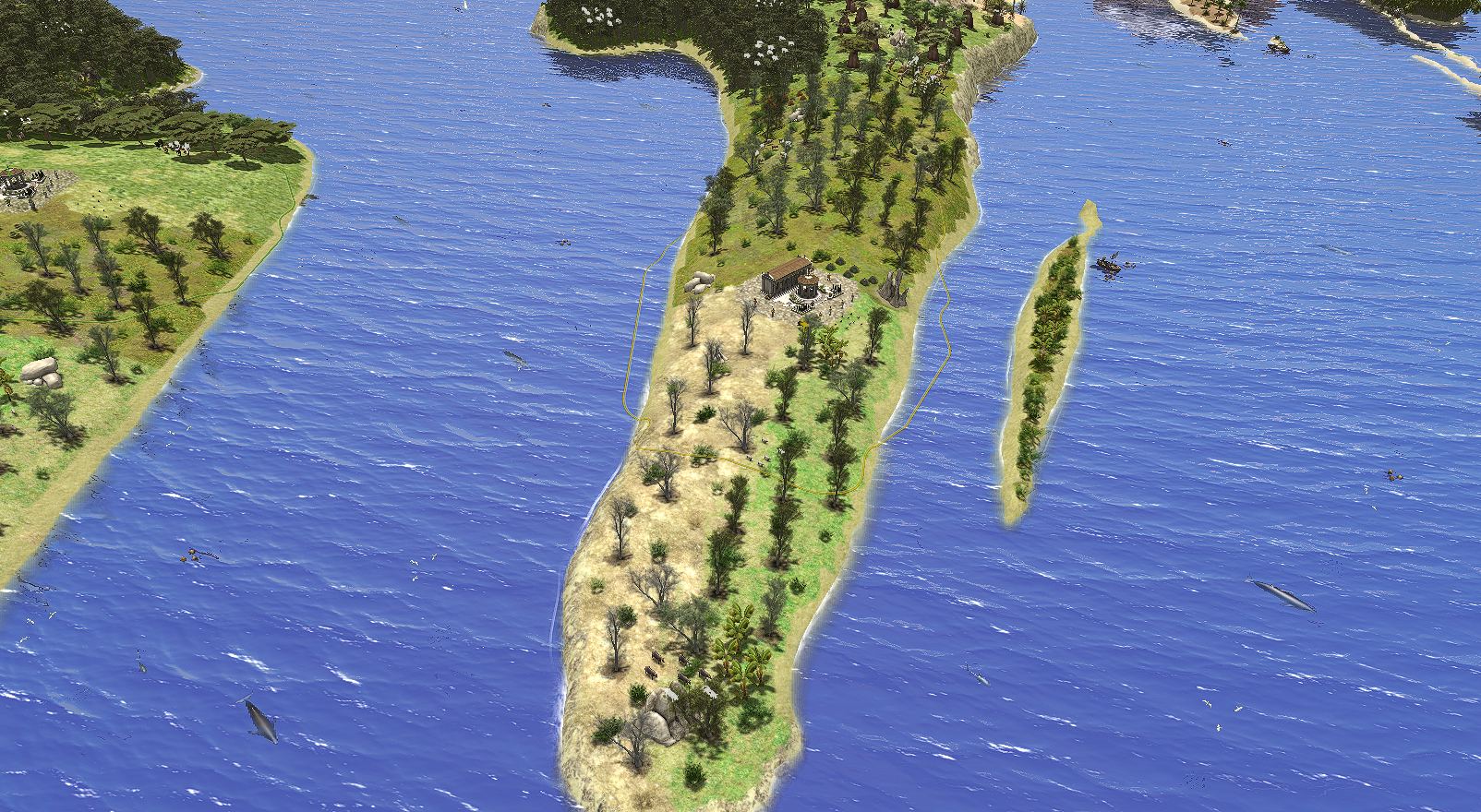
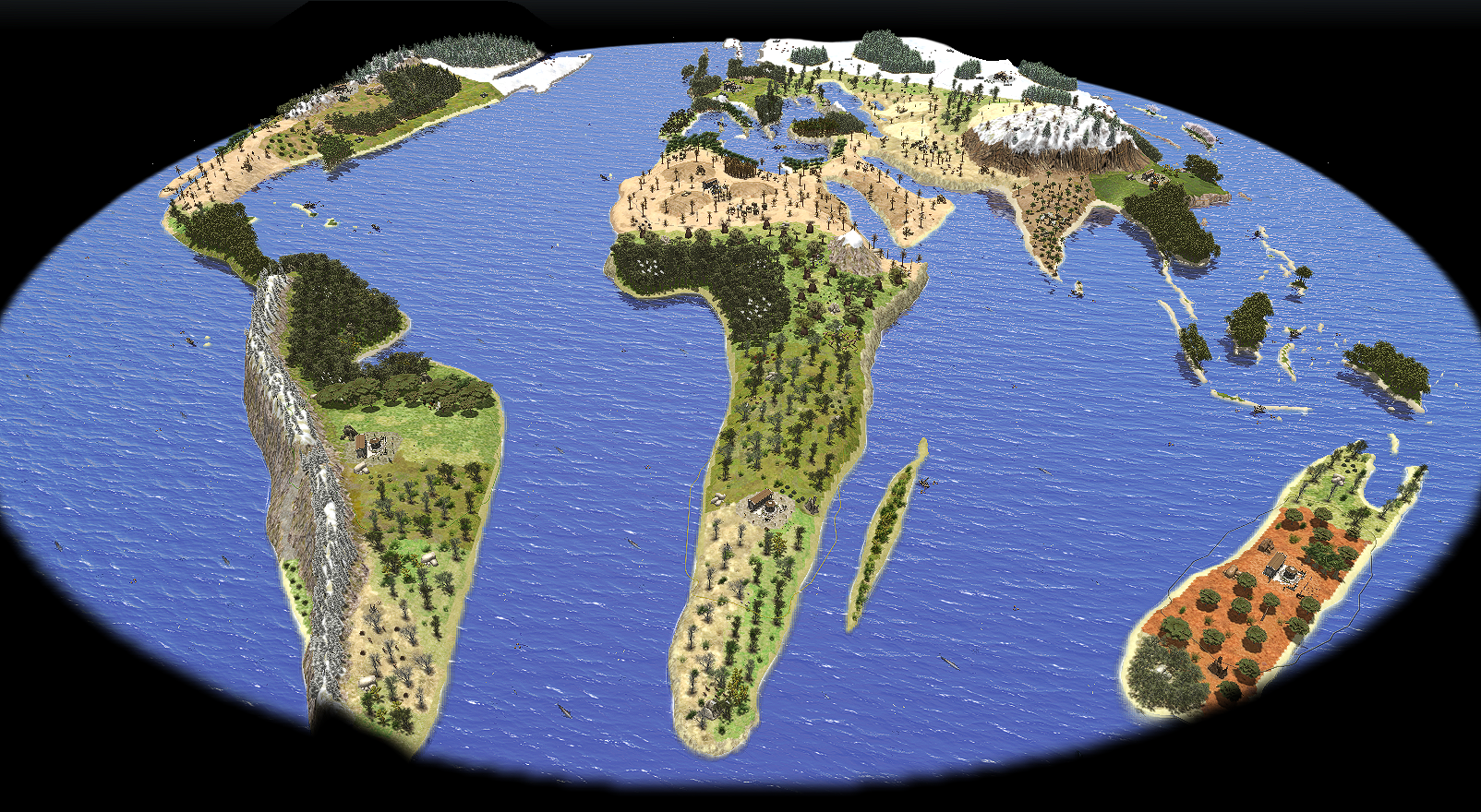
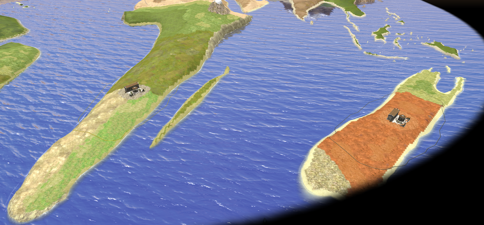
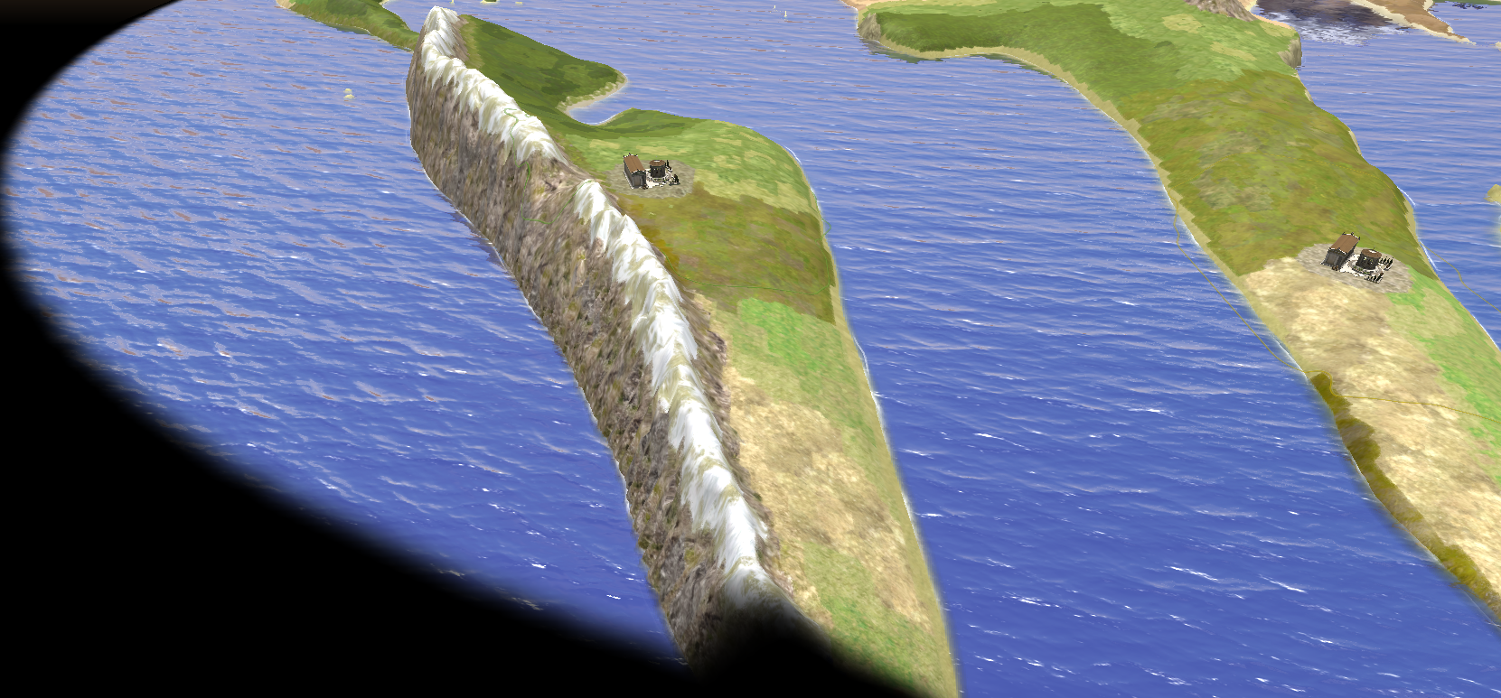
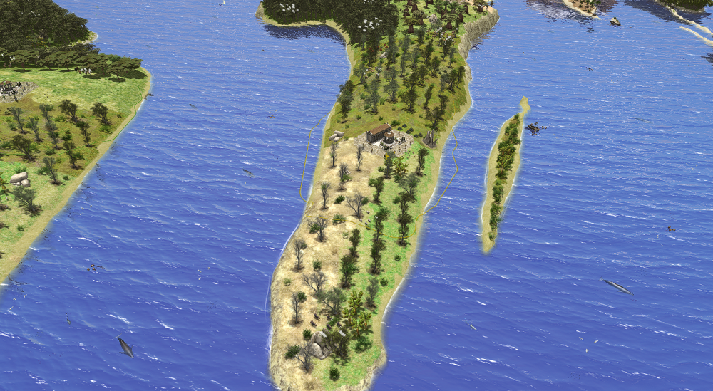
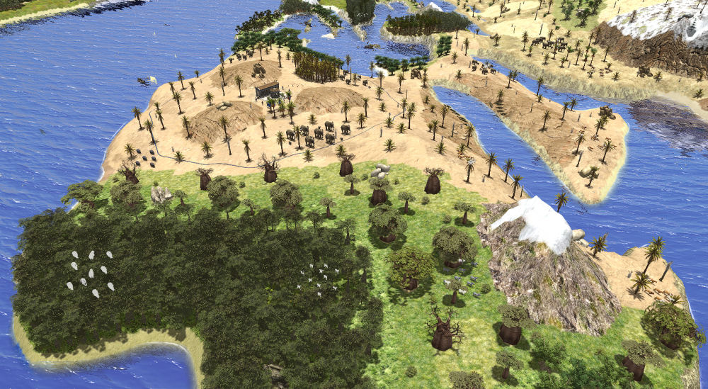
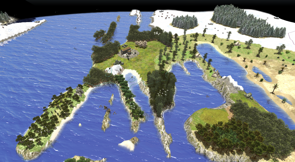
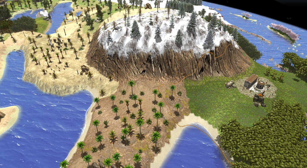
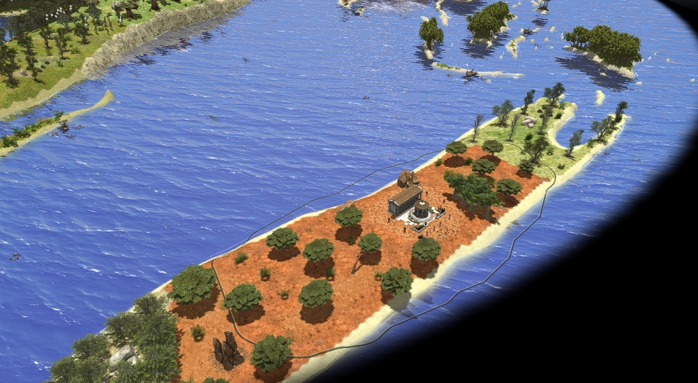
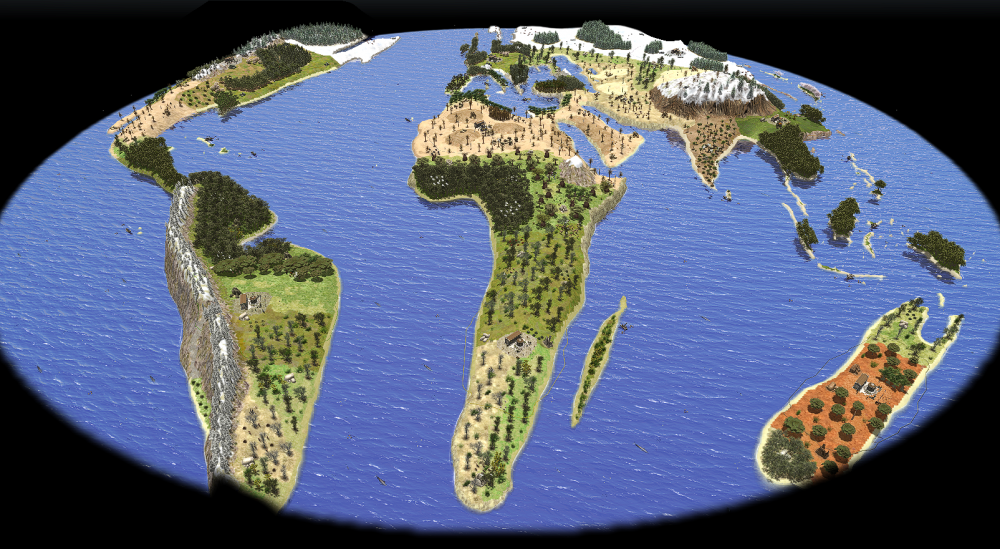
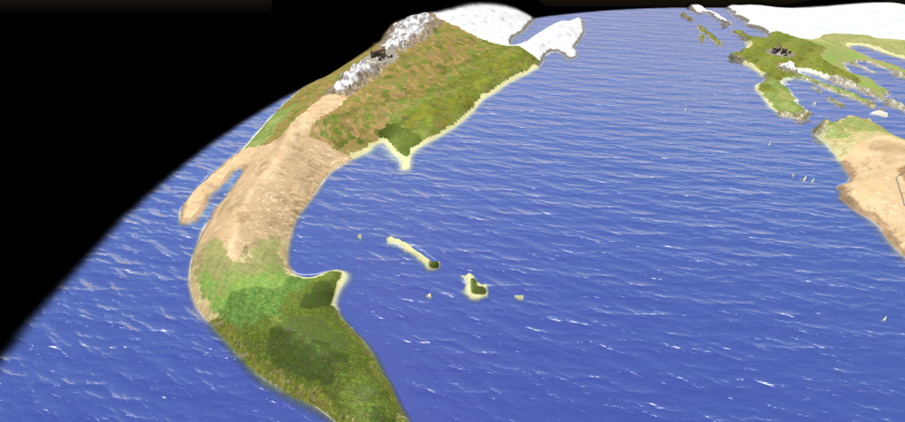
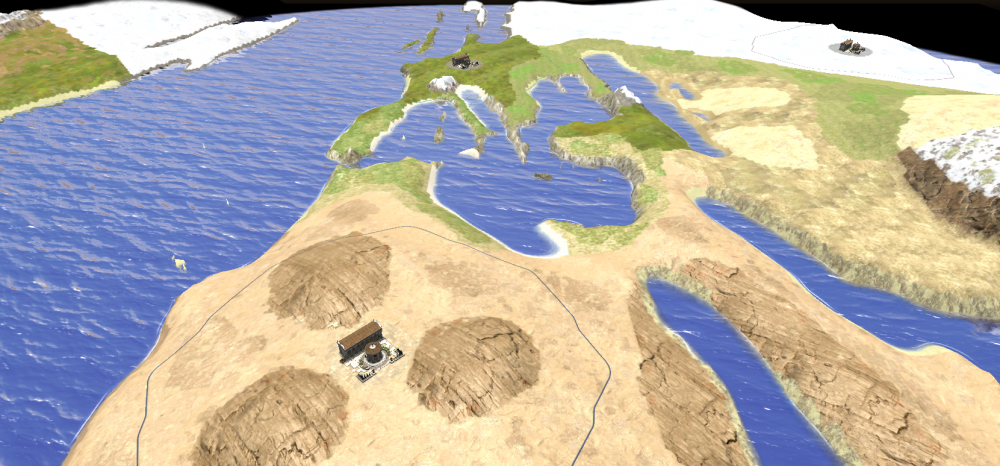
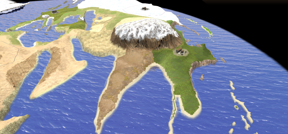
There are some islands, Borneo or Sumatra, that are full of wood, but you can't build a civil center on these ones. You can build a dock and gather the wood. It's to help Australian player, that has less available resources. EDIT: for the same reason I make Australia a bit bigger. I replace here the new file. Chile is too small and I implemented it with the latest update because you could access to Pacific Ocean only from North and Central America and it's unfair. You CAN'T go through tropical rain forest with assault sieges and elephants. It's not a bug, it's a feature World.xml World.pmp
-
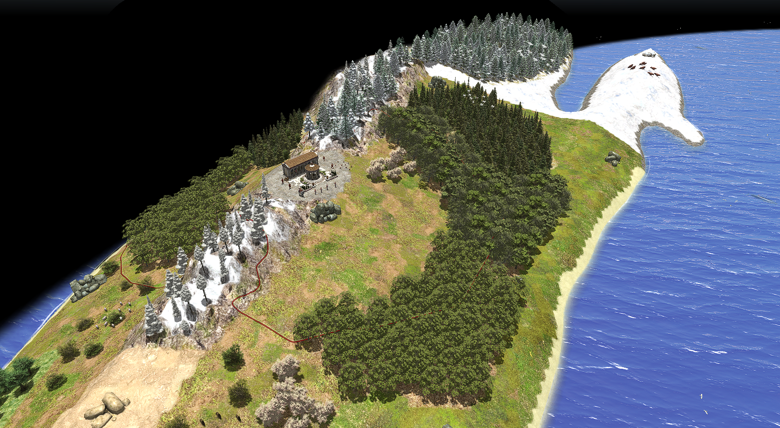
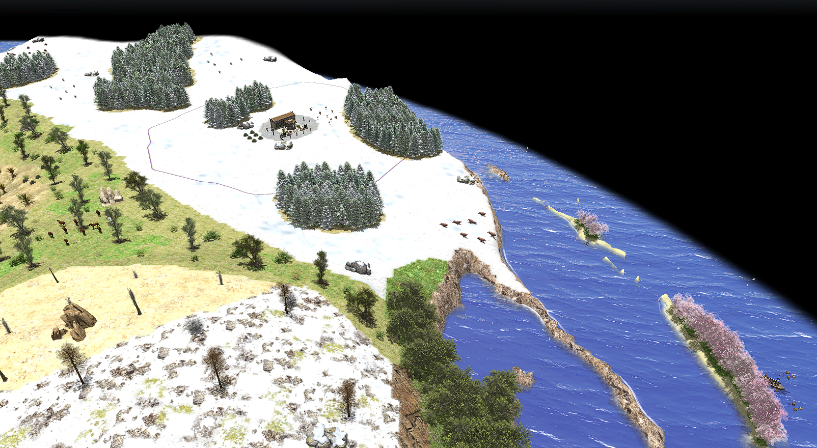
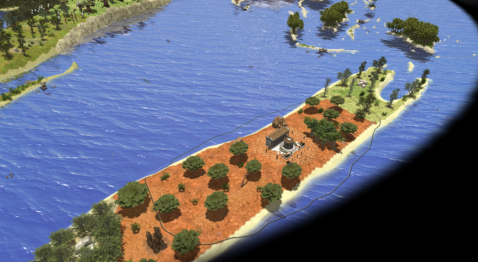
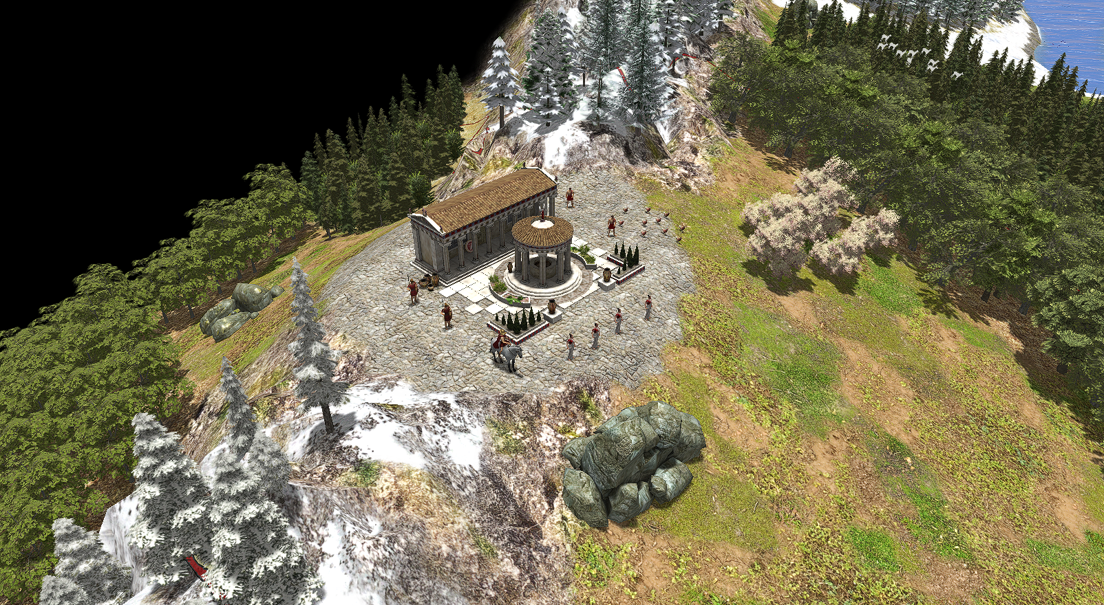
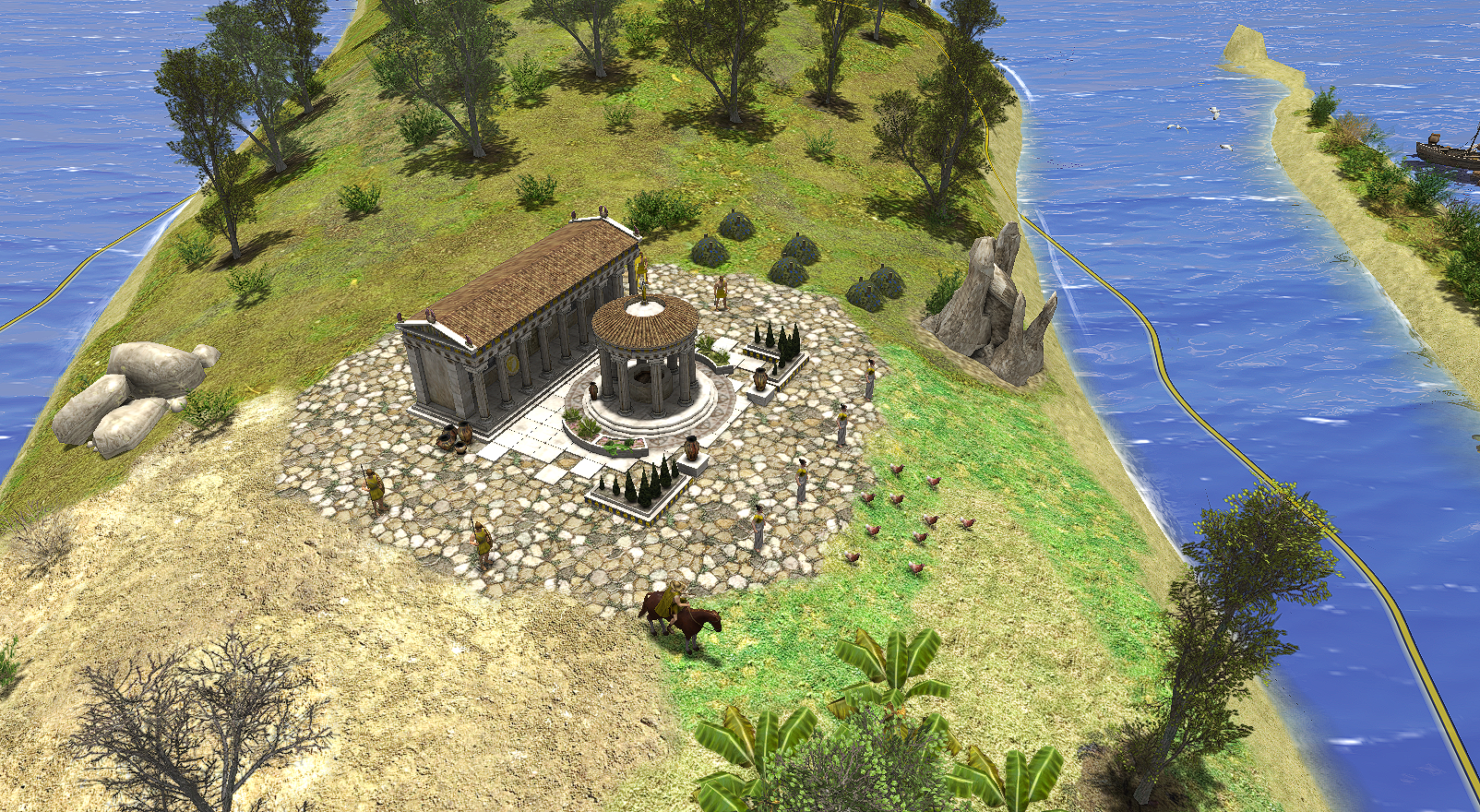
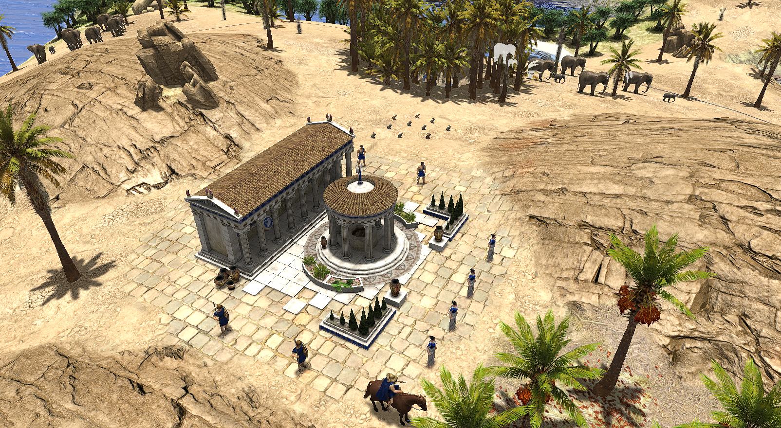
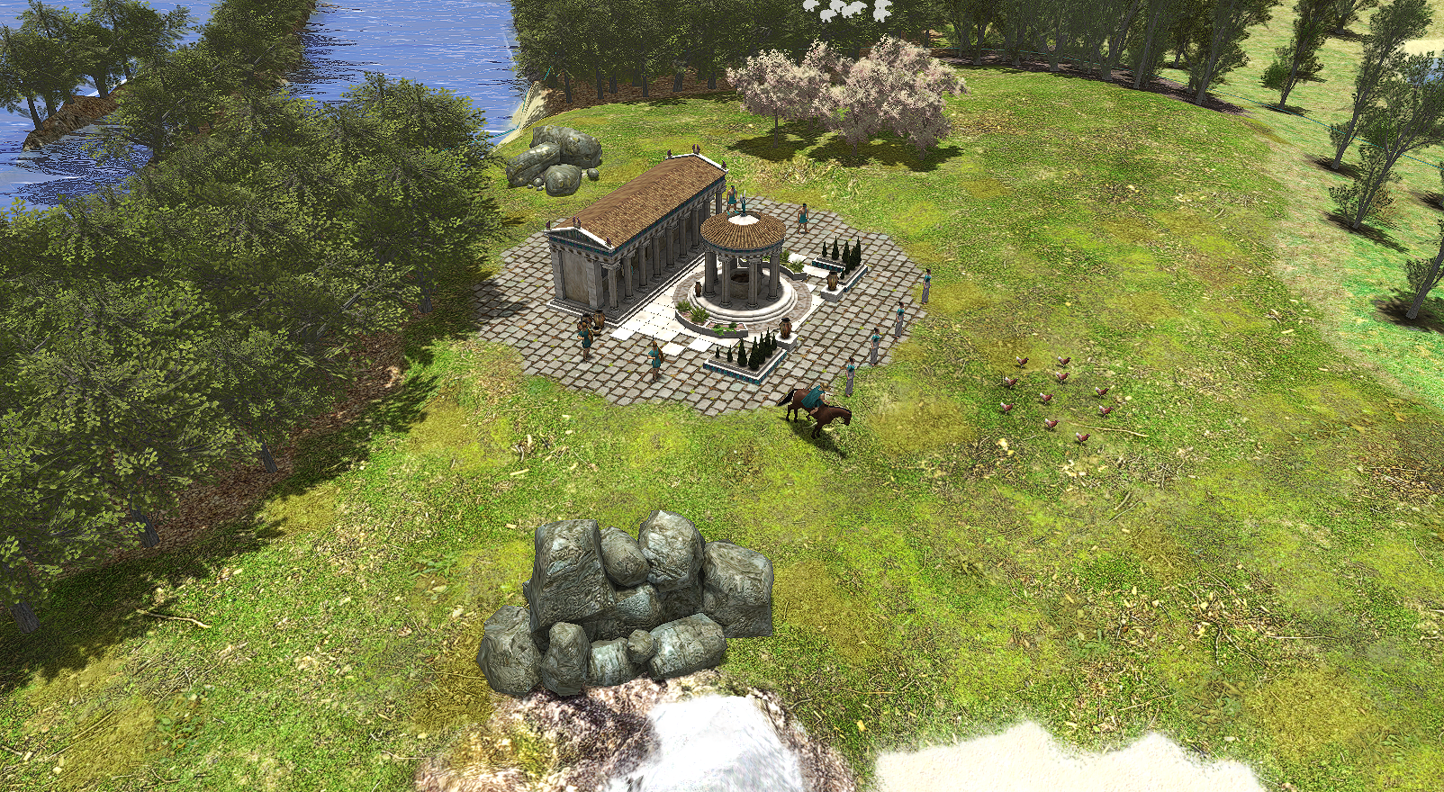
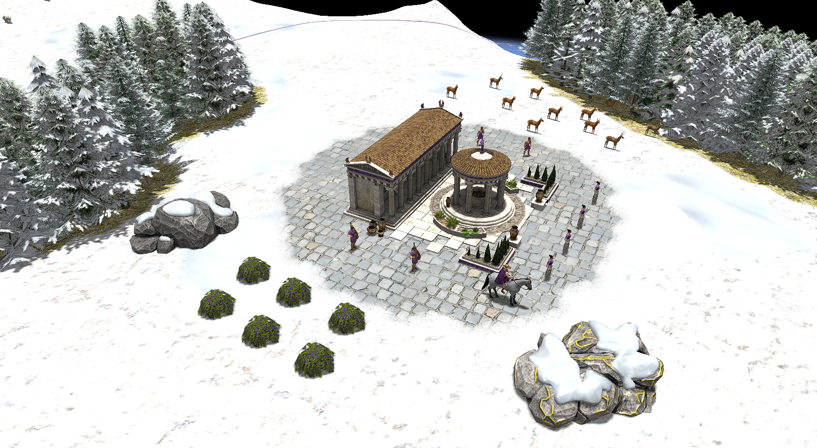
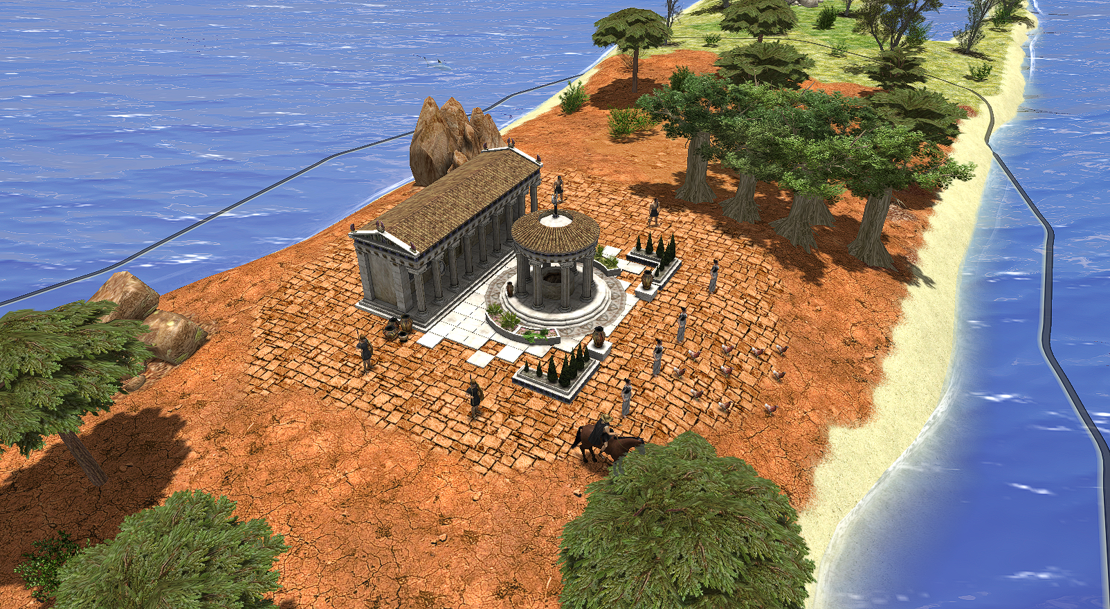
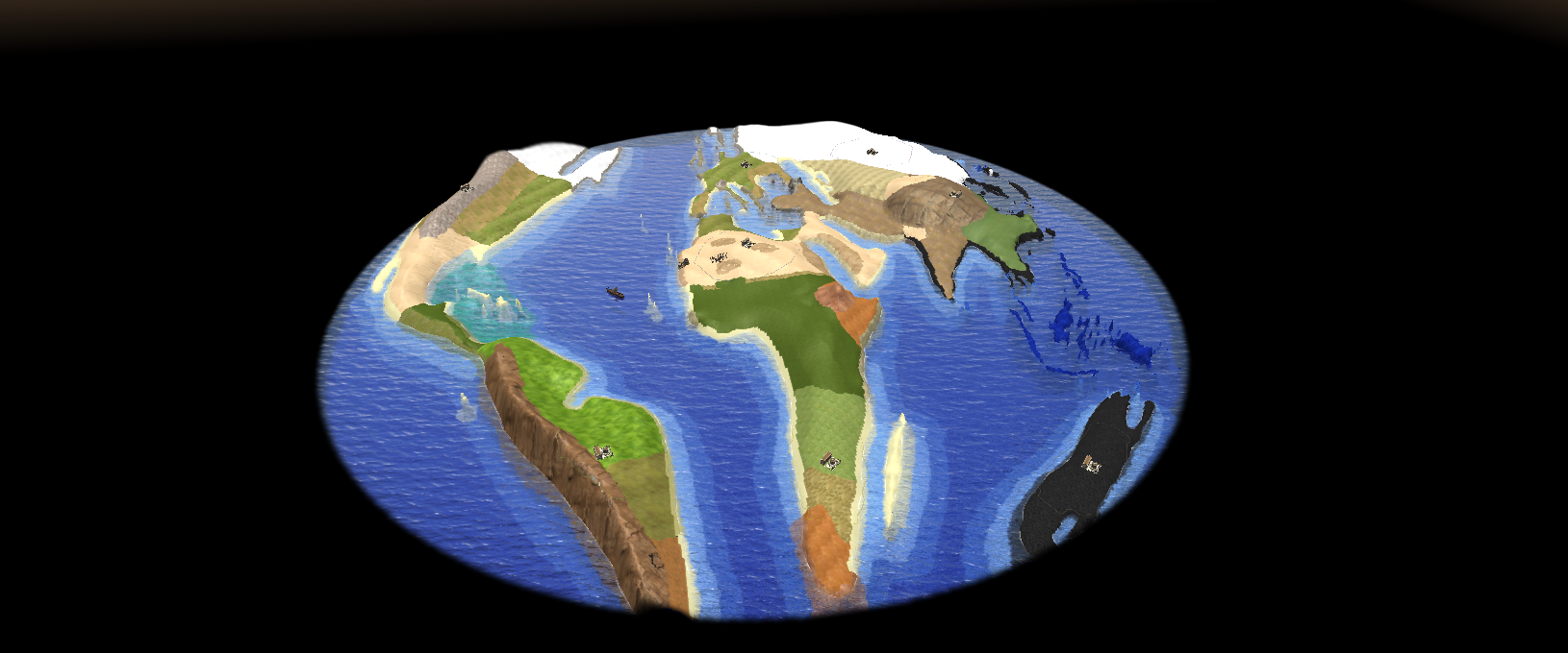
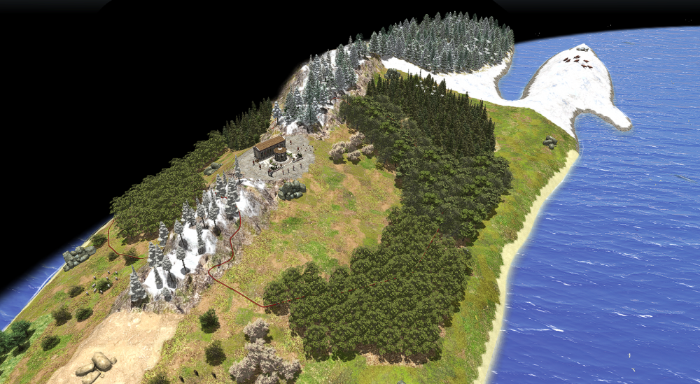
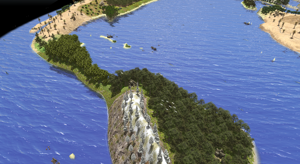
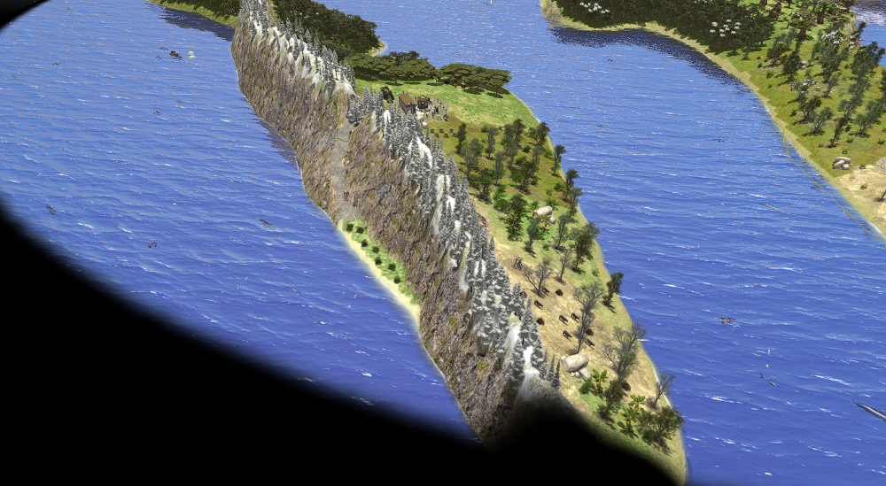
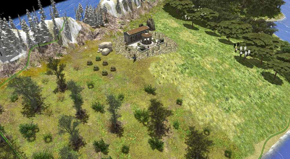
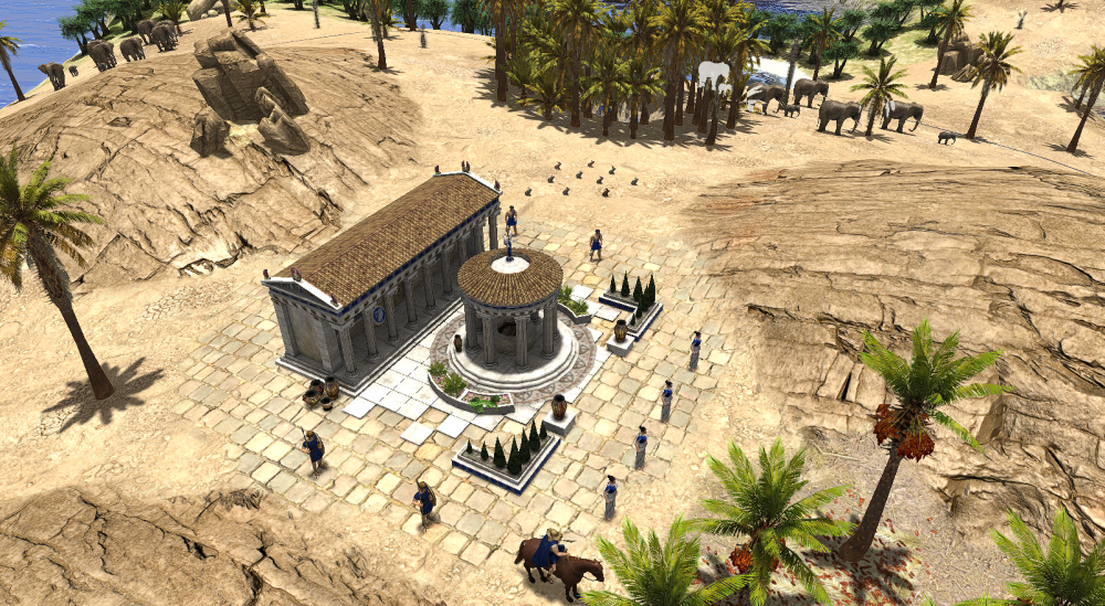
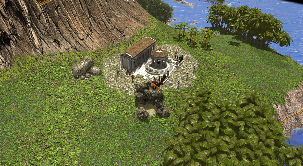
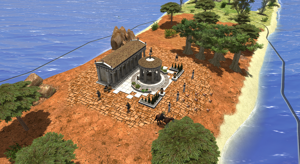
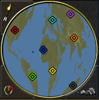
Finally good new: IT'S FINISHED! Here all the screenshots of the map. I will publish another last post to share the files and some tips


-
Map is ready, I'm doing balancing step
-
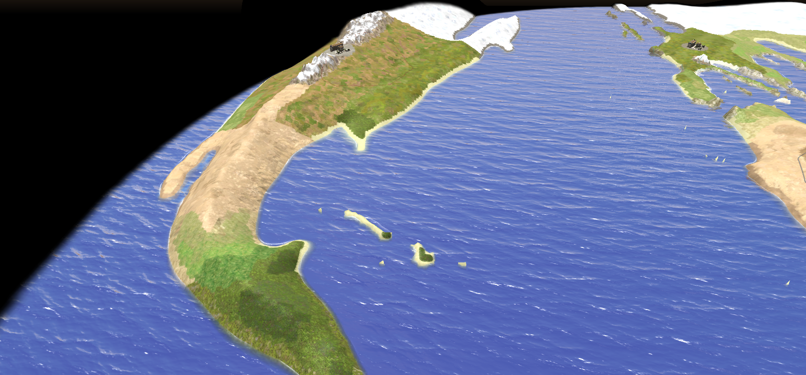
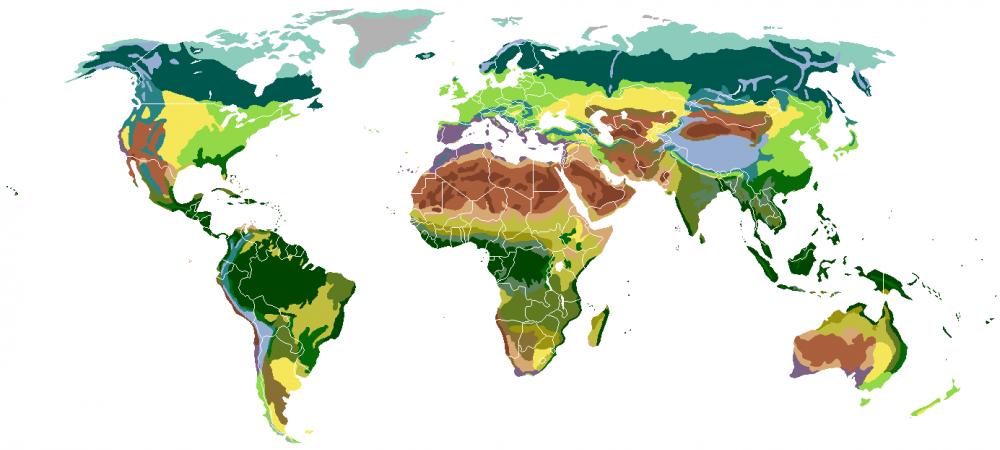
credit: wikipedia commons Remade wrong biomes and added details. If you think that there are errors, please tell me


-
Map size is giant and almost all the map is buildable. Despite that some countries are too small, as Cuba or Italy. I tried to import an heighmap bigger than 512x512 but Atlas editor crashed
-
Just to update you. It's still WIP, because I want to make texture more detailed and these colors are only a sketch. I accept all advises about colors and height changes, so I can change now before I add entities.

-
Hi, I have some suggestion to improve the map making: 1) Create a drop down menu for biomes, because there are about thirty biomes and it's difficult to find one and confront them because you can't see all of them on a single screen; 2) A searching tool for biomes through names; 3) Can be useful, but in my opinion more difficult to make it, another searching tool based on similar colors with a RGB color picker.
-
If someone want to help me, please reply in this chat: I want to share files here or on github, because I have problems with texture colors
-
I want to share with you my entusiasm for my new work. It will take very long time because it's a huge project and I'm at the beginning but I'm really happy and I hope that you will like it. It was very difficult to preserve proportion and I based the heighmap on sinusoidal projection. Sadly It's impossible to include Antartica, I think that It would be amazing to build a civic center there. In the end, I want to ask an aid to map artist to improve the final result, because I'm not so creative.
-
thank you very much, it's solved
-
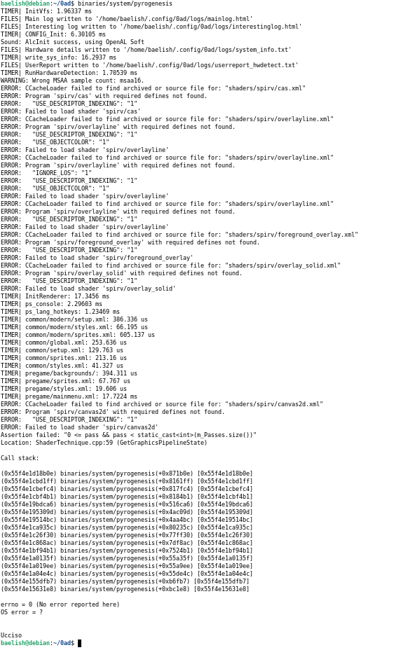
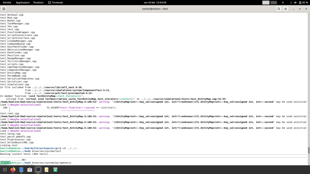
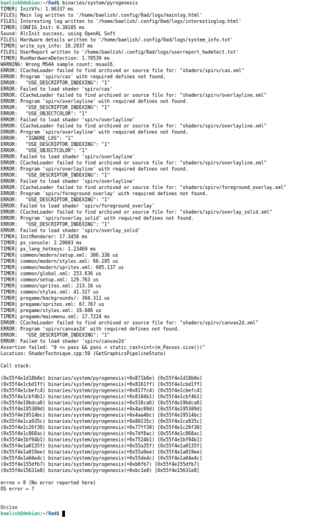
step to reproduce: cd 0ad/build/workspaces ./update-workspaces.sh -j12 --disable-atlas cd gcc make -j12 cd ../../.. binaries/system/test It returns OK binaries/system/pyrogenesis returns an error that I attach
-
I would try to make me useful, so I view opened page, but I don't understand how it works: for example problem #6688 is still opened, but it seems resolved. What is missing? And if I want to work on it, how can I do it? Can I only fork on github and do it on my own? Maybe it's a dumb question but I want to understand how to start