

Pureon
-
Posts
3.858 -
Joined
-
Last visited
-
Days Won
83
Posts posted by Pureon
-
-
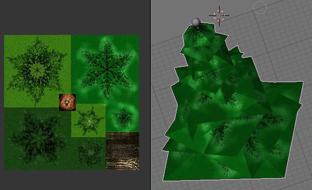
No modding unfortunately, so far I've only succeeded in turning pine trees into untextured blobs, and completely killed off all Zebras

If I told you what object I used it might ruin the image for everyone, but lets just say you'd eat from one

-
Who knew that the Stone Thrower’s horn had complex mathematical formula governing it’s size! Very interesting historical info Mythos, thanks for sharing!
-
Thanks Ykkrosh!
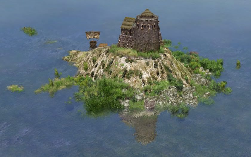
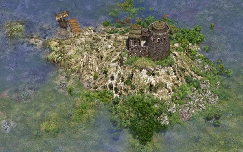
Coastal defenses
Edit: A few more because this game looks awesome:
-
Hi guys, I've been experimenting with the editor and have a few questions that I couldn't easily find the answer to on the forums/guides:
1) Is it possible to rotate an object horizontally after it's been placed in the editor? Not during placement, which I know is possible.
2) Can objects be rotated vertically in the editor?
3) Can the game's user interface be hidden?
-
Planned, or not necessarily to raise the terrain, but to make it even automatically
Could the building 3D models not have taller foundations? While I agree evening the terrain below a building is a good way to fix it, it doesn't always look very realistic. I was surprised very few buildings extended below ground level, or if they did, they didn't go very deep. Quite a few models other than buildings, notably rocks, also don't have foundations so look like they're hovering. Don't get me wrong, the buildings I've seen so far all look excellent above ground!
-
Lol, you can count on it
-
Having the FOW will certainly make it feel much more like an RTS, and makes exploring a lot more fun!
Thanks for the screenies Mythos_Ruler
-
Thread 4 looks a bit weird, running "ScanSoft\OmniPageSE4\OpHookSE4.dll" - that sounds like some background process/service is injecting itself into other applications. That probably ought to be safe, but are you able to disable that process and see if anything is different?
I stopped that process and the Atlas Editor works again! No idea how a piece of scanner software that came with my Canon Printer/Scanner can stop a program working, but it did! I'll take a look online for a permanent fix.
Really appreciate your time Ykkrosh
-
Very nice, what is it?
-
Unfortunately the Atlas editor stopped working for me about a month ago
 - maybe the next update will fix it.
Thanks for the useful info, as always!
-
So you can bring the canopy and trunk together in the actor editor, that's very cool. If you haven't tried already yourself, the dae files open in Blender 2.49, not sure in latest stable version. Mesh and UV are fine.
Should the canopy for the Acacia work the same way as the other trees? The alpha channel in the texture creates the leaves, while the mesh itself is made up of large polygons.
-
Awesome start! Well done Jesus!
The collada files should be importable into Blender. Have you tried? I might just install Blender to try it out myself. Most of the collada files seem to import just fine into Max.
I'll try it tonight, if I find the collada files that is. I'm quite comfortable with Blender's 2.4 series, but have limited experience with 2.5+ because the Python API was refactored.
-
Shouldn't be too difficult for someone to edit some of the existing tree models into Acacia trees. You would need the original Max models for them though, I think. Unfortunately I don't have Max so cannot do that myself. Pity Blender isn't more compatible with 0AD, especially since it's opensource and quite popular now.
I look forward to seeing Acacias in your next map Mythos_Ruler
-
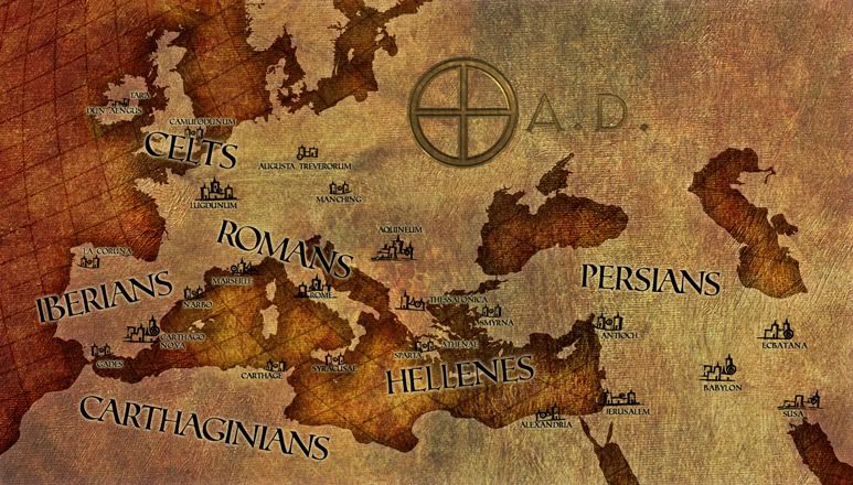
@plumo, Alpha, Aldandil: The extended timezone is making things difficult, but lets stick with one map if we can, otherwise we would end up creating many different versions. I originally looked at only having the capitals on the map, but this left many of the more historically relevant locations off.
Tyrus would be my preference over Sur, it's closer to other names for the city, including the current one.
@goblor: You're right, no idea how that ended up so far south!
Am working on the changes now. Thanks everyone!
Edit:
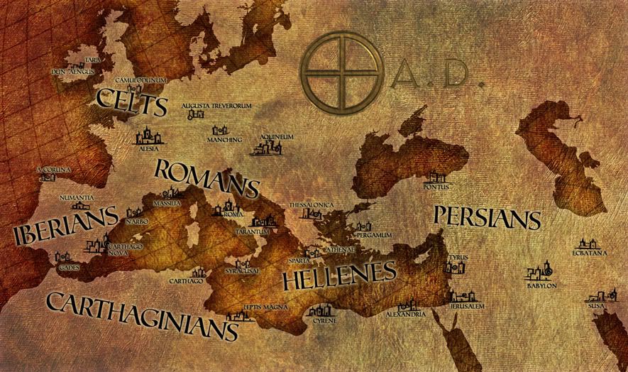
This one's at 60% zoom
-
I really like it Jeru - it's very nicely done and the information is spot-on!
-
Just to check, did you make all the components of the image yourself or get them from freely-reusable sources, or did any come from non-free sources? (If we use it in the game we need to be reasonably careful about copyright licensing.)
Understood. The map (water/land) is from various wikipedia vectors I merged together and edited. The original canvas texture is from an artist on deviantART, which I've edited and expanded, license info here. Everything else is drawn in Photoshop or Illustrator.
-
@Jeru: Purely graphical - to keep the current factions closer together. I did move it East a bit, but I guess not enough
Sorry! Looking at various maps of the Persian Empire it's within the boundaries though:http://www.forumancientcoins.com/articles/...an%20Empire.jpg
@Mythos_Ruler: Can I mail the psd to you over the weekend? I don't think everyone is quite happy with it yet.
-
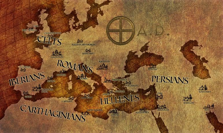
What resolution do you have it in? Is it possible for you to scale it up to 1920x1080 (and then we can have smaller resolutions down from there)?
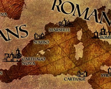
The entire map in photoshop is 2200x1300, although that has a lot of extra map space:
The map part (land+water) is originally from Illustrator, and therefore easily scalable. The hardest part is adding the details. Here is Greece using the same photoshop texture effects but much much bigger:
-
Personally I would use the latin / Greek names of a few cities...
Agreed. I'll update to Massilia, Roma, and A coruna. Will take a look at your other recommendations too. Many thanks plumo!
@dementor: Could do, but I don't want to step on anyone's toes, the developers probably already have something planned.
-
Also noticed, you didn't change Antioch.
 (It wasn't built in the Persian period of reign). My suggestion was Tyre as it was the naval base for the Persians...
Honestly completely forgot to make that change, it was on my list, nothing personal
Have changed it to Tyre and moved it to the correct location in my Master psd document. Also moved 'PERSIONS' further south. (I'll post a new image when more changes have been made)Any notable locations in Africa we're missing? North-eastern Europe is also very empty.
-
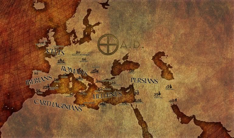
I was following this map for Babylon's location:
http://kbagdanov.files.wordpress.com/2008/10/map-1.jpg
No idea personally, maybe that's wrong
-
Thanks all, I've updated the map with most of the comments above, apart from those that were unanswered.
@dementor: The map is fairly hires, so it could be used for campaign scenarios. This is 100% zoom:
-
Thanks As_Saffah, I like your screenshots too, we haven't seen many Celt ones so far! Nice details.
I wish I could still use the Atlas Editor, I've had a few screenshot ideas since it stopped working
-
@Alpha: I appreciate the feedback, I don't have much knowledge of the period, so that's just what the map needed. All the text is editable, as is everything else, so feel free to let me know what needs changing.
The cities I've included are from maps found online with dates between 300 BC to about 100AD. It's easy to add cities, so if there are important ones missing, do let me know.
I'll make your recommended changes when I get home after work.
Alpha feedback
in General Discussion
Posted
@Jeru: I'll email them over to you. Like before, feel free to distribute under your 0AD license.
@Mythos_Ruler: This however is modding:
And no copyright is being broken, it's my model and my part-finished texture